Significant earthquakes of 1999

August 17, 1999 Earthquake: Istanbul, Kocaeli, Sakarya, Turkey

August 17, 1999 · M7.6 · 17,118 deaths · $20 billion

A magnitude 7.6 earthquake struck Istanbul, Kocaeli, Sakarya, Turkey on August 17, 1999 at 00:01:39 UTC, 13 km below the surface. It killed 17,118 people.

Map

Where it struck, with the other significant earthquakes within 200 km. Circles are sized and colored by magnitude; select one for its page.

The earthquake

Date
August 17, 1999
Time
00:01:39 UTC
Place
Istanbul, Kocaeli, Sakarya, Turkey
Magnitude
7.6 (Mw)
Focal depth
13 km (8 mi)
Intensity
10 on the Modified Mercalli scale
Epicenter
40.760° N, 29.970° E
Country
Turkey

The toll

Deaths
17,118
Injuries
50,000
Damage
$20 billion
Houses damaged
73,342

Where the literature gives no number, NCEI records a description on a scale of 1 to 4, printed here in its words. Damage is in millions of US dollars of the year of the event, not adjusted for inflation.

What the record says

NCEI’s account, from the sources it cites.

1999, Aug 17, 00:01:39.1 UTC. 40.748 N, 29.864 E, depth 17 km, magnitude 6.3 mb, 7.8 Ms. At least 17,118 people killed, nearly 50,000 injured, thousands missing, about 500,000 people homeless and estimated 3 to 6.5 billion U.S. dollars damage in Istanbul, Kocaeli and Sakarya Provinces. Felt as far east as Ankara. Felt (III) at Anapa, Russia; Chisinau, Moldova; Simferopol and on the south coast of Crimea, Ukraine. As much as 5 meters of right-lateral strike-slip displacement occurred along a 120-km zone of the North Anatolian Fault between Karamursel and Golyaka. Rupture proceeded from west to east in two subevents. Duration of strong shaking was 37 seconds with maximum acceleration 0.3-0.4g. (Reference #1053)

17,127 deaths, $20,000 million dollars damage. (reference #1250)

17,480 deaths, 73,342 buildings damaged, intensity X. (reference #1251)

As shown above, the 1999 Kocaeli earthquake is

characterized by a rapid and smooth bilateral rupture. The

rupture pattern may affect the distribution of seismic intensity through the directivity. The intensity distribution given by ERD [Earthquake Research Department (ERD) of General Directorate of Disaster Affairs of Turkey] shows that a heavy ground motion area with seismic

intensity of VIII - X [on the scale of Medvedev, Kárník,

Sponheuer] extended predominantly east and west. This

intensity pattern is consistent with that expected from the

directivity effect of our bilateral rupture model. (reference #9737)

1999, Aug 17, 00:11;40 UTC. 40.76 29.97 E. (reference #4931)

1999, Aug 17, 00:01:39.77 UTC. 40.773 N, 30.002 E, depth 13.3 km, magnitude 7.6 Mw. (reference #9910)

1999, Aug 17, 00:01:40.58 UTC. 40.807 N, 29.979 E, depth 13.3 km, magnitude 7.6 Mw. (reference #10476)

Photos

From the NCEI/WDS Natural Hazards Image Database (doi:10.7289/V5154F01). Only photos by the USGS and NOAA, which are public domain, are shown.

Duzce
Duzce Duzce is east of Sakarya/Adapazari. It was struck by a second earthquake (Mw 7.1) on November 12, 1999, that killed at least 619 people. Between Adapazari and Duzce. The brick structure on the right performed well. The reinforced concrete frame brick-infilled building slid into the brick structure causing "blunt" damage. (This photograph was taken through… Photo: NOAA National Geophysical Data Center.
Sakarya/Adapazari
Sakarya/Adapazari The ground floor of this brick infill building was occupied. Note how the concrete in two of the columns has disintegrated. The rest of the columns were able to carry the redistributed load. Sakarya is to the east of Izmit, north of Arifiye, and west of Duzce. The provincial capital of Sakarya is Adapazari. Photo: NOAA National Geophysical Data Center.
Sakarya/Adapazari
Sakarya/Adapazari The structure in the center was heavily damaged, losing most of the brick infill. The first, and probably the second story, collapsed in this structure. Sakarya is to the east of Izmit, north of Arifiye, and west of Duzce. The provincial capital of Sakarya is Adapazari. Photo: NOAA National Geophysical Data Center.
Sakarya/Adapazari
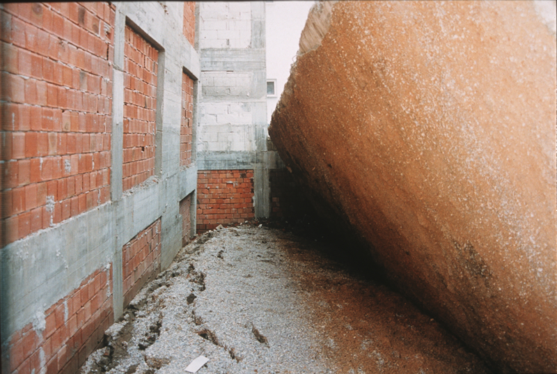
Sakarya/Adapazari The bottom of a mat foundation of a tipped building (right side of photograph). This type of foundation is made by pouring concrete over a mat of pebbles. The soil has failed due to liquefaction. Sakarya is to the east of Izmit, north of Arifiye, and west of Duzce. The provincial capital of Sakarya is Adapazari. Photo: NOAA National Geophysical Data Center.
Sakarya/Adapazari
Sakarya/Adapazari The whole building collapsed due to soil failure (liquefaction) and a first story collapse. The collapse totally blocked the road. The brick structure remained intact with no observable cracking. Note that surrounding buildings appear undamaged. Sakarya is to the east of Izmit, north of Arifiye, and west of Duzce. The provincial capital of Sakarya is… Photo: NOAA National Geophysical Data Center.
Sakarya/Adapazari
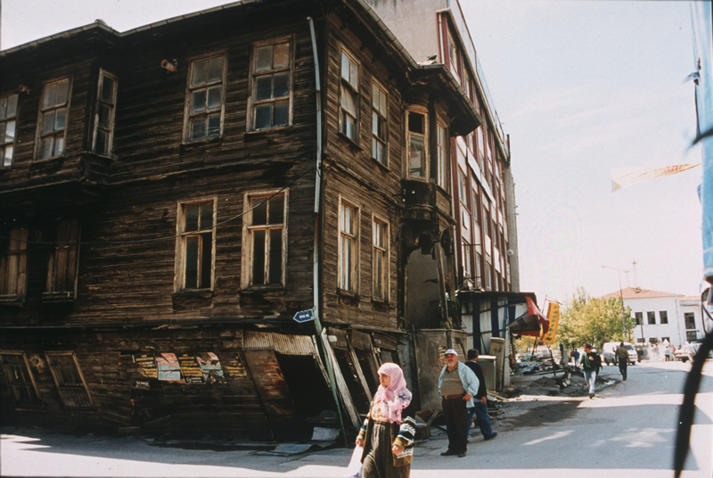
Sakarya/Adapazari A three-story wood-frame structure built in the early 1900s. The ground floor received the heaviest damage. The gentleman with the blue coat and white hat is the owner. Before the earthquake, he was planning to renovate the structure. Sakarya is to the east of Izmit, north of Arifiye, and west of Duzce. The provincial capital of Sakarya is Adapazari. Photo: NOAA National Geophysical Data Center.
TEM-Arifiye
TEM-Arifiye Demolition crews are removing the collapsed Arifiye overpass that crosses the TEM (Trans-European Motorway). It used to be a four span overpass. The view is looking at the south abutment that is a natural abutment, and is not composed of artificial fill. TEM is the Trans-European Motorway. This section leads from Izmit towards Arifiye and just south of… Photo: NOAA National Geophysical Data Center.
Kocaeli/Izmit
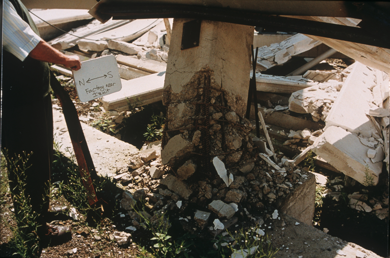
Kocaeli/Izmit This column damage occurred in one plant of a four-plant complex at the Aksoy aluminum shaping factory near Izmit. The structure was a prefabricated, concrete-frame structure. It was under construction; the prefabricated beams were connected to the columns. This site is only a few kilometers to the north of the surface trace of the fault rupture. Photo: NOAA National Geophysical Data Center.
Yuvacik
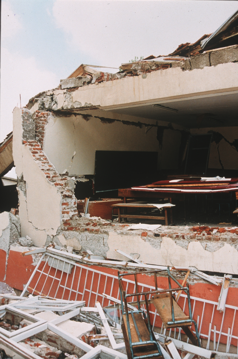
Yuvacik Yuvacik is south of Izmit and east of Golcuk. It was almost on top of the epicenter. The fault passes beneath this primary school building at Yuvacik. The permanent offset at this location is about one meter. The building is reinforced concrete frame construction with brick infill walls. Note that the brick walls do not seem to be joined at the corner.… Photo: NOAA National Geophysical Data Center.
Golcuk
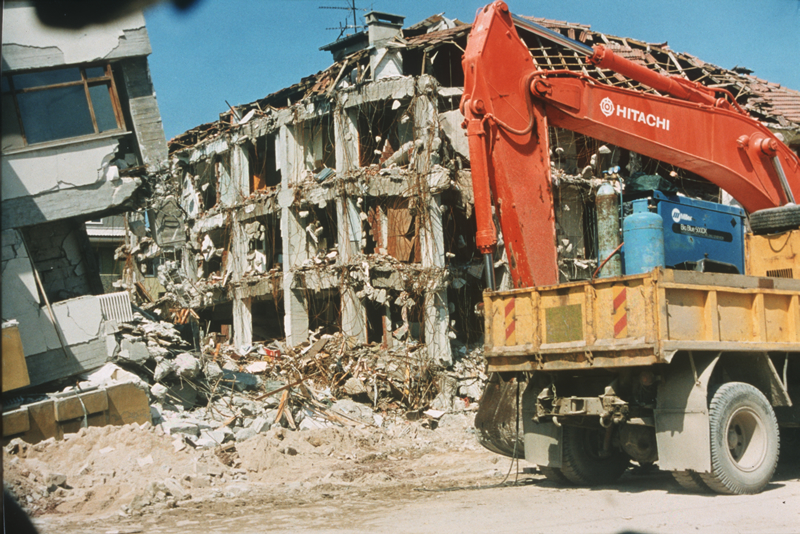
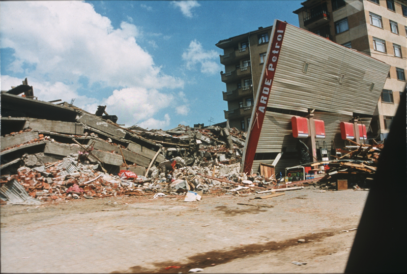
Golcuk Golcuk is west of Yuvacik and east of Yuzbasilar. Entering Golcuk from the east. This former gas station has been demolished, as has a lift slab structure on the left that pancaked. The view is to the north. (This photograph was taken through a car window.) Photo: NOAA National Geophysical Data Center.
Golcuk
Golcuk Golcuk is west of Yuvacik and east of Yuzbasilar. The view shows a four-story structure (foreground debris) that was under construction in Golcuk. The first story may have been occupied. The beam-column connections were supposed to transfer moment to the columns. A full hinging may have occurred all around and an unstable mechanism was formed. Note the… Photo: NOAA National Geophysical Data Center.
Golcuk
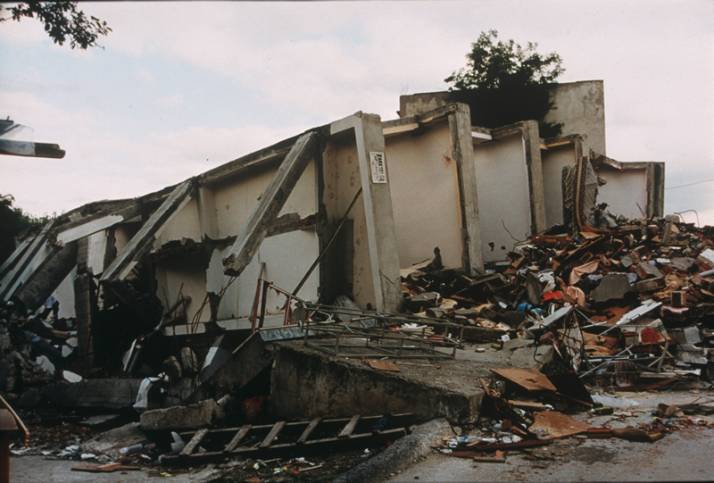
Golcuk Golcuk is west of Yuvacik and east of Yuzbasilar. These are floor slabs that have tipped over with some of the wall supports still attached. This was a five or six story reinforced concrete frame structure in Golcuk. Photo: NOAA National Geophysical Data Center.

Other significant earthquakes nearby

Within 200 km, the deadliest first.

More

Significant earthquakes of 1999The 1900sEvery quake the USGS located in 1999Recent earthquakes near hereThis day in weather history

Sources

Significant earthquakes from NOAA’s National Centers for Environmental Information, Global Historical Hazard Database, cited as NCEI/WDS, doi:10.7289/V5PN93H7. Public domain. Read 2026-09-24. NCEI earthquake 5527.