December 7, 1988 Earthquake: Leninakan, Spitak, Kirovakan, Armenia
A magnitude 6.8 earthquake struck Leninakan, Spitak, Kirovakan, Armenia on December 7, 1988 at 07:41:24 UTC, 5 km below the surface. It killed 25,000 people.
Map
Where it struck, with the other significant earthquakes within 200 km. Circles are sized and colored by magnitude; select one for its page.
The earthquake
- Date
- December 7, 1988
- Time
- 07:41:24 UTC
- Place
- Leninakan, Spitak, Kirovakan, Armenia
- Magnitude
- 6.8 (Ms)
- Focal depth
- 5 km (3 mi)
- Intensity
- 10 on the Modified Mercalli scale
- Tsunami
- None recorded
- Epicenter
- 40.987° N, 44.185° E
- Country
- Armenia
The toll
- Deaths
- 25,000
- Damage
- $16 billion
- Houses destroyed
- Very many (over 1,000)
Where the literature gives no number, NCEI records a description on a scale of 1 to 4, printed here in its words. Damage is in millions of US dollars of the year of the event, not adjusted for inflation.
What the record says
NCEI’s account, from the sources it cites.
December 7, 1988, 07:41:24.2 UTC, 40.987 N, 44.185 E, depth 5 km, magnitude 6.2 mb, 6.8 MS. At least 25,000 people killed, 19,000 injured and 500,000 homeless in the Leninakan-Spitak-Kirovakan area of northern Armena and 58 of them were completely destroyed. Damage totaled 16.2 billion dollars. Damage (X) at Spitak and (IX) at Leninakan, Korovakan and Stepanavan. Surface faulting 10 km in length and with a maximum throw of 1.5 m occurred. Power transmission lines were severely damaged and landslides buried railroad tracks in the epicentral area. Damage occurred in the Kelbodzhar area. Azerbaijan, USSR. Felt (VII) at Tabatskuri, Razdan and Borzhomi; (VI) at Bogdonovka, Tblisi and Yerevan; (V) at Goris; (IV) at Makhachkala and Grozny; (III) at Sheki and Shemakha, USSR. Four people killed and about 200 houses damaged in the Tuzluca-Kagizman-Kars area, Turkey. Felt in the Tabriz-Orumiyeh area, Iran. Two events about three seconds apart. Depth from broadband displacement seismograms based on second event. (reference #1053)
December 7, 1988, Armenia, 25,000 killed, $14,000 million damage. (reference #1250)
Photos
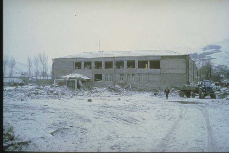
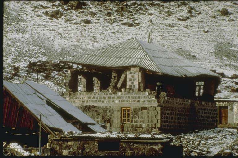
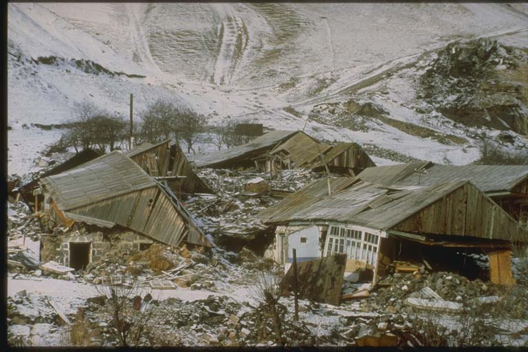
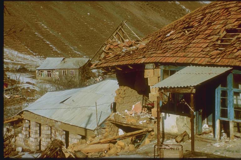
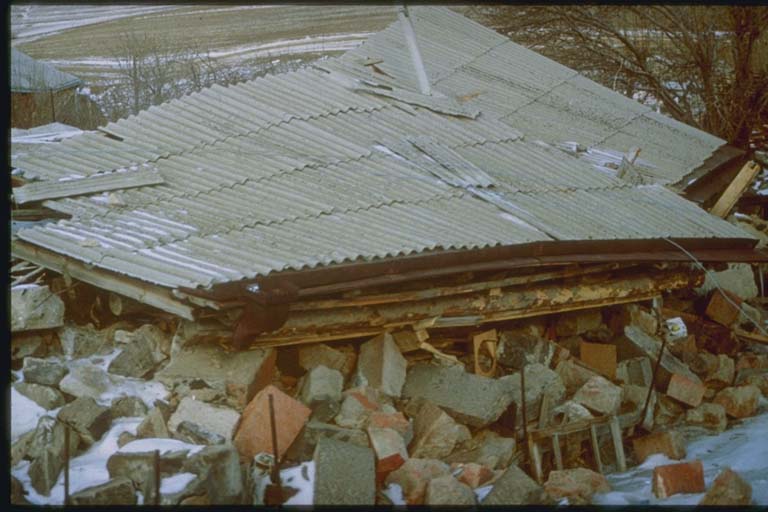
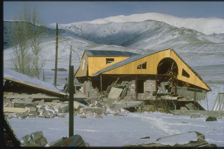
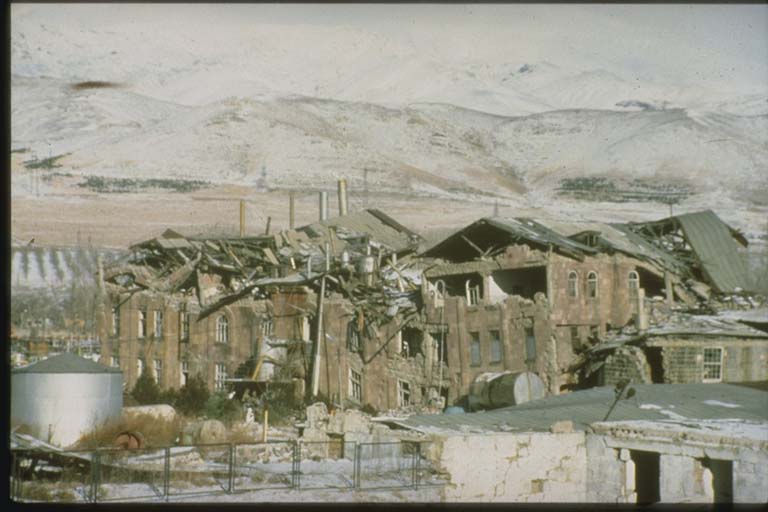
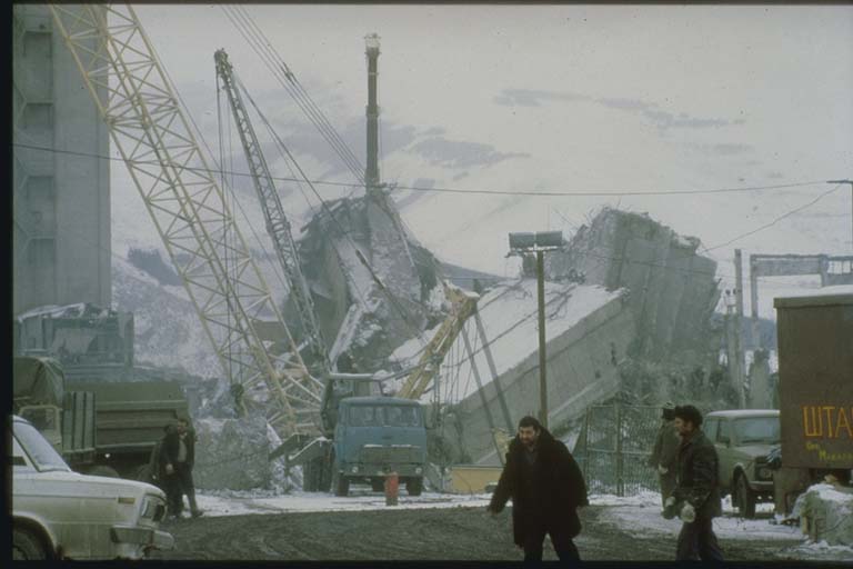
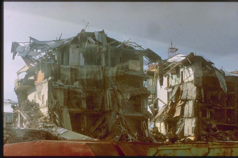
From the NCEI/WDS Natural Hazards Image Database (doi:10.7289/V5154F01). Only photos by the USGS and NOAA, which are public domain, are shown.



Other significant earthquakes nearby
Within 200 km, the deadliest first.
- 1139, Gyzndzha, Azerbaijan
- December 24, 893, Ardabil, Dvin, Iran, Armenia
- 851, Dvin, Armenia
- January 858, Dvina, Turkey, Armenia
- June 4, 1679, Dvina, Turkey, Armenia
- 854, Tovin, Armenia
- October 30, 1983, Erzurum, Kars, Khorasan, Pasinler, Narman, Turkey
- July 2, 1840, Maku, Mt Ararat, Aguri, Aralikh, Iran, Turkey
- May 28, 1903, Varginis,cardahli,mehkerek, Turkey
- May 1, 1935, Kigi, Turkey
- October 22, 1926, Turkey, Armenia
- April 29, 1991, Dzhava, Chiatura, Ambrolauri, Georgia
- December 31, 1899, Turkey
- January 9, 1925, Ardahan, Turkey
- July 12, 1900, Kars,karakurt,kagizman,digor, Turkey
More
Significant earthquakes of 1988The 1900sEvery quake the USGS located in 1988Recent earthquakes near hereThis day in weather history
Sources
Significant earthquakes from NOAA’s National Centers for Environmental Information, Global Historical Hazard Database, cited as NCEI/WDS, doi:10.7289/V5PN93H7. Public domain. Read 2026-09-24. NCEI earthquake 5184.