April 18, 1906 Earthquake: San Francisco, California, United States
A magnitude 7.9 earthquake struck San Francisco, California, United States on April 18, 1906 at 13:12:21 UTC, 20 km below the surface. It killed 700 people.
Map
Where it struck, with the other significant earthquakes within 200 km. Circles are sized and colored by magnitude; select one for its page.
The earthquake
- Date
- April 18, 1906
- Time
- 13:12:21 UTC
- Place
- San Francisco, California, United States
- Magnitude
- 7.9 (Mw)
- Focal depth
- 20 km (12 mi)
- Intensity
- 11 on the Modified Mercalli scale
- Tsunami
- Yes: the tsunami it caused
- Epicenter
- 37.670° N, 122.480° W
- Country
- United States
The toll
- Deaths
- 700
- Damage
- $400 million
- Houses destroyed
- 28,188
Where the literature gives no number, NCEI records a description on a scale of 1 to 4, printed here in its words. Damage is in millions of US dollars of the year of the event, not adjusted for inflation.
What the record says
NCEI’s account, from the sources it cites.
Reference #1128 lists 700 deaths, $24 million dollars damage.
Reference #1248 lists $524 million dollars damage.
Reference #1250 lists 2000 deaths, $524 million dollars damage.
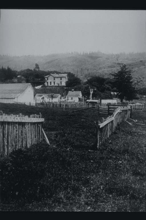
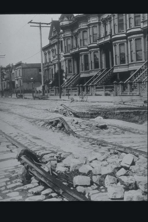
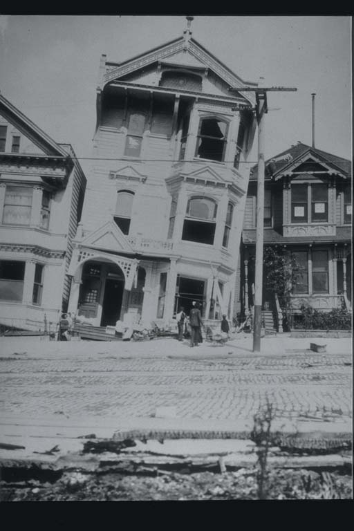
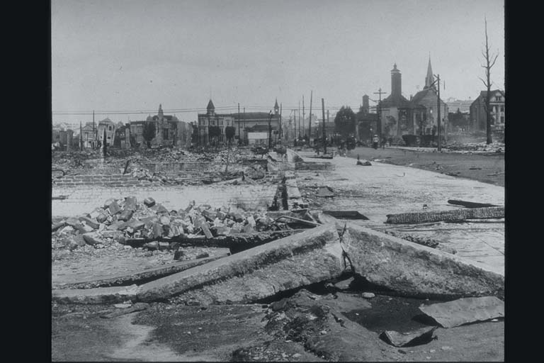
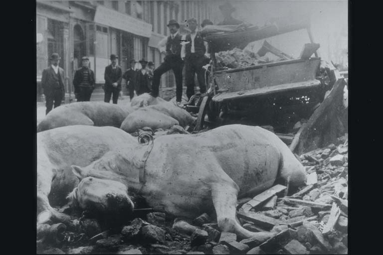
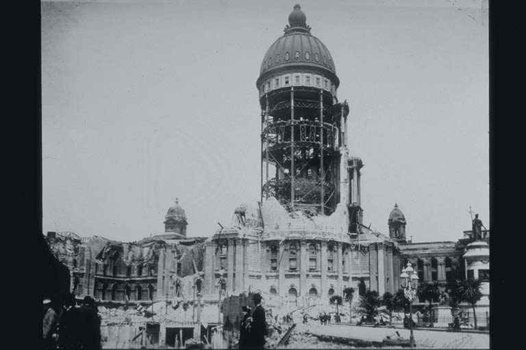
1906, April 18, 5:12 local time (13:12 UTC). There was a catastrophic earthquake in California, which destroyed San Francisco. It was caused by a right-hand horizontal shift of the flanks of the San Andreas fault by up to 4 1/2-6 m on a stretch of 350 to 550 km, according to different estimates. The earthquake began with weak oscillations, and lasted, according to different estimates, from 1 to 3 1/2 minutes. At San Francisco, according to official data, 28,188 homes were destroyed; about 380 people died. The fire which broke out did more damage than the earthquake itself. The destruction from seismic oscillations was largely due to the settling of filled in ground. The settling varied from 10 cm to 1 m. At several places on the coast, homes slid downward towards the sea by up to 1/2 m (2 feet). Everywhere on the high steep coast from Mendosino Cape to Cabo Delgada, on a stretch of many kilometers, slopes collapsed into the sea. On the lower coast between Shelter Cove and Point Arena, bedrocks and loose material slipped into the sea, and the water was turbid for several days after the earthquake (Reference #415).
Photos
From the NCEI/WDS Natural Hazards Image Database (doi:10.7289/V5154F01). Only photos by the USGS and NOAA, which are public domain, are shown.





Other significant earthquakes nearby
Within 200 km, the deadliest first.
- October 18, 1989, Loma Prieta, California, United States
- October 21, 1868, Hayward,san Francisco, California, United States
- August 24, 2014, Napa, Vallejo, California, United States
- October 2, 1969, Santa Rosa, California, United States
- June 1838, San Francisco,san Jose,santa Clara, California, United States
- February 10, 1869, San Francisco, California, United States
- February 13, 1869, San Francisco, California, United States
- May 15, 1851, Northern, California, United States
- October 22, 1854, Northern, California, United States
- October 22, 1855, San Francisco, California, United States
- September 24, 1859, Half Moon Bay, California, United States
- February 15, 1856, Northern, California, United States
- March 22, 1957, San Mateo County, California, United States
- July 20, 2007, Montclair, California, United States
- November 26, 1858, San Jose,san Francisco, California, United States
More
Significant earthquakes of 1906The 1900sEvery quake the USGS located in 1906Recent earthquakes near hereThis day in weather history
Sources
Significant earthquakes from NOAA’s National Centers for Environmental Information, Global Historical Hazard Database, cited as NCEI/WDS, doi:10.7289/V5PN93H7. Public domain. Read 2026-09-24. NCEI earthquake 2768.