January 17, 1994 Earthquake: Northridge, California, United States
A magnitude 6.7 earthquake struck Northridge, California, United States on January 17, 1994 at 12:30:55 UTC, 18 km below the surface. It killed 57 people.
Map
Where it struck, with the other significant earthquakes within 200 km. Circles are sized and colored by magnitude; select one for its page.
The earthquake
- Date
- January 17, 1994
- Time
- 12:30:55 UTC
- Place
- Northridge, California, United States
- Magnitude
- 6.7 (Mw)
- Focal depth
- 18 km (11 mi)
- Intensity
- 9 on the Modified Mercalli scale
- Tsunami
- Yes: the tsunami it caused
- Epicenter
- 34.213° N, 118.537° W
- Country
- United States
The toll
- Deaths
- 57
- Injuries
- 11,846
- Damage
- $40 billion
- Houses destroyed
- 40,000
Where the literature gives no number, NCEI records a description on a scale of 1 to 4, printed here in its words. Damage is in millions of US dollars of the year of the event, not adjusted for inflation.
What the record says
NCEI’s account, from the sources it cites.
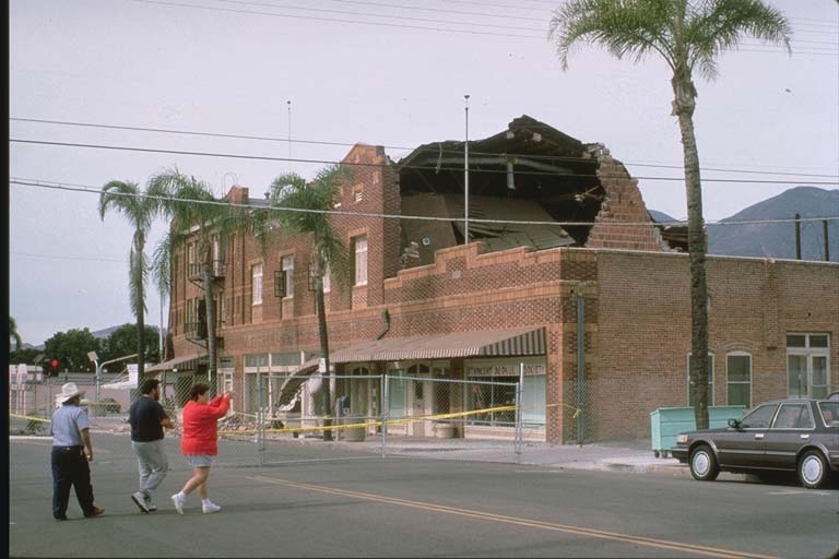
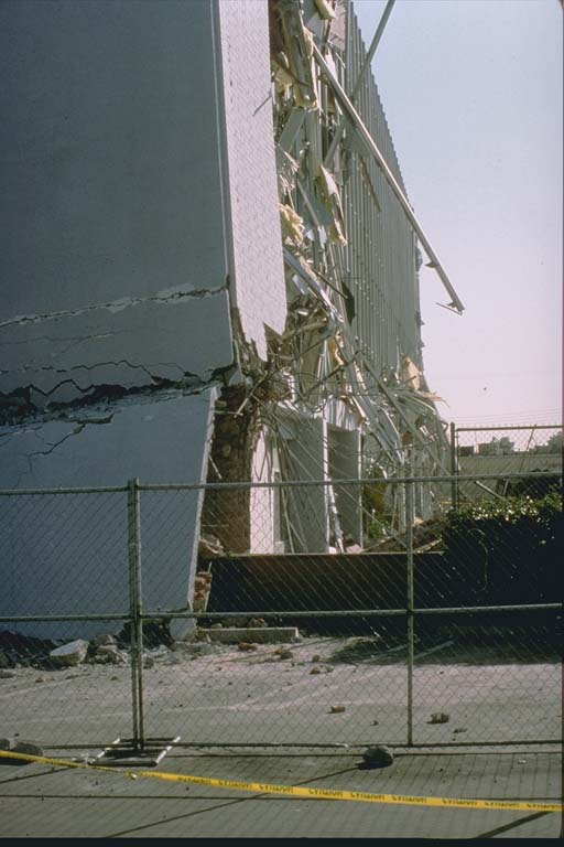
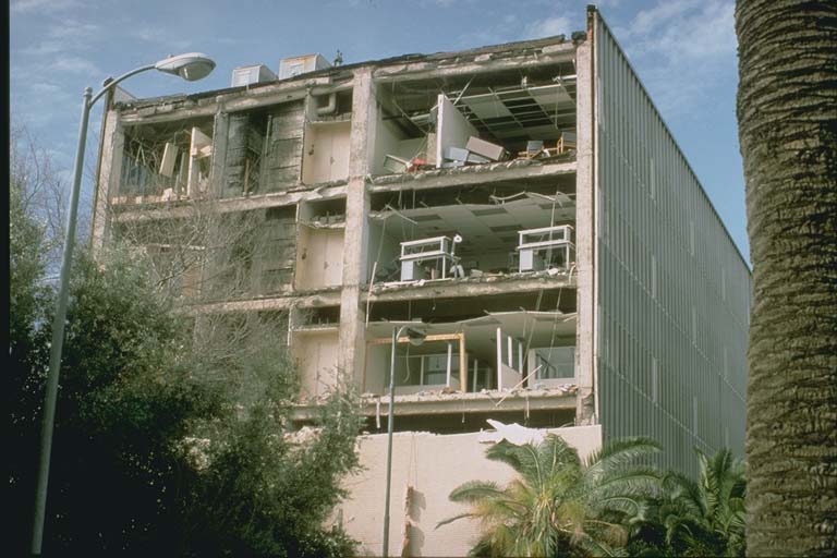
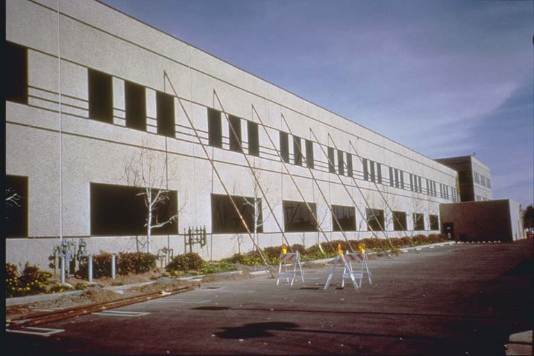
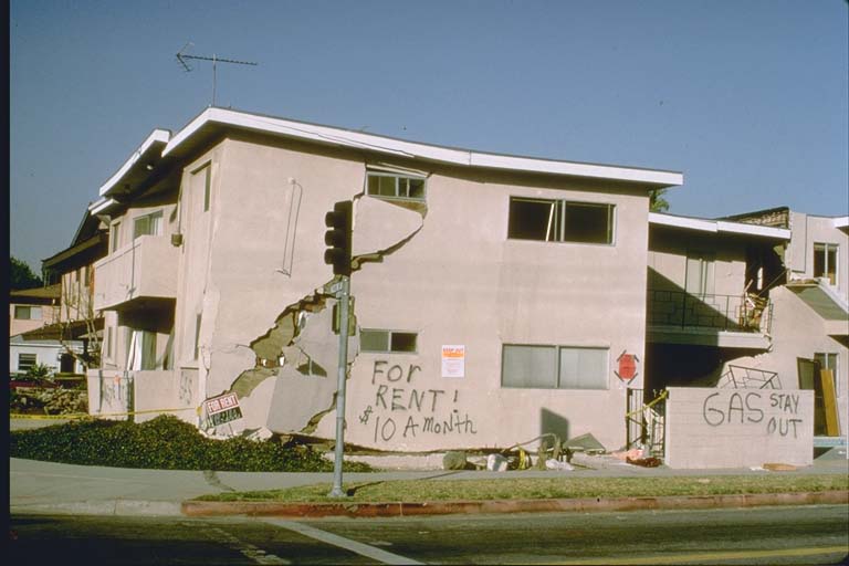
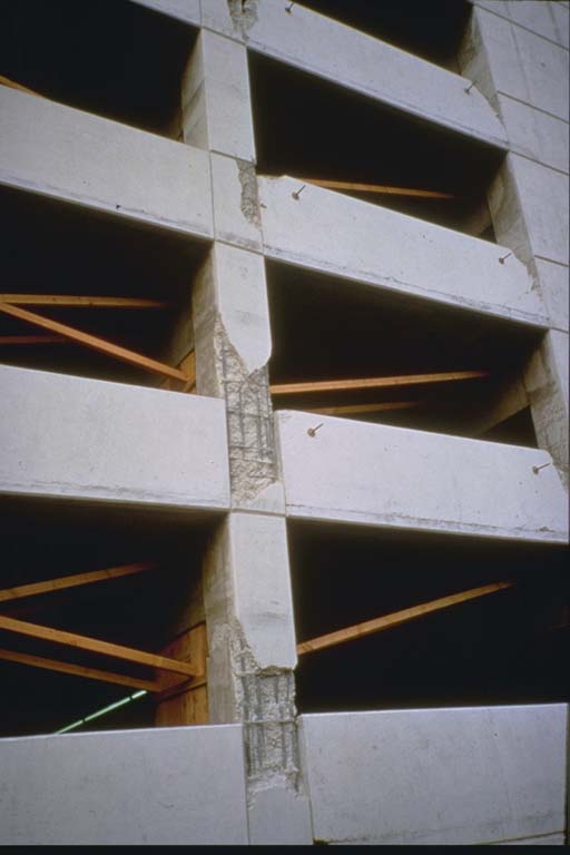
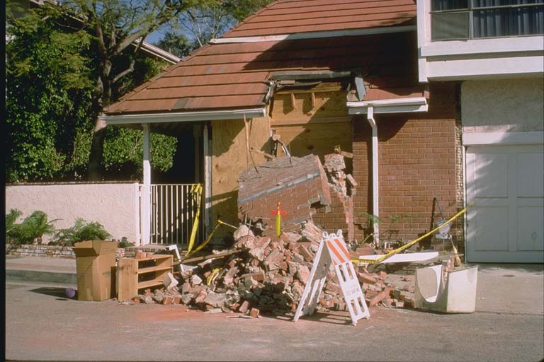
Fatalities, injuries, and damage in Los Angeles, Ventura, Orange and San Bernardino Counties. Maximum intensities of (IX) observed in and near Northridge and in Sherman Oaks. Significant damage occurred at Fillmore, Glendale, Santa Clarita, Santa Monica, Simi Valley and in western and central Los Angeles. Collapsed overpasses closed sections of the Santa Monica, Antelope Valley, Simi Valley and Golden State Freeways. The maximum recorded acceleration exceeded 1.0g at several sites in the area. A maximum uplift of about 15 cm occurred in the Santa Susana Mountains and many rockslides occurred in mountain areas. Some ground cracks were observed at Granada Hills and in Potrero Canyon. Some liquefaction occurred at Simi Valley and in other parts of the Los Angeles Basin.
There were two events about 2.3 seconds apart.
The Northridge Earthquake caused over $40 billion of disaster losses, 57 deaths, and 11,846 injuries. (reference #13955)
Ref. #1053 (USGS PDE) lists damage between $13 and $20 billion; Ref. #1250 (EM-DAT) lists damage $26 billion; Ref. #1289 (Calif Geo Survey) lists damage $40 billion.
Photos
From the NCEI/WDS Natural Hazards Image Database (doi:10.7289/V5154F01). Only photos by the USGS and NOAA, which are public domain, are shown.





Other significant earthquakes nearby
Within 200 km, the deadliest first.
- March 11, 1933, Long Beach, California, United States
- February 9, 1971, San Fernando, California, United States
- December 8, 1812, San Juan Capistrano, California, United States
- June 29, 1925, Santa Barbara, California, United States
- July 21, 1952, Kern County, California, United States
- October 1, 1987, Whittier, California, United States
- December 25, 1899, California, United States
- June 28, 1992, Landers, Yucca Valley, California, United States
- June 28, 1991, Arcadia, Glendale, Los Angeles, California, United States
- August 22, 1952, Kern County, California, United States
- August 31, 1930, Southern, California, United States
- October 4, 1987, Whittier, Pasadena, California, United States
- December 21, 1812, Purisima, California, United States
- April 21, 1918, San Jacinto, Hemet, California, United States
- July 4, 2019, Ridgecrest, Nevada, California, United States
More
Significant earthquakes of 1994The 1900sEvery quake the USGS located in 1994Recent earthquakes near hereThis day in weather history
Sources
Significant earthquakes from NOAA’s National Centers for Environmental Information, Global Historical Hazard Database, cited as NCEI/WDS, doi:10.7289/V5PN93H7. Public domain. Read 2026-09-24. NCEI earthquake 5372.