Significant earthquakes of 1992

June 28, 1992 Earthquake: Landers, Yucca Valley, California, United States

June 28, 1992 · M7.6 · 3 deaths · $92 million

A magnitude 7.6 earthquake struck Landers, Yucca Valley, California, United States on June 28, 1992 at 11:57:34 UTC, 1 km below the surface. It killed 3 people.

Map

Where it struck, with the other significant earthquakes within 200 km. Circles are sized and colored by magnitude; select one for its page.

The earthquake

Date
June 28, 1992
Time
11:57:34 UTC
Place
Landers, Yucca Valley, California, United States
Magnitude
7.6 (Ms)
Focal depth
1 km (1 mi)
Intensity
9 on the Modified Mercalli scale
Tsunami
None recorded
Epicenter
34.201° N, 116.436° W

The toll

Deaths
3
Injuries
400
Damage
$92 million

Where the literature gives no number, NCEI records a description on a scale of 1 to 4, printed here in its words. Damage is in millions of US dollars of the year of the event, not adjusted for inflation.

What the record says

NCEI’s account, from the sources it cites.

1992, June 28. One person was killed at Yucca Valley, two people died of heart attacks, more than 400 people were injured and substantial damage occurred in the Landers-Yucca Valley area. Maximum intensity IX. Preliminary estimate of damage for this earthquake plus the following magnitude 6.7 event at 1505 UTC is 92 million U.S. dollars. Felt throughout southern California, southern Nevada, western Arizona and southern Utah. Felt in high-rise buildings as far north as Boise, Idaho and as far east as Albuquerque, New Mexico and Denver, Colorado. Surface faulting observed along a 70-kilometer segment from Joshua Tree to near Barstow with as much as 5.5 meters of horizontal displacement and as much as 1.8 meters of vertical displacement. Seiches were reported as far north as Lake Union, Washington and as far east as Aurora, Colorado and Corpus Christi, Texas.

(from reference #1053)

Reference #1250 lists $100 million damage.

Photos

From the NCEI/WDS Natural Hazards Image Database (doi:10.7289/V5154F01). Only photos by the USGS and NOAA, which are public domain, are shown.

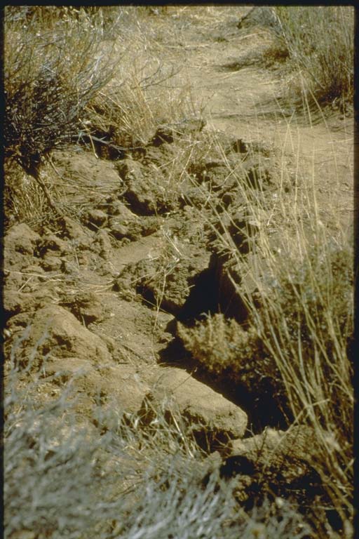
Four to six foot fault scarp, Landers earthquake
Four to six foot fault scarp, Landers earthquake This figure shows the four to six foot fault scarp of the Landers earthquake. The ground rupture, initiated on the Johnson Valley Fault west of Landers, traveled northward along a series of northwest trending faults and terminated in the Rodman Mountains south of Barstow. Measurements indicate a movement along the fault line a maximum of 18 feet… Photo: Lindie Brewer, U.S. Geological Survey.
Liquefaction adjacent to Santa Ana River near Big Bear epicenter
Liquefaction adjacent to Santa Ana River near Big Bear epicenter This figure shows a soil failure adjacent to the Santa Ana River near the epicenter of the Big Bear earthquake. Light colored tan sand lies on top of the gray soil on the cracked road bed. These secondary cracks produced by earth shaking were found near the entrance to the South Fork campground, on slopes and in the stream embankments. There were no… Photo: Lindie Brewer, U.S. Geological Survey.
Ground cracking near Aberdeen
Ground cracking near Aberdeen This figure shows the ground cracking near Aberdeen on State Highway 247. A portion of this highway, the main north - south traffic artery through Johnson Valley, Landers, Flamingo Heights, and Yucca Valley was closed to through traffic. The surface faulting reportedly interrupted the ten mile section of State Highway 247. Road cracks, some described as 30… Photo: Lindie Brewer, U.S. Geological Survey.
Buckled water tank lifted off base by Landers earthquake
Buckled water tank lifted off base by Landers earthquake At the intersection of Reche Road and Lander Lane, 210,000 gallon, 24-foot high, bolted-steel water tank was lifted off a gravel base six to ten inches and set back almost in place, denting the tank's bottom (elephant's foot buckle""). Metal bolts that held the tank sides together were sheared off near the bottom of the tank. The tank was about two-thirds… Photo: Lindie Brewer, U.S. Geological Survey.
Damage to bowling alley near Landers epicenter
Damage to bowling alley near Landers epicenter Yucca Bowl (bowling alley) shown here was located on the eastern edge of the Yucca Valley business district. The Yucca Bowl was housed in a north-south oriented, steel-frame, masonry building. The east wall of the reinforced masonry building pulled away from the building and fell on the adjacent vacant lot. Portions of the roof also collapsed and the… Photo: Lindie Brewer, U.S. Geological Survey.
Detail of damage to bowling alley
Detail of damage to bowling alley A second view of Yucca Bowl (bowling alley) located on the eastern edge of the Yucca Valley business district. The Yucca Bowl was housed in a north-south oriented, steel-frame, masonry building. The east wall of the reinforced masonry building pulled away from the building and fell on the adjacent vacant lot. Portions of the roof also collapsed and the… Photo: Lindie Brewer, U.S. Geological Survey.
Damage to Monument Market near Landers epicenter
Damage to Monument Market near Landers epicenter A view of Monument Market located on the eastern edge of Joshua Tree on Highway 62. The building, probably constructed in the late 1960's, was a single story concrete masonry unit structure with a wood-frame roof. The front of the building included glass panels extending the full length of the building. During the earthquakes, the west wall pulled away… Photo: Lindie Brewer, U.S. Geological Survey.
Detail of damage to Monument Market
Detail of damage to Monument Market A view of Monument Market located on the eastern edge of Joshua Tree on Highway 62. The building, probably constructed in the late 1960's, was a single story concrete masonry unit structure with a wood-frame roof. The front of the building included glass panels extending the full length of the building. During the earthquakes, the west wall pulled away… Photo: Lindie Brewer, U.S. Geological Survey.
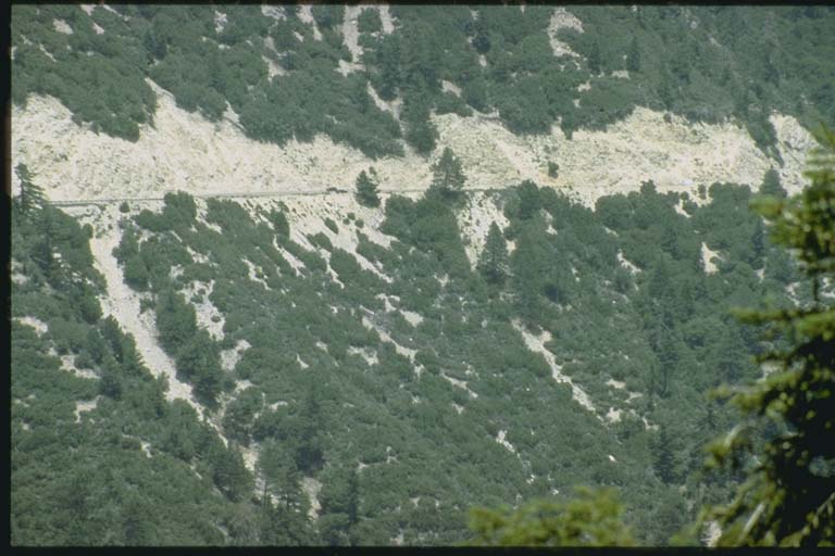
Landslides along Highway 18 in the San Bernardino Mountains
Landslides along Highway 18 in the San Bernardino Mountains This figure shows a view of the landslides along Highway 18 that connects Redlands to Big Bear in the San Bernardino Mountains. The strong shaking also caused landslides to occur along Highway 38. The steep slopes are white in color because of the white decomposed granite soil. Big boulders were embedded in the soil covered slopes. The dust clouds created… Photo: Lindie Brewer, U.S. Geological Survey.
Repair of earthquake-damaged road
Repair of earthquake-damaged road This figure shows a close-up of road repair. Seismic damage to the transportation systems consisted of broken and offset pavement at surface expressions of faulting. Some sections of the asphalt roadway were so badly cracked that road crews graded the sandy shoulders to allow emergency and local residents to bypass the severely damaged sections. Some dirt… Photo: Lindie Brewer, U.S. Geological Survey.
Path of huge boulder dislodged by Big Bear earthquake
Path of huge boulder dislodged by Big Bear earthquake Several huge boulders reportedly bounded down Yucaipa Ridge above Forest Falls. One large boulder crashed down the hillside, mowing down tall cedars in its path. The boulder, the size of a small garage and measuring 16 ft by 16 ft by 14 ft, came to rest about 20 yards behind the Clarke residence on Prospect Drive in the western edge of Forest Falls. The… Photo: Lindie Brewer, U.S. Geological Survey.
Dislodged boulder destroyed forest in its path
Dislodged boulder destroyed forest in its path Several huge boulders reportedly bounded down Yucaipa Ridge above Forest Falls. One large boulder crashed down the hillside, mowing down tall cedars in its path. The boulder, the size of a small garage and measuring 16 ft by 16 ft by 14 ft, came to rest about 20 yards behind the Clarke residence on Prospect Drive in the western edge of Forest Falls. The… Photo: Lindie Brewer, U.S. Geological Survey.

Other significant earthquakes nearby

Within 200 km, the deadliest first.

More

Significant earthquakes of 1992The 1900sEvery quake the USGS located in 1992Recent earthquakes near hereThis day in weather history

Sources

Significant earthquakes from NOAA’s National Centers for Environmental Information, Global Historical Hazard Database, cited as NCEI/WDS, doi:10.7289/V5PN93H7. Public domain. Read 2026-09-24. NCEI earthquake 5328.