August 18, 1959 Earthquake: Hebgen Lake, Montana, United States
A magnitude 7.2 earthquake struck Hebgen Lake, Montana, United States on August 18, 1959 at 06:37:20 UTC, 10 km below the surface. It killed 28 people.
Map
Where it struck, with the other significant earthquakes within 200 km. Circles are sized and colored by magnitude; select one for its page.
The earthquake
- Date
- August 18, 1959
- Time
- 06:37:20 UTC
- Place
- Hebgen Lake, Montana, United States
- Magnitude
- 7.2 (Mw)
- Focal depth
- 10 km (6 mi)
- Intensity
- 10 on the Modified Mercalli scale
- Tsunami
- Yes: the tsunami it caused
- Epicenter
- 44.630° N, 110.891° W
- Country
- United States
The toll
- Deaths
- 28
- Damage
- $11 million
- Houses damaged
- Some (about 51 to 100)
Where the literature gives no number, NCEI records a description on a scale of 1 to 4, printed here in its words. Damage is in millions of US dollars of the year of the event, not adjusted for inflation.
What the record says
NCEI’s account, from the sources it cites.
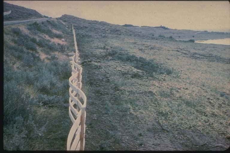
This earthquake caused 28 fatalities and about $11 million damage to highways and timber. It is characterized by extensive fault scarps, subsidence and uplift, a massive landslide, and a seiche in Hebgen Lake. A maximum MM intensity X was assigned to the fault scarps in the epicentral area. The instrumental epicenter lies within the region of surface faulting. The most spectacular and disastrous effect of the earthquke was the huge avalanche of rock, soil, and trees that cascaded from the steep south wall of the Madison River canyon. This slide formed a barrier that blocked the gorge and stoped the flow of the Madison River and within a few weeks, created a lake almost 53 m deep. The volume of material that blocked the Madison River below Hebgen Dam has been estimated at 28-33 million m3. Most of the 28 deaths were caused by rockslides that covered the Rock Creek public campground on the Madison River, about 9.5 km below Hebgen Dam.
New fault scarps as high as 6 m formed near Hebgen Lake. The major fault scarps formed along pre-existing normal faults northeast of Hebgen Lake. Subsidence ocurred over much of an area that was about 24 km north-south and about twice as long east-west. As a result of the faulting near Hebgen Lake, the bedrock beneath the lake was permanently warped, causing the lake floor to drop and generate a seiche. Maximum subsidence was 6.7 m in Hebgen Lake Basin. About 130 km2 subsided more than 3 m, and about 500 km2 subsided more than 0.3 m. The earth-fill dam sustained significant cracks in its concrete core and spillway, but it continued to be an effective structure.
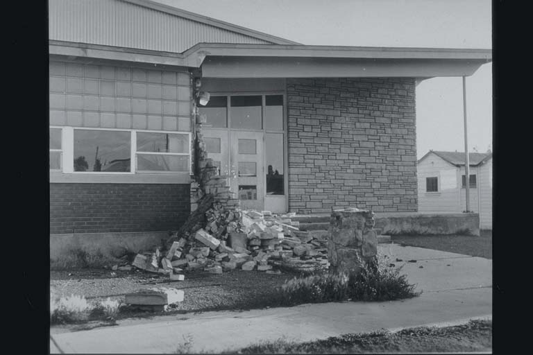
Many summer houses in the Hebgen Lake area were damaged: houses and cabins shifted off their foundations, chimneys fell, and pipeines broke. Most small-unit masonry structures and wooden buildings along the major fault scarps survived with little damage when subjected only to vibratory forces. Roadways were cracked and shifted extensively, and much timber was destroyed. Highway damage near Hebgen Lake was due to landslides slumping vertically and flowing laterally beneath pavements and bridges, which caused severe cracks and destruction. Three of the five reinforced bridges in the epicentral area also sustained significant damage.
High intensities were observed in the northwest section of Yellowstone National Park. Here, new geysers erupted and massive slumping caused large cracks in the ground from which steam emitted. Many hot springs became muddy.
(above from reference #542)
Reference #1250 lists $26 million dollars damage.
Reference #10476 (v.10) lists 1959-08-18 06:37:20.43 UTC, 44.63 N 110.91 W, magnitude 7.2 Mw
Photos
From the NCEI/WDS Natural Hazards Image Database (doi:10.7289/V5154F01). Only photos by the USGS and NOAA, which are public domain, are shown.

Other significant earthquakes nearby
Within 200 km, the deadliest first.
More
Significant earthquakes of 1959The 1900sEvery quake the USGS located in 1959Recent earthquakes near hereThis day in weather history
Sources
Significant earthquakes from NOAA’s National Centers for Environmental Information, Global Historical Hazard Database, cited as NCEI/WDS, doi:10.7289/V5PN93H7. Public domain. Read 2026-09-24. NCEI earthquake 4199.