June 28, 1925 Earthquake: Clarkston Valley, Montana, United States
A magnitude 6.7 earthquake struck Clarkston Valley, Montana, United States on June 28, 1925 at 01:21:05 UTC, 25 km below the surface.
Map
Where it struck, with the other significant earthquakes within 200 km. Circles are sized and colored by magnitude; select one for its page.
The earthquake
- Date
- June 28, 1925
- Time
- 01:21:05 UTC
- Place
- Clarkston Valley, Montana, United States
- Magnitude
- 6.7 (Ms)
- Focal depth
- 25 km (16 mi)
- Intensity
- 8 on the Modified Mercalli scale
- Tsunami
- None recorded
- Epicenter
- 46.400° N, 111.240° W
- Country
- United States
The toll
- Damage
- $150,000
- Houses damaged
- Some (about 51 to 100)
Where the literature gives no number, NCEI records a description on a scale of 1 to 4, printed here in its words. Damage is in millions of US dollars of the year of the event, not adjusted for inflation.
What the record says
NCEI’s account, from the sources it cites.
1925. June 28, 01 21 (June 27). Clarkston Valley, north of Gallatin County, Mont. The most severe damage from this strong earthquake occurred in Gallatin County at Manhattan, Three Forks, Logan, and Lombard. Because no large cities were near the epicenter, property damage did not exceed
$150,000.
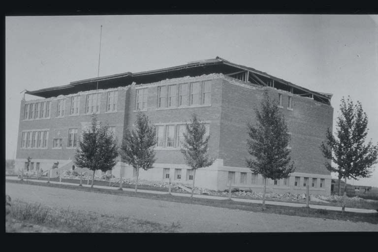
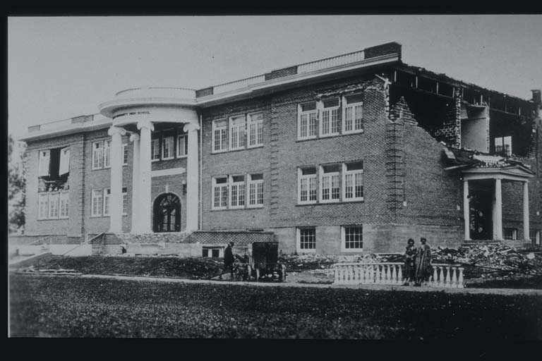
At Manhattan, the community high school and the
grade school were both damaged severely, but reinforced concrete buildings were undamaged. Many chimneys were toppled.
At Three Forks, walls of the schoolhouse bulged on
all sides, and its foundation and basement were damaged.
A church, whose walls were not tied together by an upper floor, also sustained heavy damage. Later shocks demolished the walls. Almost all masonry buildings showed cracks and damage, but because most of the buildings were of frame construction, they sustained only cracks in plaster and some
fallen chimneys.
At Logan, the poorly designed and constructed
schoolhouse was damaged heavily. However, a large brick roundhouse sustained only a few cracks. As at Three Forks, most of the buildings at Logan were of frame construction and therefore sustained only cracks in plaster and destruction of chimneys.
At Lombard, where the Chicago, Milwaukee and St. Paul Railway crosses the Northern Pacific Railway, large boulders were dislodged to such an extent that trains were delayed on the Northern Pacific line. Also, a huge rock slide blocked the Deer Park entrance of the Lombard Tunnel on the Chicago, Milwaukee and St. Paul Railway and the canyon of Sixteenmile Creek, causing a lake to form.
Cracks occurred in graded and filled roads but not
in cuts or where the natural surface had not been disturbed. Approaches to many bridges settled as much as 30 cm. One spring formed near Josephine and began to flow, but other springs and sources of water in the neighborhood ceased to flow. Felt from the North Dakota line to Washington, and from southern Canada to southern Wyoming Aflershocks continued for several months.
(above from reference #542)
Photos
From the NCEI/WDS Natural Hazards Image Database (doi:10.7289/V5154F01). Only photos by the USGS and NOAA, which are public domain, are shown.
Other significant earthquakes nearby
Within 200 km, the deadliest first.
More
Significant earthquakes of 1925The 1900sEvery quake the USGS located in 1925Recent earthquakes near hereThis day in weather history
Sources
Significant earthquakes from NOAA’s National Centers for Environmental Information, Global Historical Hazard Database, cited as NCEI/WDS, doi:10.7289/V5PN93H7. Public domain. Read 2026-09-24. NCEI earthquake 9672.