M5.1 earthquake 57 km SE of Adak, Alaska
A magnitude 5.1 earthquake struck 57 km SE of Adak, Alaska on Sun, Nov 6, 2022, 1:02 AM HADT (10:02 UTC), 49 km (30 mi) below the surface.
Map
Where this earthquake was located, with the others nearby. Select one for its page.
The earthquake
- Magnitude
- 5.1 (Mww, W-phase moment), moderate
- Magnitude from
- USGS National Earthquake Information Center
- Local time
- UTC
- 2022-11-06 10:02:04 UTC
- Depth
- 48.9 km (30.4 mi), shallow
- Epicenter
- 51.550° N, 175.983° W
- Region
- Alaska
- Felt reports
- 3
- Strongest shaking
- III, weak shaking
- Tsunami flag
- Yes: a large quake in an oceanic region
- Status
- Reviewed by a seismologist
Magnitude estimates
Different scales measure different things and differ by a few tenths. The USGS marks one as preferred, and it is the one this page uses.
| Mag. | Scale | Computed by | Notes |
|---|---|---|---|
| 5.1 | Mww, W-phase moment | USGS National Earthquake Information Center | Preferred · Reviewed · ±0.08 · 15 stations |
| 5.1 | Mww, W-phase moment | Alaska Earthquake Center | Preliminary |
| 5.1 | ML, local (Richter) | NOAA National Tsunami Warning Center | Reviewed · 17 stations |
| 5.1 | Mwr, regional moment | USGS National Earthquake Information Center | Moment tensor · Reviewed |
Tsunami
The USGS flags a quake this large in an oceanic region. The flag does not mean a tsunami happened; the tsunami warning centers decide that, and their messages are below when they issued any.
Current tsunami warnings: tsunami.gov. Warnings in force in the US also appear on our alerts pages.
Shaking
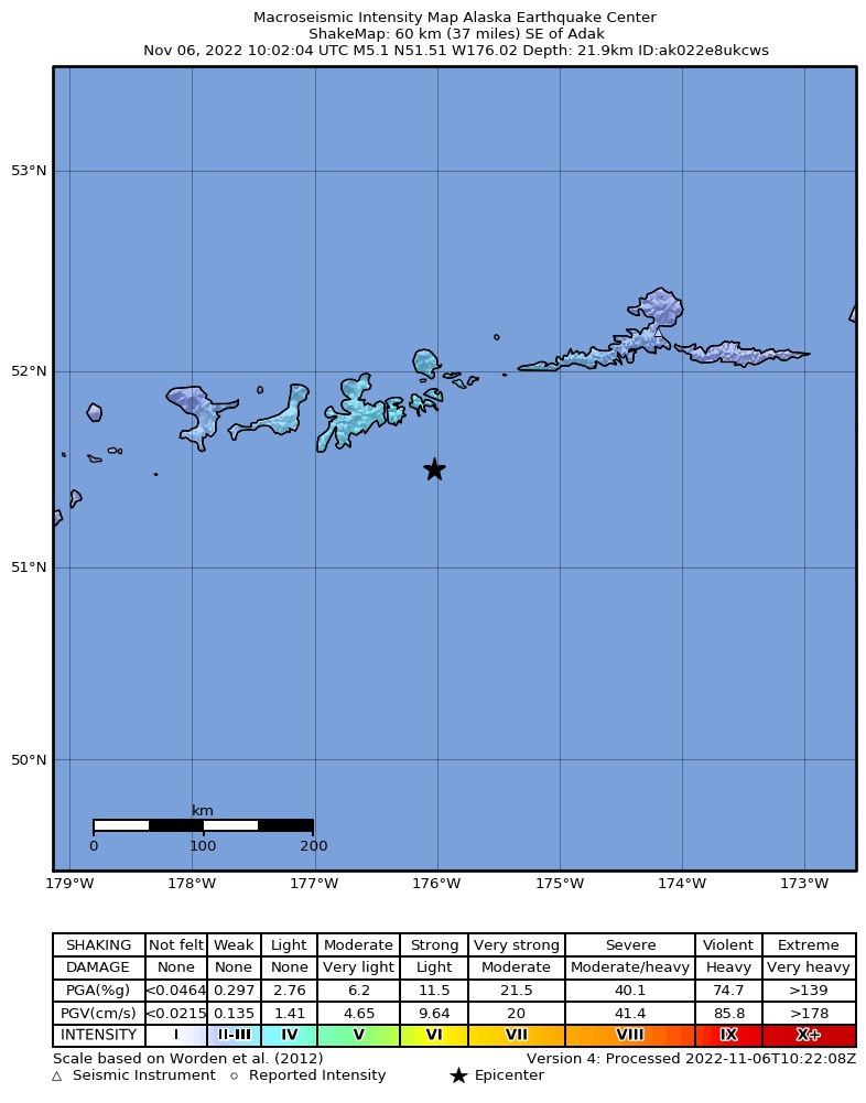
The USGS ShakeMap: shaking estimated from seismic stations and the quake’s size, on the Modified Mercalli intensity scale.
- Strongest estimated
- III, weak shaking
- Peak ground acceleration
- 1.5% of gravity
- Peak ground velocity
- -0.3 cm/s
- Map
- Automatic
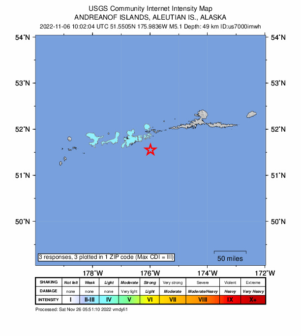
Did you feel it?
3 people reported to the USGS what they felt; the strongest reported shaking was III, weak shaking.
Fault motion and ground failure
How the rock slipped, from the moment tensor, and the USGS estimate of landslides and liquefaction.
- Faulting
- Reverse (thrust)
- Moment magnitude
- 5.1 Mww
- Nodal plane 1
- Strike 269°, dip 37°, rake 119°
- Nodal plane 2
- Strike 54°, dip 59°, rake 70°
How well it is located
Reviewed by a seismologist.
- Location uncertainty
- About 4.7 km horizontally, 4.6 km in depth
- Magnitude uncertainty
- ±0.08
- Depth from
- From location
- Station coverage gap
- 135°
- Stations used
- 136
Nearby
Within 100 km, magnitude 2.1 and up: 97 in the 60 days after this one and 31 in the 30 days before it.
After
- 2.1Andreanof Islands, Aleutian Islands, Alaska · 1426 days ago · 22 km deep · 6 km away
- 3.0Andreanof Islands, Aleutian Islands, Alaska · 1425 days ago · 35 km deep · 11 km away
- 2.6Andreanof Islands, Aleutian Islands, Alaska · 1425 days ago · 51 km deep · 32 km away
- 3.959 km ESE of Adak, Alaska · 1425 days ago · 68 km deep · 23 km away
- 2.4120 km SSW of Atka, Alaska · 1425 days ago · 13 km deep · 83 km away
- 2.1113 km SSW of Atka, Alaska · 1425 days ago · 9 km deep · 77 km away
- 3.0118 km SSW of Atka, Alaska · 1424 days ago · 10 km deep · 79 km away
- 4.197 km ESE of Adak, Alaska · 1424 days ago · 35 km deep · 48 km away
- 4.293 km ESE of Adak, Alaska · 1424 days ago · 47 km deep · 46 km away
- 3.074 km SSE of Adak, Alaska · 1421 days ago · 41 km deep · 28 km away
- 2.957 km ESE of Adak, Alaska · 1421 days ago · 35 km deep · 9 km away
- 2.8Andreanof Islands, Aleutian Islands, Alaska · 1420 days ago · 81 km deep · 29 km away
- 2.158 km SSW of Atka, Alaska · 1420 days ago · 8 km deep · 95 km away
- 2.145 km E of Adak, Alaska · 1419 days ago · 79 km deep · 36 km away
- 2.759 km SSE of Adak, Alaska · 1419 days ago · 35 km deep · 33 km away
- 2.169 km ESE of Adak, Alaska · 1419 days ago · 24 km deep · 14 km away
- 2.2102 km SE of Adak, Alaska · 1417 days ago · 25 km deep · 45 km away
- 2.255 km SE of Adak, Alaska · 1416 days ago · 24 km deep · 14 km away
- 3.494 km ESE of Adak, Alaska · 1415 days ago · 44 km deep · 37 km away
- 2.219 km SE of Adak, Alaska · 1415 days ago · 67 km deep · 38 km away
- 2.9Andreanof Islands, Aleutian Islands, Alaska · 1414 days ago · 35 km deep · 19 km away
- 3.065 km SSW of Adak, Alaska · 1413 days ago · 35 km deep · 76 km away
- 2.675 km SE of Adak, Alaska · 1412 days ago · 35 km deep · 21 km away
- 2.290 km ENE of Adak, Alaska · 1412 days ago · 157 km deep · 91 km away
- 2.797 km SW of Atka, Alaska · 1411 days ago · 35 km deep · 58 km away
- 2.799 km ESE of Adak, Alaska · 1410 days ago · 35 km deep · 48 km away
- 2.742 km ENE of Adak, Alaska · 1409 days ago · 131 km deep · 53 km away
- 3.392 km SW of Atka, Alaska · 1408 days ago · 35 km deep · 54 km away
- 2.8119 km SSW of Atka, Alaska · 1408 days ago · 35 km deep · 65 km away
- 2.382 km W of Atka, Alaska · 1407 days ago · 109 km deep · 78 km away
- 2.5Andreanof Islands, Aleutian Islands, Alaska · 1406 days ago · 51 km deep · 68 km away
- 2.867 km SE of Adak, Alaska · 1405 days ago · 35 km deep · 16 km away
- 3.439 km SSW of Adak, Alaska · 1405 days ago · 35 km deep · 64 km away
- 4.883 km ESE of Adak, Alaska · 1404 days ago · 52 km deep · 27 km away · felt by 1
- 2.373 km E of Adak, Alaska · 1404 days ago · 158 km deep · 51 km away
- 3.342 km S of Adak, Alaska · 1404 days ago · 35 km deep · 50 km away
- 2.165 km SE of Adak, Alaska · 1403 days ago · 26 km deep · 12 km away
- 3.084 km SW of Atka, Alaska · 1402 days ago · 35 km deep · 65 km away
- 2.538 km E of Adak, Alaska · 1402 days ago · 134 km deep · 38 km away
- 2.754 km SSE of Adak, Alaska · 1402 days ago · 35 km deep · 36 km away
- 2.264 km SW of Adak, Alaska · 1401 days ago · 27 km deep · 89 km away
- 2.527 km SSW of Adak, Alaska · 1401 days ago · 73 km deep · 52 km away
- 3.060 km SSE of Adak, Alaska · 1401 days ago · 35 km deep · 33 km away
- 4.2Andreanof Islands, Aleutian Islands, Alaska · 1401 days ago · 49 km deep · 51 km away
- 2.256 km SSE of Adak, Alaska · 1400 days ago · 24 km deep · 39 km away
- 2.982 km SSE of Adak, Alaska · 1399 days ago · 35 km deep · 44 km away
- 2.789 km SE of Adak, Alaska · 1398 days ago · 35 km deep · 32 km away
- 4.893 km ESE of Adak, Alaska · 1396 days ago · 47 km deep · 44 km away · felt by 1
- 3.696 km ESE of Adak, Alaska · 1395 days ago · 46 km deep · 48 km away
- 2.562 km SE of Adak, Alaska · 1394 days ago · 34 km deep · 7 km away
- 4.3Andreanof Islands, Aleutian Islands, Alaska · 1394 days ago · 51 km deep · 44 km away
- 2.9Andreanof Islands, Aleutian Islands, Alaska · 1394 days ago · 31 km deep · 48 km away
- 3.1103 km SW of Atka, Alaska · 1394 days ago · 35 km deep · 53 km away
- 2.521 km W of Adak, Alaska · 1393 days ago · 94 km deep · 73 km away
- 2.527 km SE of Adak, Alaska · 1391 days ago · 70 km deep · 30 km away
- 2.892 km SE of Adak, Alaska · 1391 days ago · 10 km deep · 37 km away
- 2.647 km NE of Adak, Alaska · 1390 days ago · 175 km deep · 68 km away
- 2.319 km ESE of Adak, Alaska · 1390 days ago · 77 km deep · 38 km away
- 4.094 km SW of Atka, Alaska · 1389 days ago · 50 km deep · 52 km away
- 3.245 km SSE of Adak, Alaska · 1388 days ago · 39 km deep · 26 km away
The first 60 of 97.
Before
- 2.6Andreanof Islands, Aleutian Islands, Alaska · 1426 days ago · 167 km deep · 49 km away
- 3.032 km ESE of Adak, Alaska · 1427 days ago · 79 km deep · 31 km away
- 2.1Andreanof Islands, Aleutian Islands, Alaska · 1427 days ago · 142 km deep · 63 km away
- 2.955 km SSW of Adak, Alaska · 1428 days ago · 35 km deep · 66 km away
- 2.190 km SSE of Adak, Alaska · 1429 days ago · 15 km deep · 50 km away
- 2.942 km S of Adak, Alaska · 1429 days ago · 35 km deep · 48 km away
- 2.563 km E of Adak, Alaska · 1430 days ago · 90 km deep · 51 km away
- 4.090 km ESE of Adak, Alaska · 1430 days ago · 46 km deep · 45 km away
- 2.683 km ESE of Adak, Alaska · 1432 days ago · 52 km deep · 37 km away
- 3.1Andreanof Islands, Aleutian Islands, Alaska · 1432 days ago · 246 km deep · 72 km away
- 2.663 km SSW of Adak, Alaska · 1433 days ago · 35 km deep · 78 km away
- 3.083 km SSE of Adak, Alaska · 1433 days ago · 10 km deep · 44 km away
- 2.5Andreanof Islands, Aleutian Islands, Alaska · 1434 days ago · 35 km deep · 47 km away
- 3.017 km SW of Adak, Alaska · 1437 days ago · 72 km deep · 59 km away
- 2.767 km SSW of Adak, Alaska · 1438 days ago · 35 km deep · 78 km away
- 2.858 km SE of Adak, Alaska · 1440 days ago · 35 km deep · 8 km away
- 2.579 km SSW of Atka, Alaska · 1440 days ago · 35 km deep · 85 km away
- 3.6Andreanof Islands, Aleutian Islands, Alaska · 1441 days ago · 35 km deep · 83 km away
- 2.139 km ENE of Adak, Alaska · 1441 days ago · 139 km deep · 55 km away
- 2.130 km NNE of Adak, Alaska · 1441 days ago · 209 km deep · 75 km away
Earthquakes todayAlaska earthquakesLive radar here
Sources
From the USGS Earthquake Hazards Program and its partner networks, event us7000imwh (also filed as at00rkx7vf, ak022e8ukcws). Read Thu, Oct 1, 2026, 10:15 PM UTC.