M4.8 earthquake 93 km ESE of Adak, Alaska
A magnitude 4.8 earthquake struck 93 km ESE of Adak, Alaska on Mon, Dec 5, 2022, 5:33 AM HAST (15:33 UTC), 47 km (29 mi) below the surface.
Map
Where this earthquake was located, with the others nearby. Select one for its page.
The earthquake
- Magnitude
- 4.8 (mb), light
- Local time
- UTC
- 2022-12-05 15:33:45 UTC
- Depth
- 46.8 km (29.1 mi), shallow
- Epicenter
- 51.605° N, 175.352° W
- Region
- Alaska
- Felt reports
- 1
- Strongest shaking
- III, weak shaking
- Tsunami flag
- No
- Status
- Reviewed by a seismologist
Shaking
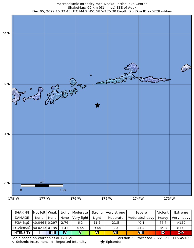
The USGS ShakeMap: shaking estimated from seismic stations and the quake’s size, on the Modified Mercalli intensity scale.
- Strongest estimated
- III, weak shaking
- Peak ground acceleration
- 0.6% of gravity
- Peak ground velocity
- -1.3 cm/s
- Map
- Automatic
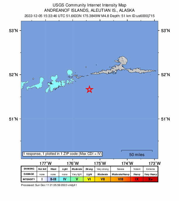
Did you feel it?
1 person reported to the USGS what they felt; the strongest reported shaking was IV, light shaking.
How well it is located
Reviewed by a seismologist.
- Location uncertainty
- About 5.0 km horizontally, 5.1 km in depth
- Magnitude uncertainty
- ±0.03
- Depth from
- From location
- Station coverage gap
- 132°
- Stations used
- 98
Nearby
Within 100 km, magnitude 1.8 and up: 145 in the 60 days after this one and 89 in the 30 days before it.
After
- 2.062 km SE of Adak, Alaska · 1394 days ago · 25 km deep · 44 km away
- 3.696 km ESE of Adak, Alaska · 1394 days ago · 46 km deep · 4 km away
- 2.060 km SE of Adak, Alaska · 1394 days ago · 37 km deep · 43 km away
- 1.952 km W of Atka, Alaska · 1393 days ago · 14 km deep · 66 km away
- 2.016 km SSE of Adak, Alaska · 1393 days ago · 115 km deep · 83 km away
- 2.049 km SSE of Adak, Alaska · 1393 days ago · 34 km deep · 69 km away
- 2.562 km SE of Adak, Alaska · 1392 days ago · 34 km deep · 44 km away
- 4.3Andreanof Islands, Aleutian Islands, Alaska · 1392 days ago · 51 km deep · 7 km away
- 2.9Andreanof Islands, Aleutian Islands, Alaska · 1392 days ago · 31 km deep · 4 km away
- 3.1103 km SW of Atka, Alaska · 1392 days ago · 35 km deep · 13 km away
- 1.960 km SE of Adak, Alaska · 1392 days ago · 15 km deep · 57 km away
- 1.9109 km SSW of Atka, Alaska · 1391 days ago · 16 km deep · 32 km away
- 2.4Andreanof Islands, Aleutian Islands, Alaska · 1391 days ago · 22 km deep · 77 km away
- 2.527 km SE of Adak, Alaska · 1390 days ago · 70 km deep · 70 km away
- 2.499 km S of Atka, Alaska · 1389 days ago · 19 km deep · 81 km away
- 2.892 km SE of Adak, Alaska · 1389 days ago · 10 km deep · 48 km away
- 2.647 km NE of Adak, Alaska · 1389 days ago · 175 km deep · 81 km away
- 2.319 km ESE of Adak, Alaska · 1388 days ago · 77 km deep · 74 km away
- 3.6Andreanof Islands, Aleutian Islands, Alaska · 1388 days ago · 35 km deep · 84 km away
- 4.094 km SW of Atka, Alaska · 1388 days ago · 50 km deep · 9 km away
- 2.063 km SE of Adak, Alaska · 1387 days ago · 17 km deep · 47 km away
- 1.815 km SE of Adak, Alaska · 1387 days ago · 64 km deep · 81 km away
- 3.245 km SSE of Adak, Alaska · 1386 days ago · 39 km deep · 70 km away
- 3.144 km SSE of Adak, Alaska · 1386 days ago · 43 km deep · 69 km away
- 2.285 km E of Adak, Alaska · 1386 days ago · 74 km deep · 33 km away
- 3.067 km NE of Adak, Alaska · 1385 days ago · 229 km deep · 87 km away
- 3.770 km ESE of Adak, Alaska · 1385 days ago · 65 km deep · 23 km away
- 3.3100 km S of Atka, Alaska · 1385 days ago · 12 km deep · 75 km away
- 3.063 km SE of Adak, Alaska · 1384 days ago · 35 km deep · 56 km away
- 1.960 km SSE of Adak, Alaska · 1383 days ago · 24 km deep · 59 km away
- 2.082 km ESE of Adak, Alaska · 1383 days ago · 24 km deep · 18 km away
- 2.553 km ESE of Adak, Alaska · 1383 days ago · 108 km deep · 40 km away
- 2.996 km SE of Adak, Alaska · 1383 days ago · 10 km deep · 39 km away
- 1.860 km SE of Adak, Alaska · 1382 days ago · 26 km deep · 46 km away
- 2.04 km NNW of Adak, Alaska · 1382 days ago · 69 km deep · 96 km away
- 2.242 km S of Atka, Alaska · 1382 days ago · 40 km deep · 79 km away
- 3.392 km SW of Atka, Alaska · 1381 days ago · 35 km deep · 13 km away
- 3.548 km SE of Adak, Alaska · 1381 days ago · 55 km deep · 54 km away
- 1.971 km SSE of Adak, Alaska · 1381 days ago · 20 km deep · 73 km away
- 3.020 km ENE of Adak, Alaska · 1381 days ago · 200 km deep · 81 km away
- 2.088 km ESE of Adak, Alaska · 1381 days ago · 24 km deep · 12 km away
- 2.6Andreanof Islands, Aleutian Islands, Alaska · 1381 days ago · 35 km deep · 84 km away
- 2.652 km SSW of Atka, Alaska · 1380 days ago · 35 km deep · 69 km away
- 2.231 km SSW of Atka, Alaska · 1379 days ago · 33 km deep · 79 km away
- 2.055 km SE of Adak, Alaska · 1379 days ago · 29 km deep · 49 km away
- 1.938 km S of Adak, Alaska · 1379 days ago · 37 km deep · 87 km away
- 1.984 km SE of Adak, Alaska · 1378 days ago · 17 km deep · 30 km away
- 3.073 km WNW of Atka, Alaska · 1378 days ago · 133 km deep · 92 km away
- 3.956 km NE of Adak, Alaska · 1377 days ago · 182 km deep · 77 km away
- 3.251 km S of Atka, Alaska · 1376 days ago · 35 km deep · 87 km away
- 2.3108 km SSE of Adak, Alaska · 1375 days ago · 7 km deep · 69 km away
- 3.064 km SSE of Adak, Alaska · 1374 days ago · 35 km deep · 72 km away
- 2.733 km ENE of Adak, Alaska · 1374 days ago · 141 km deep · 70 km away
- 2.139 km SSE of Adak, Alaska · 1373 days ago · 32 km deep · 70 km away
- 2.159 km SE of Adak, Alaska · 1373 days ago · 23 km deep · 57 km away
- 3.169 km ENE of Adak, Alaska · 1371 days ago · 147 km deep · 65 km away
- 2.151 km SE of Adak, Alaska · 1370 days ago · 30 km deep · 60 km away
- 3.763 km SE of Adak, Alaska · 1370 days ago · 35 km deep · 55 km away
- 1.871 km ESE of Adak, Alaska · 1370 days ago · 22 km deep · 28 km away
- 1.99 km SSE of Adak, Alaska · 1369 days ago · 70 km deep · 88 km away
The first 60 of 145.
Before
- 2.789 km SE of Adak, Alaska · 1396 days ago · 35 km deep · 28 km away
- 1.967 km S of Adak, Alaska · 1397 days ago · 28 km deep · 97 km away
- 1.930 km E of Adak, Alaska · 1397 days ago · 82 km deep · 67 km away
- 2.059 km SE of Adak, Alaska · 1397 days ago · 26 km deep · 45 km away
- 1.940 km SSE of Adak, Alaska · 1398 days ago · 36 km deep · 71 km away
- 2.982 km SSE of Adak, Alaska · 1398 days ago · 35 km deep · 75 km away
- 1.871 km SE of Adak, Alaska · 1398 days ago · 26 km deep · 41 km away
- 1.855 km SE of Adak, Alaska · 1399 days ago · 22 km deep · 51 km away
- 2.256 km SSE of Adak, Alaska · 1399 days ago · 24 km deep · 81 km away
- 4.2Andreanof Islands, Aleutian Islands, Alaska · 1399 days ago · 49 km deep · 12 km away
- 3.060 km SSE of Adak, Alaska · 1399 days ago · 35 km deep · 74 km away
- 2.527 km SSW of Adak, Alaska · 1399 days ago · 73 km deep · 94 km away
- 1.9101 km ESE of Adak, Alaska · 1400 days ago · 19 km deep · 11 km away
- 2.754 km SSE of Adak, Alaska · 1400 days ago · 35 km deep · 79 km away
- 2.538 km E of Adak, Alaska · 1400 days ago · 134 km deep · 59 km away
- 2.270 km S of Atka, Alaska · 1401 days ago · 38 km deep · 77 km away
- 3.084 km SW of Atka, Alaska · 1401 days ago · 35 km deep · 21 km away
- 1.978 km WSW of Atka, Alaska · 1401 days ago · 80 km deep · 29 km away
- 2.165 km SE of Adak, Alaska · 1401 days ago · 26 km deep · 47 km away
- 1.917 km SSE of Adak, Alaska · 1402 days ago · 104 km deep · 82 km away
Earthquakes todayAlaska earthquakesLive radar here
Sources
From the USGS Earthquake Hazards Program and its partner networks, event us6000j715 (also filed as ak022fkwbbim). Read Wed, Sep 30, 2026, 6:58 AM UTC.