M2.3 earthquake 19km NW of Parkfield, CA
A magnitude 2.3 earthquake struck 19km NW of Parkfield, CA on Wed, Jul 28, 2021, 8:29 PM PDT (03:29 UTC), 4 km (3 mi) below the surface.
A larger quake followed: M4.0 6km NW of Pinnacles, CA. This one was a foreshock.
Map
Where this earthquake was located, with the others nearby. Select one for its page.
The earthquake
- Magnitude
- 2.3 (Md, duration), micro
- Magnitude from
- Northern California Seismic System
- Local time
- UTC
- 2021-07-29 03:29:14 UTC
- Depth
- 4.0 km (2.5 mi), shallow
- Epicenter
- 36.022° N, 120.583° W
- Region
- California
- Felt reports
- 2
- Tsunami flag
- No
- Status
- Reviewed by a seismologist
Did you feel it?
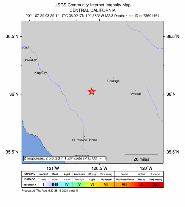
2 people reported to the USGS what they felt; the strongest reported shaking was II, weak shaking.
How well it is located
Reviewed by a seismologist.
- Location uncertainty
- About 0.2 km horizontally, 0.2 km in depth
- Magnitude uncertainty
- ±0.14
- Depth from
- From location
- Station coverage gap
- 78°
- Stations used
- 56
Nearest places
Distance and direction from each place to the epicenter, with its forecast.
Nearby
Within 100 km, magnitude 1.5 and up: 102 in the 60 days after this one and 36 in the 30 days before it.
After
- 2.315km SE of Tres Pinos, CA · 1892 days ago · 9 km deep · 93 km away · felt by 2
- 2.27km NNW of Pinnacles, CA · 1892 days ago · 5 km deep · 82 km away
- 2.39km SSW of San Lucas, CA · 1891 days ago · 11 km deep · 43 km away
- 2.515km WSW of Cantua Creek, CA · 1891 days ago · 18 km deep · 51 km away
- 1.730km NE of Pinnacles, CA · 1891 days ago · 5 km deep · 78 km away
- 1.719km SSE of Lopez Point, CA · 1890 days ago · 3 km deep · 83 km away
- 1.87km SW of San Ardo, CA · 1890 days ago · 10 km deep · 34 km away
- 2.77km NNW of Cholame, CA · 1890 days ago · 9 km deep · 35 km away · felt by 3
- 2.320km SW of New Idria, CA · 1890 days ago · 10 km deep · 40 km away
- 2.212km NW of Pinnacles, CA · 1888 days ago · 5 km deep · 88 km away
- 1.712km NW of Pinnacles, CA · 1888 days ago · 5 km deep · 88 km away
- 1.68km WNW of Greenfield, CA · 1888 days ago · 8 km deep · 76 km away
- 1.72km ENE of Pinnacles, CA · 1887 days ago · 3 km deep · 75 km away
- 1.517km NE of Pinnacles, CA · 1887 days ago · 9 km deep · 79 km away
- 1.72km NNE of Pinnacles, CA · 1887 days ago · 9 km deep · 77 km away
- 2.13km NNW of Pinnacles, CA · 1886 days ago · 4 km deep · 79 km away
- 2.89km WNW of Templeton, CA · 1884 days ago · 6 km deep · 52 km away
- 2.012km NW of Pinnacles, CA · 1884 days ago · 6 km deep · 87 km away
- 2.33km SE of San Ardo, CA · 1883 days ago · 10 km deep · 27 km away
- 1.923km SE of Pinnacles, CA · 1883 days ago · 10 km deep · 52 km away
- 1.720km NW of Parkfield, CA · 1881 days ago · 4 km deep · 0 km away
- 1.95km NE of Pinnacles, CA · 1881 days ago · 9 km deep · 77 km away
- 1.810km SE of Home Garden, CA · 1881 days ago · 21 km deep · 95 km away
- 1.616km SE of Pinnacles, CA · 1880 days ago · 3 km deep · 60 km away
- 1.923km NNE of San Ardo, CA · 1880 days ago · 9 km deep · 25 km away
- 1.513km WNW of Huron, CA · 1880 days ago · 10 km deep · 38 km away
- 1.78km WNW of Huron, CA · 1878 days ago · 10 km deep · 42 km away
- 1.96km NNE of Pinnacles, CA · 1878 days ago · 9 km deep · 77 km away
- 1.912km SSW of Cantua Creek, CA · 1877 days ago · 2 km deep · 47 km away
- 2.510km NNW of Pinnacles, CA · 1876 days ago · 5 km deep · 85 km away · felt by 1
- 2.010km NNW of Pinnacles, CA · 1876 days ago · 5 km deep · 85 km away
- 2.210km NNW of Pinnacles, CA · 1876 days ago · 6 km deep · 85 km away
- 2.710km NNW of Pinnacles, CA · 1876 days ago · 6 km deep · 85 km away · felt by 5
- 1.69km ENE of Pinnacles, CA · 1876 days ago · 4 km deep · 73 km away
- 2.110km SSW of Stratford, CA · 1876 days ago · 2 km deep · 65 km away
- 2.04km ESE of Pinnacles, CA · 1875 days ago · 11 km deep · 72 km away · felt by 1
- 2.113km NW of Parkfield, CA · 1875 days ago · 10 km deep · 7 km away
- 2.62km SSE of Parkfield, CA · 1874 days ago · 6 km deep · 21 km away · felt by 3
- 2.410km NW of Pinnacles, CA · 1873 days ago · 3 km deep · 86 km away · felt by 2
- 2.112km W of Cantua Creek, CA · 1873 days ago · 17 km deep · 54 km away
- 3.016km ENE of New Idria, CA · 1873 days ago · 16 km deep · 49 km away · felt by 5
- 2.419km NNW of San Simeon, CA · 1872 days ago · 8 km deep · 66 km away
- 1.97km NNE of Greenfield, CA · 1872 days ago · 4 km deep · 69 km away · felt by 1
- 1.82km ENE of Cayucos, CA · 1871 days ago · 0 km deep · 69 km away
- 2.03km ENE of Lopez Point, CA · 1869 days ago · 9 km deep · 85 km away
- 1.96km ESE of Pinnacles, CA · 1869 days ago · 6 km deep · 70 km away
- 1.817km N of New Idria, CA · 1867 days ago · 10 km deep · 61 km away
- 1.65km NW of Parkfield, CA · 1867 days ago · 5 km deep · 14 km away
- 1.619km NNW of Coalinga, CA · 1867 days ago · 8 km deep · 31 km away
- 1.931km WNW of San Simeon, CA · 1866 days ago · 6 km deep · 92 km away
- 1.925km SSW of South Dos Palos, CA · 1866 days ago · 2 km deep · 82 km away
- 1.722km NW of San Simeon, CA · 1866 days ago · 4 km deep · 72 km away
- 1.827km NW of San Simeon, CA · 1865 days ago · 10 km deep · 75 km away
- 1.923km NW of Parkfield, CA · 1864 days ago · 6 km deep · 4 km away · felt by 1
- 1.825km NW of Parkfield, CA · 1863 days ago · 5 km deep · 6 km away
- 2.012km NW of Pinnacles, CA · 1863 days ago · 5 km deep · 88 km away
- 1.923km NNW of San Simeon, CA · 1863 days ago · 12 km deep · 69 km away
- 2.012km S of Home Garden, CA · 1863 days ago · 26 km deep · 90 km away
- 2.11km NE of Pinnacles, CA · 1863 days ago · 9 km deep · 76 km away
- 1.720km SW of New Idria, CA · 1861 days ago · 10 km deep · 38 km away
The first 60 of 102.
Before
- 3.47km NNW of Cholame, CA · 1893 days ago · 9 km deep · 35 km away · felt by 24
- 1.511km WSW of Huron, CA · 1895 days ago · 8 km deep · 36 km away
- 1.512km S of Tres Pinos, CA · 1896 days ago · 4 km deep · 100 km away
- 2.517km SSE of Lopez Point, CA · 1898 days ago · 12 km deep · 83 km away · felt by 4
- 2.612km NW of Parkfield, CA · 1898 days ago · 8 km deep · 7 km away · felt by 4
- 1.97km WNW of Paso Robles, CA · 1899 days ago · 8 km deep · 45 km away
- 2.03km E of Lemoore, CA · 1899 days ago · 15 km deep · 81 km away
- 2.28km NW of Cantua Creek, CA · 1900 days ago · 6 km deep · 63 km away
- 2.46km NNW of Cholame, CA · 1901 days ago · 8 km deep · 36 km away
- 1.79km NW of Pinnacles, CA · 1902 days ago · 8 km deep · 84 km away
- 2.616km NW of Pinnacles, CA · 1904 days ago · 5 km deep · 92 km away · felt by 3
- 1.712km E of Coalinga, CA · 1905 days ago · 7 km deep · 34 km away
- 1.82km NE of Pinnacles, CA · 1906 days ago · 9 km deep · 76 km away
- 1.912km S of Tres Pinos, CA · 1906 days ago · 5 km deep · 100 km away · felt by 1
- 1.94km NNW of Pinnacles, CA · 1906 days ago · 4 km deep · 80 km away · felt by 1
- 2.822km ENE of San Lucas, CA · 1908 days ago · 8 km deep · 30 km away · felt by 8
- 1.616km SSE of Tres Pinos, CA · 1909 days ago · 6 km deep · 93 km away
- 1.726km SSW of South Dos Palos, CA · 1909 days ago · 0 km deep · 81 km away
- 2.124km SSW of South Dos Palos, CA · 1909 days ago · 0 km deep · 82 km away
- 2.36km NNW of Pinnacles, CA · 1914 days ago · 6 km deep · 81 km away
Earthquakes todayCalifornia earthquakesLive radar here
Sources
From the USGS Earthquake Hazards Program and its partner networks, event nc73601461. Read Sat, Oct 3, 2026, 2:05 PM UTC.