M1.9 earthquake 15 km NE of Cantwell, Alaska
A magnitude 1.9 earthquake struck 15 km NE of Cantwell, Alaska on Wed, Sep 8, 2021, 5:37 PM AKDT (01:37 UTC), 6 km (4 mi) below the surface.
A larger quake followed: M4.4 60 km SSE of Cantwell, Alaska. This one was a foreshock.
Map
Where this earthquake was located, with the others nearby. Select one for its page.
The earthquake
- Magnitude
- 1.9 (ml), micro
- Local time
- UTC
- 2021-09-09 01:37:31 UTC
- Depth
- 6.3 km (3.9 mi), shallow
- Epicenter
- 63.471° N, 148.703° W
- Region
- Alaska
- Felt reports
- 1
- Tsunami flag
- No
- Status
- Reviewed by a seismologist
Did you feel it?
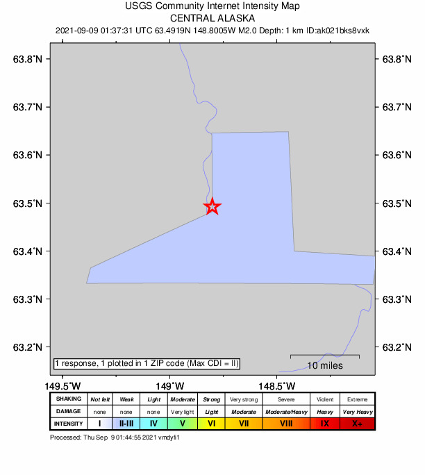
1 person reported to the USGS what they felt; the strongest reported shaking was II, weak shaking.
How well it is located
Reviewed by a seismologist.
- Stations used
- 65
Nearest places
Distance and direction from each place to the epicenter, with its forecast.
Nearby
Within 100 km, magnitude 1.5 and up: 145 in the 60 days after this one and 55 in the 30 days before it.
After
- 1.736 km ENE of Ferry, Alaska · 1845 days ago · 13 km deep · 76 km away
- 1.781 km ESE of Denali Park, Alaska · 1845 days ago · 2 km deep · 70 km away
- 1.658 km SSE of Cantwell, Alaska · 1844 days ago · 72 km deep · 61 km away
- 1.849 km NE of Chase, Alaska · 1844 days ago · 74 km deep · 85 km away
- 2.062 km W of Cantwell, Alaska · 1844 days ago · 107 km deep · 75 km away
- 2.132 km ENE of Cantwell, Alaska · 1844 days ago · 0 km deep · 19 km away
- 1.554 km WSW of McKinley Park, Alaska · 1843 days ago · 111 km deep · 64 km away
- 1.913 km NE of Healy, Alaska · 1843 days ago · 114 km deep · 53 km away
- 1.851 km NE of Chase, Alaska · 1843 days ago · 58 km deep · 85 km away
- 2.239 km SSW of Cantwell, Alaska · 1843 days ago · 82 km deep · 54 km away
- 2.244 km WSW of Cantwell, Alaska · 1842 days ago · 98 km deep · 60 km away
- 1.767 km ESE of Denali National Park, Alaska · 1841 days ago · 98 km deep · 94 km away
- 1.517 km E of Ferry, Alaska · 1841 days ago · 4 km deep · 63 km away
- 1.881 km SW of Delta Junction, Alaska · 1840 days ago · 0 km deep · 84 km away · felt by 1
- 2.087 km WNW of Paxson, Alaska · 1840 days ago · 0 km deep · 81 km away
- 2.467 km ESE of Denali National Park, Alaska · 1840 days ago · 128 km deep · 99 km away · felt by 1
- 2.89 km SSW of Cantwell, Alaska · 1839 days ago · 84 km deep · 25 km away
- 2.132 km SE of Cantwell, Alaska · 1839 days ago · 73 km deep · 34 km away
- 2.336 km W of Cantwell, Alaska · 1838 days ago · 103 km deep · 49 km away · felt by 1
- 2.858 km SSW of Cantwell, Alaska · 1838 days ago · 71 km deep · 73 km away
- 1.842 km SSW of Cantwell, Alaska · 1837 days ago · 77 km deep · 56 km away
- 1.912 km SW of Cantwell, Alaska · 1837 days ago · 84 km deep · 27 km away
- 2.140 km WSW of Cantwell, Alaska · 1837 days ago · 99 km deep · 55 km away
- 2.052 km NNE of Chase, Alaska · 1837 days ago · 69 km deep · 82 km away
- 1.770 km ESE of Denali National Park, Alaska · 1837 days ago · 115 km deep · 89 km away
- 1.639 km WSW of Denali Park, Alaska · 1836 days ago · 121 km deep · 51 km away
- 1.654 km E of Denali National Park, Alaska · 1834 days ago · 18 km deep · 97 km away · felt by 1
- 1.831 km SW of Cantwell, Alaska · 1834 days ago · 87 km deep · 47 km away
- 1.770 km ENE of Chase, Alaska · 1833 days ago · 59 km deep · 86 km away
- 1.551 km WSW of Cantwell, Alaska · 1833 days ago · 99 km deep · 66 km away
- 1.768 km ESE of Denali National Park, Alaska · 1833 days ago · 119 km deep · 92 km away
- 1.815 km NNE of Healy, Alaska · 1833 days ago · 113 km deep · 56 km away
- 1.534 km WSW of Ferry, Alaska · 1832 days ago · 3 km deep · 71 km away
- 2.326 km SSW of Cantwell, Alaska · 1832 days ago · 3 km deep · 40 km away
- 1.647 km WSW of Cantwell, Alaska · 1832 days ago · 90 km deep · 62 km away
- 1.931 km W of Ferry, Alaska · 1831 days ago · 149 km deep · 80 km away
- 1.661 km SSE of Cantwell, Alaska · 1831 days ago · 9 km deep · 66 km away
- 2.18 km NNE of Cantwell, Alaska · 1831 days ago · 10 km deep · 8 km away
- 1.545 km SSW of Cantwell, Alaska · 1831 days ago · 78 km deep · 59 km away
- 1.564 km WSW of Ferry, Alaska · 1831 days ago · 9 km deep · 86 km away
- 1.872 km ESE of Denali National Park, Alaska · 1830 days ago · 121 km deep · 95 km away
- 1.984 km SW of Delta Junction, Alaska · 1830 days ago · 68 km deep · 79 km away
- 1.567 km ESE of Denali National Park, Alaska · 1830 days ago · 122 km deep · 97 km away
- 1.632 km WSW of Cantwell, Alaska · 1830 days ago · 9 km deep · 47 km away
- 2.019 km W of Healy, Alaska · 1830 days ago · 124 km deep · 51 km away
- 2.061 km ESE of Denali National Park, Alaska · 1830 days ago · 97 km deep · 96 km away
- 2.280 km NW of Lake Louise, Alaska · 1829 days ago · 0 km deep · 94 km away
- 1.652 km N of Chase, Alaska · 1828 days ago · 85 km deep · 87 km away
- 2.014 km NW of Ferry, Alaska · 1827 days ago · 139 km deep · 77 km away
- 1.79 km WNW of Healy, Alaska · 1827 days ago · 117 km deep · 50 km away
- 1.5Central Alaska · 1827 days ago · 117 km deep · 93 km away
- 1.857 km WSW of Denali Park, Alaska · 1826 days ago · 113 km deep · 69 km away
- 1.965 km WSW of Delta Junction, Alaska · 1826 days ago · 0 km deep · 94 km away
- 1.574 km E of Cantwell, Alaska · 1826 days ago · 32 km deep · 62 km away
- 1.822 km ENE of Denali Park, Alaska · 1826 days ago · 87 km deep · 36 km away
- 1.669 km ESE of Denali National Park, Alaska · 1826 days ago · 116 km deep · 91 km away
- 1.569 km NNE of Petersville, Alaska · 1825 days ago · 109 km deep · 96 km away
- 1.838 km SW of Cantwell, Alaska · 1825 days ago · 69 km deep · 53 km away
- 1.756 km N of Chase, Alaska · 1825 days ago · 72 km deep · 83 km away
- 1.571 km E of Cantwell, Alaska · 1824 days ago · 3 km deep · 58 km away
The first 60 of 145.
Before
- 1.959 km W of Cantwell, Alaska · 1846 days ago · 108 km deep · 72 km away
- 1.550 km W of Cantwell, Alaska · 1849 days ago · 101 km deep · 62 km away
- 1.93 km N of Cantwell, Alaska · 1850 days ago · 3 km deep · 13 km away
- 2.962 km WSW of Ferry, Alaska · 1851 days ago · 14 km deep · 94 km away
- 1.665 km NNE of Petersville, Alaska · 1852 days ago · 101 km deep · 97 km away
- 1.968 km ESE of Denali National Park, Alaska · 1852 days ago · 127 km deep · 95 km away
- 1.754 km NNE of Chase, Alaska · 1853 days ago · 80 km deep · 80 km away
- 1.563 km WNW of Cantwell, Alaska · 1853 days ago · 134 km deep · 73 km away
- 1.864 km ENE of Chase, Alaska · 1853 days ago · 68 km deep · 84 km away
- 3.244 km WSW of Denali Park, Alaska · 1854 days ago · 123 km deep · 55 km away
- 1.658 km S of Cantwell, Alaska · 1855 days ago · 11 km deep · 68 km away
- 2.975 km SE of Denali National Park, Alaska · 1858 days ago · 111 km deep · 95 km away
- 1.676 km S of Cantwell, Alaska · 1858 days ago · 60 km deep · 84 km away
- 1.671 km ESE of Denali National Park, Alaska · 1859 days ago · 124 km deep · 90 km away
- 1.575 km ESE of Denali National Park, Alaska · 1860 days ago · 111 km deep · 93 km away
- 1.559 km SSW of Cantwell, Alaska · 1860 days ago · 75 km deep · 74 km away
- 2.071 km SE of Denali National Park, Alaska · 1860 days ago · 119 km deep · 100 km away
- 1.546 km SW of Cantwell, Alaska · 1861 days ago · 84 km deep · 62 km away
- 1.765 km SSE of Cantwell, Alaska · 1861 days ago · 71 km deep · 69 km away
- 1.861 km ESE of McKinley Park, Alaska · 1861 days ago · 84 km deep · 51 km away
Earthquakes todayAlaska earthquakesLive radar here
Sources
From the USGS Earthquake Hazards Program and its partner networks, event ak021bks8vxk (also filed as us7000f9ir). Read Mon, Sep 28, 2026, 3:15 PM UTC.