M3.0 earthquake 17 km SSW of Lindsay, Texas
A magnitude 3.0 earthquake struck 17 km SSW of Lindsay, Texas on Fri, Oct 25, 2019, 8:35 AM CDT (13:35 UTC), 5 km (3 mi) below the surface.
A larger quake followed: M3.8 50 km NW of Toyah, Texas. This one was a foreshock.
Map
Where this earthquake was located, with the others nearby. Select one for its page.
The earthquake
- Magnitude
- 3.0 (ML, local (Richter)), minor
- Magnitude from
- USGS National Earthquake Information Center
- Local time
- UTC
- 2019-10-25 13:35:39 UTC
- Depth
- 5.0 km (3.1 mi), shallow
- Epicenter
- 31.222° N, 103.591° W
- Region
- Texas
- Felt reports
- 1
- Tsunami flag
- No
- Status
- Reviewed by a seismologist
Did you feel it?
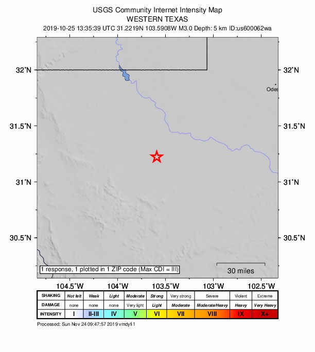
1 person reported to the USGS what they felt; the strongest reported shaking was III, weak shaking.
How well it is located
Reviewed by a seismologist.
- Location uncertainty
- About 1.0 km horizontally, 1.7 km in depth
- Magnitude uncertainty
- ±0.10
- Depth from
- Operator assigned
- Station coverage gap
- 40°
- Stations used
- 38
Nearest places
Distance and direction from each place to the epicenter, with its forecast.
Nearby
Within 100 km, magnitude 1.5 and up: 24 in the 60 days after this one and 16 in the 30 days before it.
After
- 2.614 km SSW of Coyanosa, Texas · 2531 days ago · 2 km deep · 46 km away
- 2.559 km NW of Toyah, Texas · 2527 days ago · 5 km deep · 81 km away
- 2.526 km SW of Coyanosa, Texas · 2523 days ago · 3 km deep · 35 km away
- 3.658 km S of Whites City, New Mexico · 2522 days ago · 5 km deep · 84 km away · felt by 5
- 2.857 km S of Whites City, New Mexico · 2521 days ago · 5 km deep · 83 km away
- 2.525 km SW of Coyanosa, Texas · 2518 days ago · 5 km deep · 33 km away
- 1.660 km NW of Toyah, Texas · 2513 days ago · 6 km deep · 82 km away
- 2.454 km S of Whites City, New Mexico · 2513 days ago · 5 km deep · 85 km away
- 2.659 km S of Whites City, New Mexico · 2512 days ago · 5 km deep · 85 km away
- 2.953 km NW of Toyah, Texas · 2506 days ago · 5 km deep · 75 km away
- 1.644 km W of Mentone, Texas · 2503 days ago · 3 km deep · 75 km away
- 1.514 km SSE of Toyah, Texas · 2503 days ago · 6 km deep · 15 km away
- 3.154 km S of Whites City, New Mexico · 2503 days ago · 5 km deep · 86 km away
- 1.752 km NW of Toyah, Texas · 2503 days ago · 7 km deep · 74 km away
- 2.735 km SE of Malaga, New Mexico · 2500 days ago · 10 km deep · 91 km away
- 1.859 km SSW of Whites City, New Mexico · 2500 days ago · 6 km deep · 100 km away
- 3.011 km E of Balmorhea, Texas · 2489 days ago · 5 km deep · 27 km away · felt by 5
- 1.616 km S of Lindsay, Texas · 2483 days ago · 6 km deep · 5 km away
- 3.850 km NW of Toyah, Texas · 2481 days ago · 5 km deep · 72 km away · felt by 2
- 2.911 km S of Coyanosa, Texas · 2481 days ago · 5 km deep · 53 km away
- 1.858 km S of Whites City, New Mexico · 2480 days ago · 6 km deep · 84 km away
- 2.519 km WSW of Coyanosa, Texas · 2478 days ago · 5 km deep · 35 km away
- 2.818 km SW of Coyanosa, Texas · 2478 days ago · 5 km deep · 37 km away · felt by 1
- 2.855 km NW of Toyah, Texas · 2477 days ago · 7 km deep · 77 km away
Before
- 1.617 km S of Lindsay, Texas · 2537 days ago · 5 km deep · 7 km away · felt by 1
- 1.548 km NW of Toyah, Texas · 2537 days ago · 5 km deep · 69 km away
- 2.810 km S of Toyah, Texas · 2539 days ago · 5 km deep · 21 km away
- 2.510 km SSW of Lindsay, Texas · 2539 days ago · 5 km deep · 7 km away
- 2.559 km S of Whites City, New Mexico · 2539 days ago · 5 km deep · 82 km away
- 2.8western Texas · 2540 days ago · 5 km deep · 82 km away
- 2.558 km S of Whites City, New Mexico · 2540 days ago · 5 km deep · 81 km away
- 1.69 km NW of Lindsay, Texas · 2546 days ago · 6 km deep · 23 km away
- 2.831 km SW of Coyanosa, Texas · 2546 days ago · 3 km deep · 30 km away
- 2.555 km S of Whites City, New Mexico · 2548 days ago · 5 km deep · 83 km away
- 1.755 km NW of Toyah, Texas · 2550 days ago · 6 km deep · 77 km away
- 2.853 km S of Whites City, New Mexico · 2553 days ago · 5 km deep · 86 km away
- 2.853 km S of Whites City, New Mexico · 2553 days ago · 5 km deep · 86 km away · felt by 1
- 1.65 km E of Lindsay, Texas · 2559 days ago · 5 km deep · 19 km away
- 2.33 km S of Pecos, Texas · 2561 days ago · 5 km deep · 21 km away · felt by 2
- 2.921 km SSW of Lindsay, Texas · 2564 days ago · 5 km deep · 5 km away
Earthquakes todayTexas earthquakesLive radar here
Sources
From the USGS Earthquake Hazards Program and its partner networks, event us600062wa. Read Fri, Oct 2, 2026, 7:01 PM UTC.