M3.8 earthquake 50 km NW of Toyah, Texas
A magnitude 3.8 earthquake struck 50 km NW of Toyah, Texas on Tue, Dec 17, 2019, 5:16 AM CST (11:16 UTC), 5 km (3 mi) below the surface.
Map
Where this earthquake was located, with the others nearby. Select one for its page.
The earthquake
- Magnitude
- 3.8 (ML, local (Richter)), minor
- Magnitude from
- USGS National Earthquake Information Center
- Local time
- UTC
- 2019-12-17 11:16:58 UTC
- Depth
- 5.0 km (3.1 mi), shallow
- Epicenter
- 31.619° N, 104.194° W
- Region
- Texas
- Felt reports
- 2
- Strongest shaking
- V, moderate shaking
- Tsunami flag
- No
- Status
- Reviewed by a seismologist
Shaking
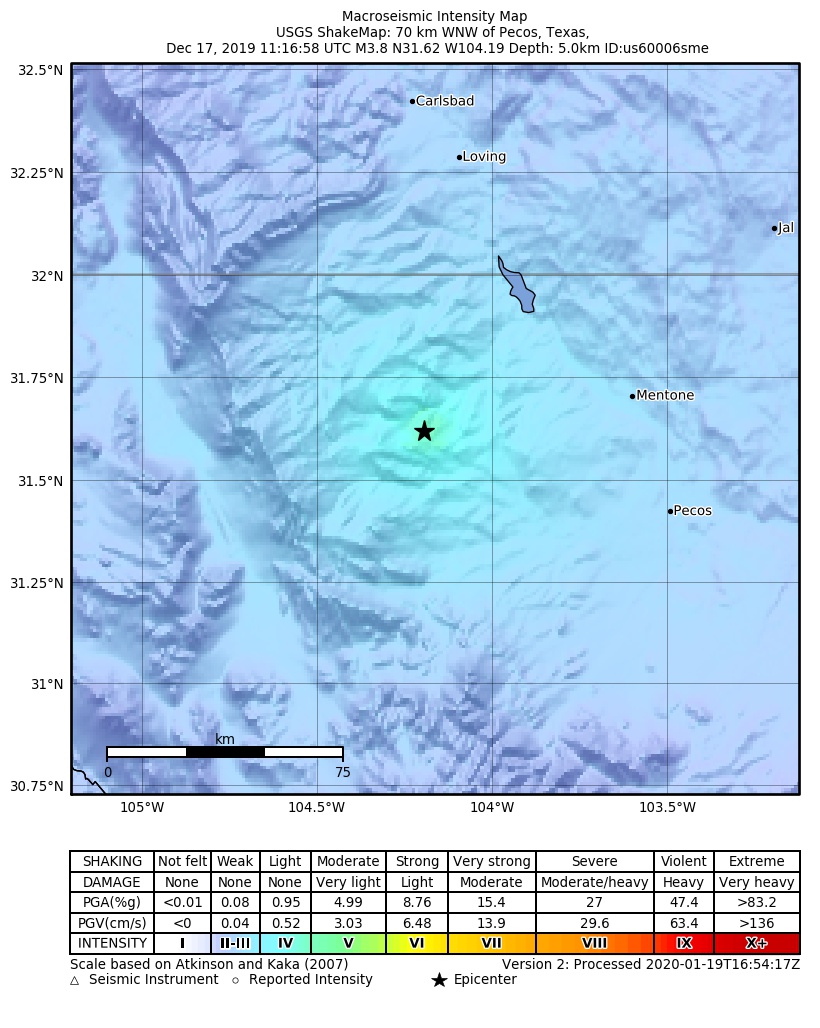
The USGS ShakeMap: shaking estimated from seismic stations and the quake’s size, on the Modified Mercalli intensity scale.
- Strongest estimated
- V, moderate shaking
- Peak ground acceleration
- 10.4% of gravity
- Peak ground velocity
- 0.3 cm/s
- Map
- Automatic
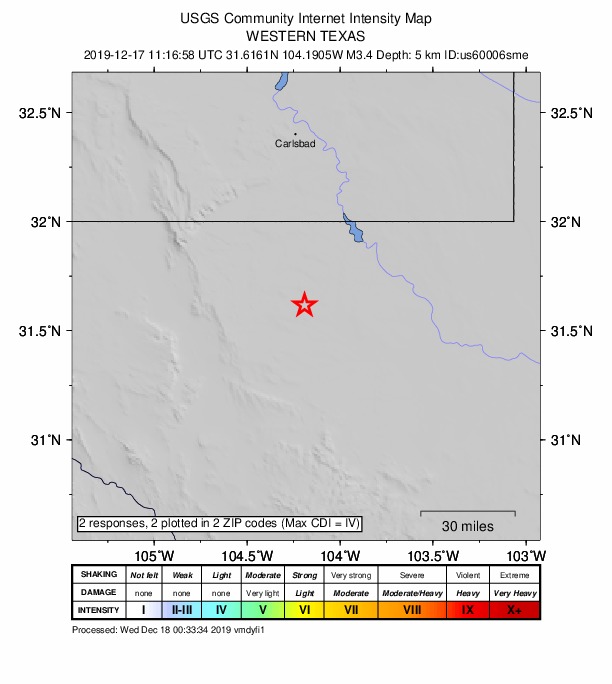
Did you feel it?
2 people reported to the USGS what they felt; the strongest reported shaking was IV, light shaking.
How well it is located
Reviewed by a seismologist.
- Location uncertainty
- About 1.1 km horizontally, 1.8 km in depth
- Magnitude uncertainty
- ±0.06
- Depth from
- Operator assigned
- Station coverage gap
- 55°
- Stations used
- 40
Nearest places
Distance and direction from each place to the epicenter, with its forecast.
Nearby
Within 100 km, magnitude 1.5 and up: 34 in the 60 days after this one and 10 in the 30 days before it.
After
- 1.858 km S of Whites City, New Mexico · 2481 days ago · 6 km deep · 13 km away
- 2.855 km NW of Toyah, Texas · 2477 days ago · 7 km deep · 5 km away
- 2.619 km E of Balmorhea, Texas · 2472 days ago · 4 km deep · 92 km away
- 2.959 km S of Whites City, New Mexico · 2470 days ago · 5 km deep · 12 km away
- 2.851 km SSE of Whites City, New Mexico · 2469 days ago · 5 km deep · 15 km away
- 2.535 km SE of Malaga, New Mexico · 2469 days ago · 5 km deep · 62 km away
- 2.951 km SSE of Whites City, New Mexico · 2465 days ago · 5 km deep · 14 km away
- 1.852 km NW of Toyah, Texas · 2450 days ago · 6 km deep · 1 km away
- 3.258 km S of Whites City, New Mexico · 2447 days ago · 5 km deep · 12 km away
- 2.757 km S of Whites City, New Mexico · 2447 days ago · 5 km deep · 14 km away
- 2.957 km S of Whites City, New Mexico · 2445 days ago · 5 km deep · 13 km away · felt by 1
- 3.058 km S of Whites City, New Mexico · 2444 days ago · 5 km deep · 12 km away
- 3.159 km S of Whites City, New Mexico · 2443 days ago · 5 km deep · 12 km away · felt by 3
- 2.053 km SSW of Whites City, New Mexico · 2442 days ago · 6 km deep · 38 km away
- 1.940 km W of Mentone, Texas · 2439 days ago · 7 km deep · 19 km away
- 1.740 km W of Mentone, Texas · 2439 days ago · 6 km deep · 19 km away
- 2.957 km S of Whites City, New Mexico · 2439 days ago · 5 km deep · 13 km away
- 3.639 km W of Mentone, Texas · 2437 days ago · 5 km deep · 19 km away · felt by 2
- 3.640 km W of Mentone, Texas · 2437 days ago · 5 km deep · 19 km away · felt by 2
- 2.740 km W of Mentone, Texas · 2437 days ago · 8 km deep · 18 km away
- 2.857 km S of Whites City, New Mexico · 2437 days ago · 9 km deep · 18 km away
- 2.755 km S of Whites City, New Mexico · 2437 days ago · 5 km deep · 19 km away
- 1.639 km W of Mentone, Texas · 2437 days ago · 7 km deep · 20 km away
- 2.758 km S of Whites City, New Mexico · 2435 days ago · 5 km deep · 13 km away
- 2.456 km S of Whites City, New Mexico · 2435 days ago · 5 km deep · 11 km away
- 2.754 km S of Whites City, New Mexico · 2431 days ago · 5 km deep · 20 km away
- 2.657 km S of Whites City, New Mexico · 2431 days ago · 5 km deep · 13 km away
- 2.6western Texas · 2429 days ago · 4 km deep · 20 km away
- 2.556 km S of Whites City, New Mexico · 2428 days ago · 5 km deep · 19 km away
- 2.754 km S of Whites City, New Mexico · 2427 days ago · 5 km deep · 15 km away
- 2.563 km S of Whites City, New Mexico · 2426 days ago · 5 km deep · 25 km away
- 2.815 km NW of Barstow, Texas · 2424 days ago · 5 km deep · 66 km away
- 2.721 km WSW of Coyanosa, Texas · 2424 days ago · 8 km deep · 98 km away
- 2.556 km S of Whites City, New Mexico · 2422 days ago · 5 km deep · 19 km away
Before
- 1.616 km S of Lindsay, Texas · 2483 days ago · 6 km deep · 76 km away
- 2.552 km SSW of Whites City, New Mexico · 2489 days ago · 5 km deep · 37 km away
- 3.011 km E of Balmorhea, Texas · 2489 days ago · 5 km deep · 89 km away · felt by 5
- 1.859 km SSW of Whites City, New Mexico · 2500 days ago · 6 km deep · 30 km away
- 2.735 km SE of Malaga, New Mexico · 2501 days ago · 10 km deep · 60 km away
- 1.752 km NW of Toyah, Texas · 2503 days ago · 7 km deep · 2 km away
- 3.154 km S of Whites City, New Mexico · 2503 days ago · 5 km deep · 13 km away
- 1.514 km SSE of Toyah, Texas · 2503 days ago · 6 km deep · 64 km away
- 1.644 km W of Mentone, Texas · 2504 days ago · 3 km deep · 20 km away
- 2.953 km NW of Toyah, Texas · 2506 days ago · 5 km deep · 3 km away
Earthquakes todayTexas earthquakesLive radar here
Sources
From the USGS Earthquake Hazards Program and its partner networks, event us60006sme. Read Sat, Oct 3, 2026, 2:22 AM UTC.