M1.9 earthquake 58 km WSW of Anchor Point, Alaska
A magnitude 1.9 earthquake struck 58 km WSW of Anchor Point, Alaska on Thu, Aug 15, 2019, 1:37 AM AKDT (09:37 UTC), 83 km (51 mi) below the surface.
A larger quake followed: M4.1 16 km ESE of Pedro Bay, Alaska. This one was a foreshock.
Map
Where this earthquake was located, with the others nearby. Select one for its page.
The earthquake
- Magnitude
- 1.9 (ML, local (Richter)), micro
- Magnitude from
- Alaska Earthquake Center
- Local time
- UTC
- 2019-08-15 09:37:41 UTC
- Depth
- 82.8 km (51.4 mi), intermediate-depth
- Epicenter
- 59.639° N, 152.826° W
- Region
- Alaska
- Felt reports
- 1
- Tsunami flag
- No
- Status
- Reviewed by a seismologist
Did you feel it?
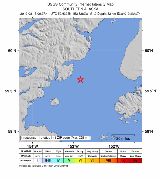
1 person reported to the USGS what they felt; the strongest reported shaking was II, weak shaking.
How well it is located
Reviewed by a seismologist.
- Stations used
- 89
Nearest places
Distance and direction from each place to the epicenter, with its forecast.
Nearby
Within 100 km, magnitude 1.5 and up: at least 200 in the 60 days after this one and 165 in the 30 days before it.
After
- 1.774 km SW of Nanwalek, Alaska · 2604 days ago · 69 km deep · 77 km away
- 3.012 km SW of Nanwalek, Alaska · 2603 days ago · 56 km deep · 61 km away
- 1.664 km ESE of Pedro Bay, Alaska · 2603 days ago · 87 km deep · 16 km away
- 1.511 km WSW of Happy Valley, Alaska · 2603 days ago · 72 km deep · 59 km away
- 1.838 km SW of Nanwalek, Alaska · 2603 days ago · 60 km deep · 67 km away
- 1.565 km WNW of Ninilchik, Alaska · 2603 days ago · 116 km deep · 77 km away
- 1.563 km E of Pedro Bay, Alaska · 2603 days ago · 90 km deep · 14 km away
- 2.429 km SSE of Port Graham, Alaska · 2603 days ago · 59 km deep · 89 km away
- 1.658 km WNW of Happy Valley, Alaska · 2603 days ago · 98 km deep · 57 km away
- 1.750 km SSW of Nanwalek, Alaska · 2603 days ago · 60 km deep · 82 km away · felt by 1
- 1.551 km WNW of Ninilchik, Alaska · 2602 days ago · 79 km deep · 65 km away
- 1.752 km W of Nanwalek, Alaska · 2602 days ago · 83 km deep · 21 km away
- 1.651 km W of Anchor Point, Alaska · 2602 days ago · 81 km deep · 20 km away
- 1.729 km WNW of Happy Valley, Alaska · 2602 days ago · 75 km deep · 53 km away
- 2.062 km W of Nanwalek, Alaska · 2602 days ago · 80 km deep · 30 km away
- 2.048 km E of Pedro Bay, Alaska · 2602 days ago · 106 km deep · 30 km away
- 1.850 km E of Pedro Bay, Alaska · 2602 days ago · 115 km deep · 28 km away
- 2.251 km WNW of Happy Valley, Alaska · 2601 days ago · 88 km deep · 55 km away
- 2.147 km WNW of Nanwalek, Alaska · 2601 days ago · 73 km deep · 14 km away
- 2.544 km ENE of Pedro Bay, Alaska · 2600 days ago · 128 km deep · 46 km away
- 1.519 km WSW of Happy Valley, Alaska · 2600 days ago · 83 km deep · 52 km away
- 3.155 km E of Pedro Bay, Alaska · 2600 days ago · 100 km deep · 19 km away
- 1.566 km WNW of Happy Valley, Alaska · 2600 days ago · 110 km deep · 51 km away
- 1.615 km SSW of Halibut Cove, Alaska · 2600 days ago · 5 km deep · 87 km away
- 1.55 km NW of Anchor Point, Alaska · 2600 days ago · 61 km deep · 54 km away
- 1.552 km E of Pedro Bay, Alaska · 2600 days ago · 115 km deep · 32 km away
- 1.6Southern Alaska · 2600 days ago · 102 km deep · 17 km away
- 1.763 km WNW of Nanwalek, Alaska · 2599 days ago · 88 km deep · 12 km away
- 1.647 km ESE of Pope-Vannoy Landing, Alaska · 2599 days ago · 103 km deep · 56 km away
- 1.541 km SE of Pedro Bay, Alaska · 2599 days ago · 110 km deep · 38 km away
- 1.583 km WSW of Nanwalek, Alaska · 2599 days ago · 70 km deep · 75 km away
- 1.865 km E of Port Alsworth, Alaska · 2598 days ago · 121 km deep · 60 km away
- 1.737 km W of Anchor Point, Alaska · 2598 days ago · 74 km deep · 30 km away
- 1.660 km E of Port Alsworth, Alaska · 2598 days ago · 141 km deep · 67 km away
- 1.741 km NW of Ninilchik, Alaska · 2598 days ago · 82 km deep · 89 km away
- 3.762 km NW of Ninilchik, Alaska · 2597 days ago · 106 km deep · 82 km away · felt by 1
- 1.537 km E of Pedro Bay, Alaska · 2597 days ago · 133 km deep · 38 km away
- 2.369 km WNW of Ninilchik, Alaska · 2597 days ago · 137 km deep · 78 km away
- 1.758 km NE of Pedro Bay, Alaska · 2596 days ago · 128 km deep · 55 km away
- 1.859 km ESE of Pedro Bay, Alaska · 2596 days ago · 99 km deep · 15 km away
- 1.558 km WNW of Anchor Point, Alaska · 2596 days ago · 91 km deep · 34 km away
- 1.862 km E of Port Alsworth, Alaska · 2596 days ago · 132 km deep · 68 km away
- 1.563 km WNW of Anchor Point, Alaska · 2596 days ago · 109 km deep · 38 km away
- 1.546 km W of Ninilchik, Alaska · 2596 days ago · 98 km deep · 57 km away
- 1.857 km WNW of Nanwalek, Alaska · 2596 days ago · 84 km deep · 16 km away
- 2.061 km W of Happy Valley, Alaska · 2596 days ago · 86 km deep · 43 km away
- 1.775 km SE of Pope-Vannoy Landing, Alaska · 2595 days ago · 85 km deep · 60 km away
- 1.518 km WNW of Ninilchik, Alaska · 2595 days ago · 64 km deep · 68 km away
- 2.163 km W of Anchor Point, Alaska · 2595 days ago · 109 km deep · 24 km away
- 2.134 km NW of Nanwalek, Alaska · 2595 days ago · 71 km deep · 27 km away
- 1.531 km WNW of Happy Valley, Alaska · 2595 days ago · 92 km deep · 58 km away
- 1.749 km NW of Ninilchik, Alaska · 2594 days ago · 89 km deep · 79 km away
- 1.716 km W of Anchor Point, AK · 2594 days ago · 63 km deep · 43 km away
- 1.637 km E of Pedro Bay, Alaska · 2594 days ago · 126 km deep · 41 km away
- 2.259 km WNW of Happy Valley, Alaska · 2594 days ago · 104 km deep · 48 km away
- 2.240 km E of Pedro Bay, Alaska · 2594 days ago · 129 km deep · 38 km away
- 1.936 km ENE of Pedro Bay, Alaska · 2594 days ago · 136 km deep · 48 km away
- 1.782 km N of Aleneva, Alaska · 2594 days ago · 65 km deep · 97 km away
- 1.558 km WNW of Nanwalek, Alaska · 2593 days ago · 82 km deep · 18 km away
- 2.333 km NE of Pedro Bay, Alaska · 2593 days ago · 149 km deep · 58 km away
The first 60 of at least 200.
Before
- 1.682 km WSW of Nanwalek, Alaska · 2604 days ago · 67 km deep · 72 km away
- 1.566 km WNW of Anchor Point, Alaska · 2604 days ago · 122 km deep · 42 km away
- 1.569 km ENE of Pedro Bay, Alaska · 2604 days ago · 108 km deep · 51 km away
- 1.622 km W of Nanwalek, Alaska · 2605 days ago · 67 km deep · 41 km away
- 1.949 km ENE of Pedro Bay, Alaska · 2605 days ago · 140 km deep · 48 km away
- 1.961 km NW of Ninilchik, Alaska · 2605 days ago · 93 km deep · 93 km away
- 1.558 km WNW of Anchor Point, Alaska · 2605 days ago · 89 km deep · 31 km away
- 1.858 km ESE of Pedro Bay, Alaska · 2606 days ago · 102 km deep · 16 km away
- 2.562 km WNW of Happy Valley, Alaska · 2606 days ago · 116 km deep · 49 km away
- 1.611 km ENE of Ninilchik, Alaska · 2606 days ago · 68 km deep · 90 km away
- 2.043 km ENE of Pedro Bay, Alaska · 2606 days ago · 131 km deep · 44 km away
- 1.644 km WNW of Nanwalek, Alaska · 2606 days ago · 76 km deep · 18 km away
- 1.613 km N of Ninilchik, Alaska · 2606 days ago · 53 km deep · 88 km away
- 1.769 km W of Happy Valley, Alaska · 2606 days ago · 101 km deep · 45 km away
- 2.764 km ESE of Pedro Bay, Alaska · 2606 days ago · 110 km deep · 16 km away
- 1.544 km WSW of Nanwalek, Alaska · 2607 days ago · 71 km deep · 42 km away · felt by 1
- 1.638 km E of Pedro Bay, Alaska · 2607 days ago · 127 km deep · 38 km away
- 2.748 km WNW of Happy Valley, Alaska · 2607 days ago · 103 km deep · 53 km away
- 1.851 km SE of Pope-Vannoy Landing, Alaska · 2607 days ago · 127 km deep · 70 km away
- 2.151 km SE of Pedro Bay, Alaska · 2607 days ago · 109 km deep · 44 km away
Earthquakes todayAlaska earthquakesLive radar here
Sources
From the USGS Earthquake Hazards Program and its partner networks, event ak019afkkp74. Read Thu, Oct 1, 2026, 4:33 AM UTC.