M2.6 earthquake 8 km NNW of Cold Bay, Alaska
A magnitude 2.6 earthquake struck 8 km NNW of Cold Bay, Alaska on Mon, May 30, 2016, 4:08 AM AKDT (12:08 UTC), 155 km (97 mi) below the surface.
A larger quake followed: M4.6 31 km ESE of King Cove, Alaska. This one was a foreshock.
Map
Where this earthquake was located, with the others nearby. Select one for its page.
The earthquake
- Magnitude
- 2.6 (ML, local (Richter)), micro
- Magnitude from
- USGS National Earthquake Information Center
- Local time
- UTC
- 2016-05-30 12:08:00 UTC
- Depth
- 155.4 km (96.5 mi), intermediate-depth
- Epicenter
- 55.251° N, 162.788° W
- Region
- Alaska
- Tsunami flag
- No
- Status
- Reviewed by a seismologist
Magnitude estimates
Different scales measure different things and differ by a few tenths. The USGS marks one as preferred, and it is the one this page uses.
| Mag. | Scale | Computed by | Notes |
|---|---|---|---|
| 2.6 | ML, local (Richter) | USGS National Earthquake Information Center | Preferred · Reviewed · ±0.128 · 8 stations |
| 2.5 | ML, local (Richter) | Alaska Earthquake Center | Preliminary |
Did you feel it?
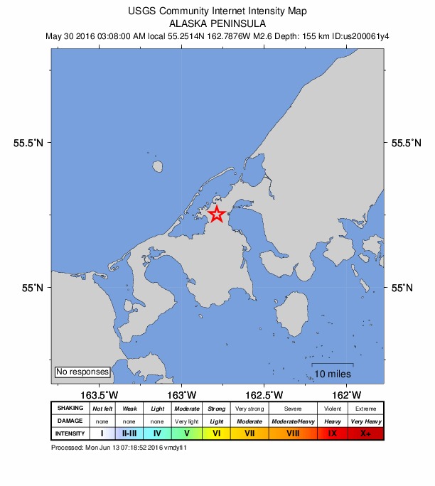
No one has reported feeling this quake to the USGS.
How well it is located
Reviewed by a seismologist.
- Location uncertainty
- About 23.8 km horizontally, 9.5 km in depth
- Magnitude uncertainty
- ±0.13
- Depth from
- From location
- Station coverage gap
- 201°, poorly surrounded by stations
- Stations used
- 6
Nearest places
Distance and direction from each place to the epicenter, with its forecast.
Nearby
Within 100 km, magnitude 1.5 and up: 30 in the 60 days after this one and 10 in the 30 days before it.
After
- 1.925 km SE of King Cove, Alaska · 3776 days ago · 86 km deep · 62 km away
- 2.313 km ESE of False Pass, Alaska · 3772 days ago · 171 km deep · 59 km away
- 2.052 km SSW of King Cove, Alaska · 3767 days ago · 51 km deep · 72 km away
- 2.021 km S of False Pass, Alaska · 3763 days ago · 97 km deep · 75 km away
- 1.948 km SSE of False Pass, Alaska · 3762 days ago · 64 km deep · 88 km away
- 2.240 km SW of Nelson Lagoon, Alaska · 3760 days ago · 15 km deep · 90 km away
- 2.942 km NW of False Pass, Alaska · 3759 days ago · 202 km deep · 75 km away
- 1.840 km SW of King Cove, Alaska · 3751 days ago · 80 km deep · 50 km away
- 2.356 km E of King Cove, Alaska · 3750 days ago · 64 km deep · 90 km away
- 4.631 km ESE of King Cove, Alaska · 3749 days ago · 70 km deep · 67 km away · tsunami flag
- 2.042 km SE of False Pass, Alaska · 3745 days ago · 60 km deep · 75 km away
- 1.959 km SSE of King Cove, Alaska · 3744 days ago · 10 km deep · 89 km away
- 1.946 km WNW of False Pass, Alaska · 3744 days ago · 159 km deep · 87 km away
- 1.637 km S of King Cove, Alaska · 3743 days ago · 71 km deep · 68 km away
- 2.357 km ESE of King Cove, Alaska · 3743 days ago · 81 km deep · 93 km away
- 2.237 km SE of False Pass, Alaska · 3742 days ago · 78 km deep · 67 km away
- 2.743 km WSW of False Pass, Alaska · 3738 days ago · 123 km deep · 99 km away
- 2.522 km WNW of False Pass, Alaska · 3738 days ago · 156 km deep · 66 km away
- 2.025 km SE of False Pass, Alaska · 3736 days ago · 76 km deep · 68 km away
- 2.041 km SSW of False Pass, Alaska · 3733 days ago · 79 km deep · 100 km away
- 1.856 km S of King Cove, Alaska · 3732 days ago · 26 km deep · 83 km away
- 2.054 km SE of False Pass, Alaska · 3730 days ago · 59 km deep · 88 km away
- 1.753 km SSE of King Cove, Alaska · 3729 days ago · 45 km deep · 87 km away
- 1.953 km SSW of King Cove, Alaska · 3725 days ago · 52 km deep · 72 km away
- 2.153 km S of King Cove, Alaska · 3724 days ago · 19 km deep · 77 km away
- 2.118 km ENE of King Cove, Alaska · 3723 days ago · 113 km deep · 50 km away
- 2.031 km S of King Cove, Alaska · 3721 days ago · 63 km deep · 61 km away
- 2.043 km NNW of False Pass, Alaska · 3719 days ago · 161 km deep · 58 km away
- 2.260 km SSW of King Cove, Alaska · 3719 days ago · 53 km deep · 80 km away
- 1.935 km NW of Cold Bay, Alaska · 3719 days ago · 157 km deep · 27 km away
Before
- 2.34 km SW of False Pass, Alaska · 3784 days ago · 114 km deep · 64 km away
- 2.154 km SE of False Pass, Alaska · 3784 days ago · 58 km deep · 86 km away
- 4.2Alaska Peninsula · 3785 days ago · 111 km deep · 57 km away
- 2.851 km SSE of King Cove, Alaska · 3791 days ago · 25 km deep · 85 km away
- 2.549 km SSW of King Cove, Alaska · 3793 days ago · 11 km deep · 66 km away
- 2.629 km WSW of Cold Bay, Alaska · 3793 days ago · 162 km deep · 29 km away
- 2.838 km S of False Pass, Alaska · 3797 days ago · 78 km deep · 89 km away
- 2.376 km S of King Cove, Alaska · 3797 days ago · 55 km deep · 100 km away
- 2.150 km W of False Pass, Alaska · 3805 days ago · 104 km deep · 100 km away
- 2.255 km SSE of King Cove, Alaska · 3806 days ago · 26 km deep · 91 km away
Earthquakes todayAlaska earthquakesLive radar here
Sources
From the USGS Earthquake Hazards Program and its partner networks, event us200061y4 (also filed as ak13614104, ak0166xxcbnu). Read Sun, Oct 4, 2026, 2:06 AM UTC.