M4.6 earthquake 31 km ESE of King Cove, Alaska
A magnitude 4.6 earthquake struck 31 km ESE of King Cove, Alaska on Wed, Jun 29, 2016, 4:25 AM AKDT (12:25 UTC), 70 km (44 mi) below the surface.
Map
Where this earthquake was located, with the others nearby. Select one for its page.
The earthquake
- Magnitude
- 4.6 (Mww, W-phase moment), light
- Magnitude from
- USGS National Earthquake Information Center
- Local time
- UTC
- 2016-06-29 12:25:44 UTC
- Depth
- 70.3 km (43.7 mi), intermediate-depth
- Epicenter
- 54.918° N, 161.901° W
- Region
- Alaska
- Strongest shaking
- IV, light shaking
- Tsunami flag
- Yes: a large quake in an oceanic region
- Status
- Reviewed by a seismologist
Magnitude estimates
Different scales measure different things and differ by a few tenths. The USGS marks one as preferred, and it is the one this page uses.
| Mag. | Scale | Computed by | Notes |
|---|---|---|---|
| 4.6 | Mww, W-phase moment | USGS National Earthquake Information Center | Preferred · Reviewed |
| 4.6 | Mw, moment | Alaska Earthquake Center | Preliminary |
| 5.0 | ML, local (Richter) | NOAA National Tsunami Warning Center | Reviewed · 11 stations |
| 4.6 | Mww, W-phase moment | Alaska Earthquake Center | Moment tensor · Reviewed |
Tsunami
The USGS flags a quake this large in an oceanic region. The flag does not mean a tsunami happened; the tsunami warning centers decide that, and their messages are below when they issued any.
Current tsunami warnings: tsunami.gov. Warnings in force in the US also appear on our alerts pages.
Shaking
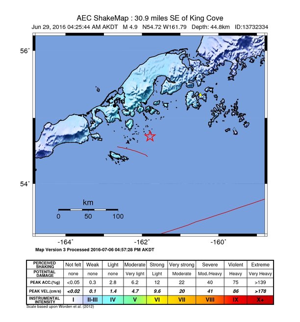
The USGS ShakeMap: shaking estimated from seismic stations and the quake’s size, on the Modified Mercalli intensity scale.
- Strongest estimated
- IV, light shaking
- Map
- Automatic
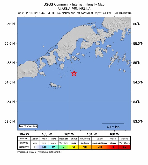
Did you feel it?
No one has reported feeling this quake to the USGS.
Fault motion and ground failure
How the rock slipped, from the moment tensor, and the USGS estimate of landslides and liquefaction.
- Faulting
- Oblique reverse
- Moment magnitude
- 4.6 Mww
- Nodal plane 1
- Strike 348°, dip 67°, rake 149°
- Nodal plane 2
- Strike 91°, dip 62°, rake 27°
How well it is located
Reviewed by a seismologist.
- Location uncertainty
- About 5.0 km horizontally, 3.3 km in depth
- Depth from
- From location
- Station coverage gap
- 144°
- Stations used
- 409
Nearest places
Distance and direction from each place to the epicenter, with its forecast.
Nearby
Within 100 km, magnitude 1.6 and up: 76 in the 60 days after this one and 27 in the 30 days before it.
After
- 2.042 km SE of False Pass, Alaska · 3745 days ago · 60 km deep · 77 km away
- 2.1100 km SSE of King Cove, Alaska · 3744 days ago · 26 km deep · 74 km away
- 1.975 km SE of King Cove, Alaska · 3744 days ago · 18 km deep · 45 km away
- 1.959 km SSE of King Cove, Alaska · 3744 days ago · 10 km deep · 45 km away
- 1.637 km S of King Cove, Alaska · 3744 days ago · 71 km deep · 29 km away
- 2.357 km ESE of King Cove, Alaska · 3743 days ago · 81 km deep · 26 km away
- 2.237 km SE of False Pass, Alaska · 3742 days ago · 78 km deep · 73 km away
- 2.295 km SE of King Cove, Alaska · 3741 days ago · 3 km deep · 67 km away
- 1.961 km S of Sand Point, Alaska · 3740 days ago · 26 km deep · 94 km away
- 2.262 km S of Sand Point, Alaska · 3740 days ago · 26 km deep · 87 km away
- 2.4120 km SE of King Cove, Alaska · 3739 days ago · 26 km deep · 92 km away
- 2.7103 km SE of King Cove, Alaska · 3739 days ago · 26 km deep · 74 km away
- 2.994 km SE of King Cove, Alaska · 3738 days ago · 9 km deep · 66 km away
- 2.396 km SE of King Cove, Alaska · 3737 days ago · 13 km deep · 70 km away
- 1.991 km SE of King Cove, Alaska · 3737 days ago · 13 km deep · 65 km away
- 2.025 km SE of False Pass, Alaska · 3737 days ago · 76 km deep · 84 km away
- 2.980 km SE of King Cove, Alaska · 3733 days ago · 10 km deep · 52 km away
- 1.856 km S of King Cove, Alaska · 3733 days ago · 26 km deep · 48 km away
- 2.079 km SSE of King Cove, Alaska · 3730 days ago · 16 km deep · 54 km away
- 2.054 km SE of False Pass, Alaska · 3730 days ago · 59 km deep · 82 km away
- 2.283 km SE of King Cove, Alaska · 3729 days ago · 26 km deep · 53 km away
- 1.753 km SSE of King Cove, Alaska · 3729 days ago · 45 km deep · 33 km away
- 2.490 km SE of False Pass, Alaska · 3728 days ago · 13 km deep · 87 km away
- 2.299 km SE of King Cove, Alaska · 3728 days ago · 13 km deep · 72 km away
- 2.289 km SSE of King Cove, Alaska · 3727 days ago · 10 km deep · 63 km away
- 3.288 km SE of King Cove, Alaska · 3726 days ago · 4 km deep · 61 km away
- 1.934 km SW of Sand Point, Alaska · 3726 days ago · 46 km deep · 72 km away
- 1.953 km SSW of King Cove, Alaska · 3725 days ago · 52 km deep · 57 km away
- 2.153 km S of King Cove, Alaska · 3724 days ago · 19 km deep · 51 km away
- 2.118 km ENE of King Cove, Alaska · 3723 days ago · 113 km deep · 23 km away
- 2.478 km SE of King Cove, Alaska · 3722 days ago · 15 km deep · 50 km away
- 1.945 km SSW of Sand Point, Alaska · 3721 days ago · 13 km deep · 71 km away
- 2.031 km S of King Cove, Alaska · 3721 days ago · 63 km deep · 29 km away
- 2.486 km SE of King Cove, Alaska · 3721 days ago · 12 km deep · 58 km away
- 3.2124 km SSE of King Cove, Alaska · 3721 days ago · 32 km deep · 98 km away
- 2.144 km S of Sand Point, Alaska · 3720 days ago · 48 km deep · 97 km away
- 2.260 km SSW of King Cove, Alaska · 3719 days ago · 53 km deep · 61 km away
- 1.935 km NW of Cold Bay, Alaska · 3719 days ago · 157 km deep · 95 km away
- 1.681 km SE of King Cove, Alaska · 3718 days ago · 25 km deep · 51 km away
- 2.456 km SSW of Nelson Lagoon, Alaska · 3718 days ago · 114 km deep · 75 km away
- 1.941 km S of Nelson Lagoon, Alaska · 3718 days ago · 90 km deep · 94 km away
- 1.847 km SE of King Cove, Alaska · 3718 days ago · 74 km deep · 17 km away
- 1.962 km S of Sand Point, Alaska · 3717 days ago · 32 km deep · 86 km away
- 2.195 km S of Sand Point, Alaska · 3716 days ago · 23 km deep · 89 km away
- 2.282 km SSW of Sand Point, Alaska · 3715 days ago · 13 km deep · 74 km away
- 2.993 km S of King Cove, Alaska · 3715 days ago · 20 km deep · 83 km away
- 2.056 km SE of King Cove, Alaska · 3713 days ago · 54 km deep · 27 km away
- 2.955 km WSW of Nelson Lagoon, Alaska · 3712 days ago · 181 km deep · 93 km away
- 2.047 km ESE of King Cove, Alaska · 3712 days ago · 76 km deep · 16 km away
- 2.379 km SSE of King Cove, Alaska · 3710 days ago · 22 km deep · 54 km away
- 2.163 km ESE of King Cove, Alaska · 3708 days ago · 61 km deep · 35 km away
- 1.938 km SE of King Cove, Alaska · 3707 days ago · 62 km deep · 14 km away
- 1.8107 km SSE of King Cove, Alaska · 3706 days ago · 27 km deep · 80 km away
- 2.587 km SE of King Cove, Alaska · 3704 days ago · 9 km deep · 60 km away
- 2.333 km SSW of Sand Point, Alaska · 3704 days ago · 52 km deep · 82 km away
- 2.253 km SE of King Cove, Alaska · 3702 days ago · 47 km deep · 24 km away
- 2.294 km SE of King Cove, Alaska · 3701 days ago · 26 km deep · 67 km away
- 2.381 km ESE of King Cove, Alaska · 3700 days ago · 26 km deep · 51 km away
- 2.576 km SSE of False Pass, Alaska · 3700 days ago · 19 km deep · 95 km away
- 2.238 km ESE of King Cove, Alaska · 3700 days ago · 64 km deep · 9 km away
The first 60 of 76.
Before
- 2.356 km E of King Cove, Alaska · 3750 days ago · 64 km deep · 29 km away
- 1.967 km SSE of King Cove, Alaska · 3750 days ago · 26 km deep · 43 km away
- 2.356 km S of Sand Point, Alaska · 3750 days ago · 26 km deep · 93 km away
- 1.840 km SW of King Cove, Alaska · 3751 days ago · 80 km deep · 56 km away
- 1.863 km SE of King Cove, Alaska · 3751 days ago · 64 km deep · 33 km away
- 2.393 km SE of False Pass, Alaska · 3751 days ago · 27 km deep · 87 km away
- 3.098 km SE of False Pass, Alaska · 3751 days ago · 26 km deep · 94 km away
- 2.064 km S of Sand Point, Alaska · 3756 days ago · 25 km deep · 90 km away
- 2.837 km NW of Sand Point, Alaska · 3759 days ago · 99 km deep · 97 km away
- 3.363 km S of Sand Point, Alaska · 3759 days ago · 14 km deep · 86 km away
- 2.240 km SW of Nelson Lagoon, Alaska · 3760 days ago · 15 km deep · 92 km away
- 2.594 km SSE of King Cove, Alaska · 3762 days ago · 15 km deep · 71 km away
- 2.591 km SSE of King Cove, Alaska · 3762 days ago · 26 km deep · 65 km away
- 1.948 km SSE of False Pass, Alaska · 3762 days ago · 64 km deep · 88 km away
- 2.021 km S of False Pass, Alaska · 3763 days ago · 97 km deep · 97 km away
- 2.586 km SE of King Cove, Alaska · 3763 days ago · 26 km deep · 55 km away
- 2.990 km SSE of King Cove, Alaska · 3764 days ago · 34 km deep · 64 km away
- 2.183 km SSE of King Cove, Alaska · 3765 days ago · 20 km deep · 58 km away
- 2.052 km SSW of King Cove, Alaska · 3767 days ago · 51 km deep · 55 km away
- 2.795 km SE of King Cove, Alaska · 3768 days ago · 26 km deep · 68 km away
Earthquakes todayAlaska earthquakesLive radar here
Sources
From the USGS Earthquake Hazards Program and its partner networks, event us200067y8 (also filed as ak13732334, at00o9j96v, ak0168bjkgzb). Read Sun, Oct 4, 2026, 5:44 AM UTC.