M2.8 earthquake 14 km NNW of Atka, Alaska
A magnitude 2.8 earthquake struck 14 km NNW of Atka, Alaska on Thu, Jan 14, 2016, 3:08 AM HAST (13:08 UTC), 192 km (119 mi) below the surface.
A larger quake followed: M6.3 72 km SSE of Atka, Alaska. This one was a foreshock.
Map
Where this earthquake was located, with the others nearby. Select one for its page.
The earthquake
- Magnitude
- 2.8 (ML, local (Richter)), micro
- Magnitude from
- USGS National Earthquake Information Center
- Local time
- UTC
- 2016-01-14 13:08:59 UTC
- Depth
- 192.1 km (119.4 mi), intermediate-depth
- Epicenter
- 52.316° N, 174.266° W
- Region
- Alaska
- Tsunami flag
- No
- Status
- Reviewed by a seismologist
Magnitude estimates
Different scales measure different things and differ by a few tenths. The USGS marks one as preferred, and it is the one this page uses.
| Mag. | Scale | Computed by | Notes |
|---|---|---|---|
| 2.8 | ML, local (Richter) | USGS National Earthquake Information Center | Preferred · Reviewed |
| 2.8 | ML, local (Richter) | Alaska Earthquake Center | Preliminary |
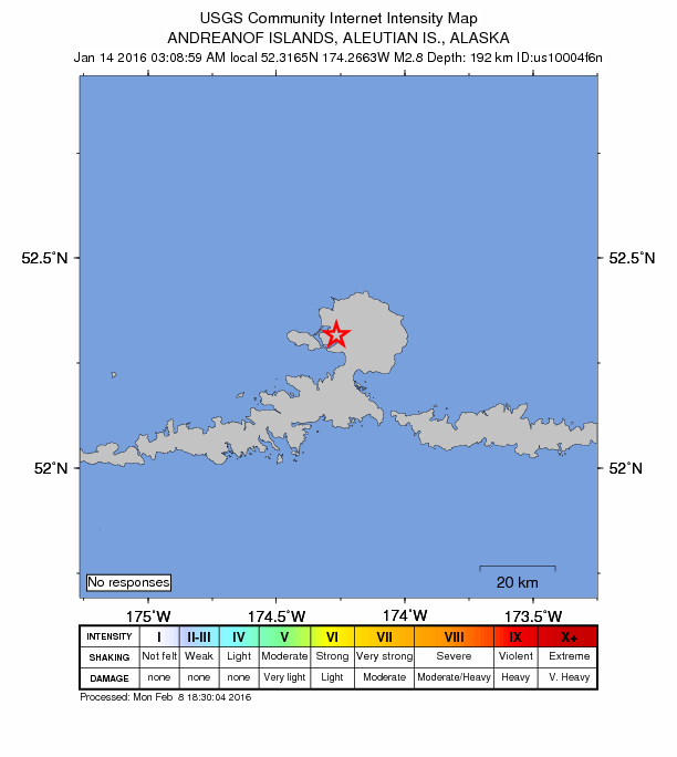
Did you feel it?
No one has reported feeling this quake to the USGS.
How well it is located
Reviewed by a seismologist.
- Location uncertainty
- About 29.9 km horizontally, 6.3 km in depth
- Stations used
- 16
Nearby
Within 100 km, magnitude 1.5 and up: 100 in the 60 days after this one and 34 in the 30 days before it.
After
- 1.683 km SW of Atka, Alaska · 3916 days ago · 37 km deep · 92 km away
- 2.456 km NNE of Atka, Alaska · 3915 days ago · 134 km deep · 46 km away
- 3.4Andreanof Islands, Aleutian Islands, Alaska · 3915 days ago · 66 km deep · 66 km away
- 2.483 km SE of Atka, Alaska · 3914 days ago · 23 km deep · 97 km away
- 1.858 km SW of Atka, Alaska · 3911 days ago · 40 km deep · 68 km away
- 2.333 km NE of Atka, Alaska · 3910 days ago · 156 km deep · 31 km away
- 2.970 km S of Atka, Alaska · 3908 days ago · 3 km deep · 84 km away
- 2.275 km E of Adak, Alaska · 3906 days ago · 155 km deep · 100 km away
- 2.377 km NNW of Atka, Alaska · 3906 days ago · 181 km deep · 64 km away
- 1.780 km SW of Atka, Alaska · 3906 days ago · 30 km deep · 88 km away
- 2.477 km S of Atka, Alaska · 3905 days ago · 16 km deep · 91 km away
- 3.146 km SSE of Atka, Alaska · 3905 days ago · 85 km deep · 60 km away
- 2.575 km NE of Adak, Alaska · 3904 days ago · 173 km deep · 100 km away
- 2.539 km WNW of Atka, Alaska · 3903 days ago · 182 km deep · 31 km away
- 2.554 km SSW of Atka, Alaska · 3903 days ago · 52 km deep · 64 km away
- 2.668 km SW of Atka, Alaska · 3902 days ago · 64 km deep · 74 km away
- 2.662 km N of Atka, Alaska · 3901 days ago · 184 km deep · 49 km away
- 2.551 km S of Atka, Alaska · 3901 days ago · 177 km deep · 65 km away
- 1.572 km WSW of Atka, Alaska · 3901 days ago · 9 km deep · 75 km away
- 2.864 km SSW of Atka, Alaska · 3900 days ago · 36 km deep · 77 km away
- 2.883 km NNE of Atka, Alaska · 3899 days ago · 201 km deep · 75 km away
- 1.655 km SW of Atka, Alaska · 3898 days ago · 14 km deep · 64 km away
- 2.568 km E of Atka, Alaska · 3898 days ago · 158 km deep · 73 km away
- 2.587 km SW of Atka, Alaska · 3897 days ago · 42 km deep · 93 km away
- 2.676 km WSW of Atka, Alaska · 3896 days ago · 92 km deep · 78 km away
- 2.580 km SSE of Atka, Alaska · 3896 days ago · 25 km deep · 94 km away
- 2.175 km S of Atka, Alaska · 3896 days ago · 22 km deep · 89 km away
- 2.455 km SSE of Atka, Alaska · 3893 days ago · 20 km deep · 69 km away
- 2.352 km SE of Atka, Alaska · 3893 days ago · 63 km deep · 66 km away
- 1.748 km SSW of Atka, Alaska · 3892 days ago · 54 km deep · 59 km away
- 3.085 km NE of Atka, Alaska · 3891 days ago · 220 km deep · 81 km away
- 2.193 km SW of Atka, Alaska · 3890 days ago · 41 km deep · 100 km away
- 1.575 km SSW of Atka, Alaska · 3889 days ago · 18 km deep · 85 km away
- 2.348 km NW of Atka, Alaska · 3887 days ago · 208 km deep · 36 km away
- 3.180 km SE of Atka, Alaska · 3887 days ago · 45 km deep · 92 km away
- 2.010 km SSE of Atka, Alaska · 3886 days ago · 103 km deep · 25 km away
- 2.582 km SW of Atka, Alaska · 3886 days ago · 45 km deep · 90 km away
- 1.565 km WSW of Atka, Alaska · 3885 days ago · 64 km deep · 70 km away
- 3.068 km ESE of Atka, Alaska · 3885 days ago · 66 km deep · 78 km away
- 2.050 km ESE of Atka, Alaska · 3885 days ago · 5 km deep · 59 km away
- 2.843 km NNW of Atka, Alaska · 3884 days ago · 193 km deep · 29 km away
- 1.942 km SSE of Atka, Alaska · 3883 days ago · 23 km deep · 56 km away
- 2.786 km S of Atka, Alaska · 3883 days ago · 69 km deep · 100 km away
- 3.042 km NW of Atka, Alaska · 3883 days ago · 166 km deep · 29 km away
- 2.279 km SW of Atka, Alaska · 3882 days ago · 26 km deep · 89 km away
- 3.075 km E of Adak, Alaska · 3881 days ago · 152 km deep · 96 km away
- 1.939 km SSW of Atka, Alaska · 3881 days ago · 53 km deep · 50 km away
- 1.974 km SW of Atka, Alaska · 3880 days ago · 26 km deep · 84 km away
- 4.227 km NNW of Atka, Alaska · 3880 days ago · 192 km deep · 14 km away
- 2.592 km SW of Atka, Alaska · 3879 days ago · 41 km deep · 97 km away
- 2.269 km SW of Atka, Alaska · 3879 days ago · 42 km deep · 76 km away
- 3.961 km WNW of Atka, Alaska · 3878 days ago · 146 km deep · 53 km away
- 1.929 km E of Atka, Alaska · 3878 days ago · 9 km deep · 37 km away
- 2.386 km E of Adak, Alaska · 3877 days ago · 67 km deep · 99 km away
- 2.127 km SE of Atka, Alaska · 3877 days ago · 63 km deep · 42 km away
- 2.479 km SW of Atka, Alaska · 3875 days ago · 26 km deep · 89 km away
- 1.773 km SW of Atka, Alaska · 3874 days ago · 26 km deep · 80 km away
- 1.856 km WSW of Atka, Alaska · 3873 days ago · 73 km deep · 57 km away
- 2.121 km WNW of Atka, Alaska · 3872 days ago · 157 km deep · 15 km away
- 1.641 km SSE of Atka, Alaska · 3872 days ago · 28 km deep · 56 km away
The first 60 of 100.
Before
- 2.569 km ESE of Atka, Alaska · 3918 days ago · 44 km deep · 80 km away
- 1.942 km SSW of Atka, Alaska · 3919 days ago · 37 km deep · 53 km away
- 4.023 km W of Atka, Alaska · 3919 days ago · 201 km deep · 22 km away
- 3.971 km SW of Atka, Alaska · 3919 days ago · 64 km deep · 76 km away
- 2.8Andreanof Islands, Aleutian Islands, Alaska · 3920 days ago · 44 km deep · 69 km away
- 3.374 km E of Adak, Alaska · 3920 days ago · 26 km deep · 96 km away
- 1.554 km SW of Atka, Alaska · 3921 days ago · 50 km deep · 63 km away
- 4.371 km NNW of Atka, Alaska · 3923 days ago · 203 km deep · 58 km away
- 2.759 km NE of Atka, Alaska · 3923 days ago · 169 km deep · 52 km away
- 1.829 km E of Atka, Alaska · 3924 days ago · 15 km deep · 38 km away
- 5.188 km E of Adak, Alaska · 3924 days ago · 44 km deep · 96 km away · tsunami flag
- 2.367 km ESE of Atka, Alaska · 3924 days ago · 60 km deep · 78 km away
- 2.243 km E of Atka, Alaska · 3925 days ago · 14 km deep · 50 km away
- 2.377 km SW of Atka, Alaska · 3925 days ago · 43 km deep · 84 km away
- 3.078 km ENE of Atka, Alaska · 3926 days ago · 225 km deep · 76 km away
- 2.080 km SW of Atka, Alaska · 3927 days ago · 42 km deep · 86 km away
- 1.961 km SSE of Atka, Alaska · 3927 days ago · 19 km deep · 76 km away
- 2.472 km SSE of Atka, Alaska · 3927 days ago · 14 km deep · 86 km away
- 2.429 km NW of Atka, Alaska · 3928 days ago · 156 km deep · 19 km away
- 2.769 km SSE of Atka, Alaska · 3929 days ago · 40 km deep · 83 km away
Earthquakes todayAlaska earthquakesLive radar here
Sources
From the USGS Earthquake Hazards Program and its partner networks, event us10004f6n (also filed as ak12464078, ak016ndbc27). Read Mon, Oct 5, 2026, 7:40 AM UTC.