M2.5 earthquake 92 km SW of Atka, Alaska
A magnitude 2.5 earthquake struck 92 km SW of Atka, Alaska on Sat, Feb 20, 2016, 11:41 PM HAST (09:41 UTC), 41 km (25 mi) below the surface.
A larger quake followed: M6.3 72 km SSE of Atka, Alaska. This one was a foreshock.
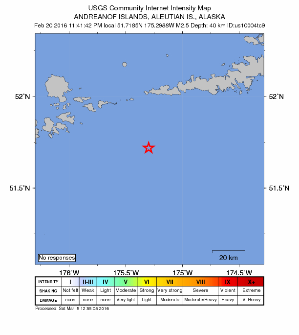
Map
Where this earthquake was located, with the others nearby. Select one for its page.
The earthquake
- Magnitude
- 2.5 (ML, local (Richter)), micro
- Magnitude from
- USGS National Earthquake Information Center
- Local time
- UTC
- 2016-02-21 09:41:42 UTC
- Depth
- 40.6 km (25.3 mi), shallow
- Epicenter
- 51.718° N, 175.299° W
- Region
- Alaska
- Tsunami flag
- No
- Status
- Reviewed by a seismologist
Magnitude estimates
Different scales measure different things and differ by a few tenths. The USGS marks one as preferred, and it is the one this page uses.
| Mag. | Scale | Computed by | Notes |
|---|---|---|---|
| 2.5 | ML, local (Richter) | USGS National Earthquake Information Center | Preferred · Reviewed · 22 stations |
| 2.5 | ML, local (Richter) | Alaska Earthquake Center | Preliminary |
Did you feel it?
No one has reported feeling this quake to the USGS.
How well it is located
Reviewed by a seismologist.
- Location uncertainty
- About 7.9 km horizontally, 50.2 km in depth
- Depth from
- From location
- Station coverage gap
- 205°, poorly surrounded by stations
- Stations used
- 24
Nearby
Within 100 km, magnitude 1.5 and up: at least 199 in the 60 days after this one and 65 in the 30 days before it.
After
- 2.269 km SW of Atka, Alaska · 3879 days ago · 42 km deep · 25 km away
- 3.961 km WNW of Atka, Alaska · 3879 days ago · 146 km deep · 81 km away
- 1.858 km SSE of Adak, Alaska · 3878 days ago · 33 km deep · 76 km away
- 2.386 km E of Adak, Alaska · 3877 days ago · 67 km deep · 8 km away
- 2.127 km SE of Atka, Alaska · 3877 days ago · 63 km deep · 97 km away
- 2.338 km ESE of Adak, Alaska · 3877 days ago · 73 km deep · 55 km away
- 2.479 km SW of Atka, Alaska · 3875 days ago · 26 km deep · 31 km away
- 2.564 km SE of Adak, Alaska · 3875 days ago · 43 km deep · 48 km away
- 1.748 km ENE of Adak, Alaska · 3875 days ago · 14 km deep · 53 km away
- 1.773 km SW of Atka, Alaska · 3875 days ago · 26 km deep · 22 km away
- 3.059 km SE of Adak, Alaska · 3874 days ago · 47 km deep · 62 km away
- 1.856 km WSW of Atka, Alaska · 3873 days ago · 73 km deep · 44 km away
- 1.716 km ESE of Adak, Alaska · 3873 days ago · 65 km deep · 78 km away
- 2.121 km WNW of Atka, Alaska · 3873 days ago · 157 km deep · 84 km away
- 1.641 km SSE of Atka, Alaska · 3872 days ago · 28 km deep · 93 km away
- 1.825 km S of Atka, Alaska · 3872 days ago · 62 km deep · 81 km away
- 4.397 km SSW of Atka, Alaska · 3872 days ago · 13 km deep · 58 km away
- 1.894 km SSW of Atka, Alaska · 3872 days ago · 67 km deep · 56 km away
- 1.815 km SE of Adak, Alaska · 3872 days ago · 63 km deep · 81 km away
- 1.927 km SSE of Atka, Alaska · 3872 days ago · 61 km deep · 95 km away
- 1.752 km S of Atka, Alaska · 3872 days ago · 37 km deep · 79 km away
- 1.867 km ENE of Adak, Alaska · 3871 days ago · 156 km deep · 56 km away
- 2.130 km NW of Atka, Alaska · 3871 days ago · 172 km deep · 90 km away
- 2.485 km ESE of Adak, Alaska · 3871 days ago · 55 km deep · 23 km away
- 2.992 km ESE of Adak, Alaska · 3871 days ago · 52 km deep · 35 km away
- 1.787 km ESE of Adak, Alaska · 3871 days ago · 59 km deep · 25 km away
- 1.796 km SE of Adak, Alaska · 3871 days ago · 26 km deep · 41 km away
- 2.089 km ESE of Adak, Alaska · 3871 days ago · 59 km deep · 24 km away
- 2.659 km SE of Adak, Alaska · 3869 days ago · 48 km deep · 58 km away
- 1.596 km ESE of Adak, Alaska · 3869 days ago · 34 km deep · 24 km away
- 1.681 km ESE of Adak, Alaska · 3869 days ago · 51 km deep · 24 km away
- 3.289 km ESE of Adak, Alaska · 3868 days ago · 50 km deep · 5 km away
- 1.9Andreanof Islands, Aleutian Islands, Alaska · 3867 days ago · 143 km deep · 57 km away
- 2.059 km W of Atka, Alaska · 3867 days ago · 110 km deep · 54 km away
- 1.916 km SSE of Adak, Alaska · 3867 days ago · 72 km deep · 86 km away
- 2.479 km SW of Atka, Alaska · 3867 days ago · 26 km deep · 30 km away
- 2.585 km SW of Atka, Alaska · 3866 days ago · 41 km deep · 8 km away
- 2.468 km SW of Atka, Alaska · 3866 days ago · 26 km deep · 24 km away
- 1.879 km SW of Atka, Alaska · 3866 days ago · 25 km deep · 28 km away
- 1.760 km SW of Atka, Alaska · 3866 days ago · 33 km deep · 32 km away
- 2.3130 km SSW of Atka, Alaska · 3863 days ago · 7 km deep · 77 km away
- 2.079 km SSE of Adak, Alaska · 3863 days ago · 20 km deep · 95 km away
- 2.179 km SSE of Adak, Alaska · 3863 days ago · 40 km deep · 93 km away
- 2.163 km ESE of Adak, Alaska · 3863 days ago · 49 km deep · 35 km away
- 2.254 km SSE of Adak, Alaska · 3860 days ago · 17 km deep · 73 km away
- 2.685 km E of Adak, Alaska · 3860 days ago · 220 km deep · 25 km away
- 4.130 km SSW of Atka, Alaska · 3860 days ago · 62 km deep · 68 km away
- 3.488 km S of Atka, Alaska · 3859 days ago · 5 km deep · 89 km away
- 2.513 km WNW of Atka, Alaska · 3859 days ago · 209 km deep · 86 km away
- 4.578 km S of Atka, Alaska · 3859 days ago · 38 km deep · 91 km away
- 5.684 km S of Atka, Alaska · 3859 days ago · 13 km deep · 96 km away · tsunami flag
- 2.9Andreanof Islands, Aleutian Islands, Alaska · 3859 days ago · 26 km deep · 98 km away
- 2.189 km S of Atka, Alaska · 3859 days ago · 26 km deep · 96 km away
- 1.873 km ESE of Adak, Alaska · 3859 days ago · 27 km deep · 23 km away
- 2.692 km S of Atka, Alaska · 3859 days ago · 23 km deep · 99 km away
- 2.495 km S of Atka, Alaska · 3859 days ago · 17 km deep · 98 km away
- 2.485 km S of Atka, Alaska · 3859 days ago · 3 km deep · 85 km away
- 2.187 km S of Atka, Alaska · 3859 days ago · 19 km deep · 92 km away
- 1.791 km SW of Atka, Alaska · 3859 days ago · 25 km deep · 16 km away
- 2.791 km S of Atka, Alaska · 3859 days ago · 14 km deep · 95 km away
The first 60 of at least 199.
Before
- 1.829 km ESE of Adak, Alaska · 3879 days ago · 58 km deep · 67 km away
- 4.6101 km ESE of Adak, Alaska · 3880 days ago · 26 km deep · 18 km away
- 2.382 km ESE of Adak, Alaska · 3880 days ago · 50 km deep · 28 km away
- 4.227 km NNW of Atka, Alaska · 3880 days ago · 192 km deep · 100 km away
- 1.963 km ESE of Adak, Alaska · 3880 days ago · 40 km deep · 40 km away
- 1.974 km SW of Atka, Alaska · 3880 days ago · 26 km deep · 32 km away
- 1.939 km SSW of Atka, Alaska · 3881 days ago · 53 km deep · 62 km away
- 3.075 km E of Adak, Alaska · 3882 days ago · 152 km deep · 33 km away
- 2.279 km SW of Atka, Alaska · 3883 days ago · 26 km deep · 32 km away
- 3.997 km ESE of Adak, Alaska · 3883 days ago · 21 km deep · 21 km away
- 2.786 km S of Atka, Alaska · 3883 days ago · 69 km deep · 78 km away
- 1.942 km SSE of Atka, Alaska · 3884 days ago · 23 km deep · 85 km away
- 2.3100 km S of Atka, Alaska · 3884 days ago · 15 km deep · 85 km away
- 2.1102 km S of Atka, Alaska · 3884 days ago · 24 km deep · 85 km away
- 2.674 km NE of Adak, Alaska · 3885 days ago · 208 km deep · 70 km away
- 2.054 km ENE of Adak, Alaska · 3885 days ago · 172 km deep · 53 km away
- 3.220 km ENE of Adak, Alaska · 3885 days ago · 77 km deep · 80 km away
- 1.565 km WSW of Atka, Alaska · 3886 days ago · 64 km deep · 27 km away
- 1.661 km SSE of Adak, Alaska · 3886 days ago · 15 km deep · 80 km away
- 1.7106 km SSW of Atka, Alaska · 3886 days ago · 15 km deep · 54 km away
Earthquakes todayAlaska earthquakesLive radar here
Sources
From the USGS Earthquake Hazards Program and its partner networks, event us10004tc9 (also filed as ak12861735, ak0162e5jtnu). Read Mon, Oct 5, 2026, 1:09 PM UTC.