M2.4 earthquake 25 km SW of Anchor Point, Alaska
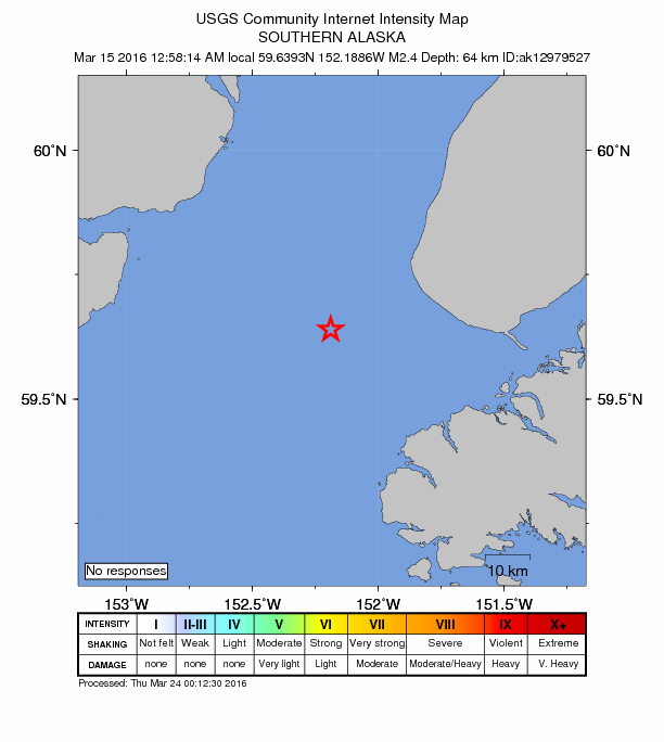
A magnitude 2.4 earthquake struck 25 km SW of Anchor Point, Alaska on Tue, Mar 15, 2016, 12:58 AM AKDT (08:58 UTC), 64 km (40 mi) below the surface.
A larger quake followed: M4.9 56 km SSW of Nanwalek, Alaska. This one was a foreshock.
Map
Where this earthquake was located, with the others nearby. Select one for its page.
The earthquake
- Magnitude
- 2.4 (ML, local (Richter)), micro
- Magnitude from
- Alaska Earthquake Center
- Local time
- UTC
- 2016-03-15 08:58:14 UTC
- Depth
- 64.4 km (40.0 mi), shallow
- Epicenter
- 59.639° N, 152.189° W
- Region
- Alaska
- Tsunami flag
- No
- Status
- Reviewed by a seismologist
Did you feel it?
No one has reported feeling this quake to the USGS.
How well it is located
Reviewed by a seismologist.
- Stations used
- 79
Nearest places
Distance and direction from each place to the epicenter, with its forecast.
Nearby
Within 100 km, magnitude 1.5 and up: at least 202 in the 60 days after this one and at least 200 in the 30 days before it.
After
- 1.845 km W of Nanwalek, Alaska · 3856 days ago · 75 km deep · 39 km away
- 1.940 km ESE of Pedro Bay, Alaska · 3856 days ago · 118 km deep · 72 km away
- 1.567 km SE of Pedro Bay, Alaska · 3856 days ago · 109 km deep · 79 km away
- 1.555 km WNW of Anchor Point, Alaska · 3856 days ago · 105 km deep · 46 km away
- 1.979 km WSW of Nanwalek, Alaska · 3856 days ago · 76 km deep · 85 km away
- 1.835 km E of Pedro Bay, Alaska · 3856 days ago · 131 km deep · 74 km away
- 1.564 km E of Port Alsworth, Alaska · 3856 days ago · 140 km deep · 83 km away
- 1.569 km WNW of Ninilchik, Alaska · 3856 days ago · 132 km deep · 83 km away
- 1.655 km E of Pedro Bay, Alaska · 3856 days ago · 105 km deep · 53 km away
- 1.564 km S of Port Graham, Alaska · 3856 days ago · 27 km deep · 99 km away
- 1.635 km ESE of Pedro Bay, Alaska · 3856 days ago · 121 km deep · 75 km away
- 2.257 km E of Pedro Bay, Alaska · 3856 days ago · 105 km deep · 52 km away
- 2.258 km ESE of Pedro Bay, Alaska · 3855 days ago · 101 km deep · 57 km away
- 2.246 km ESE of Pedro Bay, Alaska · 3855 days ago · 124 km deep · 66 km away
- 1.956 km WNW of Nanwalek, Alaska · 3855 days ago · 93 km deep · 42 km away
- 1.655 km E of Pedro Bay, Alaska · 3855 days ago · 105 km deep · 54 km away
- 1.660 km NE of Pedro Bay, Alaska · 3855 days ago · 130 km deep · 77 km away
- 1.640 km ESE of Pedro Bay, Alaska · 3855 days ago · 115 km deep · 72 km away
- 2.556 km ESE of Pedro Bay, Alaska · 3855 days ago · 110 km deep · 52 km away
- 2.058 km ENE of Pedro Bay, Alaska · 3854 days ago · 120 km deep · 58 km away
- 1.558 km E of Pedro Bay, Alaska · 3854 days ago · 99 km deep · 52 km away
- 1.854 km WNW of Happy Valley, Alaska · 3854 days ago · 106 km deep · 55 km away
- 2.559 km W of Anchor Point, Alaska · 3854 days ago · 103 km deep · 44 km away
- 1.553 km E of Pedro Bay, Alaska · 3854 days ago · 104 km deep · 56 km away
- 2.456 km E of Pedro Bay, Alaska · 3854 days ago · 102 km deep · 53 km away
- 1.661 km W of Anchor Point, Alaska · 3854 days ago · 99 km deep · 46 km away
- 1.760 km WNW of Nanwalek, Alaska · 3854 days ago · 101 km deep · 40 km away
- 2.152 km W of Anchor Point, Alaska · 3854 days ago · 88 km deep · 36 km away
- 1.649 km W of Happy Valley, Alaska · 3854 days ago · 100 km deep · 48 km away
- 1.937 km SE of Pedro Bay, Alaska · 3854 days ago · 117 km deep · 79 km away
- 1.561 km W of Anchor Point, Alaska · 3854 days ago · 107 km deep · 45 km away
- 3.373 km WNW of Happy Valley, Alaska · 3854 days ago · 130 km deep · 72 km away
- 1.850 km ESE of Pedro Bay, Alaska · 3854 days ago · 112 km deep · 59 km away
- 1.941 km SW of Nanwalek, Alaska · 3854 days ago · 65 km deep · 63 km away
- 1.741 km NW of Ninilchik, Alaska · 3853 days ago · 100 km deep · 70 km away
- 1.7Kenai Peninsula, Alaska · 3853 days ago · 33 km deep · 93 km away
- 2.346 km ENE of Pedro Bay, Alaska · 3853 days ago · 136 km deep · 76 km away
- 1.545 km W of Anchor Point, Alaska · 3853 days ago · 84 km deep · 32 km away
- 2.032 km WNW of Anchor Point, Alaska · 3853 days ago · 71 km deep · 31 km away
- 3.753 km E of Pedro Bay, Alaska · 3853 days ago · 105 km deep · 55 km away
- 2.546 km ESE of Pedro Bay, Alaska · 3853 days ago · 113 km deep · 64 km away
- 1.948 km ENE of Pedro Bay, Alaska · 3852 days ago · 133 km deep · 66 km away
- 2.025 km W of Ninilchik, Alaska · 3852 days ago · 79 km deep · 48 km away
- 1.658 km E of Pedro Bay, Alaska · 3852 days ago · 108 km deep · 51 km away
- 1.627 km WNW of Kalifornsky, Alaska · 3852 days ago · 97 km deep · 97 km away
- 1.944 km ESE of Port Alsworth, Alaska · 3852 days ago · 166 km deep · 91 km away
- 1.750 km NE of Pedro Bay, Alaska · 3852 days ago · 149 km deep · 80 km away
- 1.753 km E of Pedro Bay, Alaska · 3852 days ago · 106 km deep · 55 km away
- 1.656 km E of Pedro Bay, Alaska · 3852 days ago · 91 km deep · 53 km away
- 1.845 km ESE of Pedro Bay, Alaska · 3852 days ago · 113 km deep · 70 km away
- 1.969 km ENE of Pedro Bay, Alaska · 3852 days ago · 115 km deep · 70 km away
- 1.63 km SE of Ninilchik, Alaska · 3852 days ago · 70 km deep · 53 km away
- 1.853 km ENE of Pedro Bay, Alaska · 3852 days ago · 127 km deep · 64 km away
- 1.653 km WNW of Anchor Point, Alaska · 3852 days ago · 87 km deep · 44 km away
- 1.518 km E of Halibut Cove, Alaska · 3852 days ago · 44 km deep · 72 km away
- 2.653 km E of Port Alsworth, Alaska · 3852 days ago · 144 km deep · 88 km away
- 1.865 km WNW of Ninilchik, Alaska · 3852 days ago · 116 km deep · 77 km away
- 2.542 km SE of Pedro Bay, Alaska · 3852 days ago · 122 km deep · 73 km away
- 1.942 km ESE of Pedro Bay, Alaska · 3852 days ago · 113 km deep · 72 km away
- 1.960 km WNW of Anchor Point, Alaska · 3852 days ago · 97 km deep · 52 km away
The first 60 of at least 202.
Before
- 2.662 km E of Pedro Bay, Alaska · 3856 days ago · 107 km deep · 48 km away
- 1.557 km E of Pedro Bay, Alaska · 3857 days ago · 99 km deep · 53 km away
- 1.730 km ENE of Pedro Bay, Alaska · 3857 days ago · 141 km deep · 81 km away
- 1.563 km E of Port Alsworth, Alaska · 3857 days ago · 125 km deep · 78 km away
- 2.239 km SE of Port Graham, Alaska · 3857 days ago · 41 km deep · 77 km away
- 3.161 km E of Pedro Bay, Alaska · 3857 days ago · 106 km deep · 49 km away
- 1.635 km WNW of Nanwalek, Alaska · 3857 days ago · 77 km deep · 28 km away
- 2.361 km SE of Pope-Vannoy Landing, Alaska · 3857 days ago · 106 km deep · 96 km away
- 2.162 km W of Anchor Point, Alaska · 3857 days ago · 110 km deep · 46 km away
- 1.946 km NW of Ninilchik, Alaska · 3857 days ago · 81 km deep · 82 km away
- 1.566 km ESE of Pedro Bay, Alaska · 3857 days ago · 109 km deep · 44 km away
- 2.1Southern Alaska · 3857 days ago · 93 km deep · 81 km away
- 1.669 km W of Happy Valley, Alaska · 3858 days ago · 104 km deep · 64 km away
- 1.663 km W of Anchor Point, Alaska · 3858 days ago · 104 km deep · 47 km away
- 1.932 km E of Pedro Bay, Alaska · 3858 days ago · 127 km deep · 77 km away
- 1.548 km W of Nanwalek, Alaska · 3858 days ago · 76 km deep · 50 km away
- 1.543 km W of Happy Valley, Alaska · 3858 days ago · 78 km deep · 46 km away
- 2.233 km ENE of Pedro Bay, Alaska · 3858 days ago · 136 km deep · 81 km away · felt by 1
- 1.564 km ESE of Pedro Bay, Alaska · 3858 days ago · 105 km deep · 49 km away
- 2.055 km E of Pedro Bay, Alaska · 3858 days ago · 105 km deep · 54 km away
Earthquakes todayAlaska earthquakesLive radar here
Sources
From the USGS Earthquake Hazards Program and its partner networks, event ak0163g6eyi2 (also filed as ak12979527). Read Mon, Oct 5, 2026, 1:42 PM UTC.