M2.6 earthquake 78 km NNE of Adak, Alaska
A magnitude 2.6 earthquake struck 78 km NNE of Adak, Alaska on Sun, Jul 31, 2016, 4:01 PM HADT (01:01 UTC), 236 km (147 mi) below the surface.
A larger quake followed: M3.4 67 km E of Adak, Alaska. This one was a foreshock.
Map
Where this earthquake was located, with the others nearby. Select one for its page.
The earthquake
- Magnitude
- 2.6 (ML, local (Richter)), micro
- Magnitude from
- USGS National Earthquake Information Center
- Local time
- UTC
- 2016-08-01 01:01:09 UTC
- Depth
- 235.8 km (146.5 mi), intermediate-depth
- Epicenter
- 52.529° N, 176.211° W
- Region
- Alaska
- Tsunami flag
- No
- Status
- Reviewed by a seismologist
Magnitude estimates
Different scales measure different things and differ by a few tenths. The USGS marks one as preferred, and it is the one this page uses.
| Mag. | Scale | Computed by | Notes |
|---|---|---|---|
| 2.6 | ML, local (Richter) | USGS National Earthquake Information Center | Preferred · Reviewed |
| 2.6 | ML, local (Richter) | Alaska Earthquake Center | Preliminary |
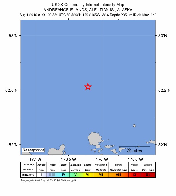
Did you feel it?
No one has reported feeling this quake to the USGS.
How well it is located
Reviewed by a seismologist.
- Location uncertainty
- About 13.6 km horizontally, 8.9 km in depth
- Station coverage gap
- 197°, poorly surrounded by stations
- Stations used
- 19
Nearby
Within 100 km, magnitude 1.5 and up: 34 in the 60 days after this one and 15 in the 30 days before it.
After
- 2.562 km E of Adak, Alaska · 3715 days ago · 156 km deep · 69 km away
- 2.231 km WSW of Adak, Alaska · 3715 days ago · 69 km deep · 100 km away
- 3.467 km E of Adak, Alaska · 3713 days ago · 54 km deep · 91 km away
- 2.143 km NE of Adak, Alaska · 3713 days ago · 138 km deep · 43 km away
- 2.727 km WSW of Adak, Alaska · 3711 days ago · 6 km deep · 98 km away
- 1.578 km W of Atka, Alaska · 3711 days ago · 121 km deep · 73 km away
- 1.773 km W of Atka, Alaska · 3711 days ago · 75 km deep · 71 km away
- 1.625 km WSW of Adak, Alaska · 3711 days ago · 7 km deep · 95 km away
- 1.525 km SSE of Adak, Alaska · 3710 days ago · 55 km deep · 96 km away
- 1.657 km ESE of Adak, Alaska · 3708 days ago · 55 km deep · 92 km away
- 1.726 km W of Adak, Alaska · 3707 days ago · 13 km deep · 95 km away
- 1.875 km E of Adak, Alaska · 3702 days ago · 69 km deep · 79 km away
- 3.049 km ESE of Adak, Alaska · 3698 days ago · 56 km deep · 100 km away
- 1.680 km E of Adak, Alaska · 3698 days ago · 61 km deep · 93 km away
- 1.640 km ESE of Adak, Alaska · 3696 days ago · 61 km deep · 83 km away
- 2.536 km NE of Adak, Alaska · 3696 days ago · 144 km deep · 51 km away
- 1.923 km N of Adak, Alaska · 3695 days ago · 89 km deep · 56 km away
- 2.547 km NE of Adak, Alaska · 3692 days ago · 225 km deep · 38 km away
- 2.281 km E of Adak, Alaska · 3690 days ago · 56 km deep · 97 km away
- 2.046 km NE of Adak, Alaska · 3690 days ago · 137 km deep · 40 km away
- 2.013 km ENE of Adak, Alaska · 3686 days ago · 99 km deep · 68 km away
- 2.369 km NE of Adak, Alaska · 3677 days ago · 225 km deep · 19 km away
- 1.623 km SSE of Adak, Alaska · 3677 days ago · 62 km deep · 98 km away
- 1.720 km SW of Adak, Alaska · 3673 days ago · 66 km deep · 97 km away
- 2.971 km WSW of Atka, Alaska · 3670 days ago · 71 km deep · 86 km away
- 3.271 km W of Atka, Alaska · 3668 days ago · 220 km deep · 71 km away
- 2.965 km NE of Adak, Alaska · 3668 days ago · 238 km deep · 36 km away
- 2.351 km NE of Adak, Alaska · 3667 days ago · 154 km deep · 39 km away
- 2.719 km WSW of Adak, Alaska · 3666 days ago · 27 km deep · 93 km away
- 3.14 km ESE of Adak, Alaska · 3663 days ago · 72 km deep · 79 km away
- 2.770 km NE of Adak, Alaska · 3661 days ago · 226 km deep · 44 km away
- 2.140 km ENE of Adak, Alaska · 3658 days ago · 133 km deep · 60 km away
- 3.056 km ENE of Adak, Alaska · 3656 days ago · 149 km deep · 54 km away
- 2.269 km E of Adak, Alaska · 3656 days ago · 34 km deep · 93 km away
Before
- 2.057 km ENE of Adak, Alaska · 3717 days ago · 182 km deep · 58 km away
- 2.482 km NE of Adak, Alaska · 3718 days ago · 237 km deep · 42 km away
- 2.472 km W of Atka, Alaska · 3723 days ago · 199 km deep · 73 km away
- 1.666 km E of Adak, Alaska · 3724 days ago · 42 km deep · 85 km away
- 2.384 km W of Atka, Alaska · 3728 days ago · 128 km deep · 70 km away
- 2.145 km ESE of Adak, Alaska · 3729 days ago · 62 km deep · 83 km away
- 2.18 km SSW of Adak, Alaska · 3732 days ago · 16 km deep · 86 km away
- 2.491 km NE of Adak, Alaska · 3735 days ago · 219 km deep · 39 km away
- 2.755 km WSW of Atka, Alaska · 3737 days ago · 76 km deep · 99 km away
- 2.796 km NE of Adak, Alaska · 3737 days ago · 135 km deep · 37 km away
- 2.555 km NE of Adak, Alaska · 3738 days ago · 175 km deep · 36 km away
- 1.684 km ENE of Adak, Alaska · 3744 days ago · 6 km deep · 68 km away
- 1.995 km WNW of Atka, Alaska · 3744 days ago · 137 km deep · 48 km away
- 2.145 km N of Adak, Alaska · 3746 days ago · 177 km deep · 35 km away
- 2.075 km ENE of Adak, Alaska · 3746 days ago · 71 km deep · 68 km away
Earthquakes todayAlaska earthquakesLive radar here
Sources
From the USGS Earthquake Hazards Program and its partner networks, event us10006cs9 (also filed as ak13821642, ak0169txlxqu). Read Sat, Oct 3, 2026, 11:20 PM UTC.