M2.5 earthquake 62 km E of Adak, Alaska
A magnitude 2.5 earthquake struck 62 km E of Adak, Alaska on Mon, Aug 1, 2016, 5:33 AM HADT (14:33 UTC), 156 km (97 mi) below the surface.
A larger quake followed: M3.6 82 km WSW of Atka, Alaska. This one was a foreshock.
Map
Where this earthquake was located, with the others nearby. Select one for its page.
The earthquake
- Magnitude
- 2.5 (ML, local (Richter)), micro
- Magnitude from
- USGS National Earthquake Information Center
- Local time
- UTC
- 2016-08-01 14:33:21 UTC
- Depth
- 156.4 km (97.2 mi), intermediate-depth
- Epicenter
- 51.978° N, 175.737° W
- Region
- Alaska
- Tsunami flag
- No
- Status
- Reviewed by a seismologist
Magnitude estimates
Different scales measure different things and differ by a few tenths. The USGS marks one as preferred, and it is the one this page uses.
| Mag. | Scale | Computed by | Notes |
|---|---|---|---|
| 2.5 | ML, local (Richter) | USGS National Earthquake Information Center | Preferred · Reviewed |
| 2.5 | ML, local (Richter) | Alaska Earthquake Center | Preliminary |
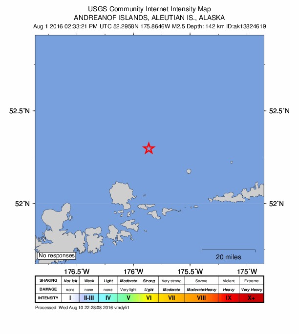
Did you feel it?
No one has reported feeling this quake to the USGS.
How well it is located
Reviewed by a seismologist.
- Location uncertainty
- About 26.5 km horizontally, 6.5 km in depth
- Depth from
- From location
- Station coverage gap
- 187°, poorly surrounded by stations
- Stations used
- 8
Nearby
Within 100 km, magnitude 1.5 and up: 108 in the 60 days after this one and 52 in the 30 days before it.
After
- 2.231 km WSW of Adak, Alaska · 3715 days ago · 69 km deep · 94 km away
- 1.923 km WNW of Atka, Alaska · 3715 days ago · 75 km deep · 87 km away
- 1.964 km SE of Adak, Alaska · 3714 days ago · 14 km deep · 66 km away
- 3.467 km E of Adak, Alaska · 3714 days ago · 54 km deep · 23 km away
- 2.330 km SSE of Adak, Alaska · 3714 days ago · 47 km deep · 66 km away
- 1.567 km SSE of Adak, Alaska · 3713 days ago · 16 km deep · 90 km away
- 2.143 km NE of Adak, Alaska · 3713 days ago · 138 km deep · 35 km away
- 2.510 km WNW of Atka, Alaska · 3712 days ago · 130 km deep · 98 km away
- 2.727 km WSW of Adak, Alaska · 3711 days ago · 6 km deep · 90 km away
- 1.578 km W of Atka, Alaska · 3711 days ago · 121 km deep · 33 km away
- 1.773 km W of Atka, Alaska · 3711 days ago · 75 km deep · 44 km away
- 1.952 km NW of Atka, Alaska · 3711 days ago · 147 km deep · 98 km away
- 1.625 km WSW of Adak, Alaska · 3711 days ago · 7 km deep · 88 km away
- 1.525 km SSE of Adak, Alaska · 3710 days ago · 55 km deep · 59 km away
- 2.586 km SW of Atka, Alaska · 3710 days ago · 26 km deep · 59 km away
- 1.865 km SE of Adak, Alaska · 3709 days ago · 10 km deep · 70 km away
- 3.682 km WSW of Atka, Alaska · 3709 days ago · 47 km deep · 41 km away
- 1.589 km ESE of Adak, Alaska · 3709 days ago · 13 km deep · 58 km away
- 1.773 km SE of Adak, Alaska · 3709 days ago · 49 km deep · 53 km away
- 1.879 km SE of Adak, Alaska · 3709 days ago · 63 km deep · 68 km away
- 2.6Andreanof Islands, Aleutian Islands, Alaska · 3708 days ago · 98 km deep · 95 km away
- 1.657 km ESE of Adak, Alaska · 3708 days ago · 55 km deep · 28 km away
- 2.078 km ESE of Adak, Alaska · 3708 days ago · 73 km deep · 39 km away
- 2.126 km WSW of Atka, Alaska · 3708 days ago · 198 km deep · 83 km away
- 1.726 km W of Adak, Alaska · 3707 days ago · 13 km deep · 89 km away
- 2.267 km SW of Atka, Alaska · 3706 days ago · 31 km deep · 71 km away
- 1.983 km SE of Adak, Alaska · 3705 days ago · 15 km deep · 66 km away
- 2.352 km SSE of Adak, Alaska · 3705 days ago · 26 km deep · 78 km away
- 2.625 km SW of Adak, Alaska · 3704 days ago · 55 km deep · 85 km away
- 2.241 km SE of Adak, Alaska · 3704 days ago · 37 km deep · 59 km away
- 1.660 km SSE of Adak, Alaska · 3703 days ago · 26 km deep · 70 km away
- 1.923 km WSW of Atka, Alaska · 3702 days ago · 41 km deep · 86 km away
- 1.875 km E of Adak, Alaska · 3702 days ago · 69 km deep · 14 km away
- 1.930 km SW of Atka, Alaska · 3701 days ago · 26 km deep · 85 km away
- 1.848 km SSE of Adak, Alaska · 3701 days ago · 22 km deep · 78 km away
- 1.635 km SSW of Adak, Alaska · 3701 days ago · 58 km deep · 90 km away
- 1.640 km SSW of Adak, Alaska · 3701 days ago · 56 km deep · 92 km away
- 1.775 km ESE of Adak, Alaska · 3701 days ago · 58 km deep · 39 km away
- 1.868 km SE of Adak, Alaska · 3701 days ago · 54 km deep · 50 km away
- 3.076 km SE of Adak, Alaska · 3701 days ago · 44 km deep · 58 km away
- 3.696 km SW of Atka, Alaska · 3700 days ago · 35 km deep · 53 km away
- 1.740 km SSW of Atka, Alaska · 3699 days ago · 46 km deep · 94 km away
- 3.049 km ESE of Adak, Alaska · 3698 days ago · 56 km deep · 43 km away
- 1.787 km SW of Atka, Alaska · 3698 days ago · 26 km deep · 53 km away
- 1.680 km E of Adak, Alaska · 3698 days ago · 61 km deep · 25 km away
- 2.991 km SE of Adak, Alaska · 3698 days ago · 38 km deep · 70 km away
- 1.640 km ESE of Adak, Alaska · 3697 days ago · 61 km deep · 30 km away
- 1.8107 km SW of Atka, Alaska · 3696 days ago · 48 km deep · 68 km away
- 2.536 km NE of Adak, Alaska · 3696 days ago · 144 km deep · 33 km away
- 1.926 km SSW of Atka, Alaska · 3696 days ago · 61 km deep · 97 km away
- 1.529 km WNW of Atka, Alaska · 3695 days ago · 14 km deep · 85 km away
- 1.923 km N of Adak, Alaska · 3695 days ago · 89 km deep · 60 km away
- 1.742 km SSE of Adak, Alaska · 3695 days ago · 37 km deep · 65 km away
- 1.624 km SSW of Adak, Alaska · 3694 days ago · 21 km deep · 82 km away
- 1.866 km SW of Atka, Alaska · 3694 days ago · 13 km deep · 69 km away
- 2.061 km SSW of Atka, Alaska · 3694 days ago · 16 km deep · 82 km away
- 2.541 km SSW of Atka, Alaska · 3692 days ago · 177 km deep · 97 km away
- 2.366 km SW of Atka, Alaska · 3692 days ago · 47 km deep · 58 km away
- 2.547 km NE of Adak, Alaska · 3692 days ago · 225 km deep · 37 km away
- 1.635 km S of Adak, Alaska · 3691 days ago · 38 km deep · 77 km away
The first 60 of 108.
Before
- 2.678 km NNE of Adak, Alaska · 3716 days ago · 236 km deep · 69 km away
- 2.057 km ENE of Adak, Alaska · 3717 days ago · 182 km deep · 12 km away
- 2.835 km SSW of Atka, Alaska · 3718 days ago · 42 km deep · 95 km away
- 2.090 km SW of Atka, Alaska · 3718 days ago · 33 km deep · 65 km away
- 2.482 km NE of Adak, Alaska · 3719 days ago · 237 km deep · 39 km away
- 1.731 km SSW of Atka, Alaska · 3719 days ago · 60 km deep · 88 km away
- 1.6101 km ESE of Adak, Alaska · 3719 days ago · 58 km deep · 61 km away
- 2.568 km SSW of Atka, Alaska · 3721 days ago · 26 km deep · 81 km away
- 1.848 km S of Adak, Alaska · 3721 days ago · 32 km deep · 80 km away
- 1.592 km ESE of Adak, Alaska · 3722 days ago · 42 km deep · 42 km away
- 1.968 km SSE of Adak, Alaska · 3723 days ago · 2 km deep · 87 km away
- 2.472 km W of Atka, Alaska · 3723 days ago · 199 km deep · 42 km away
- 1.677 km SSE of Adak, Alaska · 3723 days ago · 19 km deep · 92 km away
- 1.666 km E of Adak, Alaska · 3725 days ago · 42 km deep · 16 km away
- 1.6Andreanof Islands, Aleutian Islands, Alaska · 3725 days ago · 27 km deep · 57 km away
- 1.7120 km SE of Adak, Alaska · 3725 days ago · 38 km deep · 91 km away
- 2.495 km ESE of Adak, Alaska · 3725 days ago · 41 km deep · 50 km away
- 1.956 km SE of Adak, Alaska · 3725 days ago · 24 km deep · 63 km away
- 1.661 km SE of Adak, Alaska · 3727 days ago · 24 km deep · 67 km away
- 1.639 km SE of Adak, Alaska · 3727 days ago · 46 km deep · 52 km away
Earthquakes todayAlaska earthquakesLive radar here
Sources
From the USGS Earthquake Hazards Program and its partner networks, event us100069c7 (also filed as ak13824619, ak0169u5jgg2). Read Sun, Oct 4, 2026, 4:39 AM UTC.