Cerro Negro, Nicaragua
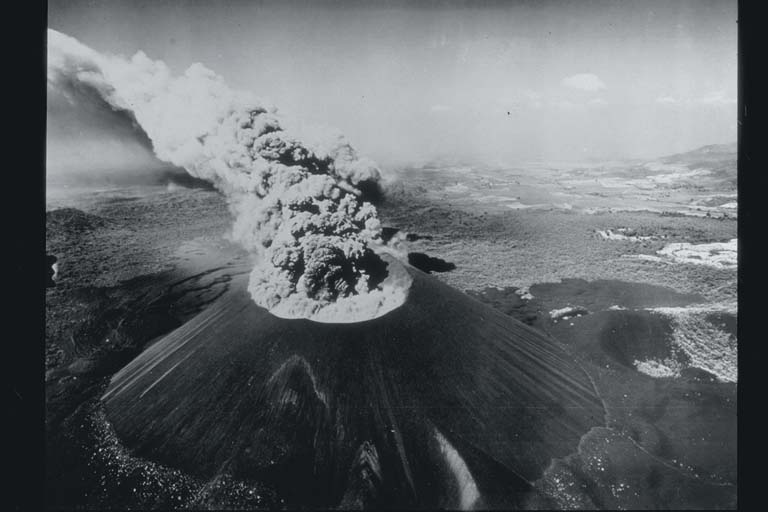
Cerro Negro is a cinder cone in Nicaragua, 728 m (2,388 ft) high. Its last known eruption: 1964 or later. NOAA records 1 significant eruption here, which killed 11 people where the toll is counted.
Cerro Negro on the map
Cerro Negro and the volcanoes within 300 km, colored by when each last erupted.
- Since 1964
- 1900 to 1963
- 1800s
- AD 1 to 1799
- Before AD 1, or undated
The volcano
- Type
- Cinder cone
- Elevation
- 728 m (2,388 ft)
- Country
- Nicaragua
- Summit
- 12.506° N, 86.702° W
- Last known eruption
- 1964 or later
- Holocene activity known from
- Historical
- Smithsonian volcano number
- 344070
Significant eruptions
1 on record, newest first.
Photos
From the NCEI/WDS Natural Hazards Image Database (doi:10.7289/V5154F01). Only photos by the USGS and NOAA, which are public domain, are shown.
Around it
The volcanoes within 300 km.
Earthquakes near Cerro NegroVolcanic ash advisories on the live map
Sources
Volcanoes and significant eruptions from NOAA’s National Centers for Environmental Information, Global Historical Hazard Database, cited as NCEI/WDS, doi:10.7289/V5PN93H7. Public domain. Read 2026-09-24. Volcano numbers are the Smithsonian Institution’s Global Volcanism Program’s.