May 31, 1970 Tsunami: N. Peru
A tsunami caused by a magnitude 7.9 earthquake began at N. Peru on May 31, 1970 at 20:23:27 UTC. The water rose as high as 0.46 meters. Its effects were recorded at 15 places in at least 2 countries. It killed 66,794 people, counting the earthquake or eruption that caused it.
Where the waves reached
The source (white) and every runup with a place, colored by the water height recorded there. A ring is a runup NCEI marks doubtful.
- Under 1 m
- 1 to 3 m
- 3 to 10 m
- 10 to 30 m
- 30 m and more
- Height not recorded
The tsunami
- Date
- May 31, 1970, 20:23:27 UTC
- Source
- N. Peru
- Cause
- Earthquake
- Earthquake
- Magnitude 7.9, 43 km deep
- Maximum water height
- 0.46 m (1.5 ft)
- Runups recorded
- 15
- Tsunami magnitude (Iida)
- 0.8
- Waters
- Ocean
- How certain
- Definite tsunami
- Source location
- 9.200° S, 78.800° W
The toll
- Deaths
- 66,794 with the earthquake or eruption that caused it
- Injuries
- 50,000 with the earthquake or eruption that caused it
- Damage
- $530 million with the earthquake or eruption that caused it
- Houses destroyed
- Many (101 to 1,000) with the earthquake or eruption that caused it
Where the literature gives no number, NCEI records a description on a scale of 1 to 4, printed here in its words. Damage is in millions of US dollars of the year of the event, not adjusted for inflation.
What the record says
NCEI’s account, from the sources it cites.
On May 31, 1970, at 15:23 [local time] a catastrophic earthquake occurred in Peru. Weak tsunamis, produced by the earthquake, were observed along the Peruvian coast. In Chimbote, a 76 cm high wave was recorded; in La Punta (Callao region), the height was 61 cm. Tsunami waves were observed on the Japanese coast. (reference #417)
[At Chimbote tide gauge] total peak-to-trough amplitude of the tsunami did not exceed 3 ft. No flooding occurred because the peak of the tsunami remained below the high-tide level at all times [...] The tsunami was also recorded on the tide gage at Callao (La Punta) [...] No tsunami was observed at the stations at Talara, San Juan, and Mataraui. (reference #12952)
Reference #552 lists a maximum runup height of 1.8 m but that value cannot be confirmed with any other reference.
Every runup
Nearest the source first. Heights are above sea level at the time; a tide gauge reads half the wave’s full height.
| Where | Country | Km from source | Water height, m | Inland, m | Measured by | First wave, UTC | Deaths |
|---|---|---|---|---|---|---|---|
| Chimbote | Peru | 24 | 0.46 | Tide gauge (half the maximum wave height) | |||
| Callao LA Punta | Peru | 364 | 0.15 | Tide gauge (half the maximum wave height) | |||
| Hanasaki | Japan | 14,301 | 0.06 | Tide gauge (half the maximum wave height) | |||
| Tokachiko | Japan | 14,514 | 0.06 | Tide gauge (half the maximum wave height) | |||
| Hiroo | Japan | 14,516 | 0.05 | Tide gauge (half the maximum wave height) | |||
| Hachinohe | Japan | 14,742 | 0.02 | Tide gauge (half the maximum wave height) | |||
| Ayukawa | Japan | 14,866 | 0.07 | Tide gauge (half the maximum wave height) | |||
| Onahama | Japan | 14,984 | 0.03 | Tide gauge (half the maximum wave height) | |||
| Mera | Japan | 15,173 | 0.04 | Tide gauge (half the maximum wave height) | |||
| Enoshima | Japan | 15,181 | 0.03 | Tide gauge (half the maximum wave height) | |||
| Omaezaki | Japan | 15,319 | 0.04 | Tide gauge (half the maximum wave height) | |||
| Kushimoto | Japan | 15,577 | 0.04 | Tide gauge (half the maximum wave height) | |||
| Murotomisaki | Japan | 15,718 | 0.05 | Tide gauge (half the maximum wave height) | |||
| Tosa-Shimizu | Japan | 15,843 | 0.07 | Tide gauge (half the maximum wave height) | |||
| Aburatsu | Japan | 16,036 | 0.05 | Tide gauge (half the maximum wave height) |
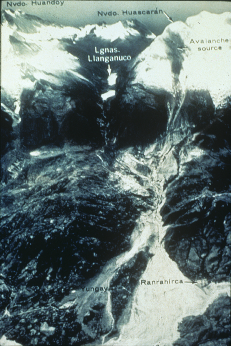
Photos
From the NCEI/WDS Natural Hazards Image Database (doi:10.7289/V5154F01). Only photos by the USGS and NOAA, which are public domain, are shown.
More
Every tsunami in 1970The 1900sTsunamis of PeruThe earthquakeThis day in weather historyAlerts in force
Sources
Tsunami events and runups from NOAA’s National Centers for Environmental Information, Global Historical Hazard Database, cited as NCEI/WDS, doi:10.7289/V5PN93H7. Public domain. Read 2026-09-24. NCEI tsunami event 2021.