The Xenia, Ohio tornado of April 3, 1974
F5 Greene and Clark counties, Ohio · tornado 37 of 148 in the Super Outbreak · surveyed by T. Theodore Fujita
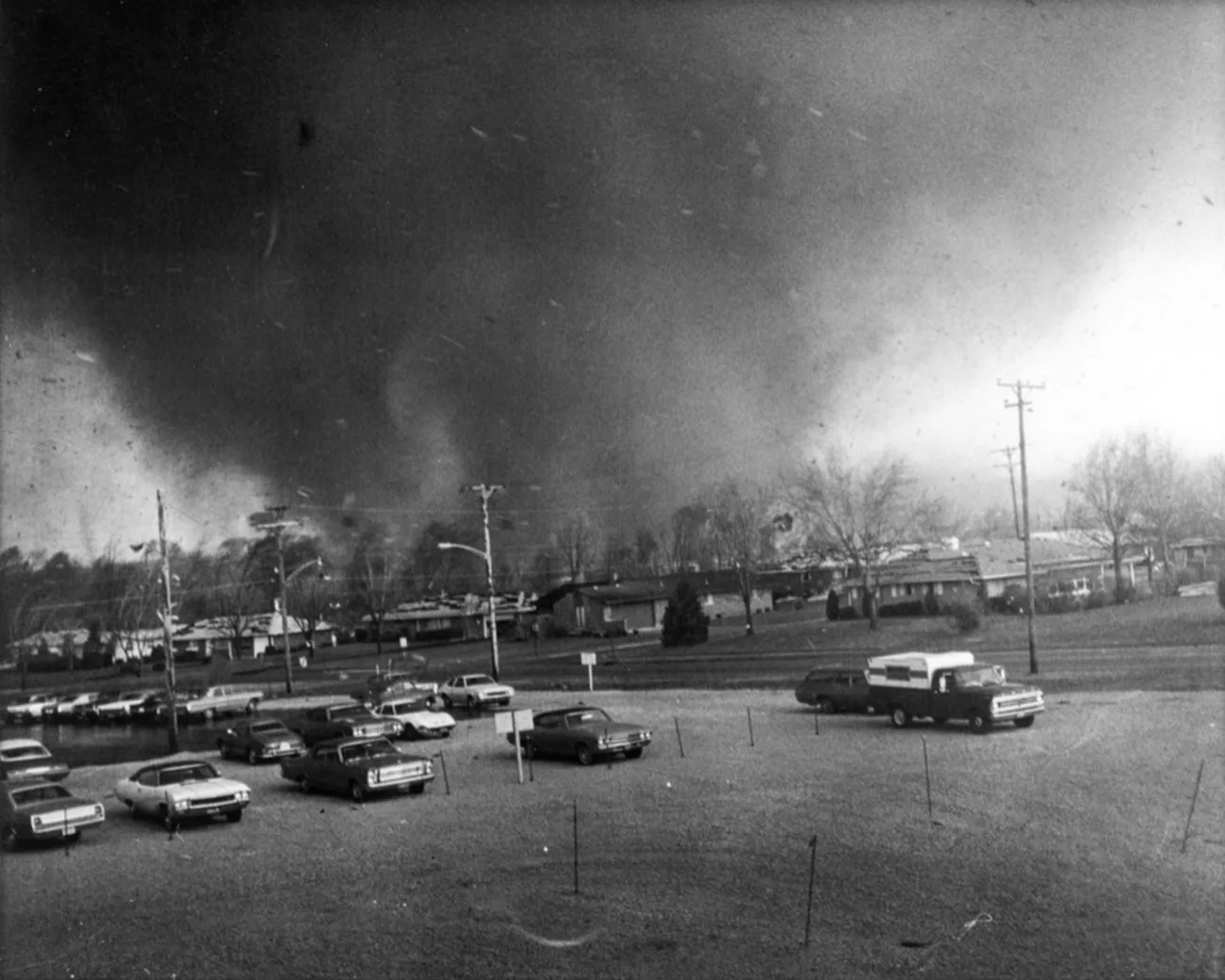
At 4:40 in the afternoon, on a day when fifteen tornadoes were on the ground at once across the eastern United States, a half-mile-wide tornado with vortices "like spaghetti" spinning beneath it crossed a town of 25,000 in southwest Ohio. It flattened two subdivisions in thirty seconds, went through the middle of downtown, dropped part of a school onto a stage where students had been rehearsing minutes before, and killed 32 people on the day. It was the deadliest tornado of the largest outbreak then on record, the only one Ted Fujita ever published as an F6, and the first violent tornado to be filmed well enough to measure. There is no radar to replay here. This page is about what 1974 could see.
- Rating
- F5 published first as F6
- Path length
- 16 mi NWS; 31 mi with the Clark County segment
- Max width
- ~880 yd a quarter to a half mile
- Touchdown
- 4:33 pm EDT central Xenia 4:40
- Forward speed
- ~50 mph 16–61 mph across Arrowhead
- Deaths
- 34 32 on the day; NCEI 36
- Injuries
- 1,150 NCEI; "more than 1,100"
- Damage
- $250M 1974 USD
- Radar
- WSR-57 Cincinnati; no velocity
- Warning lead
- ~23 min warned about 4:10 pm EDT
- Buildings
- ~1,750 with major damage
- Outbreak
- 148 tornadoes 13 states, 335 deaths
The setup
The Super Outbreak was recognised before it began. On Tuesday, April 2, the director of the National Severe Storms Forecast Center alerted every Central Region office with a radar to the likelihood of a serious outbreak the following day. The federal survey afterwards recorded that "the potential threat of the storm system was recognized 36 hours in advance," called the early-morning outlook of April 3 "excellent," and noted it had been carried on the NBC Today Show.[4][5]
The meteorology, revisited in 2010 by Stephen Corfidi and colleagues at the Storm Prediction Center, resisted a single explanation. The lee cyclone was strong but "not unprecedented"; instability "while substantial, was not extreme." What made the day was several things acting together: an unusually strong upper-level jet, a broad elevated mixed layer spreading east that preserved the heating, and weak linear forcing that let storms stay discrete for hours. Xenia's storm belonged to the second of the outbreak's three bands, in an environment of 2,000 to 3,000 J/kg of CAPE and 35 m/s of deep-layer shear over a nearly unidirectional southwesterly flow. Cloud tops in that band reached 50,000 feet, well above the 38,000-foot tropopause.[12]
The outbreak's final tally, by Fujita's count and the modern record, was 148 tornadoes in 13 states in about 16 hours, 95 of them F2 or stronger and 30 of them F4 or F5, with 335 dead and more than 6,000 injured. At its peak fifteen tornadoes were on the ground at the same time.[1][12]
The warning
The radar that watched Xenia was a WSR-57 installed at the Weather Service Office in Cincinnati in 1960. It gave "coarse reflectivity data but no velocity data," and forecasters traced the echoes onto thin paper maps laid over the scope. The Dayton office, which held warning responsibility for Greene County, had no radar of its own and watched Cincinnati's through a facsimile machine.[1]
It was enough. Around 4:10 pm the Dayton office issued a tornado warning for Montgomery and Greene counties, valid to 5:00 pm, "based on radar indication of a possible tornado 25 miles northeast of Cincinnati moving northeastward." Shortly after 4:30 the Cincinnati office, whose scope at one point showed five distinct hook echoes, telephoned Dayton to make sure they had seen the one approaching Xenia. Cincinnati's own radar log has the call at 4:42 pm: "Hook approaching Xenia, call Dayton."[1][6] Across the outbreak, more than half of all warnings were issued on radar rather than on sightings, and more than 160 hooks were reported.[4]
The warning reached people mostly through television. "The most important element in disseminating watches and warnings was the active participation by television and radio stations," the federal survey concluded.[4] In Dayton that meant Gil Whitney of WHIO-TV, who broke into programming after spotting a hook echo on the station's newly installed radar and told viewers to take cover, naming the Arrowhead neighbourhood as directly in the path. Fifty years later Xenia still credits him with lives. "As soon as you heard Gil Whitney," a retired fire lieutenant told the station in 2024, the sentence needing no ending.[19] The station's radar was reflectivity only; claims that it was an early Doppler are not supported.
-
The National Severe Storms Forecast Center alerts all Central Region radar offices to the likelihood of a serious outbreak the next day.[5]
-
NWS Dayton tornado warning for Montgomery and Greene counties, valid to 5:00 pm, on a radar-indicated hook.[1]
-
Near Bellbrook, "two small funnels descended from the cloud, and one of them touched the ground." Cincinnati telephones Dayton about the hook.[1][11]
-
Touchdown near Lower Bellbrook Road, five miles southwest of Xenia.[1][2]
-
More funnels appear, "twisting around each other," then vanish, "leaving a huge swirl of dust rising from the ground." The Arrowhead subdivision is destroyed in thirty seconds.[11]
-
Central Xenia. Suction vortices are seen inside the dust cloud "as it entered the city." At Wright-Patterson Air Force Base a CPS-9 radar photographs the hook, "comma shaped with the tornado at the comma head."[1][9][11]
-
Cincinnati radar log: "Hook approaching Xenia, call Dayton."[6]
-
Wilberforce and Central State University. The tornado lifts north of Cedarville, then a second touchdown near Cortsville carries the damage into Clark County toward South Charleston.[2][7]
-
Power fails at the Cincinnati radar with five hook echoes on the scope; it is out for about three hours.[4][6]
Nine minutes
The tornado formed between Bellbrook and Xenia and came into the town from the southwest at about 50 mph, first across the Windsor Park and Arrowhead subdivisions. Arrowhead was a neighbourhood of newer single-storey homes, many without basements; it lost more than 300 of them.[2][27] Fujita, from the film, timed the destruction of Arrowhead at thirty seconds, during which the tornado's forward speed swung between 16 and 61 mph.[11]
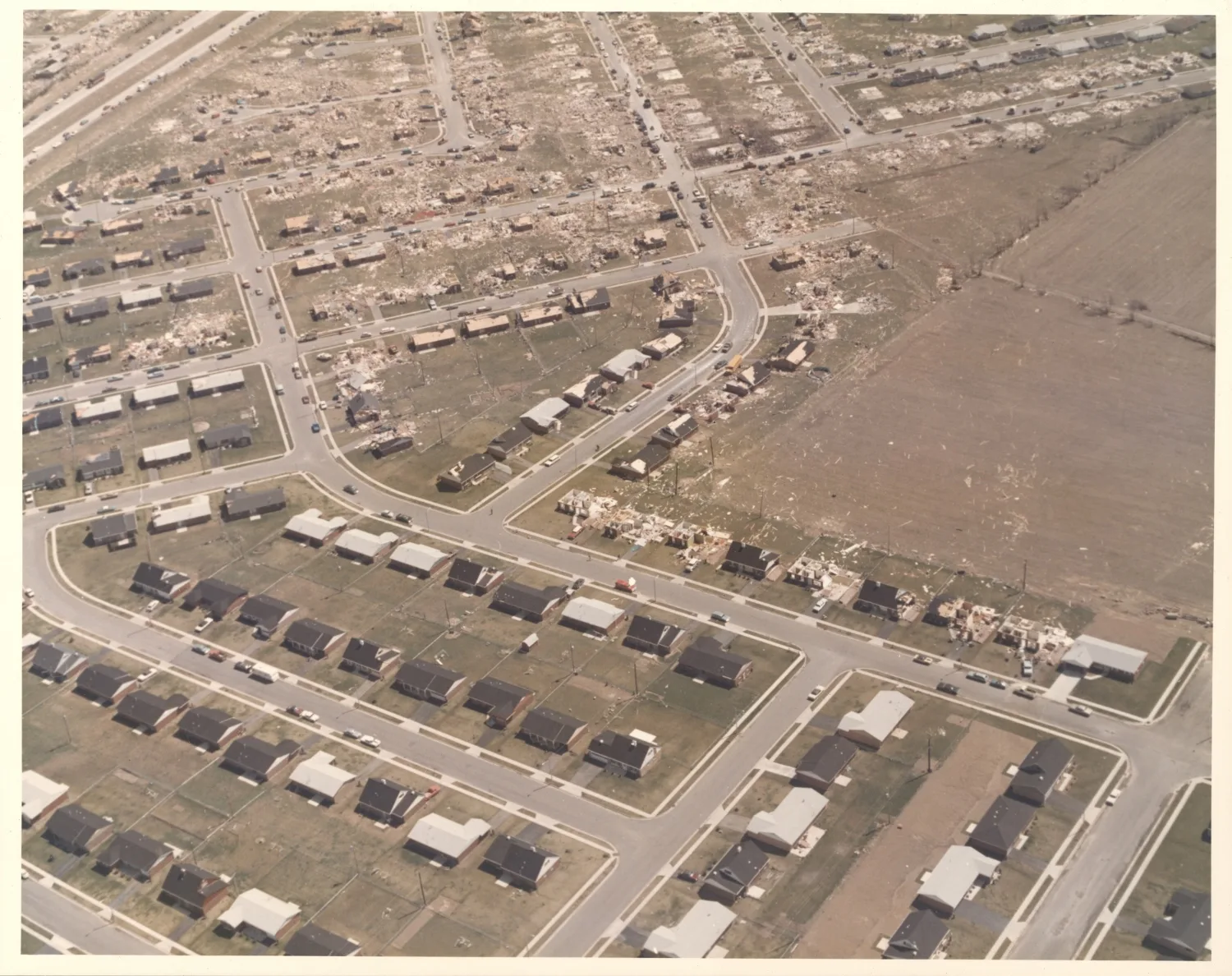
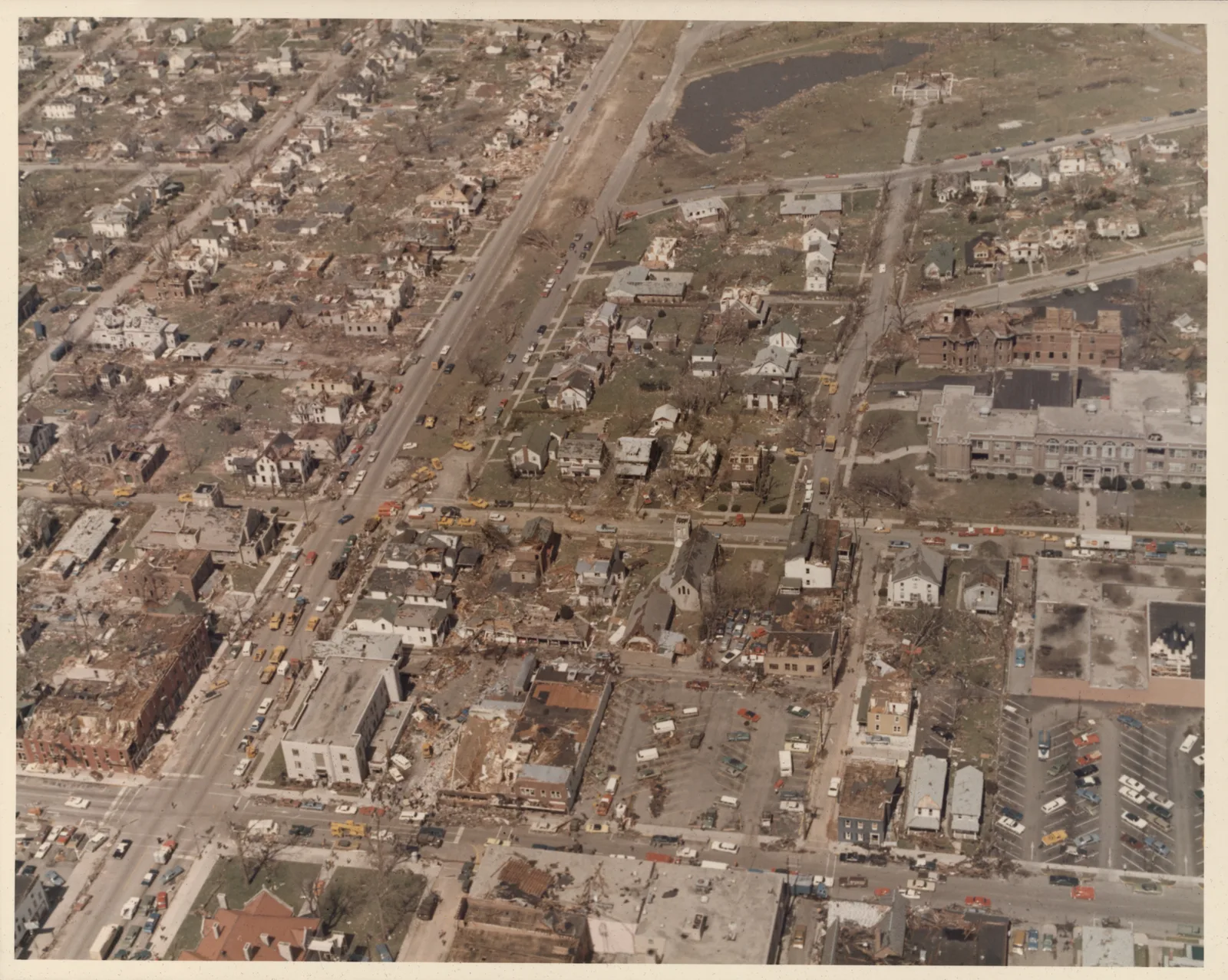
From Arrowhead it went through the centre of town. The A&W root beer stand was flattened with people inside; it passed over a moving Penn Central freight train and threw cars off the tracks; it toppled headstones in Cherry Grove Cemetery and took the roofs off the business district.[29] Nine of Xenia's twelve schools were damaged or destroyed, and nine churches. The engineering survey counted about 1,750 buildings with major damage and 1,200 more with minor damage, along a path 2,000 to 3,000 feet wide through the city.[14][20][24]
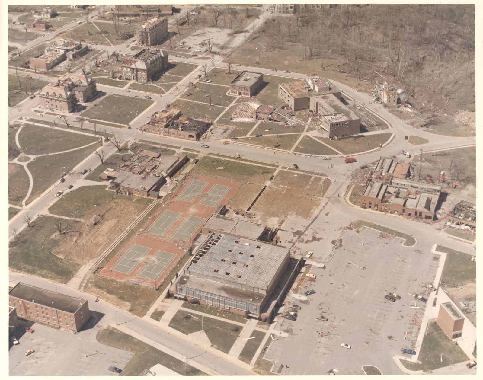
Beyond the town it struck Wilberforce and Central State University, where about 80 percent of the campus was damaged, before lifting north of Cedarville. A second touchdown near Cortsville continued into Clark County. The NWS track page gives 16 miles for the Xenia segment; the Storm Events database records 20.4 miles in Greene County and a further 10.9 in Clark, both rated F5.[2][7][21]
The schools
School had let out an hour before. About 8,300 students had gone home, and five of the city's ten schools were in the direct path.[14][20] At Xenia High School the load-bearing masonry walls of the gymnasium and cafeteria collapsed and the second-storey roof "was uplifted and totally disintegrated." A group of students rehearsing a musical took cover in the hallway seconds before a school bus was thrown onto the stage.[14][29]
The engineers who surveyed the town for the National Academy of Sciences drew the lesson in one sentence: "Interior hallways sustained negligible damage and would have provided safe shelter for the children had the schools been in session."[14] The federal survey drew the other one. "The school system in Xenia had a disaster plan, but had never conducted a tornado drill," it found, and: "Had the April 3 tornado occurred 2 hours earlier, without well executed tornado plans and prior drills, hundreds might have died."[4]
What radar could see in 1974
This site's archive begins in 1991, with the first WSR-88Ds. Nothing from 1974 can be replayed, because nothing from 1974 was recorded in a form that could be. What exists is film: the WSR-57 scopes carried a 35 mm camera and a Polaroid permanently mounted over a repeater display, and thousands of feet of that film went to the National Climatic Data Center.[17] From it, Ernest Agee and colleagues at Purdue reconstructed the day's storms in 1975: "the Covington radar, when placed on the 50 n mi range, showed a pronounced hook echo with the Xenia storm." The same storm, crossing Cincinnati, then "interrupted the radar service at Covington for approximately two hours."[13]
Fujita had a second radar record, and matched it to a photograph. At 4:40 pm, "within a few seconds" of a picture taken by Thomas Benadum half a mile southwest of the town, "a CPS-9 picture of a hook echo was obtained by the 15th Weather Squadron at Wright-Patterson AFB." The tornado sat at the head of a comma-shaped hook. What the sequence then showed was something operational forecasters had not been trained to expect: the tornado moved out of the hook as it matured, an "unhooking" Fujita warned about directly. "Those who watch radarscope during tornadic activities have a tendency to consider the location of a hook as being that of a tornado. This is not entirely true, because some intense tornadoes could be far outside the parent hooks."[9]
No Doppler data exist for this tornado. In 1974 Doppler weather radar was a research instrument in Oklahoma, and the outbreak's federal survey listed it under promising developments rather than tools: "Particularly promising are the recent developments in the use of Doppler radar to identify small-scale velocity fields." The first operational WSR-88D was not commissioned until 1994.[4][18] The nearest thing to a modern radar view of a Xenia tornado is the F4 of September 20, 2000, which hit "some of the same areas that were hit in 1974" and which the Wilmington WSR-88D recorded in full.[28]
The next violent tornado to strike Xenia, the F4 of September 20, 2000, is in the archive, seen by the Wilmington radar that did not exist in 1974.
Open in the archiveThe F6
Fujita's first published survey of the outbreak, in the June 1974 Weatherwise, covered 93 tornado paths and contained a sentence he would never repeat: "The Xenia tornado (No. 24) is rated as F6 while F5 tornadoes are identified as Hamburg tornado (No. 23), Depauw tornado (No. 27), Sayler Park tornado (No. 30), Brandenburg tornado (No. 33), and Guin tornado (No. 75)." He attached his own caveat in the same paragraph: "these F scale ratings are the result of visual inspection of damage with expected accuracy of ± one scale."[8] On his scale, F6 began at 319 mph and was labelled "inconceivable damage."[10]
What replaced the F6 was measurement, of a kind nobody had made before. Sixteen-year-old Bruce Boyd had filmed the tornado crossing Arrowhead on a Super 8 camera, three minutes and twenty-one seconds of it, and Fujita analysed the film photogrammetrically, tracking dust clusters frame by frame. "There was no evidence of the condensation funnel reaching the ground," he wrote; instead the tornado "was accompanied by numerous suction vortices like spaghetti, moving around beneath a large funnel cloud which never reached the surface. For a short time, there were a pair of twin suction vortices on the ground, which rotated around each other." One of those vortices, 30 to 40 feet across, moved west to east at about 200 mph.[9][11]
His conclusion separated the tornado from the vortices inside it: "Without suction vortices, the Xenia tornado windspeed at ground level might have been only 150 mph. Inside strong suction vortices the windspeed probably reached 250 to 305 mph depending upon the altitude." The 305 was at 150 to 200 metres above the ground; near the surface, his figures were about 215 mph outside a vortex and 255 inside one. And he drew from it a description of what F5 wind physically is: "an F5 wind will last for an extremely short time (probably less than 2 seconds) in a very narrow swath (probably less than 20 m). A portion of a house could be sheared off while leaving the other portion practically untouched."[9]
| Estimate | What it is | Height | Source |
|---|---|---|---|
| 305 mph | Photogrammetry of the Boyd film, total wind inside a suction vortex | 150–200 m | Fujita 1975[9] |
| 200 / 265 mph | Same analysis, without and with the suction vortex's rotation | near ground | Fujita 1976[11] |
| 220 mph | Independent photogrammetry | — | Golden and Purcell, in Fujita 1976[11] |
| 170–210 mph | Engineering analysis of failed structures in Xenia | roof level, ~10 m | National Academy of Sciences 1975[14] |
| 138–187 mph | West Junior High School roof beams | roof level | Mehta, Minor and McDonald 1976[14] |
| 309 mph | Inferred from the modulation of a chance sound recording, assuming three vortices | — | Arnold and Bass 1981[15] |
These are not competing measurements of one thing. The engineering figures describe what buildings in Xenia had to withstand, at roof height, and top out around 200 mph; the academy report found "no evidence" in the documented damage that ground-level winds anywhere in the outbreak exceeded 250 mph. The photogrammetric figures describe the air aloft inside the vortices, which no building was tall enough to meet. Fujita himself headed his 1976 comparison table with the warning that photogrammetric analyses "are not always as reliable as the users think they are." The acoustic figure rests, by its authors' own account, on two stated assumptions, after their primary method "provided no reliable results."[11][14][15]
The victims
The count depends on the counter. The National Weather Service and the marker in downtown Xenia say 34, which includes two Ohio Air National Guardsmen from the 178th who died in a fire at a downtown furniture store they were guarding during the cleanup. Contemporary tallies of the day's dead were 32 or 33; the National Academy's engineers wrote 30; the Storm Events database records 36.[1][7][14][23][24] Injuries are given as "more than 1,100" by the NWS and 1,150 by NCEI, with figures up to 1,600 in later reporting.[1][7][22]
Four of the dead were connected to Central State University: Laura Lee Hull, a freshman killed driving on U.S. 42; Ralph Smith, a maintenance worker; Evelyn Rockhold, the credit union treasurer; and Oscar Robinson, a postal clerk.[21] Bobby Graham lost three siblings, Sherry, David and Billy, at a cellar on Trumbull Street.[19] Greene Memorial Hospital, which lost power and telephones, treated about 500 people in 24 hours.[27]
"We walked outside and literally we could see the funnel cloud from the west, and we got down to the basement."
Mike DeWine, then a Greene County prosecutor, later Governor of Ohio, to WHIO[19]
Aftermath and recovery
The federal disaster declaration came the next day, April 4, for fourteen Ohio counties. President Nixon arrived unannounced on April 9 and toured the courthouse, the disaster control centre and the YMCA. "In terms of destruction, just total devastation, this is the worst I have seen," he said, and: "This town will come back, it will come back stronger and better than it was before."[25] Six weeks later, signing the Disaster Relief Act of 1974 that Xenia had helped push through Congress, he was still thinking about the town: "is Xenia going to become, for example, a dead city, or Wilkes-Barre, or what have you?"[26]
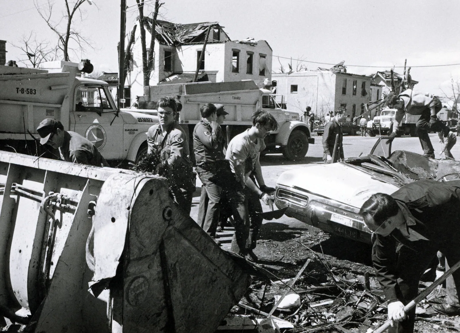
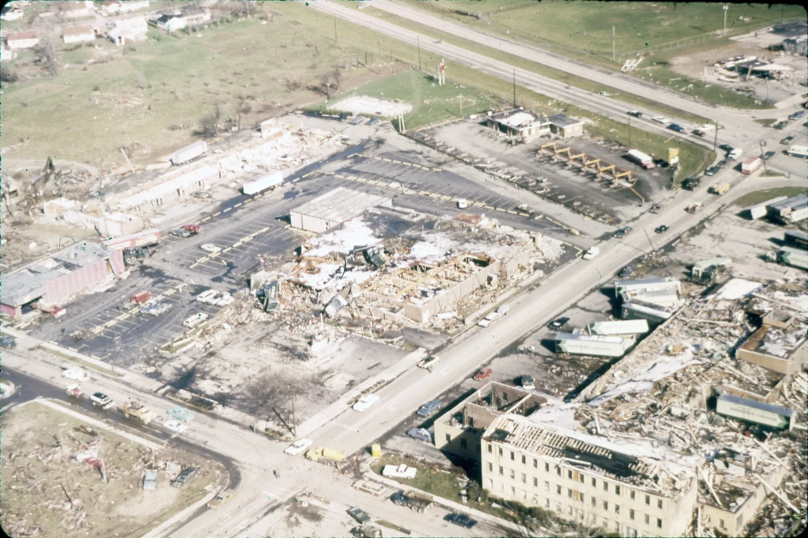
The Xenia Daily Gazette's staff won the 1975 Pulitzer Prize for local spot news reporting.[20][29] The town rebuilt: about 1,400 buildings, half the city, had been damaged or destroyed, and by one count 85 percent of its 3,357 homes were damaged and 1,237 condemned.[22][24] Simon Kenton Elementary, one of the most severely damaged new institutional buildings in the country, was levelled by the Corps of Engineers and rebuilt with 90 percent less glass and no load-bearing walls.[14]
The outbreak changed the warning system more than any single storm before it. The federal survey's first recommendation was to "expand NOAA Weather Radio as quickly as possible," and Congress appropriated money to extend the network to 70 percent of the population. It also called for emergency power at every radar, a direct consequence of Cincinnati's three dark hours.[4][16] In Ohio, the state's Committee for Severe Weather Awareness dates to 1978, and Xenia installed sirens and marked shelters in every building.[29]
Xenia has been hit twice since: an F2 on April 25, 1989, and an F4 on September 20, 2000 that ran nine miles at 65 mph through "some of the same areas that were hit in 1974," killed one person and injured about a hundred. Only one of the five sirens sounded; the others had lost power.[24][28]
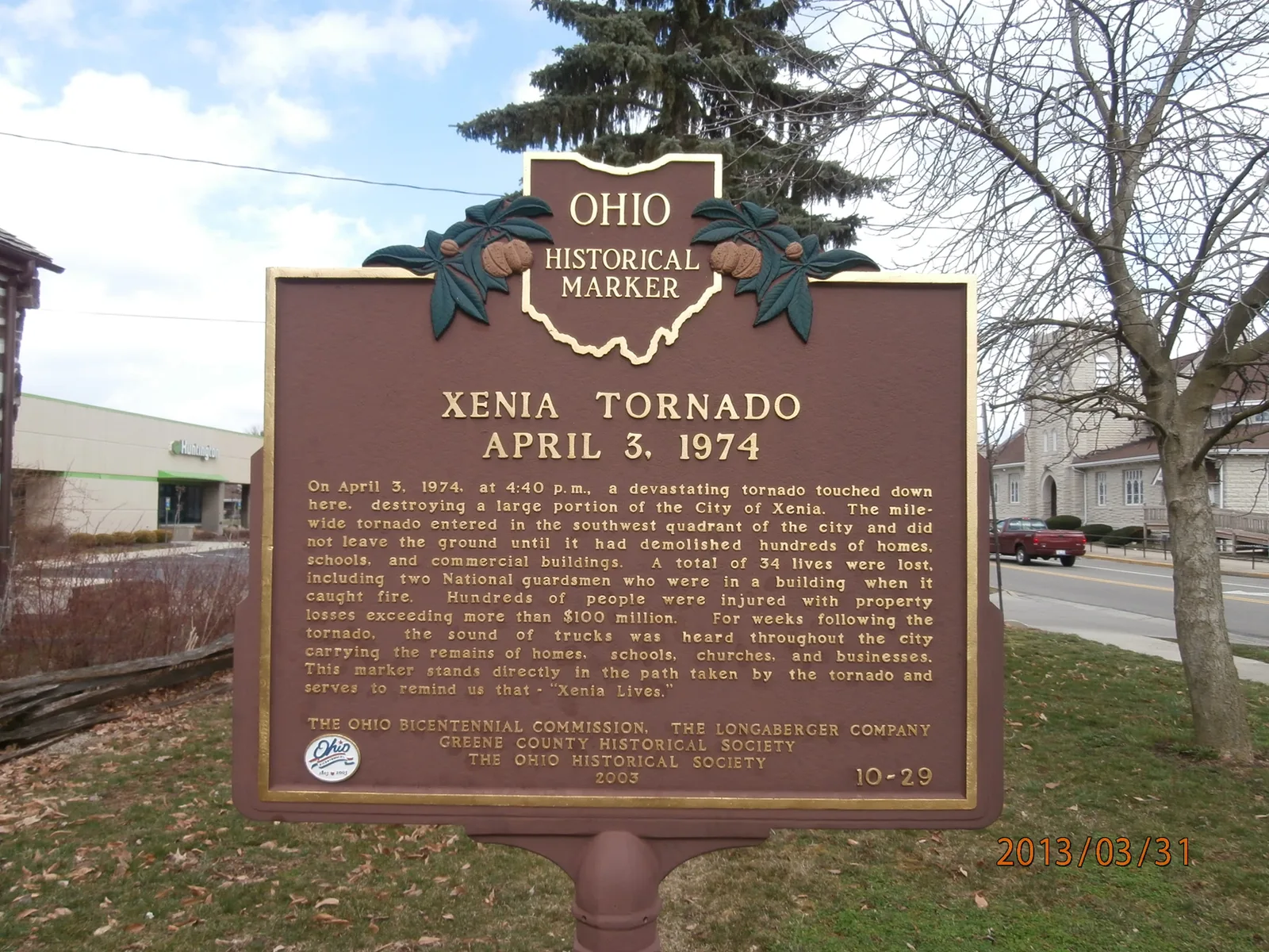
On April 3, 2024, fifty years on, a wreath was laid at the memorial at 4:40 pm. Greene County gathered video oral histories into a community archive under the phrase on the marker, "Xenia Lives."[23] "If I were doing a Mount Rushmore for tornadoes," an NWS meteorologist said that spring, "Xenia's would certainly be on it."[20]
Videos
Related
The 2011 outbreak this one is measured against is on the Hackleburg and Tuscaloosa pages; the Hackleburg tornado crossed Tanner, Alabama, which the 1974 outbreak hit with two F5s in one evening. For a violent tornado that a 1990 radar also could not warn for, see Plainfield. The earliest tornado this site can replay is Bridge Creek-Moore, 1999.
All tornado profiles · Search the radar archive by date and time
Sources
Times are EDT; Ohio was on year-round daylight time in 1974. Where Fujita's papers and the federal survey use Central time, the conversion is noted. Statistics in the vitals table follow NWS Wilmington, with the NCEI and survey figures noted where they differ.
- NWS Wilmington, The Super Outbreak of April 3-4, 1974.
- NWS Wilmington, Super Outbreak track map and Xenia path description.
- NWS Wilmington, Radar and observations of April 3, 1974.
- U.S. Department of Commerce, NOAA, Natural Disaster Survey Report 74-1: The Widespread Tornado Outbreak of April 3-4, 1974, December 1974 (PDF).
- NOAA, Preliminary Report: The Widespread Tornado Outbreak of April 3-4, 1974, April 29, 1974 (PDF).
- Weather Service Office Cincinnati, Radar and action summary, April 3-4, 1974, dated April 9, 1974 (PDF).
- NCEI Storm Events Database, 1974 bulk details file, events 10086976 (Greene County) and 10086978 (Clark County), from ncei.noaa.gov/pub/data/swdi/stormevents/csvfiles/.
- T. T. Fujita, Jumbo Tornado Outbreak of 3 April 1974, Weatherwise 27(3), June 1974; SMRP Research Paper 120 (PDF).
- T. T. Fujita, New Evidence from April 3-4, 1974 Tornadoes, Ninth Conference on Severe Local Storms, October 1975; SMRP Research Paper 127, Texas Tech University Southwest Collection (PDF).
- T. T. Fujita, Proposed Characterization of Tornadoes and Hurricanes by Area and Intensity, SMRP Research Paper 91, 1971 (PDF).
- T. T. Fujita, Graphic Examples of Tornadoes, Bulletin of the American Meteorological Society 57(4), 1976; and Photogrammetric Analyses of Tornadoes, in Proceedings of the Symposium on Tornadoes, Texas Tech University, June 1976.
- S. F. Corfidi, S. J. Weiss, J. S. Kain, S. J. Corfidi, R. M. Rabin and J. J. Levit, Revisiting the 3–4 April 1974 Super Outbreak of Tornadoes, Weather and Forecasting 25(2), 2010.
- E. M. Agee, C. Church, C. Morris and J. Snow, Some Synoptic Aspects and Dynamic Features of Vortices Associated with the Tornado Outbreak of 3 April 1974, Monthly Weather Review 103(4), 1975.
- National Research Council, Committee on Natural Disasters, Engineering Aspects of the Tornadoes of April 3-4, 1974, National Academy of Sciences, 1975 (PDF); and K. C. Mehta, Windspeed Estimates: Engineering Analyses, in Proceedings of the Symposium on Tornadoes, Texas Tech University, 1976.
- R. T. Arnold and H. E. Bass, Determination of Tornado Wind Speeds from Tornadic Sounds, NUREG/CR-1816, U.S. Nuclear Regulatory Commission, February 1981 (PDF).
- T. A. Coleman, K. R. Knupp, J. Spann, J. B. Elliott and B. E. Peters, The History (and Future) of Tornado Warning Dissemination in the United States, Bulletin of the American Meteorological Society 92(5), 2011.
- R. C. Whiton, P. L. Smith, S. G. Bigler, K. E. Wilk and A. C. Harbuck, History of Operational Use of Weather Radar by U.S. Weather Services. Part I: The Pre-NEXRAD Era, Weather and Forecasting 13(2), 1998.
- NEXRAD Radar Operations Center, NEXRAD program history (PDF).
- WHIO, Xenia Tornado: 50 Years Later, 'As soon as you heard Gil Whitney;' lives were saved that day, April 3, 2024, and the station's companion pieces on Governor DeWine and on Bobby Graham.
- D. Vonada, Xenia lives, Ohio Cooperative Living, April 1, 2024.
- K. Mobley, Central State University's tower: hope in the rubble of the 1974 tornado, Ideastream / WYSO, April 4, 2024.
- J. Kiesewetter, Xenia rebuilt from tornado 50 years ago, WVXU, April 2, 2024.
- Greene County, Ohio, Xenia Lives: Remembering the 1974 Xenia Tornado.
- S. Halasz, Xenia tornado: 49 years later, Xenia Gazette, April 5, 2023.
- R. Nixon, Remarks During an Inspection Tour of Tornado Damage in Ohio, April 9, 1974, The American Presidency Project.
- R. Nixon, Remarks on Signing the Disaster Relief Act of 1974, May 22, 1974, The American Presidency Project.
- Wright State University Libraries, Xenia Tornado of 1974, January 29, 2025.
- NWS Wilmington, The September 20, 2000 Xenia tornado; and NCEI Storm Events, event 5175230.
- Wikipedia, 1974 Xenia tornado and 2000 Xenia tornado, consulted September 2026, used as finding aids.
No radar imagery from 1974 appears on this page because none in a replayable form exists. Where sources disagree on a figure, the difference is noted in the text. Corrections: contact@weatherovertime.com.