The Tuscaloosa-Birmingham tornado of April 27, 2011
EF4 Greene, Tuscaloosa and Jefferson counties, Alabama · surveyed by NWS Birmingham
It was on the ground for an hour and a half and eighty miles, crossed two cities, and was broadcast live the whole way. It is probably the most-watched tornado in history, and it happened on a day when 199 others touched down across fourteen states and 316 people died. The warnings that afternoon worked: the mean lead time across the outbreak was 22 minutes and every fatality was inside a watch and preceded by a warning. That is the part worth sitting with.
- Rating
- EF4 190 mph estimated
- Deaths
- 64–66 sources differ
- Injuries
- 1,500
- Path length
- 80.68 mi
- Max width
- 2,600 yd 1.5 mi, at I-65
- On the ground
- 91 min 4:43–6:14 pm CDT
- Forward speed
- ~55 mph
- Damage
- $2.4B 2011 USD
- The outbreak
- 199 tornadoes that day
- Radar
- KBMX no dual-pol yet
The day
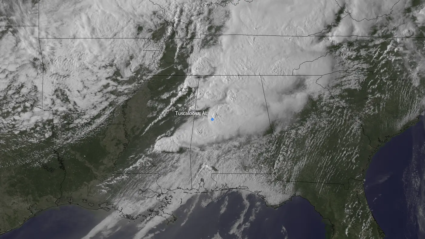
The Storm Prediction Center began flagging April 27 five days out. By the 1300 UTC outlook on the morning itself it carried a High risk and the words "dangerous tornado outbreak is expected." The 1630 UTC update went further: "major tornado outbreak expected," with a 45 percent hatched tornado probability, a number the service assessment singles out as "particularly noteworthy."[3][4] Sixteen tornado watches were issued across the day, four of them carrying particularly dangerous situation wording. Alabama's afternoon watch, number 235, went out at 1:45 pm and described a "classic tornado outbreak situation."[5]
By the end of it, 199 tornadoes had touched down in fourteen states and 316 people were dead, 234 of them in Alabama. Within the six forecast offices the service assessment examined there were 122 confirmed tornadoes, 31 rated EF3 or stronger, eleven EF4s and four EF5s, and the average EF4 or EF5 path was 66 miles long.[2]
This matters for reading everything below. NWS Birmingham surveyed 29 tornadoes in central Alabama alone that day, including the Hackleburg EF5 that killed more people than this one. Figures for the outbreak and figures for this tornado are routinely mixed up, and the outbreak's are four to five times larger.
Ninety-one minutes
The tornado touched down at 4:43 pm in rural northern Greene County and tracked northeast at around 55 miles an hour, which is fast enough that the entire eighty-mile path took an hour and a half. It reached its greatest width, 2,600 yards, crossing Interstate 65.[1]
In Tuscaloosa it went through Cedar Crest, where cinder-block homes were levelled and at least three people died; Alberta City, where the elementary school was nearly destroyed and the shopping centre completely so; and Holt, where the survey found a home on its foundation "swept clean." Beyond the city it hit Concord, Pleasant Grove where the survey recorded EF4 damage with slabs wiped clean, McDonald Chapel and Smithfield Estates, before lifting at 6:14 pm about two miles north of Tarrant.[1]
The county's own emergency operations centre was destroyed. The Curry Facility, a 300,000 square foot reinforced-steel building housing Tuscaloosa County Emergency Management, took a direct hit and lost most of its equipment and vehicles. The city's incident command centre was separately out of action, under renovation, so staff had been watching the weather from an upstairs conference room on a small television.[6]
The radar record
KBMX carried reflectivity and velocity only. In April 2011 the dual-polarisation upgrade had not reached Birmingham, so the correlation coefficient that would show the debris was not available to the forecasters working this tornado. The service assessment's radar discussion contains no mention of dual-polarisation at all; the debris signature it does describe is the reflectivity "debris ball" at the tip of the hook.[2]
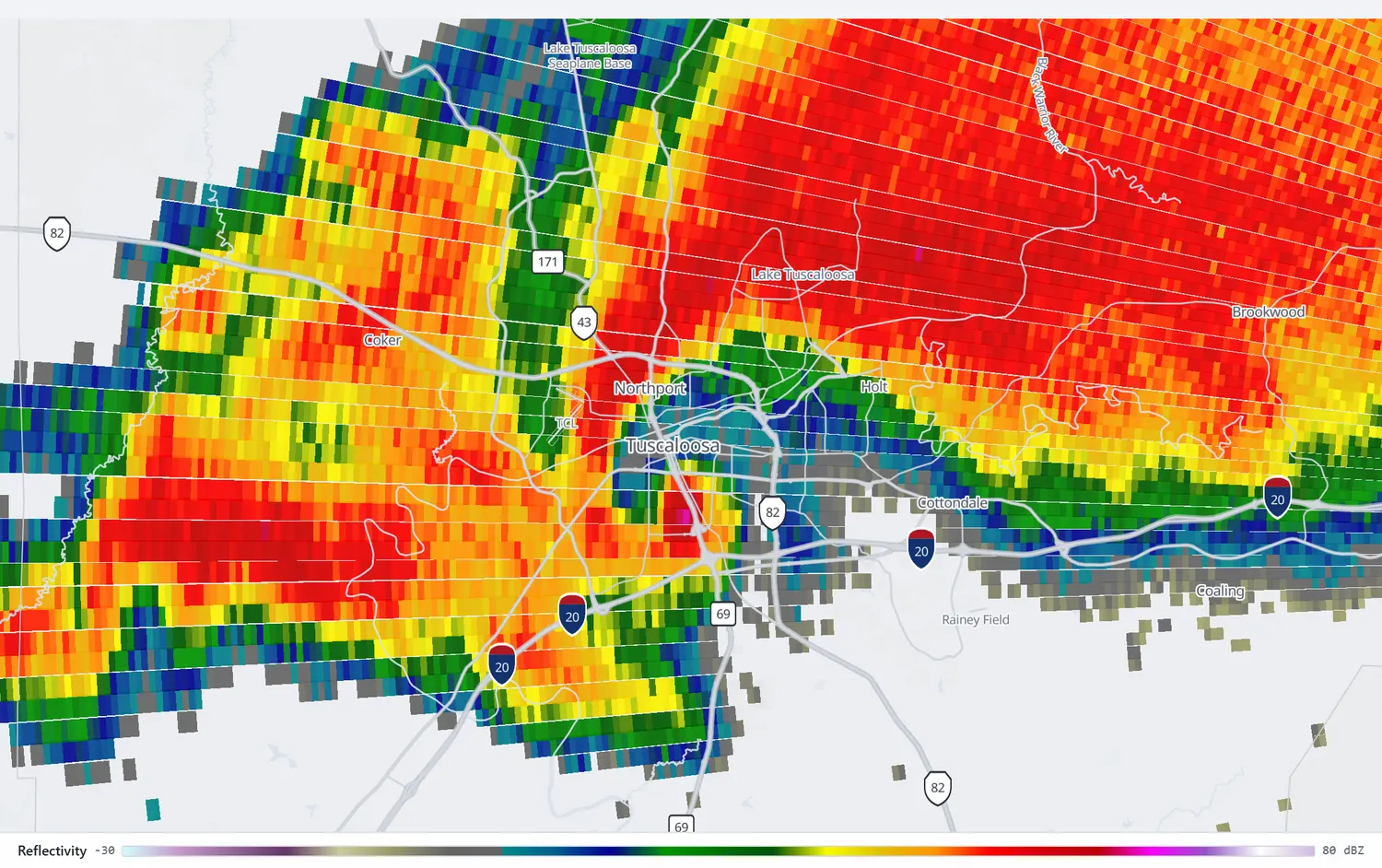
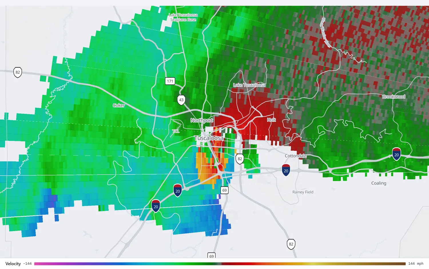
Follow the whole eighty miles on KBMX, from Greene County through Tuscaloosa to the northern edge of Birmingham.
Open in the archive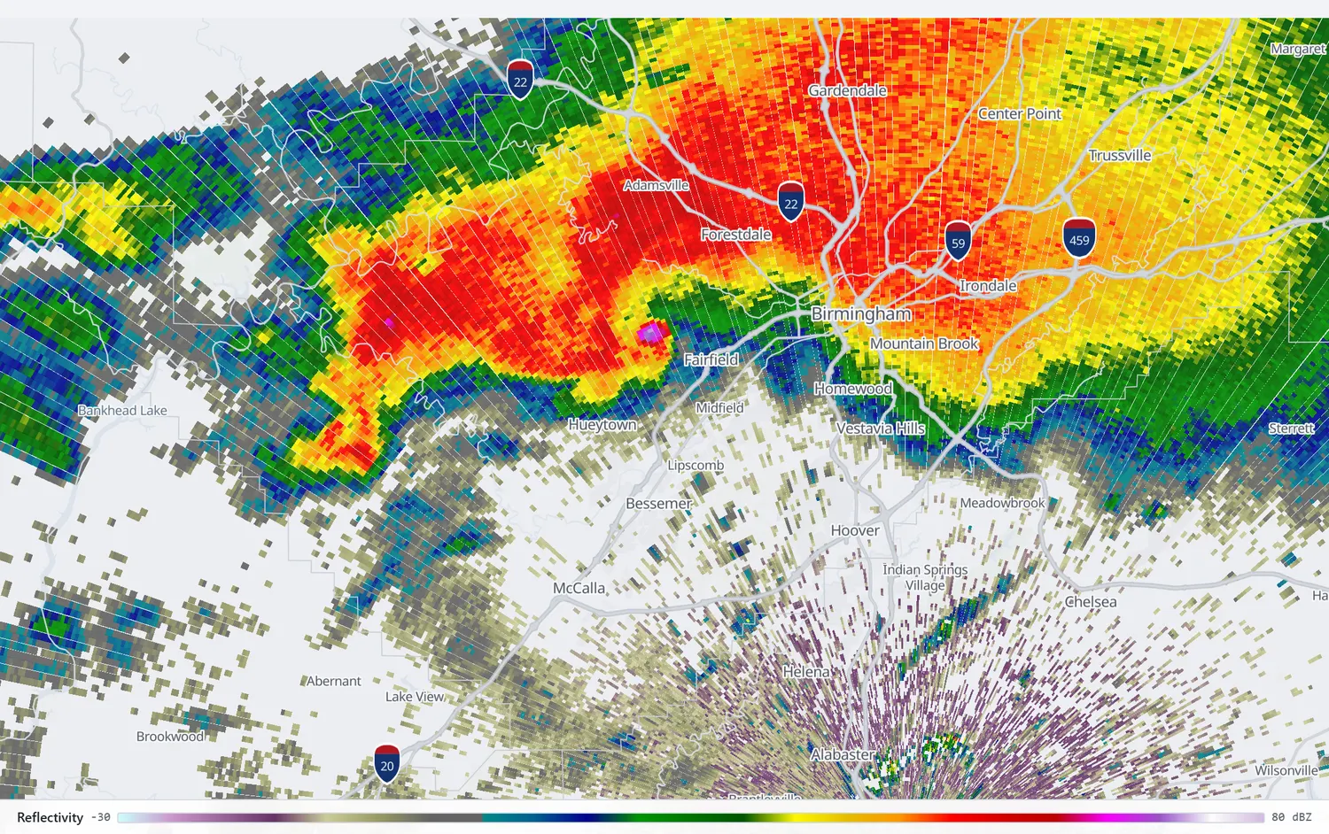
Live on television
James Spann, chief meteorologist at ABC 33/40, was on air continuously for close to nine hours. A camera on top of a building captured the tornado crossing Tuscaloosa at about 5:21 pm and held it for nearly the whole passage before the wind disabled the camera, while Spann narrated, naming streets and landmarks as the debris cloud crossed them.[7] It is, by some distance, the most-seen footage of a violent tornado ever recorded.
The Weather Service's own assessment singles out the warning that preceded it as a best practice: in the last warning before the tornado reached the city, the Birmingham office added the McFarland Mall, Bryant-Denny Stadium and Deerlick Creek Campgrounds to the list of places about to be hit.[2] A tornado emergency naming Tuscaloosa went out at 4:58 pm, about seven minutes before the centre reached McFarland Boulevard.
"You've got 300,000 to 400,000 people watching you, and what you say and your body language can determine if somebody makes a decision that results in them living or dying."
James Spann, ABC 33/40[8]
What Spann has written since is more interesting than the footage. His conclusion from the day is that broadcasting is not enough on its own: "I think the one thing we learned that day is, what I do is not enough. I'm just part of the process in the weather warning process."[8] He has also become one of the loudest voices against over-warning, arguing in 2022 that "warning after warning after warning with no verification is simply crying wolf, and it has to stop," that the public is being desensitised, and that "humility is missing in our science."[9]
The service assessment found the same problem from the other end. Its historical table shows the Birmingham office's tornado warning false alarm ratio running above 0.75 every year from 2006 and reaching 0.859 in 2010. Its sixteenth finding is that people needed visual confirmation before acting and most did not know what a large tornado looks like: "People reported that they spent several minutes looking directly at the tornado before they realized what it was."[2]
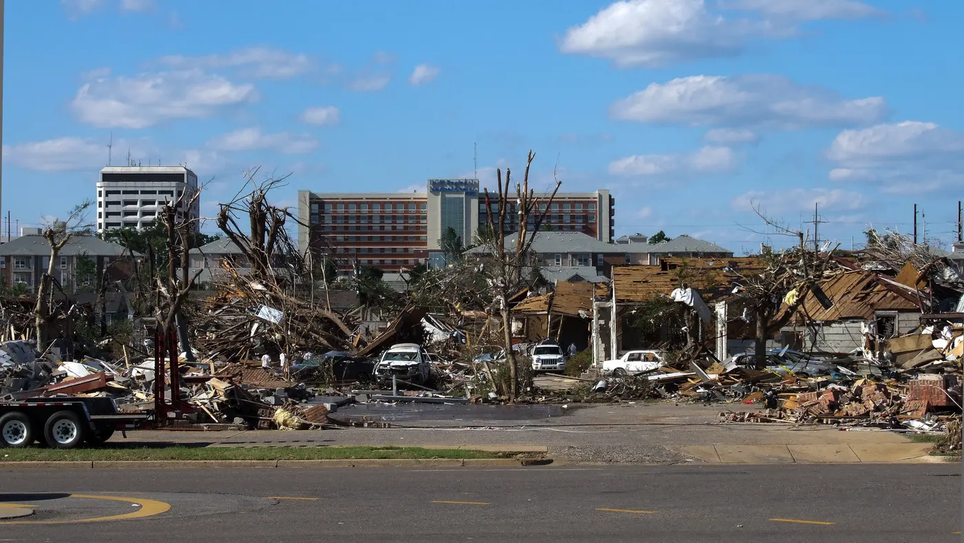
What Tuscaloosa lost
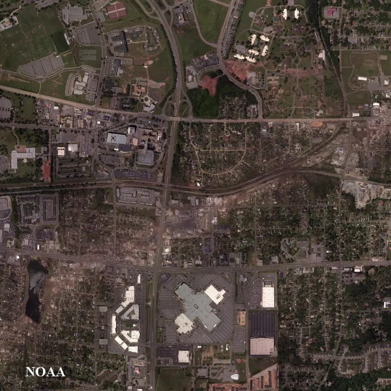
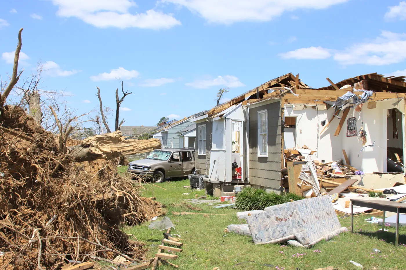
Between twelve and thirteen percent of the city was destroyed, with 5,435 homes and businesses directly affected and four schools lost. Morning storms had already forced the schools to close, which is why they were empty.[10] Rosedale Court, a public housing complex, took a direct hit: nine people died, and of its 188 units a hundred were destroyed, leaving 96 families homeless. The complex was later razed.[11]
Six University of Alabama students were killed. All six received posthumous degrees, and on anniversaries Denny Chimes rings once for each person Tuscaloosa County lost.[12]
"April 27th, 2011, is a B.C./A.D. moment for us."
Walt Maddox, Mayor of Tuscaloosa[10]
The rating
NWS Birmingham rated it EF4 with estimated peak winds of 190 mph, and the rating was disputed at the time. Some survey teams concluded they had found EF5 damage. The structures that had been swept away were found to be improperly anchored, or to lack interior walls, or to sit within surrounding damage inconsistent with winds above 200 mph, and on that basis an EF5 rating could not be applied.[13] It is the same argument, from the same year, that the Joplin and Moore surveys had with themselves: the scale measures buildings, and buildings vary.
The death toll is genuinely unsettled, and the differences are not rounding. NWS Birmingham's survey page says 65. The service assessment's own table says 66. The current NCEI record says 64 direct and 8 indirect, splitting them 44 in Tuscaloosa County and 20 in Jefferson. Tuscaloosa County commemorates 53.[1][2][14] The path length differs too: 80.68 miles on the survey against 74.32 summed from the NCEI county segments, which carry no Greene County entry for this tornado.
After
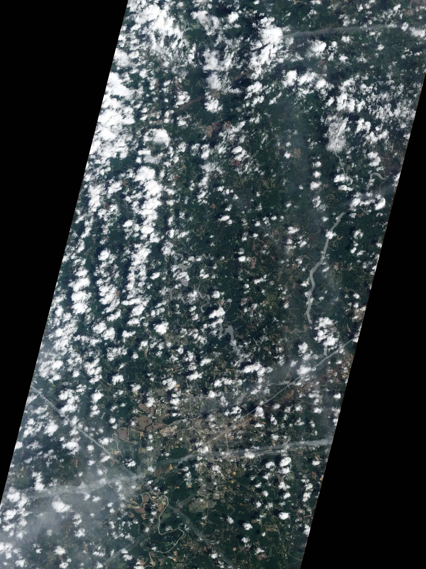
A federal disaster declaration came the next day, April 28, covering Tuscaloosa and Jefferson among eight counties for individual assistance and all 67 Alabama counties for debris removal.[16] Fifteen years on, Maddox put the city's spending at $130 million, of which $99 million went into infrastructure on the reasoning that it was the fastest way to bring businesses back, and said FEMA had estimated a fifteen-year recovery.[10]
Whether anything changed in how people are warned is harder to answer. Spann's own verdict on the day is unsparing: "The death toll in my state that day was 252, and that's absolutely inexcusable."[7] The service assessment's recommendations were mostly about wording and about shelter guidance, including a finding that generic call-to-action text was inadequate because an interior room is often not enough in an EF4 or EF5.[2] That is the same conclusion NIST reached from Joplin a month later, and the same one the Moore schools demonstrated two years after that.
Videos
Related
Joplin, less than a month later and the deadliest US tornado since 1947 · Moore, 2013 · All tornado profiles · Search the radar archive by date and time
Sources
Times are CDT (UTC−5). Three official sources give three different death tolls for this tornado; all are listed above rather than reconciled. Figures for the April 27 outbreak as a whole are much larger and are labelled as such throughout.
- NWS Birmingham, Tuscaloosa-Birmingham EF-4 Tornado, April 27, 2011, and the office's outbreak summary for central Alabama.
- NOAA/National Weather Service, Service Assessment: The Historic Tornadoes of April 2011, December 2011.
- Storm Prediction Center, Day 1 Convective Outlook, 1300 UTC April 27, 2011.
- Storm Prediction Center, Day 1 Convective Outlook, 1630 UTC April 27, 2011, the "major tornado outbreak expected" update carrying the 45 percent hatched tornado area.
- Storm Prediction Center, PDS Tornado Watch 235, April 27, 2011.
- Tuscaloosa Thread, Mayor Maddox recalls leading the city on April 27.
- weather.com, James Spann's marathon broadcast.
- The Alabama Baptist, Meteorologist James Spann recalls the heavy responsibility of a destructive day.
- J. Spann, Too Many Warnings, Too Much Hype, April 17, 2022.
- Tuscaloosa Thread, Tuscaloosa tornado recovery, fifteen years on, and ABC 33/40, Tuscaloosa marks 15 years.
- Tuscaloosa African American Heritage collection, Rosedale Court.
- University of Alabama, UA remembers the April 27, 2011 tornado.
- Wikipedia, 2011 Tuscaloosa–Birmingham tornado, on the contested rating, consulted August 2026. See also LaDue, Marshall and Scharfenberg, "Discriminating EF4 and EF5 Tornado Damage" (2012).
- NCEI Storm Events Database, Tuscaloosa and Jefferson county segments for April 27, 2011, via the bulk detail files, and WBRC, Tuscaloosa marks 15 years, for the county commemoration figure.
- NASA Earth Observatory, Tornado Track in Tuscaloosa, Alabama.
- Federal Register, Alabama major disaster declaration FEMA-1971-DR, declared April 28, 2011.
- Knupp, K. R., and others, 2014: Meteorological Overview of the Devastating 27 April 2011 Tornado Outbreak. Bulletin of the American Meteorological Society, 95(7), 1041–1062. doi:10.1175/BAMS-D-11-00229.1
Radar imagery on this page was rendered by WeatherOverTime from NOAA Level II data recorded by KBMX. Corrections: contact@weatherovertime.com.