The Hackleburg-Phil Campbell tornado of April 27, 2011
EF5 Marion, Franklin, Lawrence, Morgan, Limestone and Madison counties, Alabama · surveyed by NWS Birmingham and NWS Huntsville
On the worst tornado day in the United States since 1974, a supercell that had existed for less than an hour put a tornado on the ground in the hills of Marion County, Alabama. It reached EF5 intensity by the time it crossed Hackleburg, held it through Phil Campbell and Oak Grove, and was still violent an hour later at Tanner, near the Tennessee River. Seventy-two people died, more than in any other tornado of the outbreak and more than in any Alabama tornado on record. It also left a question the science has since answered differently from the survey: how long the tornado actually was.
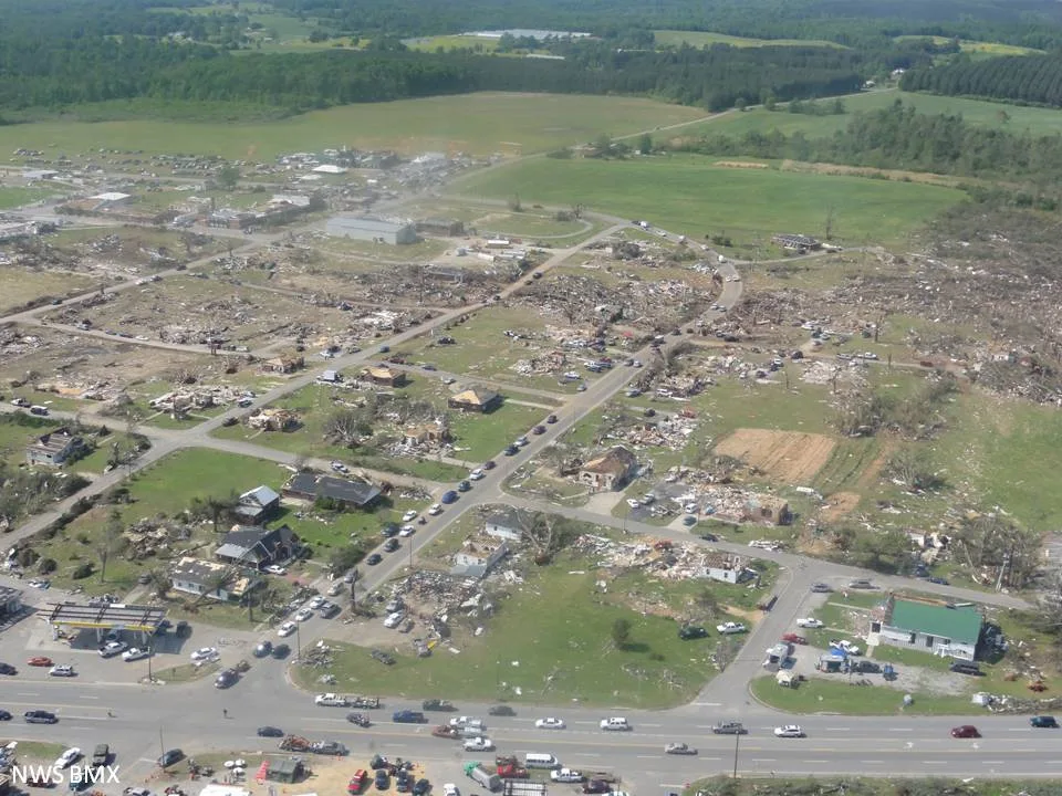
- Rating
- EF5 210 mph estimated
- Path length
- 132 mi NWS; 102 mi in the 2022 reanalysis
- Max width
- 2,200 yd 1.25 mi, Lawrence County
- Touchdown
- 3:05 pm CDT SW of Hamilton
- Forward speed
- ~58 mph
- Deaths
- 72 71 in the reanalysis
- Injuries
- 145+ an undercount, see text
- Damage
- >$1B 2011 USD
- Radar
- KGWX, KHTX no dual-pol yet
- Warning lead
- 6 min warned 2:59 pm, ~20 min for Hackleburg
- Watch
- PDS 235 issued 1:45 pm CDT
- Outbreak
- 199 tornadoes 316 deaths, April 27
The setup
April 27, 2011 was forecast days out. On the morning of April 25 the Storm Prediction Center drew a Moderate risk for two days ahead and wrote of a "concentrated significant threat for potentially strong tornadoes and widespread wind damage centered over the mid South/TN Valley region," language it called "indicative of outbreak potential."[7] By the 1300 UTC outlook on the day itself the risk was High and the wording was plain: "a dangerous tornado outbreak is expected from late morning into late evening." The 1630 UTC update placed a 45 percent hatched tornado probability over the region and stated that a "major tornado outbreak" was expected, with the greatest threat "from Columbus MS eastward to Birmingham and Huntsville AL." The Hackleburg tornado would form almost exactly on that line.[6]
The day came in three parts. A line of storms crossed Alabama before dawn and produced 76 tornadoes across the region, five of them EF3. A second, weaker line followed around midday. Both mattered for what came after: they knocked out power across central and northern Alabama, disabled sirens, and took NOAA Weather Radio transmitters off the air, in some places for the rest of the day.[10][11] The midday line also left behind a thermal boundary across north Alabama that the afternoon storms would interact with.
By late afternoon the environment was about as favourable for violent tornadoes as the region produces. Kevin Knupp of the University of Alabama in Huntsville and his co-authors documented a 995 hPa surface low over western Kentucky, a 30 m/s low-level jet over Alabama, surface-based CAPE of 2,500 to 3,000 J/kg over central Alabama, 0–1 km storm-relative helicity of 600 to 900 m²/s², and a significant tornado parameter above 10 in eastern Mississippi and western Alabama at 2200 UTC. Roughly 90 percent of the supercells that formed in the outbreak region that afternoon produced at least one tornado.[11]
The Hackleburg storm was not a long-lived monster before it produced its tornado. The 2022 reanalysis by Anthony Lyza and colleagues at NOAA's National Severe Storms Laboratory traced its first continuous 40 dBZ echo to 1917 UTC in northeastern Mississippi. Its first tornado was on the ground 48 minutes later. The median interval for the 29 tornadic supercells of that day was two and a half hours. A neighbouring storm that formed 44 km away and seven minutes apart from it took nearly that long to produce a tornado and never exceeded EF1.[12]
The forecast and the warning
At 1:45 pm CDT the Storm Prediction Center issued Tornado Watch 235 for most of Alabama and southern Tennessee and marked it a Particularly Dangerous Situation. It gave a greater than 95 percent probability of two or more tornadoes and of at least one strong tornado, and its discussion said "a classic tornado outbreak situation is developing across much of AL," posing "a dangerous risk of strong/violent and potentially long-track tornadoes."[8]
The warning for Hackleburg came at 2:59 pm from NWS Birmingham, a tornado warning for northern Marion County that named the town, six minutes before the tornado touched down and about twenty before it arrived.[1][9] NWS Huntsville, whose area begins at the Franklin County line, warned Franklin County at 3:17 pm. Its 3:51 pm warning for Lawrence, Limestone and Morgan counties described "a large and extremely dangerous tornado near Mt Hope," and its 4:11 pm warning named Tanner, Harvest and Capshaw in the path. At 4:37 pm the office issued a tornado emergency for northern Madison County: "a tornado has been confirmed on the ground" near Harvest.[9]
On paper the warnings were good. Across the six offices assessed after the outbreak, mean tornado warning lead time was 22 minutes and probability of detection 89 percent. What the assessment found was a dissemination problem: "The morning storms caused power outages affecting not only the public, but also several NOAA Weather Radio All Hazards transmitters. In some of these areas, power was not restored by the time the more significant afternoon/evening storms moved through the area." The Cullman transmitter was struck by a tornado at 2:45 pm; the Huntsville transmitter went down at 5:15 pm.[10]
-
PDS Tornado Watch 235 issued, valid to 10:00 pm.[8]
-
NWS Birmingham tornado warning for northern Marion County, naming Hackleburg.[9]
-
Touchdown southwest of Hamilton, Marion County. The tornado reaches EF4 intensity southwest of Hackleburg.[1]
-
NWS Huntsville tornado warning for Franklin County.[9]
-
Hackleburg. The KGWX velocity scan at 3:19 pm places the circulation on the town's southwest edge. EF5 damage across the northwest of town; 18 dead.[1][17]
-
Crosses from Marion into Franklin County, 25 miles from touchdown.[1][5]
-
Phil Campbell. A debris ball appears on KGWX at the tip of the hook as the tornado crosses the town. Twenty-seven die in Franklin County.[2][5]
-
Into Lawrence County. Near Oak Grove the tornado reaches its greatest width, 2,200 yards, and a car is carried more than 640 feet. Fourteen die in the county, five of them at Mount Hope.[5][17][28]
-
"A large and extremely dangerous tornado near Mt Hope."[9]
-
Tanner, Limestone County, at high-end EF4. The tornado destroys WAFF-TV's Doppler radar and takes down the transmission lines feeding Browns Ferry.[11][17]
-
All three Browns Ferry reactors shut down automatically on loss of offsite power.[30]
-
Tornado emergency for northern Madison County; tornado confirmed near Harvest. Anderson Hills subdivision, hit by an F4 in 1995, is hit again.[9][2]
-
Per the 2022 reanalysis, the tornado dissipates near Hazel Green after 102 miles. A new EF3 tornado forms near the state line and runs into Franklin County, Tennessee.[12]
-
End of the track as the NWS surveyed it, south of Huntland, Tennessee, 132 miles from touchdown. NWS Huntsville's web page says 5:20 pm; its poster and the Storm Data record say 5:40.[2][3][5]
The track
The tornado began at 3:05 pm about five miles southwest of Hamilton and moved east-northeast at close to 60 mph. NWS Birmingham's survey found EF4 damage, winds estimated at 170 mph, southwest of Hackleburg, strengthening to EF5 as it entered the town.[1] From there the intensity barely let up for forty miles. NWS Huntsville's survey describes "continuous significant devastation" through Phil Campbell; at Oak Grove in Franklin County the swath reached a mile and a quarter wide; at Mount Hope in Lawrence County it produced high-end EF5 damage; and at Tanner and East Limestone, an hour and 75 miles from touchdown, it was still doing high-end EF4 damage.[2][11][17]
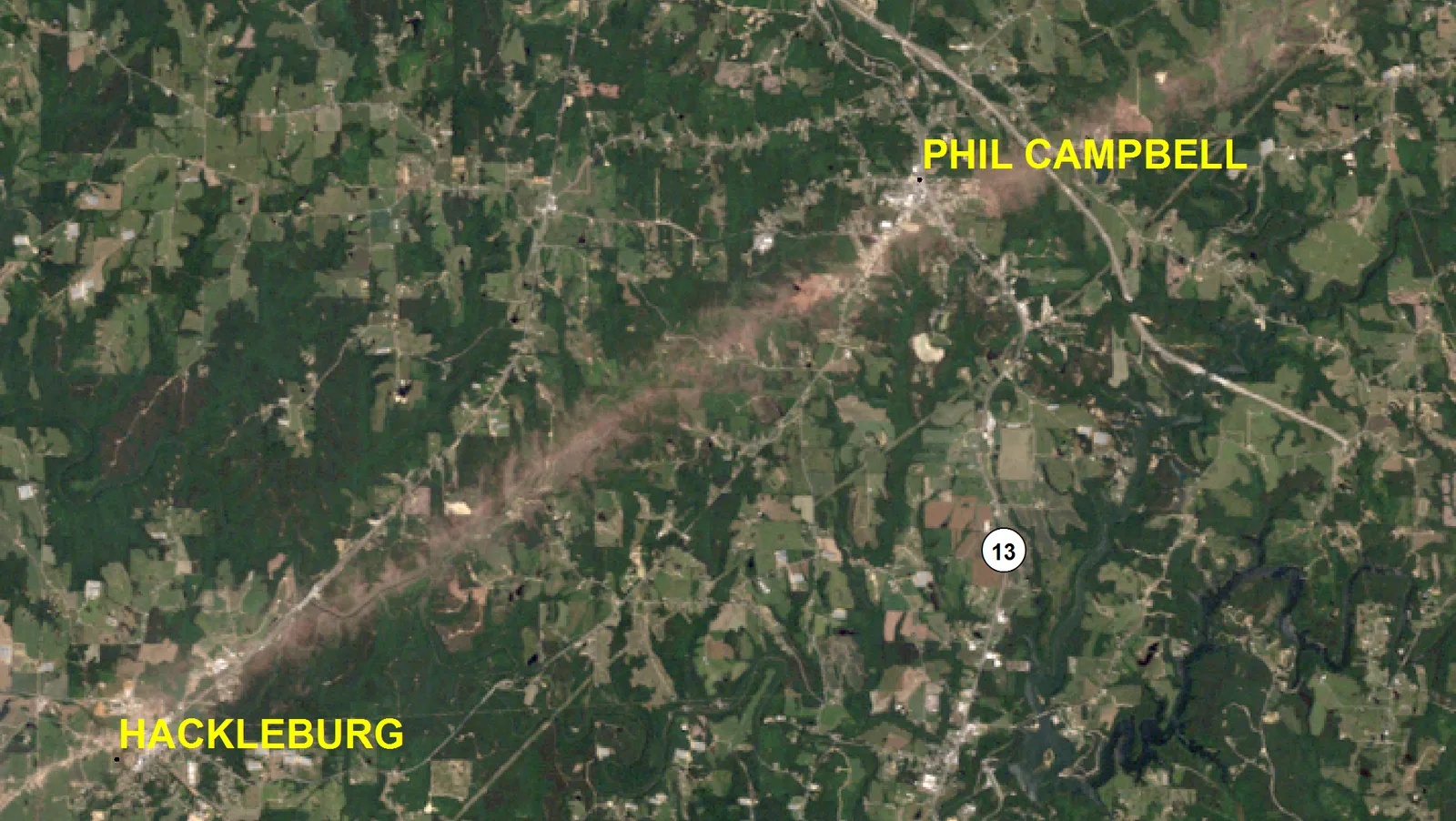
The damage indicators along the way were extreme in the ordinary sense and unusual in the specific. In Phil Campbell, trees were debarked and asphalt was stripped from roads. At Oak Grove a car was lofted and carried more than 640 feet. The tornado narrowly missed the Browns Ferry nuclear plant, but destroyed the trunk transmission lines around it, forcing the plant offline and blacking out Huntsville and northeast Alabama for five days. At Tanner it destroyed the Doppler radar WAFF-TV operated in eastern Limestone County, an event the station broadcast live as the radar's sweep swung wildly and then stopped.[17][35]
Then there is the debris. A team led by John Knox of the University of Georgia used a Facebook page set up to reunite people with belongings the outbreak had scattered, and mapped 934 objects with known takeoff and landing points. Fifty-six percent of them came from this one tornado. A photograph from Phil Campbell was recovered in Lenoir City, Tennessee, 353 km (219 miles) away, the longest documented transport of tornado debris on record. A windbreaker from Hackleburg travelled 107 km (66 miles) to Elkmont. Jeans from the Wrangler plant were found in Courtland, 46 miles up the track.[14][17]
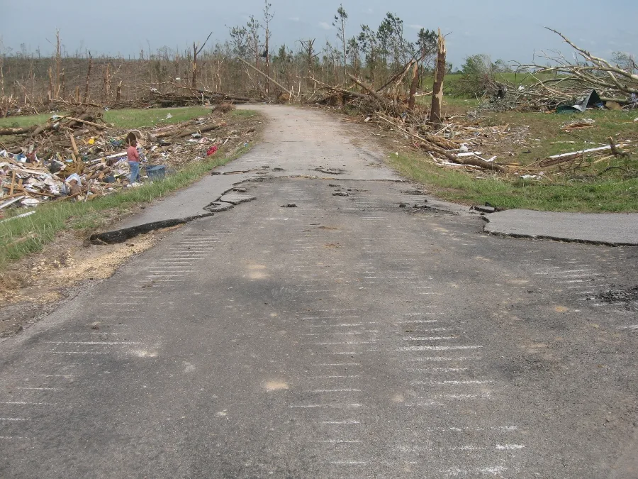
Hackleburg and Phil Campbell
Hackleburg had about 1,500 people. In roughly a minute it lost its police station, its fire station, the roof of its town hall, its only grocery store, its pharmacy, its doctor's office, its elementary school and its high school, and the Wrangler distribution plant that was its largest employer. The Los Angeles Times, reporting from the town three days later, listed the survivals as carefully as the losses: the police officer who took cover in the old jail as his cruiser was crushed, the grocery manager who hid under a produce rack, the 69-year-old mayor who came out of the town hall alive.[21]
"It's like the photos you see of Hiroshima after the atomic bomb. I mean, it wiped out everything."
James Anglin, Hackleburg city councilman, to the Los Angeles Times[21]
The Wrangler plant had operated since 1981, a 369,000 square foot building capable of producing 27 million pairs of jeans a year. Fourteen people were inside on the second shift. Thirteen escaped unhurt; the office manager, Linda Knight, was killed by a falling roof beam after 32 years with the company.[21][24] A county storm shelter built for 18 people held 34 that afternoon, and all 34 survived, an outcome the federal service assessment singled out.[10]
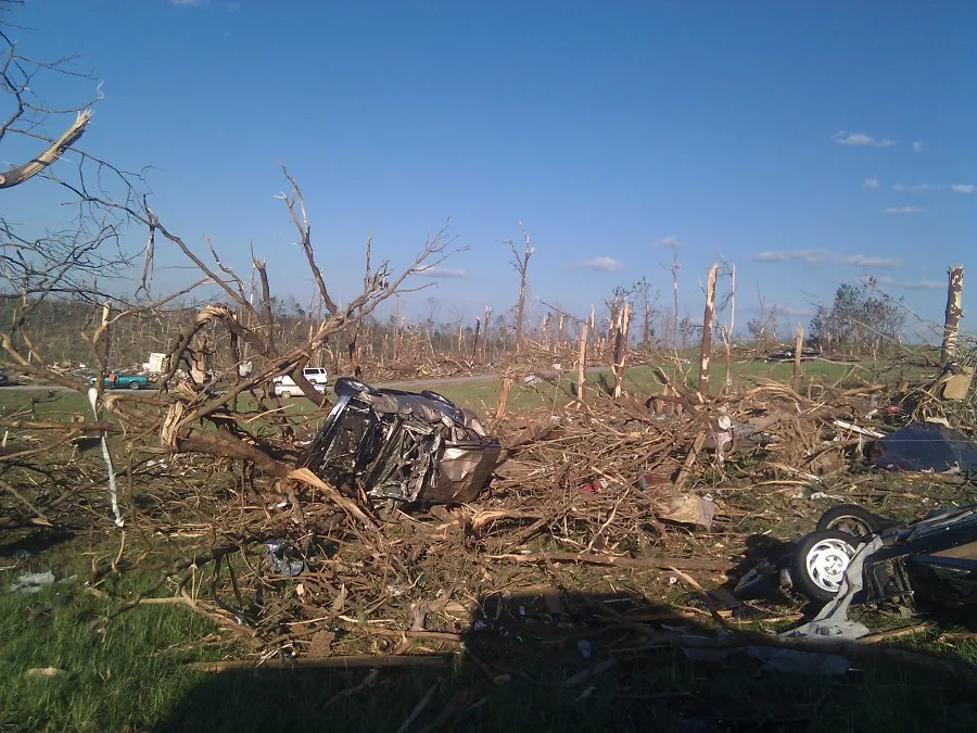
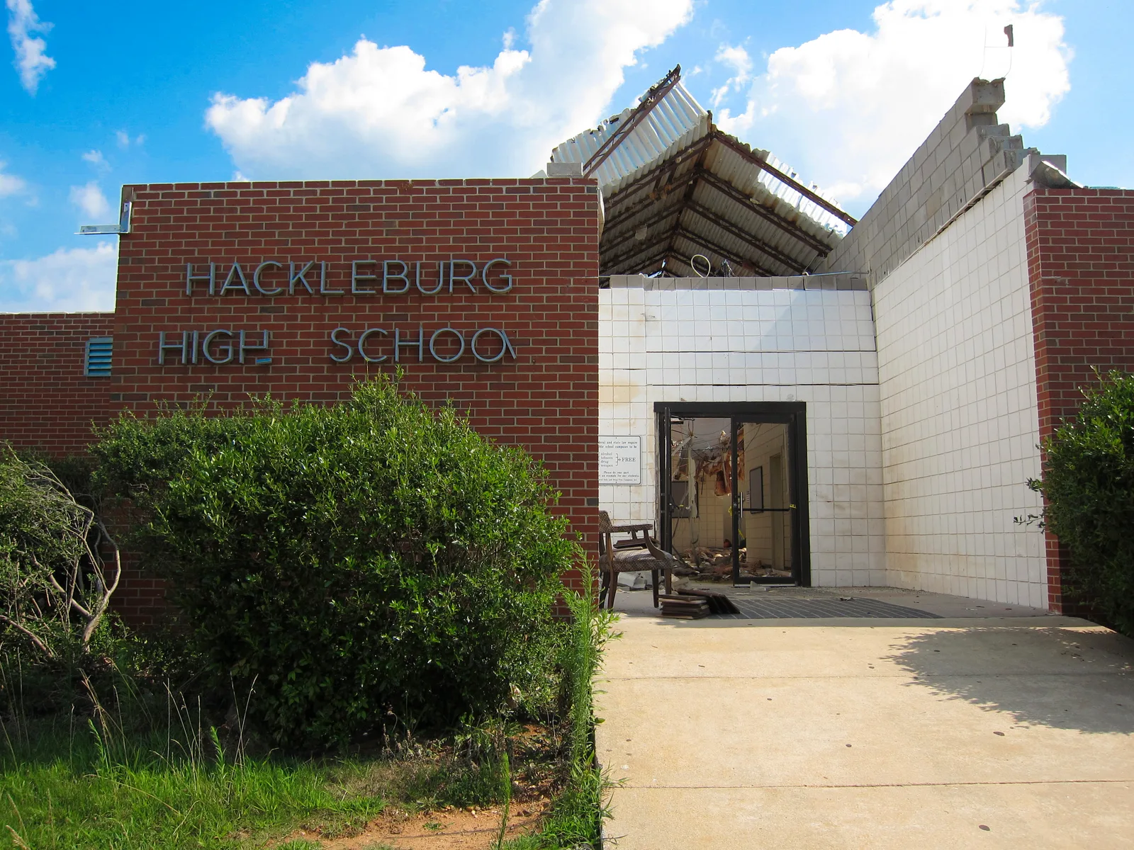
Phil Campbell, twelve miles northeast, is a town of about a thousand people and the only town in Alabama with both a first and last name, after the English railroad crew leader who founded it in the 1880s. Twenty-seven people died in Franklin County, most of them in and around the town.[5][27] Every April 27 since, a bell has tolled 27 times at 3:27 pm.[25] Vicki Galloway lost her mother, her sister and her brother, found together in the wreckage; two strangers retrieved the bodies and carried them to the fire department. "I've never known that you can hurt as bad as that," she told the TimesDaily fifteen years later.[26]
Two months after the tornado the town's centenary celebration went ahead as planned, in a form nobody had planned. A gathering of people named Phil Campbell, an idea a Brooklyn writer of that name had first organised in 1995 after hearing the town mentioned on "Hee Haw," turned into a relief effort, with Phil Campbells arriving from as far as Nottingham, England.[27]
The radar record
Three WSR-88Ds watched this tornado, none of them close and none of them yet dual-polarised. KGWX at Columbus Air Force Base, Mississippi was 39 miles from Hackleburg and 47 from Phil Campbell; KHTX at Hytop in northeast Alabama was 52 miles from Tanner and 38 from Harvest; KBMX at Birmingham was about a hundred miles from all of it. The network's dual-polarisation upgrade began that summer, and KHTX received it in January 2012, so the scans below are reflectivity and velocity only.[16][18] The full Level II record of the day from all three sites is in the archive.
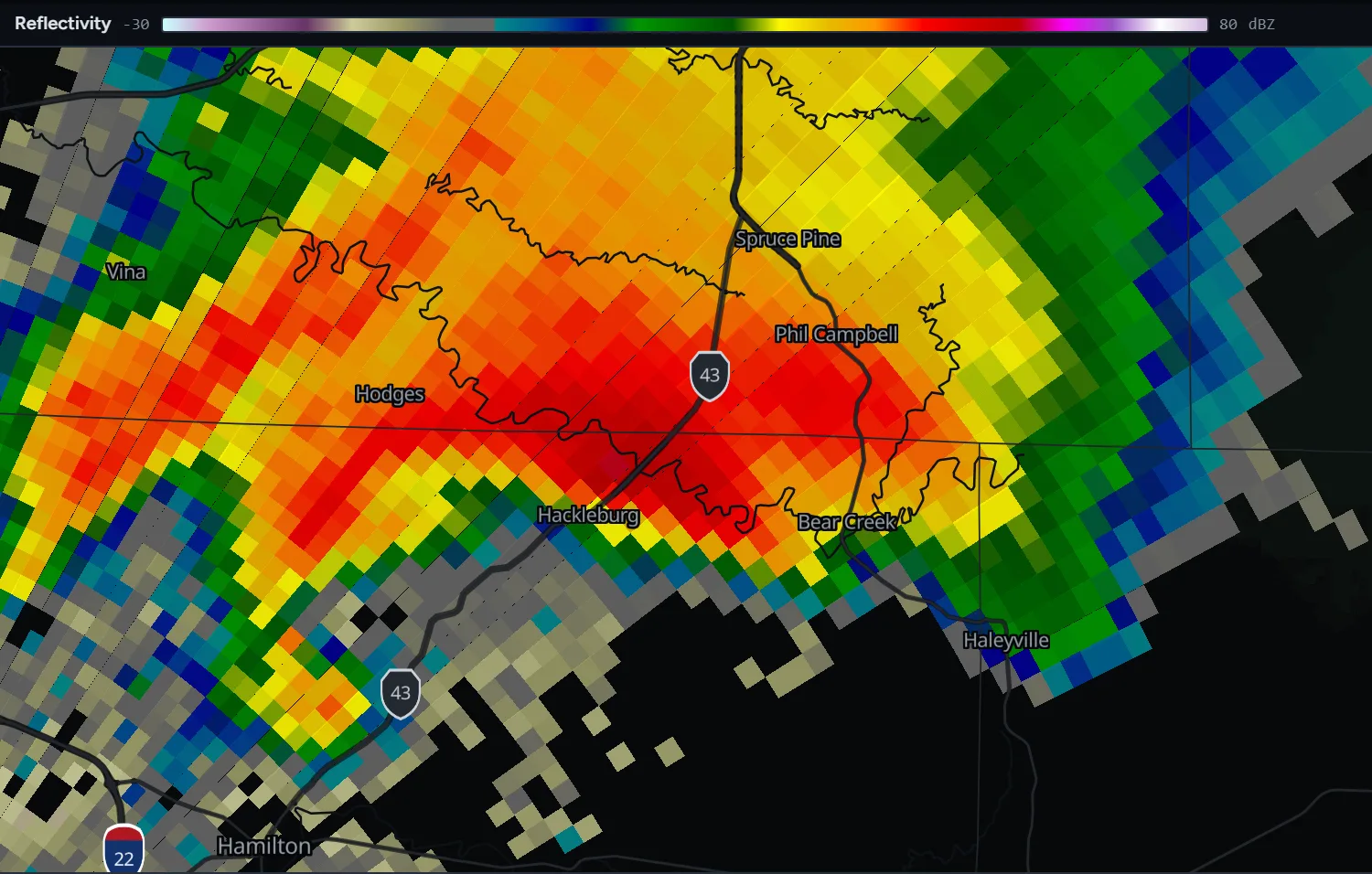
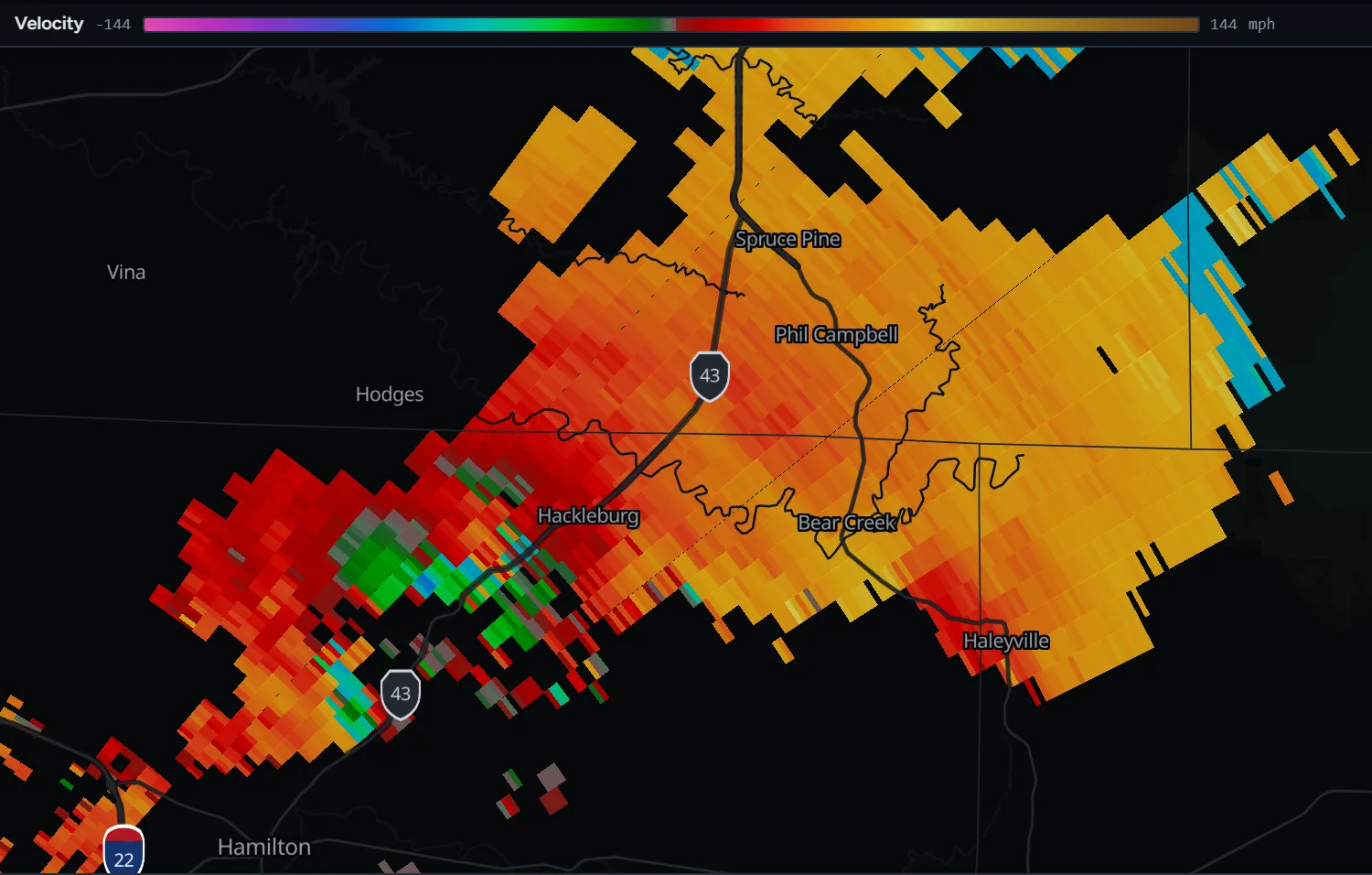
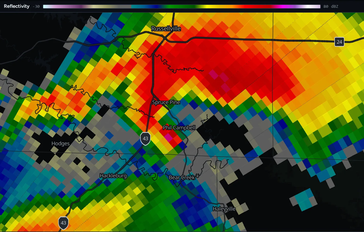
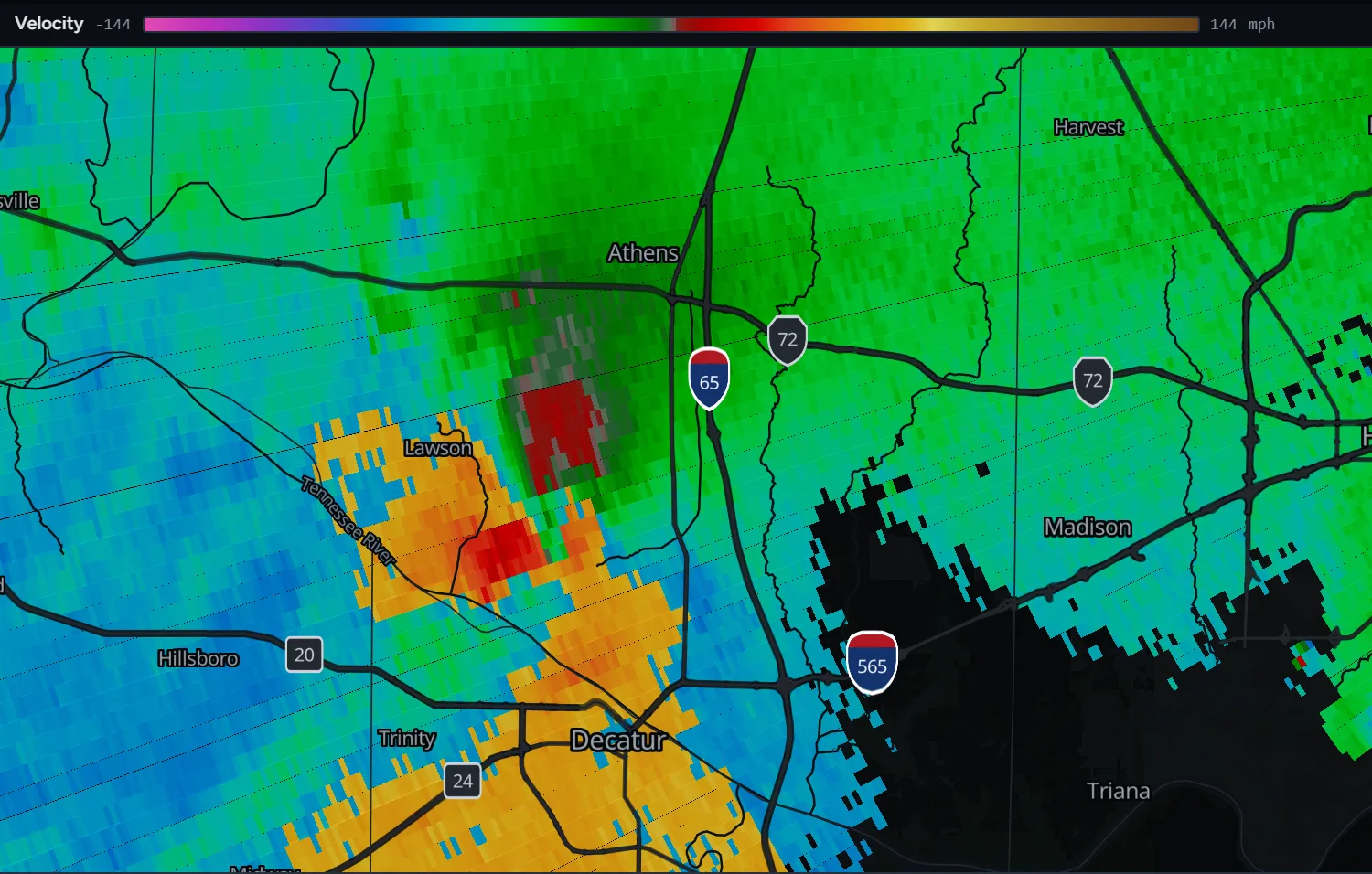
Replay the strike on Hackleburg and Phil Campbell on KGWX, reflectivity and velocity side by side, starting minutes before the tornado reached the town.
Open in the archiveOr pick it up on KHTX as it crosses the Tennessee River toward Tanner, Harvest and the Tennessee line.
Open at the riverOne radar did have dual-polarisation that day: ARMOR, the University of Alabama in Huntsville's C-band research radar at Huntsville airport, operated jointly with WHNT-TV. Elise Schultz and colleagues, who catalogued its observations of the outbreak, wrote that "the most notable debris signature was observed from the Hackleburg-Tanner-Harvest, AL, EF-5 tornado. This DPTDS was seen on radar for over an hour and a half, and was at least 2 km in diameter for much of the tornado's lifetime. The first evidence of this signature was observed at a distance of 106 km as the tornado entered Hackleburg." NWS Huntsville used that debris signature operationally: during an 18-minute stretch in rural Lawrence County when no reports of any kind reached the office, the radars were the only evidence that the tornado was still on the ground.[15]
The KHTX data also holds a small scientific reversal. At 2116 UTC the radar showed two debris signatures in the same storm, one on the tornado and one to its west, where an anticyclonic tornado would sit if there were one. A 2011 paper concluded there was not, and that debris from the main tornado had merely wrapped into a weak circulation. The 2022 reanalysis, with ARMOR's polarimetric data in hand, catalogued it as a real anticyclonic satellite tornado in northeastern Lawrence County, on the ground for five minutes.[12][16]
How long it was
The National Weather Service surveyed a single tornado from Marion County, Alabama to Franklin County, Tennessee: 132 miles, the longest of the outbreak, on the ground for two hours and a quarter. That figure is in the Storm Data record, on both offices' web pages and in the Knupp et al. overview, which puts it at about 212 km.[1][2][5][11]
The 2022 reanalysis of every tornadic supercell of the day terminated the track at 164.15 km (102 miles), at 2150 UTC, in northern Madison County. Its stated reasons: "Radar observations from the Hytop WSR-88D radar (KHTX) indicate a likely dissipation of this tornado in northern Madison County"; an analysis of aerial imagery and ARMOR data had found the track ending there; the NWS Damage Assessment Toolkit's own track ends near Hazel Green; and "the official Storm Data entry for the Madison County, Alabama, segment of this tornado describes a substantial weakness or break in the damage track in northern Madison County." The Tennessee portion became a separate EF3 tornado, 21.5 km long, likely forming very near the state line.[12] Even the NWS narrative describes the tornado "weakening briefly" in Madison County before it "reintensified in Lincoln County, TN."[17]
The same paper corrected two other figures. The death toll became 71, after the authors and NWS Huntsville found that a Phil Campbell resident who died at the Wrangler plant in Hackleburg had been counted in both counties. And the injury count of 145 was set aside as unusable, because Storm Data records 100 injuries in Marion County, 45 in Limestone and Madison, and none at all in Franklin, Lawrence or Madison, counties that between them account for 49 of the deaths.[12]
What the EF5 rests on
The 210 mph in the survey is an estimate from damage, an expected value for the indicators the surveyors matched, and refers by the scale's definition to a three-second gust at ten metres. No instrument measured this tornado's winds, and no radar-derived wind value for it has been published. What the record does contain is the set of contextual evidence the surveyors used. NWS Birmingham's page describes vehicles tossed up to 200 yards, a brick home "completely leveled" with its debris thrown more than 40 yards, and "large amounts of wind rowing, the strewing of building materials in straight lines."[1][11]
A 2025 paper in the Bulletin of the American Meteorological Society, examining why no EF5 was rated in the United States between 2013 and 2025, used Hackleburg as an example of a rating that leans on such evidence: "In the Hackleburg tornado, the lofting of vehicles 150-200 yards and the 'wind rowing' of debris, or collection of debris in long, narrow rows downstream of its source, were used as evidence of EF5 damage in the city of Hackleburg. In fact, while dozens of homes were swept away in total along the 164-km (102 mi) track, only one home was explicitly noted to have actually been anchored to its foundation." The standard EF5 indicator, a well-built home swept clean, assumes the home was anchored; here the rating rests on what the tornado did to cars, roads and the debris itself.[13]
Two cautions on figures that circulate with this tornado. Ground scouring half a metre deep, an earthen storm shelter torn open, an 800-pound safe thrown 600 feet, and a radar couplet of 129 m/s all belong to other tornadoes of the same day: Philadelphia, Mississippi; Rainsville; and Tuscaloosa-Birmingham respectively.[11] And the rating varied along the track, so it needs a place attached: EF5 in Marion, Franklin and Lawrence counties, high-end EF4 at Tanner, EF4 into Madison County.[2][5]
Tanner, again
On the evening of April 3, 1974, during the Super Outbreak this day is most often compared to, an F5 tornado formed near Newburg in Franklin County and ran 85 miles through northern Lawrence County, Tanner, Harvest and Hazel Green into Tennessee. Thirty minutes behind it, at almost the same point of entry near the Tennessee River, a second major tornado touched down and followed the first, on a path that "varied from that of its predecessor by only a block to less than 2 miles." Between them the two killed 55 people and destroyed or heavily damaged more than 1,100 buildings.[19]
The counties are the same ones the 2011 tornado crossed after Franklin: Lawrence, Morgan, Limestone and Madison. The named communities, Tanner, Harvest and Hazel Green, are the ones in the 2011 tornado's name and at its end. The Anderson Hills subdivision in Harvest, hit by an F4 in May 1995 that killed one person and destroyed 21 houses, was hit again in 2011; at least one resident lived through both.[2][36] Tanner's two 2011 deaths were Glen and Janice Riddle, 55 and 54, in their mobile home on Rosie Road; the three grandchildren they were raising survived.[23]
The victims
Seventy-two deaths by the NWS count: 18 in Marion County, 27 in Franklin, 14 in Lawrence, 4 in Limestone and Madison together, and 9 further along in Madison County.[5][10] The Decatur Daily's compilation of the state's dead, published eleven days after the outbreak, names all 18 from Hackleburg, among them Bridget Barnwell Brisbois, 34, whose two-week-old baby survived, and Kaarlo and Leah Jokela, 76 and 77. In Phil Campbell the named include Rickey Ethan Knox, 10, and Edgar Mojica, 9. At Mount Hope, Horace and Helen Smith, 83 and 84, two of the community's best-known residents, were found in a field beside J.W. Parker, a 78-year-old cattle farmer. In Harvest, Katelyn Cornwell, 15, died in her grandparents' mobile home with her grandfather, and Ronnie McGaha, 42, a retired Navy veteran, was killed by a falling chimney as he shielded his daughter.[23][28]
Why so many died is partly a question about the tornado and partly about the day. A statewide mortality study of the 247 Alabama deaths found that 54 percent occurred in single-family homes and 21 percent in mobile homes, a reversal of the usual national pattern, because EF4 and EF5 tornadoes destroy site-built houses. Only 41 percent of the dead were documented as having received any warning at all, and only 28 percent took protective action. Seven of the state's twelve indirect deaths came from the power outages that followed.[20] On the track itself, Gary Dobbs, WAAY-TV's chief meteorologist, was at his home in Mount Hope calling in observations to the station when the tornado arrived faster than he could reach his shelter; he survived in a closet with a gashed arm and bruised ribs. His neighbours did not.[29]
"We were just lucky. All of my neighbors is gone. They all died around me, every one of them."
Cathy Purser, Hackleburg, to NPR[22]
Aftermath and recovery
President Obama signed a disaster declaration for Alabama the next day and visited Tuscaloosa on April 29. Marion, Limestone and Madison counties were not in the initial declaration and were added later.[32] The small towns felt it. "It kind of makes you feel ignored in a way," Wanda Terry of Hackleburg told NPR the following week, as national attention concentrated on Tuscaloosa.[22]
Browns Ferry's three reactors, which had shut down automatically at 4:36 pm when the tornado cut their transmission lines, reached cold shutdown early on April 28. TVA reported about 677,000 homes without power across its territory and called it the worst damage in the system's history; the Nuclear Regulatory Commission said the plant's systems "did exactly what they were supposed to."[30][31]
Hackleburg's future turned on one decision. On August 1, 2011, VF Corporation announced it would rebuild the Wrangler plant, having kept about 150 employees on the payroll at other Alabama sites in the meantime. Ground was broken on the first anniversary and the new plant opened on the second, in April 2013.[24] The state's disaster recovery grants sent $2.6 million to Marion County and $1.4 million to Franklin County for housing and infrastructure. Hackleburg's population was 1,483 at the 2020 census, a modest decline rather than the collapse the mayor had feared when he told the Los Angeles Times the town's entire tax base was gone.[21][24]
On the tenth anniversary the town formed a human cross on Highway 43 while the victims' names were read. "Anybody who seen what happened that day, you would have never thought in ten years we'd be anywhere near where we're at right now," Mayor Darryl Colburn said.[33] On the fifteenth, in April 2026, he put it the other way: "There was a chance with the devastation we had, maybe we don't come back."[34] A granite monument to Lawrence County's fourteen dead was erected in 2017. In Phil Campbell the bell still tolls 27 times.[25][28]
Videos
Primary footage and retrospectives, all via YouTube's privacy-enhanced embeds.
Related
The Tuscaloosa-Birmingham tornado came from a different supercell the same afternoon, was carried live on television, and killed 64 to 66 people; the two are conflated constantly, and the outbreak's totals of 199 tornadoes and 316 deaths on April 27 belong to neither.[10][11] The Joplin tornado, 25 days later, was the only one in a generation to kill more people. For the 1974 outbreak this one is measured against, and the F5 that took the same route through Tanner, see Xenia.
All tornado profiles · Search the radar archive by date and time · How to read reflectivity and velocity
Sources
Path length, deaths and injuries in the vitals table follow the National Weather Service survey; the 2022 reanalysis figures are given alongside them wherever they differ. County segment figures are from the NCEI Storm Events database. Times are CDT (UTC−5).
- NWS Birmingham, Hackleburg Tornado, April 27, 2011, damage survey for Marion County.
- NWS Huntsville, Franklin (AL), Lawrence, Morgan, Limestone, Madison and Franklin (TN) Counties EF5, damage survey.
- NWS Huntsville, Hackleburg Tornado, outreach poster (PDF).
- NWS Huntsville, Weather Setup: April 27th, 2011 Historic Tornado Outbreak.
- NCEI Storm Events Database, 2011 bulk details file, events 309488, 301811, 301846, 301902, 309095, 301941 and 301945, from ncei.noaa.gov/pub/data/swdi/stormevents/csvfiles/.
- Storm Prediction Center, Day 1 Convective Outlook, 1300 UTC and 1630 UTC, April 27, 2011.
- Storm Prediction Center, Day 3 Convective Outlook, April 25, 2011 and Day 2 Convective Outlook, April 26, 2011.
- Storm Prediction Center, Tornado Watch 235 (Particularly Dangerous Situation), April 27, 2011.
- Iowa Environmental Mesonet, archived NWS warning text: NWS Birmingham Tornado Warning 101, 2:59 pm CDT, and the NWS Huntsville warnings of April 27, 2011, including warnings 69, 72, 77 and the 4:37 pm tornado emergency (warning 83).
- NOAA National Weather Service, The Historic Tornadoes of April 2011, Service Assessment, December 2011.
- K. R. Knupp et al., Meteorological Overview of the Devastating 27 April 2011 Tornado Outbreak, Bulletin of the American Meteorological Society 95(7), 2014.
- A. W. Lyza, M. D. Flournoy and E. N. Rasmussen, Observed Characteristics of the Tornadic Supercells of 27–28 April 2011 in the Southeast United States, Monthly Weather Review 150(11), 2022.
- A. W. Lyza, H. E. Brooks and M. J. Krocak, Where Have the EF5s Gone? A Closer Look at the "Drought" of the Most Violent Tornadoes in the United States, Bulletin of the American Meteorological Society 106, 2025.
- J. A. Knox et al., Tornado Debris Characteristics and Trajectories During the 27 April 2011 Super Outbreak as Determined Using Social Media Data, Bulletin of the American Meteorological Society 94(9), 2013.
- E. V. Schultz et al., Dual-Polarization Tornadic Debris Signatures Part I: Examples and Utility in an Operational Setting, Electronic Journal of Operational Meteorology 13(9), 2012.
- M. J. Bunkers and M. A. Baxter, Radar Tornadic Debris Signatures on 27 April 2011, Electronic Journal of Operational Meteorology 12(7), 2011.
- E. W. McCaul et al., Documentation of Extreme Damage from the 27 April 2011 Tornado Outbreak, 26th Conference on Severe Local Storms, 2012.
- D. Saxion and R. Ice, New Science for the WSR-88D: Status of the Dual-Polarization Upgrade, 28th Conference on Interactive Information Processing Systems, 2012; and the January 2012 KHTX upgrade date.
- NWS Birmingham, April 3-4, 1974 Super Outbreak.
- C. H. Chiu et al., Mortality From a Tornado Outbreak, Alabama, April 27, 2011, American Journal of Public Health 103(8), 2013.
- D. Zucchino, In a small town, tornado took all there was, Los Angeles Times, April 30, 2011.
- T. Ott, In Small Towns Hit By Twisters, 'You Feel Ignored', NPR, May 3, 2011.
- Decatur Daily, List of the people who lost their lives in the tornado outbreak, May 8, 2011.
- Made in Alabama, Hackleburg Wrangler plant, April 27, 2014; WAFF, Wrangler plant will be rebuilt in Hackleburg, August 1, 2011; Alabama Department of Economic and Community Affairs, 2011 Tornadoes; Encyclopedia of Alabama, Hackleburg.
- WAFF, Bell to toll 27 times to honor victims of 2011 Phil Campbell tornado, April 27, 2016.
- TimesDaily, Phil Campbell residents recall 2011 tornadoes, April 25, 2026.
- Associated Press via NBC News, Phil Campbells help tornado-hit Phil Campbell, June 17, 2011.
- Decatur Daily, 'We are Mount Hope': Community still 'scarred-up' 7 years after tornado outbreak, April 27, 2018.
- Action News 5, Surviving a tornado: Gary Dobbs' story, January 24, 2017.
- World Nuclear News, Browns Ferry hit by major storms, April 29, 2011.
- Reuters via NBC News, Alabama nuclear plant may be down for weeks, April 28, 2011.
- The White House, President Obama Signs Alabama Disaster Declaration, April 28, 2011.
- WBRC, Hackleburg remembers those they lost, how they've recovered since April 27 tornado, April 27, 2021.
- CBS 42 via AOL, 'It was like someone had dropped a bomb': Alabama town of Hackleburg reflects on deadly tornados 15 years later, April 28, 2026.
- TV Technology, WAFF replaces radar destroyed by tornado, March 9, 2012.
- Wikipedia, 2011 Hackleburg–Phil Campbell tornado, consulted September 2026, used as a finding aid; and WAFF, Anderson Hills community hit twice by tornadoes, May 21, 2013.
Radar imagery on this page was rendered by WeatherOverTime from NOAA Level II data recorded by KGWX and KHTX. Where sources disagree on a figure, the difference is noted in the text. Corrections: contact@weatherovertime.com.