May 2, 1983 Earthquake: Central, Coalinga, California, United States
A magnitude 6.2 earthquake struck Central, Coalinga, California, United States on May 2, 1983 at 23:42:37 UTC, 10 km below the surface.
Map
Where it struck, with the other significant earthquakes within 200 km. Circles are sized and colored by magnitude; select one for its page.
The earthquake
- Date
- May 2, 1983
- Time
- 23:42:37 UTC
- Place
- Central, Coalinga, California, United States
- Magnitude
- 6.2 (Ms)
- Focal depth
- 10 km (6 mi)
- Intensity
- 8 on the Modified Mercalli scale
- Tsunami
- None recorded
- Epicenter
- 36.219° N, 120.317° W
- Country
- United States
The toll
- Injuries
- 45
- Damage
- $31 million
- Houses destroyed
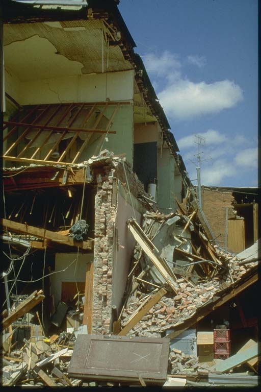
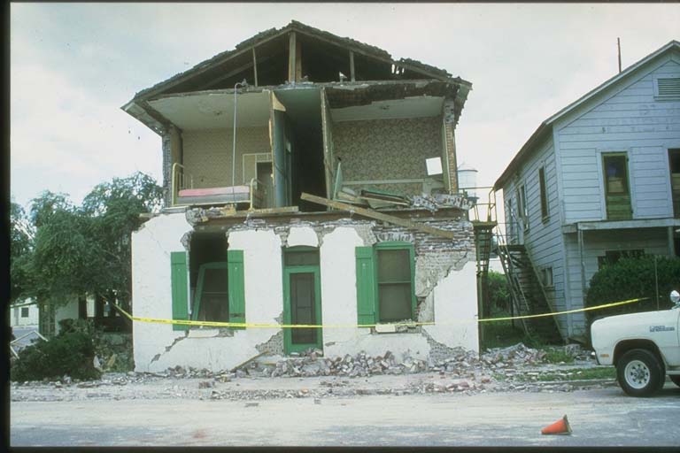
- 500
Where the literature gives no number, NCEI records a description on a scale of 1 to 4, printed here in its words. Damage is in millions of US dollars of the year of the event, not adjusted for inflation.
Photos
From the NCEI/WDS Natural Hazards Image Database (doi:10.7289/V5154F01). Only photos by the USGS and NOAA, which are public domain, are shown.




Other significant earthquakes nearby
Within 200 km, the deadliest first.
- October 18, 1989, Loma Prieta, California, United States
- July 21, 1952, Kern County, California, United States
- January 9, 1857, San Luis Obispo, California, United States
- December 22, 2003, Paso Robles,templeton,atascadero, California, United States
- August 22, 1952, Kern County, California, United States
- March 3, 1901, San Diego, California, United States
- September 28, 2004, Parkfield, San Miguel, Central, California, United States
- February 1, 1853, San Simeon, California, United States
- November 4, 1927, Off Coast, S, California, United States
- April 24, 1984, Morgan Hill, Central, California, United States
- October 8, 1865, Santa Cruz, California, United States
- October 31, 2007, San Jose, California, United States
- July 28, 1902, Southern, California, United States
More
Significant earthquakes of 1983The 1900sEvery quake the USGS located in 1983Recent earthquakes near hereThis day in weather history
Sources
Significant earthquakes from NOAA’s National Centers for Environmental Information, Global Historical Hazard Database, cited as NCEI/WDS, doi:10.7289/V5PN93H7. Public domain. Read 2026-09-24. NCEI earthquake 4977.