February 4, 1976 Earthquake: Chimaltenango, Guatemala City
A magnitude 7.5 earthquake struck Chimaltenango, Guatemala City on February 4, 1976 at 09:01:43 UTC, 5 km below the surface. It killed 23,000 people.
Map
Where it struck, with the other significant earthquakes within 200 km. Circles are sized and colored by magnitude; select one for its page.
The earthquake
- Date
- February 4, 1976
- Time
- 09:01:43 UTC
- Place
- Chimaltenango, Guatemala City
- Magnitude
- 7.5 (Ms)
- Focal depth
- 5 km (3 mi)
- Intensity
- 9 on the Modified Mercalli scale
- Tsunami
- Yes: the tsunami it caused
- Epicenter
- 15.324° N, 89.101° W
- Country
- Guatemala
The toll
- Deaths
- 23,000
- Injuries
- 76,000
- Damage
- $2.1 billion
- Houses destroyed
- 255,000
- Houses damaged
- Very many (over 1,000)
Where the literature gives no number, NCEI records a description on a scale of 1 to 4, printed here in its words. Damage is in millions of US dollars of the year of the event, not adjusted for inflation.
What the record says
NCEI’s account, from the sources it cites.
The Guatemalan earthquake of February 4, 1976, with a surface-wave magnitude of 7.6, was generated by left-lateral slippage on the Motagua fault and was felt over an area of at least 100,000 km2. This earthquake claimed more than 22,700 lives and injured more than 76,000 people. The preliminary estimate of losses is about $1,100,000,000.
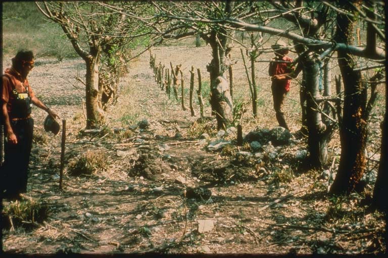
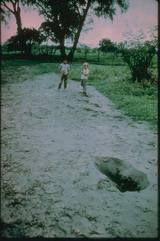
Ground breakage was observed and mapped for a distance of nearly 240 km along a segment of the fault. It is the longest surface rupture to have occurred in America since 1906. The inferred total length of faulting is nearly 300 km, postulated on the basis of small aftershocks and high damage concentration west of Guatemala City. Maximum horizontal slippage as measured on the fault, about 26 km north of Guatemala City, was 326 cm. The average horizontal displacement is approximately 100 cm. Slippage also occurred on a number of secondary faults and caused damage to houses and other structures in the vicinity of Guatemala City.
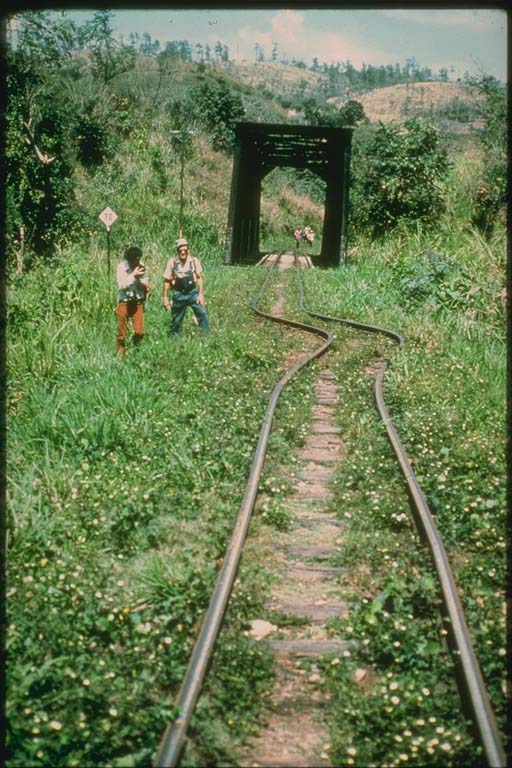
The February 4 earthquake caused extensive landsliding along the highway that leads from Guatemala City to the Pacific and Atlantic Oceans. Landslides also blocked many railroads and destroyed many communication routes in the highlands of Guatemala. A large landslide near Tecpan covered two small villages and dammed a river. Additional landslides were triggered by aftershock activity.
The maximum Modified Mercalli intensity was IX in the Mixco area, in some sections of Guatemala City, and in Gualhn. The Modified Mercalli intensity reached VI over an area of 33,000 km2. The concentration of high intensities observed near the western end of the Motagua fault suggests the influence of a westward-propagating fault rupture.
Communities and small towns that suffered 100 percent damage covered an area of 1,700 km2. At some localities, adobe structures near the causative fault (within 10 km) were essentially undamaged; at greater distances from the fault in the highlands, there was widespread collapse of adobe buildings. Modern earthquake-resistive structures in Guatemala City were damaged, including several hospitals. Several water tanks and corrugated-steel grain silos and numerous heavy parapets collapsed.
(above from ref #3343)
This event is located near Los Amateos about 157 km northeast of Guatemala City. It was generated by a left-lateral slippage of about 1 m on the Motagua fault. An estimated 23,000 were killed, more than 76,000 were injured, and it was felt over an area of at least 100,000 sq km. The maximum MM intensity was IX in the Mixco area. In some sections of Guatemala City and in Gualan, the MM Intensity reached VI over an area of 33,000 sq km. Communities and small towns that suffered 100% adobe damage covered an area of 1,700 sq km. Ground breakage was observed in a continuous, well defined line from 230 km extending from near Quebradas in the lower Motagua Valley on the east to about 10 km east of Patzaj on the west. At the closest point the fault is 25 km north of Guatemala City. Damage reported in El Salvador, Honduras and southeastern Mexico. Also felt in other areas of Central America. (ref #1053)
23,000 deaths, $2147 million damage. (ref #1280)
22,400 deaths, $6000 million damage. (ref #1232)
23,000 killed, 76,000 injured, 435,000 homeless. (ref #1177)
23,000 killed, 74,000 injured, 1 million homeless (ref #12649)
23,000 killed, 4,993,000 affected, $1000 million damage. (ref #1250)
22870 deaths, 77200 injuries. The total number of houses destroyed was 255000, and 1.1 million people were left homeless. The total loss amounted to $1100 million. (ref #8015)
Photos
From the NCEI/WDS Natural Hazards Image Database (doi:10.7289/V5154F01). Only photos by the USGS and NOAA, which are public domain, are shown.



Other significant earthquakes nearby
Within 200 km, the deadliest first.
- December 26, 1917, Guatemala City
- October 10, 1986, San Salvador, El Salvador
- April 14, 1854, San Salvador, El Salvador
- March 4, 1873, Santa Tomas, San Vicente, El Salvador
- June 3, 1773, St. Jago, Guatemala
- February 13, 2001, San Juan Tepezontes-San Vicente-Cojutep, El Salvador
- April 11, 1873, Salvador,san Vicente, El Salvador
- September 3, 1874, Antigua,chimaltenango,amatitlan, Guatemala
- July 29, 1773, Antigua, Guatemala
- April 20, 1765, Chiquimula, El Salvador, Guatemala
- April 21, 1594, San Salvador, El Salvador
- September 7, 1915, El Salvador
- July 8, 2025, Guatemala City, Escuintla, Sacatepequez
- September 29, 1982, Honduras-Guatemala-El Salvador
- August 9, 1980, Izabel Province, Honduras, N Guatemala
More
Significant earthquakes of 1976The 1900sEvery quake the USGS located in 1976Recent earthquakes near hereThis day in weather history
Sources
Significant earthquakes from NOAA’s National Centers for Environmental Information, Global Historical Hazard Database, cited as NCEI/WDS, doi:10.7289/V5PN93H7. Public domain. Read 2026-09-24. NCEI earthquake 4711.