M4.5 earthquake 2 km NE of Satte, Japan
A magnitude 4.5 earthquake struck 2 km NE of Satte, Japan on Fri, Oct 2, 2026, 6:01 AM JST (21:01 UTC), 65 km (40 mi) below the surface.
Map
Where this earthquake was located, with the others nearby. Select one for its page.
The earthquake
- Magnitude
- 4.5 (mb, body-wave), light
- Magnitude from
- USGS National Earthquake Information Center
- Local time
- UTC
- 2026-10-01 21:01:41 UTC
- Depth
- 65.0 km (40.4 mi), shallow
- Epicenter
- 36.090° N, 139.749° E
- Region
- Japan
- Felt reports
- 3
- Tsunami flag
- No
- Status
- Reviewed by a seismologist
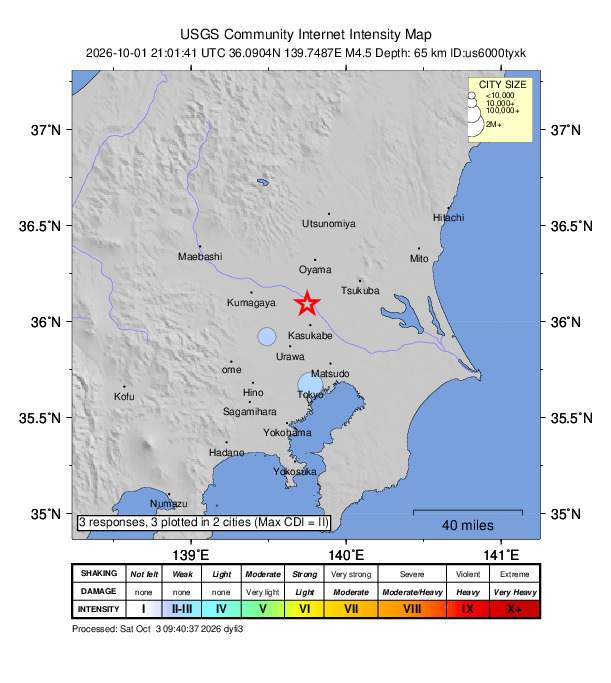
Did you feel it?
3 people reported to the USGS what they felt; the strongest reported shaking was III, weak shaking. If you felt it, tell the USGS: every report sharpens the shaking map.
How well it is located
Reviewed by a seismologist.
- Location uncertainty
- About 3.5 km horizontally, 7.6 km in depth
- Magnitude uncertainty
- ±0.12
- Depth from
- From location
- Station coverage gap
- 134°
- Stations used
- 36
Nearest places
Distance and direction from each place to the epicenter, with its forecast.
Nearby
Within 100 km, magnitude 1.5 and up: 0 since this one and 4 in the 30 days before it.
Before
- 5.30 km NNE of Yōkaichiba, Japan · 3 days ago · 42 km deep · 84 km away · felt by 25
- 4.92 km SW of Sakai, Japan · 5 days ago · 71 km deep · 3 km away · felt by 69
- 4.31 km SSW of Kōzaki, Japan · 7 days ago · 76 km deep · 62 km away
- 4.81 km SE of Ishige, Japan · 17 days ago · 80 km deep · 21 km away · felt by 73
Earthquakes todayJapan earthquakesLive radar here
Sources
From the USGS Earthquake Hazards Program and its partner networks, event us6000tyxk. Read Sun, Oct 4, 2026, 12:19 AM UTC.