M1.7 earthquake 6 km NNW of North Sultan, Washington
A magnitude 1.7 earthquake struck 6 km NNW of North Sultan, Washington on Thu, Apr 2, 2026, 7:50 PM PDT (02:50 UTC), 14 km (9 mi) below the surface.
A larger quake followed: M2.8 4 km W of Wauna, Washington. This one was a foreshock.
Map
Where this earthquake was located, with the others nearby. Select one for its page.
The earthquake
- Magnitude
- 1.7 (ML, local (Richter)), micro
- Magnitude from
- Pacific Northwest Seismic Network
- Local time
- UTC
- 2026-04-03 02:50:49 UTC
- Depth
- 14.3 km (8.9 mi), shallow
- Epicenter
- 47.930° N, 121.846° W
- Region
- Washington
- Felt reports
- 1
- Tsunami flag
- No
- Status
- Reviewed by a seismologist
Did you feel it?
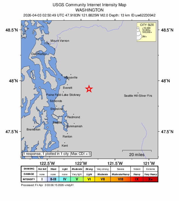
1 person reported to the USGS what they felt; the strongest reported shaking was I, not felt shaking.
How well it is located
Reviewed by a seismologist.
- Location uncertainty
- About 0.4 km horizontally, 0.8 km in depth
- Magnitude uncertainty
- ±0.12
- Depth from
- From location
- Station coverage gap
- 128°
- Stations used
- 14
Nearest places
Distance and direction from each place to the epicenter, with its forecast.
Nearby
Within 100 km, magnitude 1.5 and up: 26 in the 60 days after this one and 13 in the 30 days before it.
After
- 2.25 km E of Mirrormont, Washington · 176 days ago · 20 km deep · 52 km away
- 1.75 km NE of Hobart, Washington · 176 days ago · 19 km deep · 53 km away
- 1.73 km E of Mirrormont, Washington · 174 days ago · 18 km deep · 53 km away
- 1.74 km NW of Dash Point, Washington · 173 days ago · 20 km deep · 80 km away
- 2.53 km WSW of Concrete, Washington · 173 days ago · 5 km deep · 66 km away · felt by 9
- 2.01 km SE of Fairwood, Washington · 169 days ago · 10 km deep · 59 km away · felt by 1
- 1.84 km NE of Woods Creek, Washington · 166 days ago · 8 km deep · 2 km away
- 1.63 km NE of Lake Marcel-Stillwater, Washington · 164 days ago · 12 km deep · 25 km away
- 1.84 km WSW of Concrete, Washington · 162 days ago · 5 km deep · 67 km away
- 1.60 km S of Lakeland South, Washington · 162 days ago · 19 km deep · 80 km away
- 1.52 km WNW of Arlington, Washington · 161 days ago · 63 km deep · 38 km away
- 1.51 km E of Edmonds, Washington · 159 days ago · 27 km deep · 40 km away
- 2.75 km N of Anacortes, Washington · 158 days ago · 15 km deep · 90 km away · felt by 26
- 1.68 km ENE of Duvall, Washington · 155 days ago · 7 km deep · 18 km away
- 1.77 km NE of Fall City, Washington · 154 days ago · 16 km deep · 36 km away
- 2.05 km N of Anacortes, Washington · 154 days ago · 15 km deep · 91 km away · felt by 1
- 2.24 km WSW of Concrete, Washington · 151 days ago · 4 km deep · 66 km away
- 2.54 km WSW of Concrete, Washington · 148 days ago · 5 km deep · 67 km away · felt by 161
- 1.95 km NE of Hobart, Washington · 145 days ago · 19 km deep · 53 km away
- 1.61 km ENE of Clyde Hill, Washington · 139 days ago · 29 km deep · 42 km away
- 1.71 km ENE of Clyde Hill, Washington · 138 days ago · 29 km deep · 42 km away
- 1.66 km SSW of Port Ludlow, Washington · 133 days ago · 0 km deep · 64 km away
- 1.88 km NE of Fall City, Washington · 128 days ago · 16 km deep · 36 km away
- 2.17 km NE of Fall City, Washington · 128 days ago · 16 km deep · 35 km away
- 2.84 km W of Wauna, Washington · 127 days ago · 26 km deep · 89 km away · felt by 64
- 2.02 km NNW of Roosevelt, Washington · 125 days ago · 18 km deep · 14 km away
Before
- 1.81 km S of Shoreline, Washington · 184 days ago · 25 km deep · 42 km away
- 1.69 km NNE of Snoqualmie, Washington · 189 days ago · 13 km deep · 37 km away
- 2.43 km ENE of Belfair, Washington · 191 days ago · 48 km deep · 88 km away · felt by 1
- 2.115 km ESE of Acme, Washington · 193 days ago · 0 km deep · 84 km away · felt by 2
- 1.62 km W of Port Townsend, Washington · 193 days ago · 55 km deep · 74 km away
- 1.91 km WSW of Manchester, Washington · 194 days ago · 5 km deep · 69 km away · felt by 2
- 2.410 km NE of Snoqualmie, Washington · 194 days ago · 13 km deep · 37 km away · felt by 19
- 2.02 km ENE of Snoqualmie, Washington · 198 days ago · 15 km deep · 43 km away · felt by 2
- 2.03 km S of Monroe, Washington · 201 days ago · 27 km deep · 15 km away
- 2.06 km SW of Clinton, Washington · 203 days ago · 33 km deep · 42 km away
- 2.17 km E of Tanner, Washington · 204 days ago · 16 km deep · 53 km away · felt by 4
- 1.63 km SE of Alger, Washington · 208 days ago · 11 km deep · 82 km away
- 1.54 km NW of Tulalip Bay, Washington · 210 days ago · 28 km deep · 41 km away
Earthquakes todayWashington earthquakesLive radar here
Sources
From the USGS Earthquake Hazards Program and its partner networks, event uw62230942. Read Fri, Oct 2, 2026, 6:37 AM UTC.