M3.3 earthquake 23 km W of Gerlach, Nevada
A magnitude 3.3 earthquake struck 23 km W of Gerlach, Nevada on Mon, Sep 14, 2026, 7:12 AM PDT (14:12 UTC), 11 km (7 mi) below the surface.
A larger quake followed: M3.8 20 km WSW of Gerlach, Nevada. This one was a foreshock.
Map
Where this earthquake was located, with the others nearby. Select one for its page.
The earthquake
- Magnitude
- 3.3 (mwr), minor
- Local time
- UTC
- 2026-09-14 14:12:05 UTC
- Depth
- 11.0 km (6.8 mi), shallow
- Epicenter
- 40.619° N, 119.626° W
- Region
- Nevada
- Strongest shaking
- III, weak shaking
- Tsunami flag
- No
- Status
- Reviewed by a seismologist
Shaking
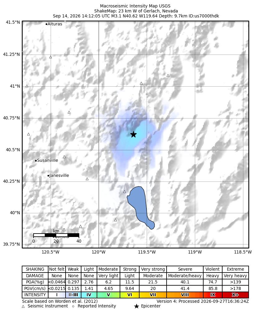
The USGS ShakeMap: shaking estimated from seismic stations and the quake’s size, on the Modified Mercalli intensity scale.
- Strongest estimated
- III, weak shaking
- Peak ground acceleration
- 0.9% of gravity
- Peak ground velocity
- 0.3 cm/s
- Map
- Automatic
Did you feel it?
No one has reported feeling this quake to the USGS. If you felt it, tell the USGS: every report sharpens the shaking map.
Fault motion and ground failure
How the rock slipped, from the moment tensor, and the USGS estimate of landslides and liquefaction.
- Faulting
- Oblique normal
- Moment magnitude
- 3.3 Mwr
- Nodal plane 1
- Strike 241°, dip 45°, rake -51°
- Nodal plane 2
- Strike 13°, dip 57°, rake -122°
How well it is located
Reviewed by a seismologist.
- Station coverage gap
- 139°
- Stations used
- 7
Nearest places
Distance and direction from each place to the epicenter, with its forecast.
Nearby
Within 100 km, magnitude 1.5 and up: 14 since this one and 5 in the 30 days before it.
After
- 1.615 km WSW of Gerlach, Nevada · 14 days ago · 0 km deep · 8 km away
- 1.622 km W of Gerlach, Nevada · 13 days ago · 9 km deep · 1 km away
- 2.221 km W of Gerlach, Nevada · 13 days ago · 11 km deep · 1 km away
- 2.422 km W of Gerlach, Nevada · 13 days ago · 8 km deep · 1 km away
- 2.120 km W of Gerlach, Nevada · 13 days ago · 8 km deep · 3 km away
- 1.522 km W of Gerlach, Nevada · 13 days ago · 12 km deep · 1 km away
- 1.822 km W of Gerlach, Nevada · 13 days ago · 15 km deep · 1 km away
- 3.820 km WSW of Gerlach, Nevada · 13 days ago · 7 km deep · 3 km away · felt by 7
- 2.221 km NNW of Chilcoot-Vinton, CA · 13 days ago · 3 km deep · 86 km away
- 1.615 km WSW of Gerlach, Nevada · 13 days ago · 10 km deep · 9 km away
- 2.02 km SSE of Burning Man Earth, Nevada · 9 days ago · 8 km deep · 37 km away
- 1.822 km SSW of Empire, Nevada · 8 days ago · 11 km deep · 28 km away
- 1.611 km E of Eagleville, California · 6 days ago · 4 km deep · 85 km away
- 2.215 km N of Susanville, CA · 4 days ago · 6 km deep · 89 km away
Before
- 1.67 km WSW of Burning Man Earth, Nevada · 21 days ago · 4 km deep · 30 km away
- 1.814 km NNW of Susanville, CA · 22 days ago · 5 km deep · 90 km away
- 2.48 km NW of Honey Lake, CA · 25 days ago · 2 km deep · 76 km away · felt by 1
- 1.717 km NNW of Sutcliffe, Nevada · 27 days ago · 14 km deep · 58 km away
- 1.914 km NNW of Susanville, CA · 35 days ago · 6 km deep · 89 km away
Earthquakes todayNevada earthquakesLive radar here
Sources
From the USGS Earthquake Hazards Program and its partner networks, event nn00924436 (also filed as us7000thdk). Read Tue, Sep 29, 2026, 4:55 PM UTC.