M2.2 earthquake 26 km WSW of Gerlach, Nevada
A magnitude 2.2 earthquake struck 26 km WSW of Gerlach, Nevada on Wed, Jan 21, 2026, 1:02 AM PST (09:02 UTC), 12 km (7 mi) below the surface.
A larger quake followed: M3.1 26 km WSW of Gerlach, Nevada. This one was a foreshock.
Map
Where this earthquake was located, with the others nearby. Select one for its page.
The earthquake
- Magnitude
- 2.2 (ML, local (Richter)), micro
- Magnitude from
- Nevada Seismological Laboratory
- Local time
- UTC
- 2026-01-21 09:02:20 UTC
- Depth
- 11.7 km (7.3 mi), shallow
- Epicenter
- 40.605° N, 119.657° W
- Region
- Nevada
- Felt reports
- 1
- Tsunami flag
- No
- Status
- Reviewed by a seismologist
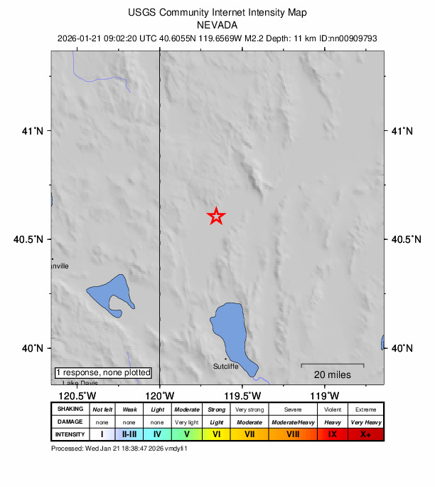
Did you feel it?
1 person reported to the USGS what they felt.
How well it is located
Reviewed by a seismologist.
- Magnitude uncertainty
- ±0.27
- Station coverage gap
- 174°
- Stations used
- 4
Nearest places
Distance and direction from each place to the epicenter, with its forecast.
Nearby
Within 100 km, magnitude 1.5 and up: 38 in the 60 days after this one and 53 in the 30 days before it.
After
- 2.420 km WSW of Gerlach, Nevada · 252 days ago · 10 km deep · 7 km away
- 2.522 km WSW of Gerlach, Nevada · 251 days ago · 11 km deep · 4 km away
- 2.715 km NNW of Susanville, CA · 250 days ago · 6 km deep · 88 km away
- 1.935 km ENE of Nixon, Nevada · 249 days ago · 9 km deep · 99 km away
- 2.117 km SE of Honey Lake, CA · 249 days ago · -1 km deep · 68 km away
- 1.630 km W of Gerlach, Nevada · 248 days ago · 11 km deep · 5 km away
- 3.018 km W of Empire, Nevada · 248 days ago · 12 km deep · 9 km away
- 3.118 km W of Empire, Nevada · 247 days ago · 8 km deep · 9 km away
- 1.914 km NNW of Susanville, CA · 246 days ago · 8 km deep · 88 km away
- 1.613 km NNW of Susanville, CA · 244 days ago · 5 km deep · 88 km away
- 2.027 km W of Gerlach, Nevada · 242 days ago · 10 km deep · 2 km away
- 1.532 km W of Gerlach, Nevada · 242 days ago · 0 km deep · 7 km away · felt by 1
- 1.732 km WSW of Gerlach, Nevada · 242 days ago · 1 km deep · 6 km away
- 2.026 km W of Gerlach, Nevada · 240 days ago · 9 km deep · 3 km away
- 1.513 km NNW of Sutcliffe, Nevada · 239 days ago · 8 km deep · 60 km away
- 2.032 km W of Gerlach, Nevada · 239 days ago · 0 km deep · 7 km away
- 1.630 km W of Gerlach, Nevada · 239 days ago · 10 km deep · 5 km away
- 2.521 km NE of Lake Davis, CA · 233 days ago · -1 km deep · 87 km away
- 2.524 km W of Empire, Nevada · 231 days ago · 6 km deep · 4 km away
- 1.814 km NNW of Susanville, CA · 228 days ago · 5 km deep · 87 km away
- 3.126 km WSW of Gerlach, Nevada · 228 days ago · 4 km deep · 2 km away
- 2.820 km WSW of Gerlach, Nevada · 227 days ago · 12 km deep · 6 km away
- 1.914 km NNW of Susanville, CA · 226 days ago · 6 km deep · 88 km away · felt by 1
- 2.527 km WSW of Gerlach, Nevada · 225 days ago · 3 km deep · 2 km away
- 1.920 km W of Empire, Nevada · 223 days ago · 4 km deep · 8 km away
- 1.732 km WSW of Gerlach, Nevada · 223 days ago · 4 km deep · 7 km away
- 2.231 km WSW of Gerlach, Nevada · 222 days ago · 11 km deep · 6 km away
- 2.23 km SE of Johnstonville, CA · 220 days ago · 2 km deep · 82 km away
- 1.616 km WSW of Empire, Nevada · 217 days ago · 12 km deep · 17 km away
- 2.014 km NNW of Susanville, CA · 213 days ago · 6 km deep · 88 km away
- 2.230 km WSW of Gerlach, Nevada · 211 days ago · 10 km deep · 5 km away
- 2.213 km NE of Lake Davis, CA · 210 days ago · 8 km deep · 94 km away
- 2.914 km NNW of Susanville, CA · 208 days ago · 5 km deep · 88 km away · felt by 2
- 2.116 km NE of Litchfield, California · 206 days ago · 9 km deep · 51 km away
- 1.813 km NNW of Susanville, CA · 204 days ago · 5 km deep · 88 km away
- 2.345 km N of Black Rock City, Nevada · 201 days ago · 6 km deep · 77 km away
- 1.833 km W of Gerlach, Nevada · 200 days ago · 7 km deep · 8 km away
- 1.832 km W of Empire, Nevada · 195 days ago · 9 km deep · 7 km away
Before
- 2.725 km WSW of Gerlach, Nevada · 255 days ago · 11 km deep · 1 km away
- 1.722 km WSW of Gerlach, Nevada · 255 days ago · 4 km deep · 4 km away
- 1.928 km W of Gerlach, Nevada · 255 days ago · 8 km deep · 3 km away
- 3.425 km WSW of Gerlach, Nevada · 255 days ago · 7 km deep · 2 km away
- 2.520 km WSW of Gerlach, Nevada · 255 days ago · 12 km deep · 6 km away
- 1.731 km W of Gerlach, Nevada · 255 days ago · 2 km deep · 6 km away
- 3.621 km WSW of Gerlach, Nevada · 255 days ago · 7 km deep · 5 km away · felt by 1
- 3.317 km W of Empire, Nevada · 255 days ago · 1 km deep · 10 km away
- 3.521 km W of Empire, Nevada · 255 days ago · 11 km deep · 5 km away · felt by 2
- 3.821 km WSW of Gerlach, Nevada · 255 days ago · 6 km deep · 5 km away · felt by 1
- 2.115 km NNW of Susanville, CA · 256 days ago · 4 km deep · 87 km away · felt by 1
- 2.014 km N of Susanville, CA · 258 days ago · 4 km deep · 86 km away
- 2.114 km N of Susanville, CA · 258 days ago · 5 km deep · 86 km away
- 1.814 km NNW of Susanville, CA · 258 days ago · 7 km deep · 88 km away
- 1.629 km W of Gerlach, Nevada · 260 days ago · 5 km deep · 4 km away
- 2.014 km NNW of Susanville, CA · 260 days ago · 6 km deep · 88 km away
- 2.222 km WSW of Gerlach, Nevada · 264 days ago · 10 km deep · 4 km away
- 2.523 km WSW of Gerlach, Nevada · 265 days ago · 12 km deep · 4 km away
- 1.78 km N of Sutcliffe, Nevada · 266 days ago · 10 km deep · 65 km away
- 1.814 km NNW of Susanville, CA · 268 days ago · 6 km deep · 88 km away · felt by 1
Earthquakes todayNevada earthquakesLive radar here
Sources
From the USGS Earthquake Hazards Program and its partner networks, event nn00909793. Read Fri, Oct 2, 2026, 3:02 AM UTC.