M4.1 earthquake 30 km W of Anchor Point, Alaska
A magnitude 4.1 earthquake struck 30 km W of Anchor Point, Alaska on Tue, Mar 31, 2026, 7:44 AM AKDT (15:44 UTC), 83 km (51 mi) below the surface.
Map
Where this earthquake was located, with the others nearby. Select one for its page.
The earthquake
- Magnitude
- 4.1 (ML, local (Richter)), light
- Magnitude from
- Alaska Earthquake Center
- Local time
- UTC
- 2026-03-31 15:44:28 UTC
- Depth
- 82.7 km (51.4 mi), intermediate-depth
- Epicenter
- 59.768° N, 152.381° W
- Region
- Alaska
- Felt reports
- 19
- Strongest shaking
- III, weak shaking
- Tsunami flag
- No
- Status
- Reviewed by a seismologist
Magnitude estimates
Different scales measure different things and differ by a few tenths. The USGS marks one as preferred, and it is the one this page uses.
| Mag. | Scale | Computed by | Notes |
|---|---|---|---|
| 4.1 | ML, local (Richter) | Alaska Earthquake Center | Preferred · Reviewed · ±0.2 · 157 stations |
| 4.1 | Mwr, regional moment | USGS National Earthquake Information Center | Reviewed · ±0.039 · 64 stations |
Shaking
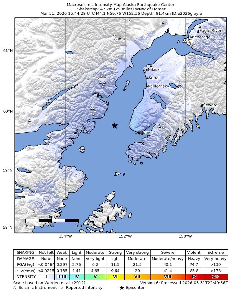
The USGS ShakeMap: shaking estimated from seismic stations and the quake’s size, on the Modified Mercalli intensity scale.
- Strongest estimated
- III, weak shaking
- Peak ground acceleration
- 0.4% of gravity
- Peak ground velocity
- 0.2 cm/s
- Map
- Automatic
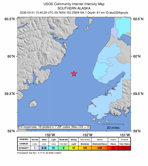
Did you feel it?
19 people reported to the USGS what they felt; the strongest reported shaking was III, weak shaking.
Fault motion and ground failure
How the rock slipped, from the moment tensor, and the USGS estimate of landslides and liquefaction.
- Faulting
- Strike-slip
- Moment magnitude
- 4.1 Mwr
- Nodal plane 1
- Strike 43°, dip 72°, rake 14°
- Nodal plane 2
- Strike 308°, dip 76°, rake 162°
How well it is located
Reviewed by a seismologist.
- Location uncertainty
- About 1.9 km horizontally, 1.3 km in depth
- Magnitude uncertainty
- ±0.20
- Station coverage gap
- 74°
- Stations used
- 246
Nearest places
Distance and direction from each place to the epicenter, with its forecast.
Nearby
Within 100 km, magnitude 1.5 and up: at least 199 in the 60 days after this one and at least 200 in the 30 days before it.
After
- 1.650 km WNW of Ninilchik, Alaska · 187 days ago · 103 km deep · 46 km away
- 1.957 km ESE of Pope-Vannoy Landing, Alaska · 187 days ago · 112 km deep · 88 km away
- 2.060 km ENE of Pedro Bay, Alaska · 187 days ago · 135 km deep · 54 km away
- 1.622 km WNW of Anchor Point, Alaska · 187 days ago · 71 km deep · 10 km away
- 1.834 km ESE of Port Alsworth, Alaska · 187 days ago · 7 km deep · 84 km away
- 1.646 km ENE of Pedro Bay, Alaska · 187 days ago · 128 km deep · 59 km away
- 2.368 km W of Happy Valley, Alaska · 187 days ago · 122 km deep · 45 km away
- 1.730 km WSW of Nanwalek, Alaska · 187 days ago · 68 km deep · 61 km away
- 3.165 km WNW of Anchor Point, Alaska · 187 days ago · 107 km deep · 37 km away
- 1.921 km ESE of Kasilof, Alaska · 187 days ago · 64 km deep · 96 km away
- 1.550 km W of Happy Valley, Alaska · 187 days ago · 99 km deep · 32 km away
- 1.560 km W of Happy Valley, Alaska · 187 days ago · 114 km deep · 38 km away
- 1.955 km NW of Ninilchik, Alaska · 187 days ago · 113 km deep · 66 km away
- 3.425 km NNW of Nanwalek, Alaska · 186 days ago · 68 km deep · 27 km away
- 1.828 km W of Salamatof, Alaska · 186 days ago · 84 km deep · 97 km away
- 3.351 km WNW of Nanwalek, Alaska · 186 days ago · 92 km deep · 39 km away
- 2.358 km W of Anchor Point, Alaska · 186 days ago · 105 km deep · 29 km away
- 3.570 km WNW of Happy Valley, Alaska · 186 days ago · 117 km deep · 51 km away
- 1.536 km WNW of Happy Valley, Alaska · 186 days ago · 89 km deep · 29 km away
- 1.646 km ENE of Pedro Bay, Alaska · 186 days ago · 122 km deep · 56 km away
- 2.347 km ENE of Pedro Bay, Alaska · 186 days ago · 127 km deep · 53 km away
- 1.845 km W of Anchor Point, Alaska · 186 days ago · 85 km deep · 16 km away
- 1.564 km E of Port Alsworth, Alaska · 186 days ago · 155 km deep · 60 km away
- 2.141 km NW of Nanwalek, Alaska · 186 days ago · 88 km deep · 23 km away
- 1.639 km SE of Pedro Bay, Alaska · 186 days ago · 119 km deep · 70 km away
- 1.647 km E of Pedro Bay, Alaska · 186 days ago · 122 km deep · 50 km away
- 1.963 km SW of Nanwalek, Alaska · 186 days ago · 70 km deep · 86 km away
- 2.35 km WNW of Diamond Ridge, Alaska · 186 days ago · 51 km deep · 42 km away
- 3.156 km W of Happy Valley, Alaska · 186 days ago · 118 km deep · 36 km away
- 1.667 km ENE of Pedro Bay, Alaska · 186 days ago · 115 km deep · 53 km away
- 1.949 km W of Anchor Point, Alaska · 185 days ago · 85 km deep · 18 km away
- 1.59 km NNE of Nikolaevsk, Alaska · 185 days ago · 57 km deep · 49 km away
- 1.763 km WNW of Happy Valley, Alaska · 185 days ago · 109 km deep · 45 km away
- 1.617 km NW of Nanwalek, Alaska · 185 days ago · 64 km deep · 37 km away
- 1.79 km ESE of Happy Valley, Alaska · 185 days ago · 71 km deep · 49 km away
- 1.518 km W of Anchor Point, Alaska · 185 days ago · 74 km deep · 12 km away
- 1.649 km W of Happy Valley, Alaska · 185 days ago · 103 km deep · 32 km away
- 1.553 km SE of Pedro Bay, Alaska · 185 days ago · 117 km deep · 61 km away
- 1.536 km W of Nanwalek, Alaska · 185 days ago · 70 km deep · 41 km away
- 3.156 km E of Pedro Bay, Alaska · 185 days ago · 122 km deep · 41 km away · felt by 1
- 1.843 km WNW of Ninilchik, Alaska · 184 days ago · 96 km deep · 48 km away
- 2.151 km ENE of Pedro Bay, Alaska · 184 days ago · 151 km deep · 60 km away
- 1.936 km W of Happy Valley, Alaska · 184 days ago · 75 km deep · 21 km away
- 2.154 km WNW of Anchor Point, Alaska · 184 days ago · 107 km deep · 26 km away
- 1.754 km ENE of Pedro Bay, Alaska · 184 days ago · 129 km deep · 52 km away
- 1.638 km W of Kalifornsky, Alaska · 184 days ago · 90 km deep · 81 km away
- 1.515 km WSW of Kenai, Alaska · 184 days ago · 68 km deep · 95 km away
- 1.563 km E of Pedro Bay, Alaska · 184 days ago · 98 km deep · 34 km away
- 1.630 km WNW of Anchor Point, Alaska · 184 days ago · 79 km deep · 14 km away
- 2.061 km WNW of Happy Valley, Alaska · 184 days ago · 115 km deep · 41 km away
- 2.268 km W of Happy Valley, Alaska · 184 days ago · 122 km deep · 45 km away
- 2.455 km E of Pedro Bay, Alaska · 184 days ago · 123 km deep · 43 km away
- 1.948 km E of Pedro Bay, Alaska · 184 days ago · 121 km deep · 48 km away
- 1.612 km NW of Fox River, Alaska · 184 days ago · 60 km deep · 75 km away
- 1.940 km WSW of Nanwalek, Alaska · 183 days ago · 84 km deep · 59 km away
- 1.946 km W of Anchor Point, Alaska · 183 days ago · 79 km deep · 16 km away
- 3.742 km NW of Nanwalek, Alaska · 183 days ago · 92 km deep · 24 km away · felt by 4
- 1.77 km NNW of Nikolaevsk, Alaska · 183 days ago · 64 km deep · 41 km away
- 1.626 km W of Clam Gulch, Alaska · 183 days ago · 82 km deep · 63 km away
- 1.621 km WNW of Kalifornsky, Alaska · 183 days ago · 80 km deep · 90 km away
The first 60 of at least 199.
Before
- 1.867 km ENE of Pedro Bay, Alaska · 188 days ago · 114 km deep · 41 km away
- 1.545 km WNW of Ninilchik, Alaska · 188 days ago · 95 km deep · 43 km away
- 2.750 km W of Anchor Point, Alaska · 188 days ago · 93 km deep · 19 km away
- 1.613 km NW of Seldovia, Alaska · 188 days ago · 58 km deep · 39 km away
- 1.854 km SE of Pedro Bay, Alaska · 188 days ago · 108 km deep · 76 km away
- 2.946 km W of Nanwalek, Alaska · 188 days ago · 73 km deep · 47 km away
- 2.055 km W of Anchor Point, Alaska · 188 days ago · 100 km deep · 25 km away
- 3.148 km W of Anchor Point, Alaska · 188 days ago · 92 km deep · 18 km away
- 1.940 km W of Nanwalek, Alaska · 188 days ago · 74 km deep · 47 km away
- 1.750 km WNW of Ninilchik, Alaska · 188 days ago · 106 km deep · 47 km away
- 2.063 km SE of Pope-Vannoy Landing, Alaska · 188 days ago · 100 km deep · 96 km away
- 1.649 km WNW of Nanwalek, Alaska · 188 days ago · 76 km deep · 32 km away
- 1.714 km W of Happy Valley, Alaska · 188 days ago · 74 km deep · 30 km away
- 2.018 km ESE of Clam Gulch, Alaska · 188 days ago · 66 km deep · 85 km away · felt by 1
- 1.662 km W of Anchor Point, Alaska · 189 days ago · 99 km deep · 32 km away
- 1.835 km W of Happy Valley, Alaska · 189 days ago · 74 km deep · 24 km away
- 1.946 km E of Pedro Bay, Alaska · 189 days ago · 123 km deep · 51 km away
- 1.753 km WNW of Happy Valley, Alaska · 189 days ago · 104 km deep · 36 km away
- 3.155 km WNW of Ninilchik, Alaska · 189 days ago · 119 km deep · 56 km away · felt by 1
- 1.768 km SE of Pope-Vannoy Landing, Alaska · 189 days ago · 104 km deep · 87 km away
Earthquakes todayAlaska earthquakesLive radar here
Sources
From the USGS Earthquake Hazards Program and its partner networks, event aka2026gioyfa (also filed as us7000s956). Read Mon, Oct 5, 2026, 3:39 AM UTC.