M5.3 earthquake 39 km E of Adak, Alaska
A magnitude 5.3 earthquake struck 39 km E of Adak, Alaska on Sat, Jan 24, 2026, 11:25 AM HAST (21:25 UTC), 61 km (38 mi) below the surface.
Map
Where this earthquake was located, with the others nearby. Select one for its page.
The earthquake
- Magnitude
- 5.3 (Mww, W-phase moment), moderate
- Magnitude from
- USGS National Earthquake Information Center
- Local time
- UTC
- 2026-01-24 21:25:38 UTC
- Depth
- 61.2 km (38.0 mi), shallow
- Epicenter
- 51.922° N, 176.069° W
- Region
- Alaska
- Felt reports
- 3
- Strongest shaking
- IV, light shaking
- Tsunami flag
- Yes: a large quake in an oceanic region
- Status
- Reviewed by a seismologist
Magnitude estimates
Different scales measure different things and differ by a few tenths. The USGS marks one as preferred, and it is the one this page uses.
| Mag. | Scale | Computed by | Notes |
|---|---|---|---|
| 5.3 | Mww, W-phase moment | USGS National Earthquake Information Center | Preferred · Reviewed · ±0.047 · 44 stations |
| 5.7 | ML, local (Richter) | Alaska Earthquake Center | Reviewed · ±0.2 · 33 stations |
| 5.1 | mb, body-wave | NOAA National Tsunami Warning Center | Reviewed · 40 stations |
| 5.3 | Mwb, body-wave moment | USGS National Earthquake Information Center | Moment tensor · Reviewed |
| 5.4 | Mww, W-phase moment | USGS, automatic first solution | First automatic solution · Confirmed |
Tsunami
The USGS flags a quake this large in an oceanic region. The flag does not mean a tsunami happened; the tsunami warning centers decide that, and their messages are below when they issued any.
- Tsunami Information Statement from the NTWC. Read the message
Current tsunami warnings: tsunami.gov. Warnings in force in the US also appear on our alerts pages.
Shaking
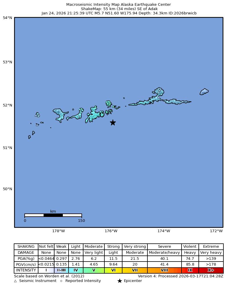
The USGS ShakeMap: shaking estimated from seismic stations and the quake’s size, on the Modified Mercalli intensity scale.
- Strongest estimated
- IV, light shaking
- Peak ground acceleration
- 8.3% of gravity
- Peak ground velocity
- 3.5 cm/s
- Map
- Automatic
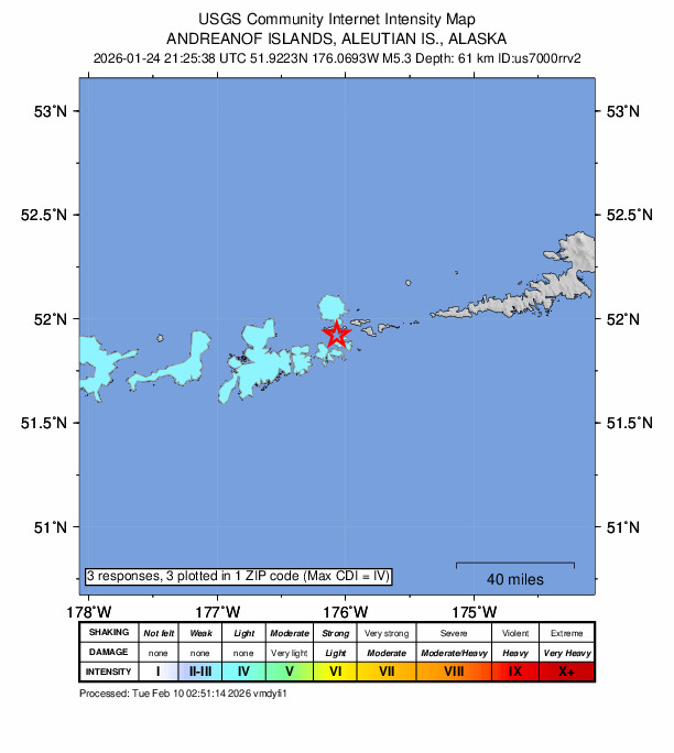
Did you feel it?
3 people reported to the USGS what they felt; the strongest reported shaking was IV, light shaking.
Aftershock forecast
The chance of at least one aftershock this large or larger, from the USGS operational aftershock forecast, issued Sat, Sep 26, 2026, 9:25 PM UTC. The USGS updates it as the sequence unfolds.
| Within | M3+ | M4+ | M5+ | M6+ | M7+ |
|---|---|---|---|---|---|
| 1 day | Under 1% | Under 1% | Under 1% | Under 1% | Under 1% |
| 1 week | 5% | Under 1% | Under 1% | Under 1% | Under 1% |
| 1 month | 17% | 2% | Under 1% | Under 1% | Under 1% |
| 1 year | 73% | 14% | 2% | Under 1% | Under 1% |
In the coming week the USGS expects about 0 aftershocks of magnitude 3 or more, and most likely between 0 and 1.
Fault motion and ground failure
How the rock slipped, from the moment tensor, and the USGS estimate of landslides and liquefaction.
- Faulting
- Reverse (thrust)
- Moment magnitude
- 5.3 Mww
- Nodal plane 1
- Strike 60°, dip 59°, rake 64°
- Nodal plane 2
- Strike 284°, dip 40°, rake 126°
How well it is located
Reviewed by a seismologist.
- Location uncertainty
- About 5.6 km horizontally, 2.8 km in depth
- Magnitude uncertainty
- ±0.05
- Depth from
- From location
- Station coverage gap
- 75°
- Stations used
- 123
Nearby
Within 100 km, magnitude 2.3 and up: 82 in the 60 days after this one and 43 in the 30 days before it.
After
- 2.463 km SSW of Adak, Alaska · 250 days ago · 8 km deep · 88 km away
- 2.454 km SSE of Adak, Alaska · 250 days ago · 9 km deep · 61 km away
- 2.563 km SSE of Adak, Alaska · 250 days ago · 35 km deep · 64 km away
- 2.755 km E of Adak, Alaska · 249 days ago · 164 km deep · 17 km away
- 3.246 km ESE of Adak, Alaska · 249 days ago · 51 km deep · 23 km away
- 2.454 km S of Adak, Alaska · 249 days ago · 31 km deep · 69 km away
- 2.584 km S of Adak, Alaska · 248 days ago · 10 km deep · 92 km away
- 2.466 km ESE of Adak, Alaska · 248 days ago · 35 km deep · 43 km away
- 2.755 km SSW of Adak, Alaska · 248 days ago · 31 km deep · 84 km away
- 2.460 km SSE of Adak, Alaska · 248 days ago · 22 km deep · 57 km away
- 2.648 km ESE of Adak, Alaska · 248 days ago · 76 km deep · 22 km away
- 2.551 km SE of Adak, Alaska · 247 days ago · 59 km deep · 35 km away
- 3.541 km SSW of Adak, Alaska · 247 days ago · 61 km deep · 67 km away
- 2.570 km SE of Adak, Alaska · 246 days ago · 35 km deep · 59 km away
- 2.841 km E of Adak, Alaska · 244 days ago · 136 km deep · 4 km away
- 2.549 km S of Adak, Alaska · 243 days ago · 35 km deep · 64 km away
- 2.651 km SSE of Adak, Alaska · 243 days ago · 38 km deep · 53 km away
- 5.140 km E of Adak, Alaska · 243 days ago · 62 km deep · 7 km away · felt by 1
- 3.259 km SE of Adak, Alaska · 242 days ago · 35 km deep · 52 km away
- 3.02 km S of Adak, Alaska · 242 days ago · 121 km deep · 39 km away
- 3.267 km SSW of Atka, Alaska · 242 days ago · 35 km deep · 96 km away
- 3.393 km ESE of Adak, Alaska · 242 days ago · 35 km deep · 62 km away
- 3.356 km WSW of Atka, Alaska · 241 days ago · 134 km deep · 77 km away
- 2.618 km SW of Adak, Alaska · 238 days ago · 10 km deep · 55 km away
- 2.593 km SSE of Adak, Alaska · 238 days ago · 10 km deep · 94 km away
- 2.453 km SW of Adak, Alaska · 237 days ago · 36 km deep · 86 km away
- 2.764 km SE of Adak, Alaska · 235 days ago · 35 km deep · 58 km away
- 5.074 km NE of Adak, Alaska · 233 days ago · 157 km deep · 50 km away · felt by 1
- 3.237 km SE of Adak, Alaska · 232 days ago · 74 km deep · 33 km away
- 2.960 km SSE of Adak, Alaska · 232 days ago · 35 km deep · 67 km away
- 3.789 km SW of Atka, Alaska · 232 days ago · 35 km deep · 67 km away
- 3.894 km SW of Atka, Alaska · 231 days ago · 41 km deep · 69 km away
- 3.944 km E of Adak, Alaska · 231 days ago · 62 km deep · 12 km away
- 2.972 km SSE of Adak, Alaska · 230 days ago · 35 km deep · 66 km away
- 2.781 km ESE of Adak, Alaska · 230 days ago · 55 km deep · 48 km away
- 2.478 km ESE of Adak, Alaska · 230 days ago · 35 km deep · 54 km away
- 2.564 km SSE of Adak, Alaska · 230 days ago · 25 km deep · 68 km away
- 2.463 km ESE of Adak, Alaska · 229 days ago · 35 km deep · 43 km away
- 2.490 km SSE of Adak, Alaska · 229 days ago · 10 km deep · 82 km away
- 3.173 km SSW of Adak, Alaska · 227 days ago · 33 km deep · 96 km away
- 2.468 km SSW of Adak, Alaska · 227 days ago · 42 km deep · 91 km away
- 2.647 km WSW of Atka, Alaska · 227 days ago · 105 km deep · 85 km away
- 3.737 km ENE of Adak, Alaska · 226 days ago · 145 km deep · 7 km away
- 3.173 km ESE of Adak, Alaska · 226 days ago · 35 km deep · 49 km away
- 4.047 km ESE of Adak, Alaska · 226 days ago · 60 km deep · 17 km away
- 2.371 km SSE of Adak, Alaska · 225 days ago · 28 km deep · 66 km away
- 2.695 km SE of Adak, Alaska · 224 days ago · 4 km deep · 76 km away
- 2.745 km S of Adak, Alaska · 224 days ago · 33 km deep · 66 km away
- 2.947 km WSW of Atka, Alaska · 222 days ago · 10 km deep · 84 km away
- 2.532 km S of Adak, Alaska · 221 days ago · 68 km deep · 58 km away
- 2.568 km SE of Adak, Alaska · 220 days ago · 35 km deep · 57 km away
- 2.664 km SSW of Adak, Alaska · 220 days ago · 38 km deep · 94 km away
- 3.061 km ESE of Adak, Alaska · 217 days ago · 35 km deep · 38 km away
- 5.089 km SSW of Atka, Alaska · 217 days ago · 34 km deep · 95 km away
- 3.052 km S of Adak, Alaska · 216 days ago · 35 km deep · 68 km away
- 3.032 km SSW of Adak, Alaska · 214 days ago · 35 km deep · 62 km away
- 2.976 km SW of Atka, Alaska · 212 days ago · 35 km deep · 87 km away
- 2.374 km S of Adak, Alaska · 211 days ago · 30 km deep · 83 km away
- 2.460 km SSW of Adak, Alaska · 209 days ago · 34 km deep · 89 km away
- 2.689 km SSE of Adak, Alaska · 208 days ago · 35 km deep · 89 km away
The first 60 of 82.
Before
- 3.445 km SSE of Adak, Alaska · 251 days ago · 35 km deep · 52 km away
- 3.044 km SSE of Adak, Alaska · 252 days ago · 35 km deep · 50 km away
- 3.169 km SE of Adak, Alaska · 252 days ago · 33 km deep · 62 km away
- 2.340 km SSE of Adak, Alaska · 253 days ago · 33 km deep · 46 km away
- 2.940 km SSE of Adak, Alaska · 254 days ago · 35 km deep · 47 km away
- 3.337 km SSE of Adak, Alaska · 254 days ago · 35 km deep · 44 km away
- 2.591 km ESE of Adak, Alaska · 255 days ago · 35 km deep · 58 km away
- 2.872 km SE of Adak, Alaska · 255 days ago · 19 km deep · 61 km away
- 2.536 km ENE of Adak, Alaska · 255 days ago · 125 km deep · 6 km away
- 2.569 km SSW of Adak, Alaska · 255 days ago · 35 km deep · 97 km away
- 3.568 km SSW of Adak, Alaska · 256 days ago · 35 km deep · 95 km away
- 2.967 km SSW of Adak, Alaska · 256 days ago · 35 km deep · 95 km away
- 2.755 km SSE of Adak, Alaska · 257 days ago · 31 km deep · 60 km away
- 2.328 km SE of Adak, Alaska · 257 days ago · 66 km deep · 36 km away
- 2.869 km SSE of Adak, Alaska · 258 days ago · 16 km deep · 68 km away
- 4.228 km SSE of Adak, Alaska · 259 days ago · 52 km deep · 38 km away
- 2.572 km SE of Adak, Alaska · 260 days ago · 27 km deep · 54 km away
- 3.195 km NE of Adak, Alaska · 261 days ago · 217 km deep · 70 km away
- 2.853 km SSE of Adak, Alaska · 262 days ago · 27 km deep · 57 km away
- 4.045 km ESE of Adak, Alaska · 266 days ago · 57 km deep · 29 km away
Earthquakes todayAlaska earthquakesLive radar here
Sources
From the USGS Earthquake Hazards Program and its partner networks, event us7000rrv2 (also filed as at00t9e0uq, ak2026brwicb, usauto7000rrv2). Read Fri, Oct 2, 2026, 1:49 AM UTC.