M5.1 earthquake 141 km SSE of Sand Point, Alaska
A magnitude 5.1 earthquake struck 141 km SSE of Sand Point, Alaska on Fri, Sep 5, 2025, 10:25 PM AKDT (06:25 UTC), 10 km (6 mi) below the surface.
Map
Where this earthquake was located, with the others nearby. Select one for its page.
The earthquake
- Magnitude
- 5.1 (Mww, W-phase moment), moderate
- Magnitude from
- USGS National Earthquake Information Center
- Local time
- UTC
- 2025-09-06 06:25:25 UTC
- Depth
- 10.0 km (6.2 mi), shallow
- Epicenter
- 54.109° N, 159.942° W
- Region
- Alaska
- Strongest shaking
- III, weak shaking
- Tsunami flag
- No
- Status
- Reviewed by a seismologist
Magnitude estimates
Different scales measure different things and differ by a few tenths. The USGS marks one as preferred, and it is the one this page uses.
| Mag. | Scale | Computed by | Notes |
|---|---|---|---|
| 5.1 | Mww, W-phase moment | USGS National Earthquake Information Center | Preferred · Reviewed · ±0.053 · 34 stations |
| 4.8 | ML, local (Richter) | Alaska Earthquake Center | Preliminary |
| 5.1 | Mwr, regional moment | USGS National Earthquake Information Center | Moment tensor · Reviewed |
| 5.2 | Mww, W-phase moment | USGS, automatic first solution | First automatic solution · Confirmed |
Shaking
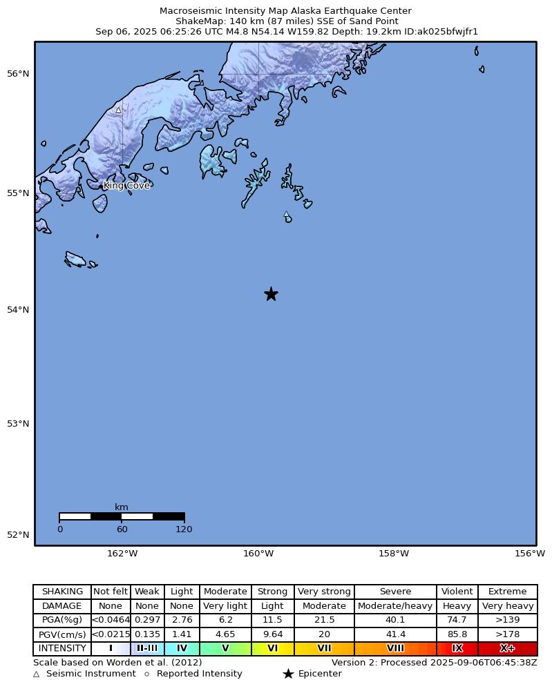
The USGS ShakeMap: shaking estimated from seismic stations and the quake’s size, on the Modified Mercalli intensity scale.
- Strongest estimated
- III, weak shaking
- Peak ground acceleration
- 0.6% of gravity
- Peak ground velocity
- 0.3 cm/s
- Map
- Automatic
Did you feel it?
No one has reported feeling this quake to the USGS.
Fault motion and ground failure
How the rock slipped, from the moment tensor, and the USGS estimate of landslides and liquefaction.
- Faulting
- Strike-slip
- Moment magnitude
- 5.1 Mww
- Nodal plane 1
- Strike 256°, dip 87°, rake -24°
- Nodal plane 2
- Strike 347°, dip 66°, rake -177°
How well it is located
Reviewed by a seismologist.
- Location uncertainty
- About 4.5 km horizontally, 1.8 km in depth
- Magnitude uncertainty
- ±0.05
- Depth from
- Operator assigned
- Station coverage gap
- 155°
- Stations used
- 232
Nearest places
Distance and direction from each place to the epicenter, with its forecast.
Nearby
Within 100 km, magnitude 2.1 and up: 28 in the 60 days after this one and at least 200 in the 30 days before it.
After
- 4.4108 km SSE of Sand Point, Alaska · 387 days ago · 22 km deep · 39 km away
- 4.0123 km SSE of Sand Point, Alaska · 384 days ago · 25 km deep · 37 km away
- 3.298 km S of Sand Point, Alaska · 382 days ago · 18 km deep · 44 km away
- 3.3102 km SSE of Sand Point, Alaska · 382 days ago · 35 km deep · 50 km away
- 4.2101 km SSE of Sand Point, Alaska · 379 days ago · 35 km deep · 42 km away
- 3.298 km SSE of Sand Point, Alaska · 374 days ago · 25 km deep · 55 km away
- 3.7155 km SSE of Sand Point, Alaska · 374 days ago · 10 km deep · 18 km away
- 3.9112 km SSE of Sand Point, Alaska · 374 days ago · 25 km deep · 34 km away
- 3.196 km SSE of Sand Point, Alaska · 373 days ago · 35 km deep · 45 km away
- 2.8107 km SSE of Sand Point, Alaska · 372 days ago · 32 km deep · 39 km away
- 3.099 km SSE of Sand Point, Alaska · 372 days ago · 26 km deep · 43 km away
- 3.2110 km SSE of Sand Point, Alaska · 371 days ago · 10 km deep · 34 km away
- 4.195 km SSE of Sand Point, Alaska · 369 days ago · 21 km deep · 48 km away · felt by 1
- 3.6106 km SSE of Sand Point, Alaska · 368 days ago · 34 km deep · 48 km away
- 3.594 km SSE of Sand Point, Alaska · 368 days ago · 42 km deep · 51 km away
- 4.697 km SSE of Sand Point, Alaska · 360 days ago · 32 km deep · 44 km away · felt by 2
- 3.894 km SSE of Sand Point, Alaska · 355 days ago · 29 km deep · 49 km away
- 2.1103 km SSE of Sand Point, Alaska · 352 days ago · 26 km deep · 53 km away
- 4.091 km SSE of Sand Point, Alaska · 352 days ago · 35 km deep · 50 km away
- 2.196 km S of Sand Point, Alaska · 352 days ago · 26 km deep · 53 km away
- 2.188 km SSE of Sand Point, Alaska · 352 days ago · 17 km deep · 54 km away
- 2.195 km SSE of Sand Point, Alaska · 352 days ago · 26 km deep · 47 km away
- 4.678 km S of Sand Point, Alaska · 347 days ago · 35 km deep · 64 km away
- 3.7105 km SSE of Sand Point, Alaska · 346 days ago · 35 km deep · 36 km away
- 4.7102 km SSE of Sand Point, Alaska · 346 days ago · 35 km deep · 44 km away · felt by 1
- 4.494 km SSE of Sand Point, Alaska · 342 days ago · 35 km deep · 47 km away
- 4.0104 km SSE of Sand Point, Alaska · 340 days ago · 10 km deep · 38 km away
- 3.487 km SSE of Sand Point, Alaska · 335 days ago · 36 km deep · 59 km away
Before
- 2.199 km SSE of Sand Point, Alaska · 395 days ago · 19 km deep · 42 km away
- 2.299 km SSE of Sand Point, Alaska · 395 days ago · 21 km deep · 41 km away
- 2.597 km S of Sand Point, Alaska · 395 days ago · 19 km deep · 44 km away
- 3.9148 km SSE of Sand Point, Alaska · 396 days ago · 35 km deep · 17 km away
- 3.8107 km SE of King Cove, Alaska · 396 days ago · 35 km deep · 94 km away
- 3.9115 km SSE of Sand Point, Alaska · 396 days ago · 10 km deep · 30 km away
- 3.1128 km S of Sand Point, Alaska · 397 days ago · 4 km deep · 18 km away
- 3.2150 km SSE of Sand Point, Alaska · 397 days ago · 27 km deep · 15 km away
- 3.3134 km SSE of Sand Point, Alaska · 397 days ago · 23 km deep · 7 km away
- 3.8142 km SSE of Sand Point, Alaska · 397 days ago · 22 km deep · 4 km away
- 3.8151 km SSE of Sand Point, Alaska · 397 days ago · 10 km deep · 13 km away
- 4.2153 km SSE of Sand Point, Alaska · 397 days ago · 10 km deep · 19 km away
- 4.4144 km SSE of Sand Point, Alaska · 397 days ago · 10 km deep · 7 km away
- 2.186 km S of Sand Point, Alaska · 397 days ago · 13 km deep · 64 km away
- 2.194 km S of Sand Point, Alaska · 397 days ago · 13 km deep · 55 km away
- 3.0101 km SSE of Sand Point, Alaska · 397 days ago · 10 km deep · 40 km away
- 2.197 km SSE of Sand Point, Alaska · 397 days ago · 26 km deep · 44 km away
- 2.393 km S of Sand Point, Alaska · 397 days ago · 26 km deep · 54 km away
- 2.3122 km SSE of Sand Point, Alaska · 397 days ago · 13 km deep · 19 km away
- 2.3127 km SSE of Sand Point, Alaska · 397 days ago · 14 km deep · 14 km away
Earthquakes todayAlaska earthquakesLive radar here
Sources
From the USGS Earthquake Hazards Program and its partner networks, event us7000qucj (also filed as usauto7000qucj, ak025bfwjfr1). Read Mon, Oct 5, 2026, 6:32 AM UTC.