M4.9 earthquake 47 km SE of Adak, Alaska
A magnitude 4.9 earthquake struck 47 km SE of Adak, Alaska on Sat, Oct 25, 2025, 1:13 AM HADT (10:13 UTC), 57 km (35 mi) below the surface.
A larger quake followed: M5.5 67 km SSW of Adak, Alaska. This one was a foreshock.
Map
Where this earthquake was located, with the others nearby. Select one for its page.
The earthquake
- Magnitude
- 4.9 (Mww, W-phase moment), light
- Magnitude from
- USGS National Earthquake Information Center
- Local time
- UTC
- 2025-10-25 10:13:06 UTC
- Depth
- 56.5 km (35.1 mi), shallow
- Epicenter
- 51.580° N, 176.133° W
- Region
- Alaska
- Felt reports
- 1
- Strongest shaking
- IV, light shaking
- Tsunami flag
- No
- Status
- Reviewed by a seismologist
Magnitude estimates
Different scales measure different things and differ by a few tenths. The USGS marks one as preferred, and it is the one this page uses.
| Mag. | Scale | Computed by | Notes |
|---|---|---|---|
| 4.9 | Mww, W-phase moment | USGS National Earthquake Information Center | Preferred · Reviewed · ±0.103 · 9 stations |
| 5.1 | ML, local (Richter) | Alaska Earthquake Center | Preliminary |
Shaking
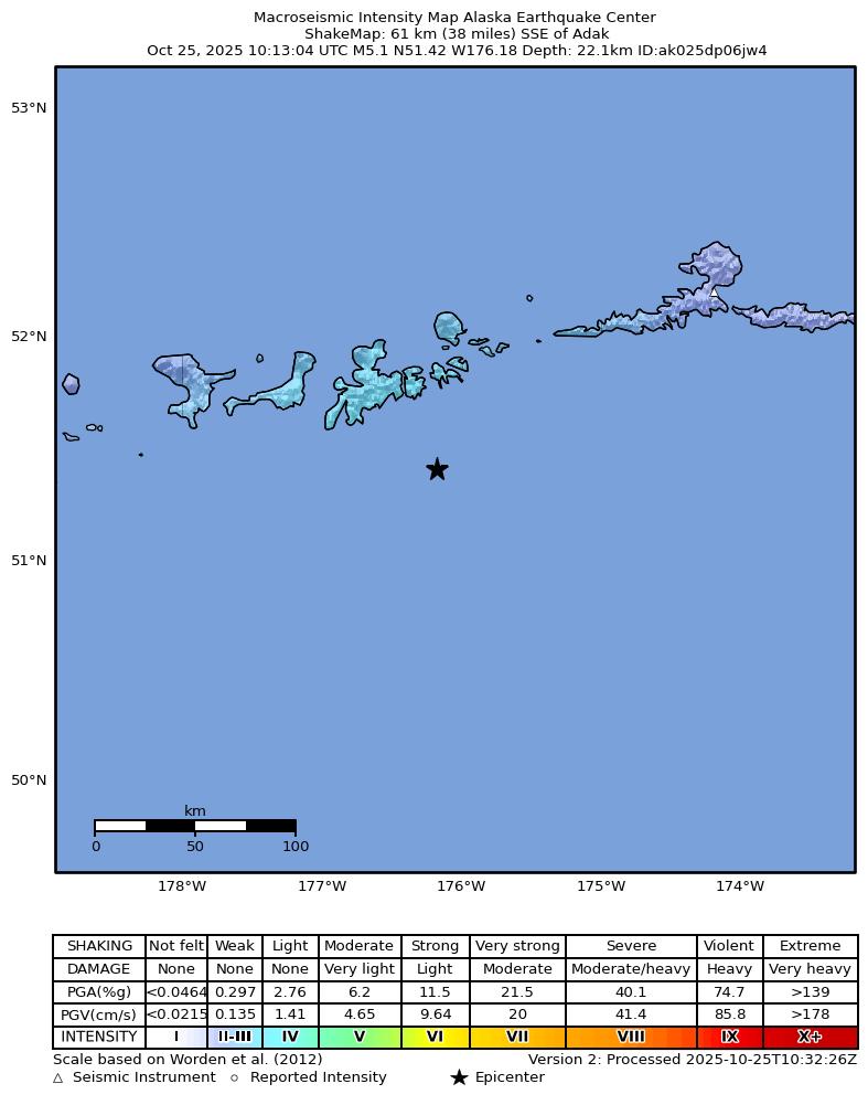
The USGS ShakeMap: shaking estimated from seismic stations and the quake’s size, on the Modified Mercalli intensity scale.
- Strongest estimated
- IV, light shaking
- Peak ground acceleration
- 1.6% of gravity
- Peak ground velocity
- 1.0 cm/s
- Map
- Automatic
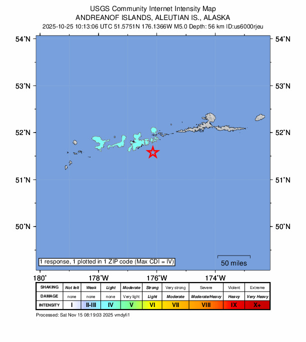
Did you feel it?
1 person reported to the USGS what they felt; the strongest reported shaking was IV, light shaking.
Fault motion and ground failure
How the rock slipped, from the moment tensor, and the USGS estimate of landslides and liquefaction.
- Faulting
- Reverse (thrust)
- Moment magnitude
- 4.9 Mww
- Nodal plane 1
- Strike 222°, dip 26°, rake 86°
- Nodal plane 2
- Strike 46°, dip 64°, rake 92°
How well it is located
Reviewed by a seismologist.
- Location uncertainty
- About 4.8 km horizontally, 4.9 km in depth
- Magnitude uncertainty
- ±0.10
- Depth from
- From location
- Station coverage gap
- 89°
- Stations used
- 92
Nearby
Within 100 km, magnitude 1.9 and up: 89 in the 60 days after this one and 11 in the 30 days before it.
After
- 3.679 km WSW of Atka, Alaska · 336 days ago · 60 km deep · 70 km away
- 4.098 km ESE of Adak, Alaska · 327 days ago · 41 km deep · 59 km away
- 3.010 km S of Adak, Alaska · 323 days ago · 67 km deep · 40 km away
- 3.676 km SSW of Adak, Alaska · 323 days ago · 35 km deep · 74 km away
- 2.6101 km SW of Atka, Alaska · 323 days ago · 10 km deep · 75 km away
- 2.567 km SSE of Adak, Alaska · 318 days ago · 35 km deep · 26 km away
- 2.015 km SSE of Adak, Alaska · 318 days ago · 59 km deep · 34 km away
- 3.198 km ESE of Adak, Alaska · 317 days ago · 35 km deep · 58 km away
- 3.267 km SE of Adak, Alaska · 317 days ago · 35 km deep · 20 km away
- 2.977 km SW of Adak, Alaska · 317 days ago · 35 km deep · 99 km away
- 3.029 km SSW of Adak, Alaska · 317 days ago · 69 km deep · 48 km away
- 2.974 km E of Adak, Alaska · 316 days ago · 27 km deep · 45 km away
- 2.252 km NE of Adak, Alaska · 316 days ago · 186 km deep · 73 km away
- 2.371 km E of Adak, Alaska · 316 days ago · 70 km deep · 42 km away
- 2.754 km S of Adak, Alaska · 315 days ago · 35 km deep · 33 km away
- 2.695 km SSE of Adak, Alaska · 314 days ago · 14 km deep · 58 km away
- 5.567 km SSW of Adak, Alaska · 313 days ago · 33 km deep · 68 km away · felt by 3
- 3.171 km SSW of Adak, Alaska · 313 days ago · 35 km deep · 68 km away
- 2.775 km SSW of Adak, Alaska · 313 days ago · 35 km deep · 74 km away
- 4.065 km SSW of Adak, Alaska · 313 days ago · 35 km deep · 67 km away
- 2.367 km SSW of Adak, Alaska · 312 days ago · 35 km deep · 73 km away
- 2.746 km ENE of Adak, Alaska · 312 days ago · 132 km deep · 48 km away
- 3.743 km N of Adak, Alaska · 311 days ago · 223 km deep · 84 km away
- 3.783 km WSW of Atka, Alaska · 311 days ago · 56 km deep · 66 km away
- 2.269 km SSW of Adak, Alaska · 311 days ago · 35 km deep · 65 km away
- 2.353 km SE of Adak, Alaska · 311 days ago · 38 km deep · 7 km away
- 2.462 km SSW of Adak, Alaska · 311 days ago · 42 km deep · 65 km away
- 2.760 km SSW of Adak, Alaska · 310 days ago · 35 km deep · 65 km away
- 2.259 km SSW of Adak, Alaska · 310 days ago · 38 km deep · 68 km away
- 2.660 km SE of Adak, Alaska · 309 days ago · 35 km deep · 15 km away
- 2.864 km SE of Adak, Alaska · 309 days ago · 35 km deep · 17 km away
- 2.349 km S of Adak, Alaska · 309 days ago · 41 km deep · 30 km away
- 2.866 km SSW of Adak, Alaska · 309 days ago · 35 km deep · 67 km away
- 2.055 km SSE of Adak, Alaska · 309 days ago · 9 km deep · 20 km away
- 2.253 km SW of Adak, Alaska · 309 days ago · 45 km deep · 72 km away
- 2.831 km NW of Adak, Alaska · 307 days ago · 123 km deep · 79 km away
- 2.750 km S of Adak, Alaska · 300 days ago · 35 km deep · 31 km away
- 2.944 km SE of Adak, Alaska · 299 days ago · 43 km deep · 5 km away
- 2.474 km SSW of Adak, Alaska · 296 days ago · 35 km deep · 69 km away
- 2.371 km SE of Adak, Alaska · 296 days ago · 24 km deep · 24 km away
- 2.065 km SW of Adak, Alaska · 296 days ago · 43 km deep · 78 km away
- 1.961 km SSW of Adak, Alaska · 296 days ago · 35 km deep · 62 km away
- 2.059 km SSW of Adak, Alaska · 296 days ago · 46 km deep · 64 km away
- 2.263 km SSW of Adak, Alaska · 296 days ago · 42 km deep · 68 km away
- 2.254 km SE of Adak, Alaska · 296 days ago · 41 km deep · 7 km away
- 3.285 km WSW of Atka, Alaska · 296 days ago · 67 km deep · 65 km away
- 2.658 km SE of Adak, Alaska · 296 days ago · 35 km deep · 11 km away
- 2.370 km SSE of Adak, Alaska · 295 days ago · 15 km deep · 39 km away
- 2.369 km SSW of Adak, Alaska · 295 days ago · 35 km deep · 67 km away
- 2.122 km S of Adak, Alaska · 294 days ago · 62 km deep · 35 km away
- 2.259 km SSW of Adak, Alaska · 294 days ago · 42 km deep · 67 km away
- 2.367 km SSE of Adak, Alaska · 294 days ago · 17 km deep · 26 km away
- 2.462 km SSW of Adak, Alaska · 293 days ago · 34 km deep · 67 km away
- 3.577 km SW of Adak, Alaska · 293 days ago · 35 km deep · 91 km away
- 3.676 km SSE of Adak, Alaska · 293 days ago · 23 km deep · 33 km away
- 2.068 km S of Adak, Alaska · 293 days ago · 35 km deep · 54 km away
- 2.277 km SSE of Adak, Alaska · 292 days ago · 22 km deep · 43 km away
- 2.345 km S of Adak, Alaska · 292 days ago · 30 km deep · 40 km away
- 2.258 km S of Adak, Alaska · 292 days ago · 30 km deep · 43 km away
- 2.256 km S of Adak, Alaska · 292 days ago · 20 km deep · 44 km away
The first 60 of 89.
Before
- 4.971 km SSW of Adak, Alaska · 347 days ago · 37 km deep · 72 km away · felt by 2
- 1.989 km ESE of Adak, Alaska · 349 days ago · 19 km deep · 46 km away
- 2.454 km SW of Adak, Alaska · 349 days ago · 36 km deep · 68 km away
- 2.672 km SE of Adak, Alaska · 349 days ago · 35 km deep · 27 km away
- 4.4100 km SW of Atka, Alaska · 359 days ago · 35 km deep · 61 km away
- 2.757 km SSW of Adak, Alaska · 362 days ago · 34 km deep · 56 km away
- 3.979 km NE of Adak, Alaska · 366 days ago · 222 km deep · 91 km away
- 3.8103 km S of Adak, Alaska · 369 days ago · 10 km deep · 87 km away
- 3.983 km SW of Atka, Alaska · 369 days ago · 35 km deep · 72 km away
- 2.783 km W of Atka, Alaska · 370 days ago · 225 km deep · 93 km away
- 2.066 km SE of Adak, Alaska · 370 days ago · 26 km deep · 20 km away
Earthquakes todayAlaska earthquakesLive radar here
Sources
From the USGS Earthquake Hazards Program and its partner networks, event us6000rjeu (also filed as ak025dp06jw4). Read Fri, Oct 2, 2026, 12:01 PM UTC.