M1.8 earthquake 26 km SSE of Minto, Alaska
A magnitude 1.8 earthquake struck 26 km SSE of Minto, Alaska on Tue, Nov 19, 2024, 8:15 PM AKST (05:15 UTC), 16 km (10 mi) below the surface.
A larger quake followed: M3.1 24 km SSW of Manley Hot Springs, Alaska. This one was a foreshock.
Map
Where this earthquake was located, with the others nearby. Select one for its page.
The earthquake
- Magnitude
- 1.8 (ML, local (Richter)), micro
- Magnitude from
- Alaska Earthquake Center
- Local time
- UTC
- 2024-11-20 05:15:22 UTC
- Depth
- 16.0 km (9.9 mi), shallow
- Epicenter
- 64.924° N, 149.179° W
- Region
- Alaska
- Felt reports
- 1
- Tsunami flag
- No
- Status
- Reviewed by a seismologist
Did you feel it?
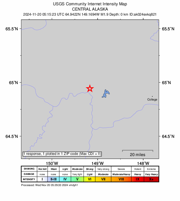
1 person reported to the USGS what they felt; the strongest reported shaking was II, weak shaking.
How well it is located
Reviewed by a seismologist.
- Stations used
- 37
Nearest places
Distance and direction from each place to the epicenter, with its forecast.
Nearby
Within 100 km, magnitude 1.5 and up: 25 in the 60 days after this one and 9 in the 30 days before it.
After
- 1.512 km ENE of Fox, Alaska · 679 days ago · 5 km deep · 85 km away · felt by 1
- 1.89 km NNE of Four Mile Road, Alaska · 676 days ago · 13 km deep · 27 km away
- 1.83 km E of Livengood, Alaska · 674 days ago · 10 km deep · 74 km away
- 1.655 km S of Manley Hot Springs, Alaska · 672 days ago · 14 km deep · 80 km away
- 1.654 km S of Manley Hot Springs, Alaska · 672 days ago · 11 km deep · 81 km away
- 1.813 km WSW of Nenana, Alaska · 671 days ago · 12 km deep · 48 km away
- 1.527 km N of Four Mile Road, Alaska · 666 days ago · 16 km deep · 10 km away
- 3.124 km SSW of Manley Hot Springs, Alaska · 658 days ago · 21 km deep · 83 km away
- 1.556 km E of Clear, Alaska · 655 days ago · 6 km deep · 96 km away
- 1.727 km N of Four Mile Road, Alaska · 654 days ago · 22 km deep · 10 km away
- 1.526 km W of Minto, Alaska · 654 days ago · 16 km deep · 45 km away
- 2.237 km NNW of Ester, Alaska · 653 days ago · 18 km deep · 47 km away
- 1.738 km SSW of Manley Hot Springs, Alaska · 649 days ago · 13 km deep · 83 km away
- 2.960 km S of Manley Hot Springs, Alaska · 647 days ago · 14 km deep · 86 km away
- 1.516 km SSW of Ester, Alaska · 647 days ago · 9 km deep · 56 km away
- 1.721 km WNW of Rampart, Alaska · 643 days ago · 17 km deep · 99 km away
- 1.819 km SSW of South Van Horn, Alaska · 642 days ago · 1 km deep · 62 km away
- 2.010 km W of Nenana, Alaska · 642 days ago · 11 km deep · 41 km away
- 1.525 km SW of Ester, Alaska · 639 days ago · 14 km deep · 47 km away
- 1.940 km WSW of Clear, Alaska · 638 days ago · 13 km deep · 92 km away
- 2.341 km WSW of Clear, Alaska · 637 days ago · 16 km deep · 97 km away · felt by 1
- 1.622 km W of Minto, Alaska · 636 days ago · 18 km deep · 39 km away
- 2.922 km SSE of Minto, Alaska · 627 days ago · 18 km deep · 4 km away
- 1.523 km SSE of Minto, Alaska · 627 days ago · 7 km deep · 3 km away
- 1.519 km W of Livengood, Alaska · 624 days ago · 1 km deep · 65 km away
Before
- 1.56 km NE of North Pole, Alaska · 683 days ago · 13 km deep · 92 km away
- 1.727 km NE of Four Mile Road, Alaska · 686 days ago · 8 km deep · 24 km away
- 2.128 km SW of Eielson Air Force Base, Alaska · 690 days ago · 13 km deep · 93 km away
- 2.028 km W of Salcha, Alaska · 690 days ago · 7 km deep · 94 km away
- 1.825 km SSE of Manley Hot Springs, Alaska · 695 days ago · 15 km deep · 65 km away
- 1.60 km WSW of South Van Horn, Alaska · 696 days ago · 11 km deep · 66 km away
- 1.517 km N of Four Mile Road, Alaska · 697 days ago · 17 km deep · 18 km away
- 2.65 km SSW of North Pole, Alaska · 704 days ago · 25 km deep · 87 km away · felt by 12
- 1.631 km W of Clear, Alaska · 710 days ago · 5 km deep · 77 km away
Earthquakes todayAlaska earthquakesLive radar here
Sources
From the USGS Earthquake Hazards Program and its partner networks, event ak024exkq821. Read Fri, Oct 2, 2026, 1:49 AM UTC.