M3.7 earthquake 98 km SE of McCarthy, Alaska
A magnitude 3.7 earthquake struck 98 km SE of McCarthy, Alaska on Sun, Oct 6, 2024, 9:20 AM AKDT (17:20 UTC), 7 km (4 mi) below the surface.
Map
Where this earthquake was located, with the others nearby. Select one for its page.
The earthquake
- Magnitude
- 3.7 (ml), minor
- Local time
- UTC
- 2024-10-06 17:20:32 UTC
- Depth
- 7.1 km (4.4 mi), shallow
- Epicenter
- 60.877° N, 141.511° W
- Region
- Alaska
- Felt reports
- 1
- Tsunami flag
- No
- Status
- Reviewed by a seismologist
Did you feel it?
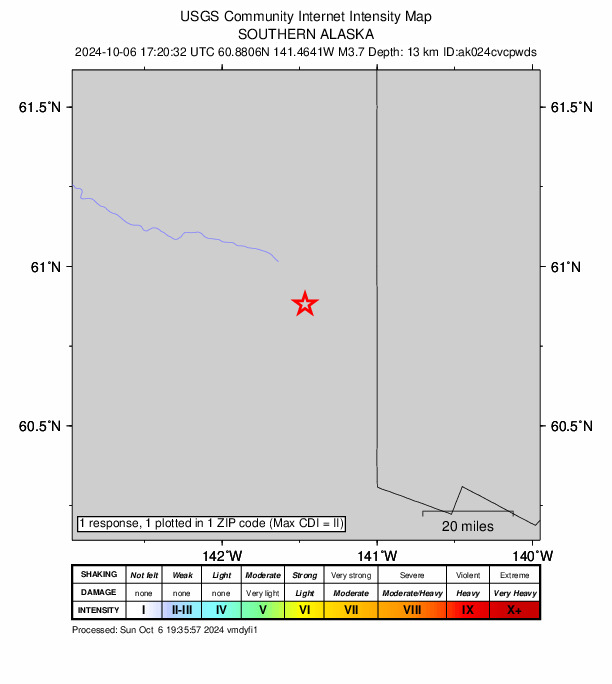
1 person reported to the USGS what they felt; the strongest reported shaking was II, weak shaking.
Fault motion and ground failure
How the rock slipped, from the moment tensor, and the USGS estimate of landslides and liquefaction.
- Faulting
- Normal
- Moment magnitude
- 3.9 Mwr
- Nodal plane 1
- Strike 131°, dip 74°, rake -105°
- Nodal plane 2
- Strike 355°, dip 22°, rake -48°
How well it is located
Reviewed by a seismologist.
- Stations used
- 111
Nearest places
Distance and direction from each place to the epicenter, with its forecast.
Nearby
Within 100 km, magnitude 1.5 and up: 48 in the 60 days after this one and 33 in the 30 days before it.
After
- 1.999 km SE of McCarthy, Alaska · 724 days ago · 7 km deep · 1 km away
- 1.898 km NW of Yakutat, Alaska · 724 days ago · 1 km deep · 83 km away
- 1.999 km SE of McCarthy, Alaska · 723 days ago · 4 km deep · 3 km away
- 1.888 km NW of Yakutat, Alaska · 722 days ago · 7 km deep · 92 km away
- 3.6154 km E of McCarthy, Alaska · 721 days ago · 8 km deep · 97 km away
- 3.2152 km SSE of Alcan Border, Alaska · 721 days ago · 10 km deep · 100 km away
- 1.9116 km NW of Yakutat, Alaska · 719 days ago · 14 km deep · 70 km away
- 3.098 km NW of Yakutat, Alaska · 719 days ago · 15 km deep · 80 km away
- 1.5112 km E of McCarthy, Alaska · 719 days ago · 15 km deep · 79 km away
- 1.9111 km NW of Yakutat, Alaska · 715 days ago · 13 km deep · 75 km away
- 2.2131 km SE of McCarthy, Alaska · 715 days ago · 12 km deep · 38 km away
- 2.197 km NW of Yakutat, Alaska · 714 days ago · 4 km deep · 82 km away
- 1.7135 km ESE of McCarthy, Alaska · 713 days ago · 5 km deep · 63 km away
- 2.0125 km ESE of McCarthy, Alaska · 713 days ago · 9 km deep · 52 km away
- 1.5125 km ESE of McCarthy, Alaska · 713 days ago · 13 km deep · 53 km away
- 3.092 km NW of Yakutat, Alaska · 712 days ago · 4 km deep · 96 km away
- 1.596 km NW of Yakutat, Alaska · 712 days ago · 6 km deep · 95 km away
- 1.7104 km NW of Yakutat, Alaska · 711 days ago · 9 km deep · 81 km away
- 1.7100 km NW of Yakutat, Alaska · 708 days ago · 11 km deep · 84 km away
- 1.7140 km ESE of McCarthy, Alaska · 708 days ago · 10 km deep · 70 km away
- 1.7147 km E of McCarthy, Alaska · 708 days ago · 5 km deep · 86 km away
- 1.599 km NW of Yakutat, Alaska · 707 days ago · 5 km deep · 91 km away
- 1.6111 km NW of Yakutat, Alaska · 705 days ago · 11 km deep · 73 km away
- 1.8135 km E of McCarthy, Alaska · 704 days ago · 3 km deep · 78 km away
- 2.0119 km ESE of McCarthy, Alaska · 702 days ago · 1 km deep · 58 km away
- 1.6126 km N of Yakutat, Alaska · 701 days ago · 10 km deep · 89 km away
- 2.0105 km WNW of Yakutat, Alaska · 701 days ago · 7 km deep · 95 km away
- 1.6158 km E of McCarthy, Alaska · 700 days ago · 14 km deep · 96 km away
- 1.8103 km NW of Yakutat, Alaska · 698 days ago · 17 km deep · 78 km away
- 1.899 km NW of Yakutat, Alaska · 696 days ago · 4 km deep · 78 km away
- 1.7110 km NW of Yakutat, Alaska · 695 days ago · 10 km deep · 68 km away
- 1.8112 km NW of Yakutat, Alaska · 694 days ago · 18 km deep · 71 km away
- 1.599 km E of McCarthy, Alaska · 693 days ago · 12 km deep · 75 km away
- 1.5135 km NW of Yakutat, Alaska · 689 days ago · 3 km deep · 65 km away
- 1.692 km NW of Yakutat, Alaska · 689 days ago · 16 km deep · 89 km away
- 1.5110 km NW of Yakutat, Alaska · 688 days ago · 24 km deep · 68 km away
- 1.5112 km WNW of Yakutat, Alaska · 684 days ago · 6 km deep · 85 km away
- 2.1136 km SSE of McCarthy, Alaska · 681 days ago · 14 km deep · 58 km away
- 1.5158 km E of McCarthy, Alaska · 681 days ago · 7 km deep · 89 km away
- 1.9141 km NNW of Yakutat, Alaska · 677 days ago · 17 km deep · 46 km away
- 1.862 km ENE of McCarthy, Alaska · 676 days ago · 4 km deep · 93 km away
- 2.2134 km SE of McCarthy, Alaska · 675 days ago · 5 km deep · 41 km away
- 1.9118 km E of McCarthy, Alaska · 674 days ago · 3 km deep · 64 km away
- 1.5134 km SSE of McCarthy, Alaska · 672 days ago · 12 km deep · 64 km away
- 2.089 km NNW of Yakutat, Alaska · 671 days ago · 9 km deep · 100 km away
- 1.5103 km NW of Yakutat, Alaska · 668 days ago · 10 km deep · 81 km away
- 1.7105 km NW of Yakutat, Alaska · 666 days ago · 2 km deep · 76 km away
- 2.3116 km WNW of Yakutat, Alaska · 665 days ago · 6 km deep · 92 km away
Before
- 1.787 km NW of Yakutat, Alaska · 725 days ago · 11 km deep · 92 km away
- 1.696 km NW of Yakutat, Alaska · 727 days ago · 14 km deep · 92 km away
- 1.681 km NW of Yakutat, Alaska · 728 days ago · 5 km deep · 99 km away
- 1.594 km NW of Yakutat, Alaska · 728 days ago · 1 km deep · 88 km away
- 2.0104 km NW of Yakutat, Alaska · 728 days ago · 7 km deep · 79 km away
- 1.7101 km NW of Yakutat, Alaska · 728 days ago · 5 km deep · 82 km away
- 1.9101 km NW of Yakutat, Alaska · 729 days ago · 8 km deep · 82 km away
- 1.571 km E of McCarthy, Alaska · 729 days ago · 0 km deep · 70 km away
- 1.587 km E of McCarthy, Alaska · 732 days ago · 2 km deep · 78 km away
- 1.7159 km ESE of McCarthy, Alaska · 733 days ago · 8 km deep · 85 km away
- 1.6123 km E of McCarthy, Alaska · 735 days ago · 3 km deep · 65 km away
- 1.7128 km NW of Yakutat, Alaska · 735 days ago · 5 km deep · 74 km away
- 1.6119 km NW of Yakutat, Alaska · 736 days ago · 10 km deep · 61 km away
- 1.8123 km S of McCarthy, Alaska · 736 days ago · 1 km deep · 99 km away
- 1.6115 km NW of Yakutat, Alaska · 739 days ago · 11 km deep · 65 km away
- 1.5131 km WNW of Yakutat, Alaska · 740 days ago · 7 km deep · 98 km away
- 2.395 km NW of Yakutat, Alaska · 742 days ago · 4 km deep · 82 km away
- 1.6107 km NW of Yakutat, Alaska · 744 days ago · 10 km deep · 76 km away
- 1.6139 km E of McCarthy, Alaska · 746 days ago · 0 km deep · 86 km away
- 1.9140 km E of McCarthy, Alaska · 746 days ago · 3 km deep · 88 km away
Earthquakes todayAlaska earthquakesLive radar here
Sources
From the USGS Earthquake Hazards Program and its partner networks, event ak024cvcpwds (also filed as us6000nwx7). Read Wed, Sep 30, 2026, 4:44 PM UTC.