M2.7 earthquake 35 km W of Karluk, Alaska
A magnitude 2.7 earthquake struck 35 km W of Karluk, Alaska on Tue, Jan 16, 2024, 6:13 AM AKST (15:13 UTC), 54 km (33 mi) below the surface.
A larger quake followed: M3.2 8 km SSW of Larsen Bay, Alaska. This one was a foreshock.
Map
Where this earthquake was located, with the others nearby. Select one for its page.
The earthquake
- Magnitude
- 2.7 (ML, local (Richter)), micro
- Magnitude from
- Alaska Earthquake Center
- Local time
- UTC
- 2024-01-16 15:13:48 UTC
- Depth
- 53.6 km (33.3 mi), shallow
- Epicenter
- 57.595° N, 155.047° W
- Region
- Alaska
- Felt reports
- 1
- Tsunami flag
- No
- Status
- Reviewed by a seismologist
Magnitude estimates
Different scales measure different things and differ by a few tenths. The USGS marks one as preferred, and it is the one this page uses.
| Mag. | Scale | Computed by | Notes |
|---|---|---|---|
| 2.7 | ML, local (Richter) | Alaska Earthquake Center | Preferred · Preliminary |
| 2.8 | ML, local (Richter) | USGS National Earthquake Information Center | Reviewed · ±0.043 · 70 stations |
Did you feel it?
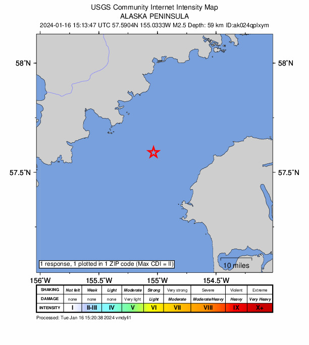
1 person reported to the USGS what they felt; the strongest reported shaking was II, weak shaking.
How well it is located
Reviewed by a seismologist.
- Stations used
- 86
Nearest places
Distance and direction from each place to the epicenter, with its forecast.
Nearby
Within 100 km, magnitude 1.5 and up: 173 in the 60 days after this one and 61 in the 30 days before it.
After
- 1.827 km NNW of Karluk, Alaska · 991 days ago · 57 km deep · 38 km away
- 2.541 km W of Karluk, Alaska · 990 days ago · 4 km deep · 7 km away
- 1.765 km N of Karluk, Alaska · 990 days ago · 81 km deep · 72 km away
- 1.785 km NW of Karluk, Alaska · 990 days ago · 2 km deep · 69 km away
- 1.789 km W of Akhiok, Alaska · 990 days ago · 59 km deep · 69 km away
- 1.879 km ESE of Egegik, Alaska · 990 days ago · 135 km deep · 75 km away
- 1.966 km SW of Karluk, Alaska · 989 days ago · 69 km deep · 49 km away
- 1.964 km E of Ugashik, Alaska · 988 days ago · 4 km deep · 76 km away
- 1.819 km SSE of Larsen Bay, Alaska · 988 days ago · 47 km deep · 75 km away
- 1.879 km W of Karluk, Alaska · 988 days ago · 90 km deep · 44 km away
- 1.788 km ESE of Ugashik, Alaska · 988 days ago · 3 km deep · 67 km away
- 2.591 km WSW of Karluk, Alaska · 986 days ago · 81 km deep · 63 km away
- 1.949 km NNW of Karluk, Alaska · 986 days ago · 72 km deep · 46 km away
- 1.920 km ENE of Larsen Bay, Alaska · 985 days ago · 57 km deep · 82 km away
- 1.827 km SW of Karluk, Alaska · 985 days ago · 47 km deep · 30 km away
- 1.552 km NNE of Karluk, Alaska · 985 days ago · 10 km deep · 68 km away
- 2.369 km ESE of Egegik, Alaska · 984 days ago · 134 km deep · 85 km away
- 1.686 km NW of Karluk, Alaska · 984 days ago · 2 km deep · 68 km away
- 1.930 km W of Karluk, Alaska · 984 days ago · 64 km deep · 5 km away
- 1.874 km SE of Ugashik, Alaska · 983 days ago · 1 km deep · 97 km away
- 1.566 km ESE of Ugashik, Alaska · 983 days ago · 4 km deep · 92 km away
- 2.132 km W of Karluk, Alaska · 982 days ago · 72 km deep · 3 km away
- 2.265 km ENE of Ugashik, Alaska · 982 days ago · 111 km deep · 76 km away
- 2.574 km ENE of Ugashik, Alaska · 981 days ago · 125 km deep · 79 km away
- 1.860 km WNW of Akhiok, Alaska · 981 days ago · 9 km deep · 59 km away
- 2.045 km WSW of Akhiok, Alaska · 980 days ago · 49 km deep · 82 km away
- 2.045 km NNE of Larsen Bay, Alaska · 980 days ago · 54 km deep · 86 km away
- 2.282 km ESE of Ugashik, Alaska · 980 days ago · 1 km deep · 71 km away
- 1.886 km ESE of Ugashik, Alaska · 979 days ago · 3 km deep · 67 km away
- 2.136 km NE of Larsen Bay, Alaska · 979 days ago · 46 km deep · 89 km away
- 2.867 km WSW of Akhiok, Alaska · 978 days ago · 55 km deep · 95 km away
- 1.960 km W of Karluk, Alaska · 978 days ago · 76 km deep · 25 km away
- 2.168 km NNW of Karluk, Alaska · 978 days ago · 91 km deep · 59 km away
- 2.186 km NNW of Karluk, Alaska · 978 days ago · 100 km deep · 76 km away
- 3.159 km ESE of Ugashik, Alaska · 977 days ago · 5 km deep · 100 km away
- 1.934 km SW of Akhiok, Alaska · 977 days ago · 7 km deep · 98 km away
- 1.563 km WSW of Karluk, Alaska · 976 days ago · 54 km deep · 41 km away
- 1.650 km NNW of Karluk, Alaska · 976 days ago · 75 km deep · 41 km away
- 1.820 km NW of Akhiok, Alaska · 976 days ago · 36 km deep · 70 km away
- 1.739 km W of Port Lions, Alaska · 976 days ago · 34 km deep · 94 km away
- 2.347 km WSW of Aleneva, Alaska · 976 days ago · 48 km deep · 91 km away
- 2.060 km SE of Ugashik, Alaska · 976 days ago · 6 km deep · 100 km away
- 1.665 km SE of Ugashik, Alaska · 975 days ago · 6 km deep · 99 km away
- 1.762 km ESE of Ugashik, Alaska · 975 days ago · 9 km deep · 98 km away
- 1.838 km WNW of Akhiok, Alaska · 975 days ago · 44 km deep · 60 km away
- 2.651 km W of Akhiok, Alaska · 974 days ago · 4 km deep · 76 km away
- 1.780 km ESE of Ugashik, Alaska · 974 days ago · 7 km deep · 71 km away
- 2.061 km ESE of Egegik, Alaska · 974 days ago · 141 km deep · 94 km away
- 1.693 km N of Karluk, Alaska · 973 days ago · 4 km deep · 94 km away
- 1.961 km SE of King Salmon, Alaska · 973 days ago · 150 km deep · 93 km away
- 1.859 km W of Karluk, Alaska · 973 days ago · 83 km deep · 24 km away
- 1.644 km NNE of Karluk, Alaska · 973 days ago · 1 km deep · 64 km away
- 2.094 km ESE of King Salmon, Alaska · 973 days ago · 117 km deep · 92 km away
- 1.975 km W of Akhiok, Alaska · 973 days ago · 23 km deep · 66 km away
- 2.246 km SW of Karluk, Alaska · 973 days ago · 56 km deep · 35 km away
- 1.783 km WNW of Karluk, Alaska · 972 days ago · 2 km deep · 49 km away
- 1.582 km WNW of Karluk, Alaska · 972 days ago · 12 km deep · 48 km away
- 1.930 km WSW of Karluk, Alaska · 972 days ago · 59 km deep · 11 km away
- 1.930 km SSW of Karluk, Alaska · 972 days ago · 15 km deep · 38 km away
- 1.585 km NNW of Karluk, Alaska · 971 days ago · 2 km deep · 77 km away
The first 60 of 173.
Before
- 1.59 km N of Karluk, Alaska · 991 days ago · 43 km deep · 36 km away
- 1.767 km WSW of Akhiok, Alaska · 991 days ago · 2 km deep · 92 km away
- 1.976 km WSW of Karluk, Alaska · 991 days ago · 6 km deep · 44 km away
- 2.051 km WNW of Akhiok, Alaska · 991 days ago · 47 km deep · 56 km away
- 1.668 km SE of King Salmon, Alaska · 992 days ago · 126 km deep · 88 km away
- 1.686 km NW of Karluk, Alaska · 992 days ago · 1 km deep · 67 km away
- 2.256 km SE of King Salmon, Alaska · 992 days ago · 152 km deep · 99 km away
- 2.475 km ENE of Ugashik, Alaska · 993 days ago · 105 km deep · 68 km away
- 2.410 km N of Karluk, Alaska · 994 days ago · 62 km deep · 35 km away
- 1.812 km NE of Larsen Bay, Alaska · 994 days ago · 13 km deep · 71 km away
- 1.772 km W of Karluk, Alaska · 995 days ago · 15 km deep · 38 km away
- 1.884 km NW of Karluk, Alaska · 995 days ago · 2 km deep · 67 km away
- 1.722 km ESE of Larsen Bay, Alaska · 996 days ago · 53 km deep · 86 km away
- 1.717 km NW of Larsen Bay, Alaska · 997 days ago · 33 km deep · 52 km away
- 1.979 km W of Akhiok, Alaska · 997 days ago · 13 km deep · 64 km away
- 1.730 km W of Karluk, Alaska · 998 days ago · 71 km deep · 5 km away
- 1.586 km NW of Karluk, Alaska · 998 days ago · 2 km deep · 68 km away
- 2.450 km ESE of Ugashik, Alaska · 998 days ago · 5 km deep · 96 km away
- 1.635 km WSW of Karluk, Alaska · 998 days ago · 54 km deep · 16 km away
- 1.978 km W of Karluk, Alaska · 998 days ago · 82 km deep · 43 km away
Earthquakes todayAlaska earthquakesLive radar here
Sources
From the USGS Earthquake Hazards Program and its partner networks, event ak024qplxym (also filed as us6000m40a). Read Sat, Oct 3, 2026, 7:38 AM UTC.