M4.6 earthquake 94 km SW of Atka, Alaska
A magnitude 4.6 earthquake struck 94 km SW of Atka, Alaska on Tue, Mar 12, 2024, 11:56 AM HADT (20:56 UTC), 38 km (24 mi) below the surface.
A larger quake followed: M4.9 53 km E of Adak, Alaska. This one was a foreshock.
Map
Where this earthquake was located, with the others nearby. Select one for its page.
The earthquake
- Magnitude
- 4.6 (Mwr, regional moment), light
- Magnitude from
- USGS National Earthquake Information Center
- Local time
- UTC
- 2024-03-12 20:56:50 UTC
- Depth
- 37.9 km (23.5 mi), shallow
- Epicenter
- 51.573° N, 175.125° W
- Region
- Alaska
- Felt reports
- 1
- Strongest shaking
- II, weak shaking
- Tsunami flag
- No
- Status
- Reviewed by a seismologist
Magnitude estimates
Different scales measure different things and differ by a few tenths. The USGS marks one as preferred, and it is the one this page uses.
| Mag. | Scale | Computed by | Notes |
|---|---|---|---|
| 4.6 | Mwr, regional moment | USGS National Earthquake Information Center | Preferred · Reviewed · ±0.083 · 14 stations |
| 4.6 | Mwr, regional moment | Alaska Earthquake Center | Preliminary |
Shaking
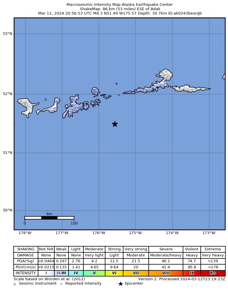
The USGS ShakeMap: shaking estimated from seismic stations and the quake’s size, on the Modified Mercalli intensity scale.
- Strongest estimated
- II, weak shaking
- Peak ground acceleration
- 0.2% of gravity
- Peak ground velocity
- -2.6 cm/s
- Map
- Automatic
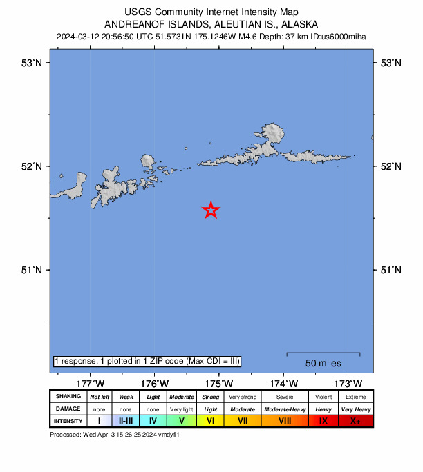
Did you feel it?
1 person reported to the USGS what they felt; the strongest reported shaking was III, weak shaking.
Fault motion and ground failure
How the rock slipped, from the moment tensor, and the USGS estimate of landslides and liquefaction.
- Faulting
- Reverse (thrust)
- Moment magnitude
- 4.6 Mwr
- Nodal plane 1
- Strike 69°, dip 72°, rake 97°
- Nodal plane 2
- Strike 227°, dip 20°, rake 69°
How well it is located
Reviewed by a seismologist.
- Location uncertainty
- About 4.8 km horizontally, 5.4 km in depth
- Magnitude uncertainty
- ±0.08
- Depth from
- From location
- Station coverage gap
- 106°
- Stations used
- 178
Nearby
Within 100 km, magnitude 1.6 and up: 157 in the 60 days after this one and 76 in the 30 days before it.
After
- 3.893 km SW of Atka, Alaska · 933 days ago · 35 km deep · 2 km away
- 2.296 km SW of Atka, Alaska · 933 days ago · 30 km deep · 4 km away
- 2.321 km SE of Atka, Alaska · 932 days ago · 78 km deep · 95 km away
- 2.974 km SW of Atka, Alaska · 932 days ago · 31 km deep · 20 km away
- 1.952 km ESE of Adak, Alaska · 932 days ago · 42 km deep · 58 km away
- 1.962 km SSE of Adak, Alaska · 931 days ago · 26 km deep · 75 km away
- 1.966 km WSW of Atka, Alaska · 930 days ago · 56 km deep · 36 km away
- 3.579 km SSE of Adak, Alaska · 930 days ago · 35 km deep · 88 km away
- 2.079 km ESE of Adak, Alaska · 930 days ago · 30 km deep · 31 km away
- 3.287 km ESE of Adak, Alaska · 929 days ago · 35 km deep · 28 km away
- 1.943 km E of Adak, Alaska · 929 days ago · 70 km deep · 67 km away
- 3.128 km SW of Atka, Alaska · 929 days ago · 86 km deep · 65 km away
- 2.279 km WSW of Atka, Alaska · 928 days ago · 104 km deep · 49 km away
- 2.165 km SE of Adak, Alaska · 926 days ago · 34 km deep · 57 km away
- 2.586 km SSE of Adak, Alaska · 925 days ago · 35 km deep · 94 km away
- 2.178 km SSE of Adak, Alaska · 925 days ago · 22 km deep · 89 km away
- 2.058 km S of Atka, Alaska · 925 days ago · 8 km deep · 54 km away
- 2.123 km SE of Adak, Alaska · 925 days ago · 65 km deep · 87 km away
- 2.830 km S of Atka, Alaska · 925 days ago · 13 km deep · 78 km away
- 2.173 km SW of Atka, Alaska · 923 days ago · 53 km deep · 21 km away
- 3.3129 km SSW of Atka, Alaska · 923 days ago · 10 km deep · 47 km away
- 1.823 km SSE of Atka, Alaska · 922 days ago · 19 km deep · 83 km away
- 2.4114 km SSW of Atka, Alaska · 922 days ago · 6 km deep · 25 km away
- 1.824 km SSE of Atka, Alaska · 922 days ago · 17 km deep · 83 km away
- 1.810 km SE of Adak, Alaska · 921 days ago · 72 km deep · 100 km away
- 1.816 km SW of Atka, Alaska · 921 days ago · 9 km deep · 78 km away
- 2.7102 km ESE of Adak, Alaska · 921 days ago · 35 km deep · 13 km away
- 3.4103 km SW of Atka, Alaska · 920 days ago · 35 km deep · 10 km away
- 2.047 km SE of Adak, Alaska · 920 days ago · 39 km deep · 67 km away
- 2.153 km SE of Adak, Alaska · 920 days ago · 32 km deep · 68 km away
- 2.072 km SW of Atka, Alaska · 920 days ago · 19 km deep · 23 km away
- 2.060 km SW of Atka, Alaska · 920 days ago · 23 km deep · 33 km away
- 1.969 km SE of Adak, Alaska · 919 days ago · 39 km deep · 48 km away
- 2.262 km SE of Adak, Alaska · 919 days ago · 26 km deep · 67 km away
- 2.652 km SSE of Atka, Alaska · 919 days ago · 35 km deep · 87 km away
- 1.617 km SW of Atka, Alaska · 919 days ago · 9 km deep · 77 km away
- 1.844 km ESE of Adak, Alaska · 918 days ago · 53 km deep · 67 km away
- 2.856 km S of Atka, Alaska · 918 days ago · 168 km deep · 76 km away
- 2.1103 km S of Atka, Alaska · 918 days ago · 0 km deep · 61 km away
- 1.656 km SE of Adak, Alaska · 918 days ago · 25 km deep · 73 km away
- 2.193 km ESE of Adak, Alaska · 918 days ago · 22 km deep · 23 km away
- 3.566 km SSE of Adak, Alaska · 917 days ago · 35 km deep · 84 km away
- 1.855 km SSE of Adak, Alaska · 917 days ago · 20 km deep · 79 km away
- 2.671 km SSE of Adak, Alaska · 917 days ago · 35 km deep · 87 km away
- 2.174 km SW of Atka, Alaska · 917 days ago · 46 km deep · 27 km away
- 2.584 km ESE of Adak, Alaska · 917 days ago · 35 km deep · 34 km away
- 3.413 km NW of Atka, Alaska · 915 days ago · 184 km deep · 93 km away
- 2.753 km S of Adak, Alaska · 915 days ago · 35 km deep · 99 km away
- 1.849 km S of Adak, Alaska · 915 days ago · 29 km deep · 99 km away
- 2.770 km WSW of Atka, Alaska · 915 days ago · 91 km deep · 56 km away
- 2.178 km SW of Atka, Alaska · 915 days ago · 21 km deep · 17 km away
- 1.975 km SE of Adak, Alaska · 915 days ago · 25 km deep · 51 km away
- 2.436 km ENE of Adak, Alaska · 915 days ago · 139 km deep · 84 km away
- 2.160 km S of Adak, Alaska · 914 days ago · 24 km deep · 100 km away
- 1.955 km SE of Adak, Alaska · 914 days ago · 24 km deep · 71 km away
- 2.165 km WSW of Atka, Alaska · 913 days ago · 55 km deep · 36 km away
- 1.973 km SSW of Atka, Alaska · 912 days ago · 16 km deep · 26 km away
- 1.968 km SSW of Atka, Alaska · 912 days ago · 20 km deep · 29 km away
- 2.316 km SW of Atka, Alaska · 911 days ago · 58 km deep · 77 km away
- 3.056 km SSE of Adak, Alaska · 911 days ago · 35 km deep · 81 km away
The first 60 of 157.
Before
- 2.659 km SE of Adak, Alaska · 934 days ago · 35 km deep · 69 km away
- 2.168 km SE of Adak, Alaska · 934 days ago · 23 km deep · 65 km away
- 2.169 km SSW of Atka, Alaska · 934 days ago · 14 km deep · 42 km away
- 3.192 km SSE of Adak, Alaska · 935 days ago · 10 km deep · 75 km away
- 2.693 km SSE of Adak, Alaska · 935 days ago · 31 km deep · 75 km away
- 2.084 km ESE of Adak, Alaska · 935 days ago · 26 km deep · 33 km away
- 2.074 km SSW of Atka, Alaska · 936 days ago · 18 km deep · 29 km away
- 2.184 km SSW of Atka, Alaska · 936 days ago · 15 km deep · 46 km away
- 2.188 km SSW of Atka, Alaska · 936 days ago · 11 km deep · 48 km away
- 2.276 km SSE of Atka, Alaska · 936 days ago · 6 km deep · 95 km away
- 2.028 km SSE of Adak, Alaska · 936 days ago · 54 km deep · 97 km away
- 2.966 km SE of Adak, Alaska · 936 days ago · 35 km deep · 71 km away
- 2.025 km SSW of Atka, Alaska · 937 days ago · 52 km deep · 72 km away
- 1.854 km SE of Adak, Alaska · 937 days ago · 25 km deep · 63 km away
- 3.157 km SE of Adak, Alaska · 937 days ago · 37 km deep · 61 km away
- 2.889 km E of Adak, Alaska · 938 days ago · 60 km deep · 27 km away
- 1.996 km SW of Atka, Alaska · 938 days ago · 25 km deep · 14 km away
- 2.665 km SE of Adak, Alaska · 938 days ago · 35 km deep · 55 km away
- 2.919 km SSW of Atka, Alaska · 938 days ago · 186 km deep · 76 km away
- 2.123 km S of Atka, Alaska · 938 days ago · 68 km deep · 81 km away
Earthquakes todayAlaska earthquakesLive radar here
Sources
From the USGS Earthquake Hazards Program and its partner networks, event us6000miha (also filed as ak0243bexrqb). Read Thu, Oct 1, 2026, 12:18 PM UTC.