M7.6 earthquake 82 km WNW of Hihifo, Tonga
A magnitude 7.6 earthquake struck 82 km WNW of Hihifo, Tonga on Thu, May 11, 2023, 5:02 AM GMT+13 (16:02 UTC), 210 km (130 mi) below the surface.
Map
Where this earthquake was located, with the others nearby. Select one for its page.
The earthquake
- Magnitude
- 7.6 (Mww, W-phase moment), major
- Magnitude from
- USGS National Earthquake Information Center
- Local time
- UTC
- 2023-05-10 16:02:00 UTC
- Depth
- 210.0 km (130.5 mi), intermediate-depth
- Epicenter
- 15.628° S, 174.493° W
- Region
- Tonga
- Felt reports
- 26
- Strongest shaking
- VI, strong shaking
- PAGER alert
- Green
- Tsunami flag
- Yes: a large quake in an oceanic region
- Status
- Reviewed by a seismologist
Magnitude estimates
Different scales measure different things and differ by a few tenths. The USGS marks one as preferred, and it is the one this page uses.
| Mag. | Scale | Computed by | Notes |
|---|---|---|---|
| 7.6 | Mww, W-phase moment | USGS National Earthquake Information Center | Preferred · Reviewed · ±0.055 · 32 stations |
| 7.4 | Mi | NOAA National Tsunami Warning Center | Reviewed · 5 stations |
| 7.4 | Mi | NOAA Pacific Tsunami Warning Center | Reviewed · 10 stations |
| 7.5 | Mwc, centroid moment | USGS National Earthquake Information Center | Moment tensor · Reviewed |
| 7.5 | Mwb, body-wave moment | USGS National Earthquake Information Center | Moment tensor · Reviewed |
| 7.6 | Mww, W-phase moment | USGS, automatic first solution | First automatic solution · Confirmed |
Deaths and damage
From NOAA NCEI’s Significant Earthquake Database (record 10693), matched to this event by time and place.
NOAA’s record of this earthquake gives no deaths, injuries or damage.
Tsunami
The USGS flags a quake this large in an oceanic region. The flag does not mean a tsunami happened; the tsunami warning centers decide that, and their messages are below when they issued any.
- Tsunami Information for Hawaii from the PTWC. Read the message
- Tsunami Information Bulletin from the PTWC. Read the message
Current tsunami warnings: tsunami.gov. Warnings in force in the US also appear on our alerts pages.
Shaking
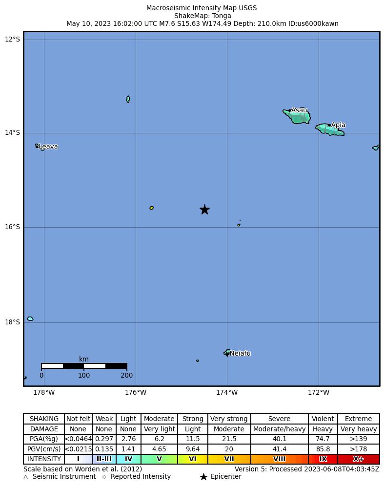
The USGS ShakeMap: shaking estimated from seismic stations and the quake’s size, on the Modified Mercalli intensity scale.
- Strongest estimated
- VI, strong shaking
- Peak ground acceleration
- 9.9% of gravity
- Peak ground velocity
- 5.9 cm/s
- Map
- Automatic
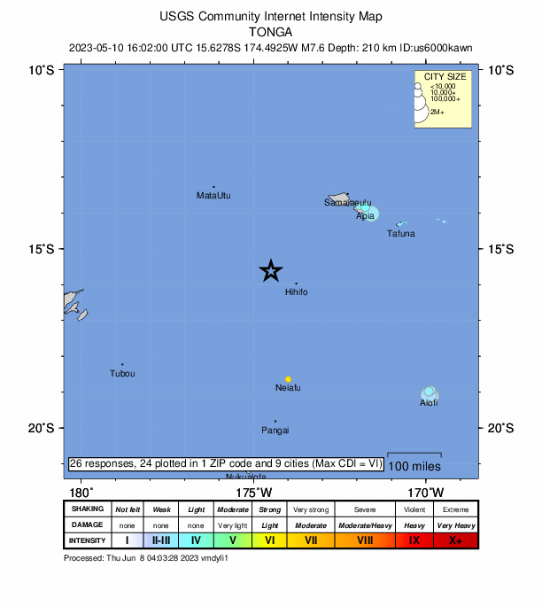
Did you feel it?
26 people reported to the USGS what they felt; the strongest reported shaking was VIII, severe shaking.
Estimated impact
The USGS PAGER system estimates deaths and economic losses from the shaking and the population and buildings exposed to it.
- Alert level
- Green: little or no damage or loss of life expected
| Range | Chance |
|---|---|
| Under 1 | 65% |
| 1 to 10 | 30% |
| 10 to 100 | 4% |
| 100 to 1,000 | Under 1% |
| 1,000 to 10,000 | Under 1% |
| 10,000 to 100,000 | Under 1% |
| 100,000 to 10,000,000 | Under 1% |
| Range, million USD | Chance |
|---|---|
| Under 1 | 65% |
| 1 to 10 | 30% |
| 10 to 100 | 4% |
| 100 to 1,000 | Under 1% |
| 1,000 to 10,000 | Under 1% |
| 10,000 to 100,000 | Under 1% |
| 100,000 to 10,000,000 | Under 1% |
Fault motion and ground failure
How the rock slipped, from the moment tensor, and the USGS estimate of landslides and liquefaction.
- Faulting
- Normal
- Moment magnitude
- 7.6 Mww
- Nodal plane 1
- Strike 246°, dip 43°, rake -62°
- Nodal plane 2
- Strike 29°, dip 53°, rake -114°
- Landslide alert
- Green
- Liquefaction alert
- Green
Tectonic setting
Why earthquakes happen here, from the USGS tectonic summary.
The May 10, 2023, M 7.6 Tonga earthquake occurred as the result of normal faulting at deep depths near the Tonga-Kermadec subduction zone. Focal mechanism solutions for the event indicate rupture occurred on either a moderately-dipping fault striking to the northeast, or a moderately-dipping fault striking southwest. From the location of the event, we infer that the event likely occurred within the subducted Pacific plate. At the location of the earthquake, the Pacific Plate and Australia Plate are converging at a velocity of 73 mm/yr.
While commonly plotted as points on maps, earthquakes of this size are more appropriately described as slip over a larger fault area. Normal faulting events of the size of the May 10, 2023, earthquake are typically 75 km by 30 km (length x width).
Earthquakes like this event, with focal depths between 70 and 300 km, are commonly termed “intermediate-depth” earthquakes. Intermediate-depth earthquakes represent deformation within subducted slabs rather than at the shallow plate interface between subducting and overriding tectonic plates. They typically cause less damage on the ground surface above their foci than is the case with similar-magnitude shallow-focus earthquakes, but large intermediate-depth earthquakes may be felt at great distance from their epicenters.
The May 10, 2023, earthquake occurred in a seismically active region where five other earthquakes larger than magnitude 7 have occurred within 250 km in the previous 50 years. The largest event in the region was the 2009 M 8.1 earthquake, which occurred about 270 km to the east.
More information about the tectonics of the Tonga-Kermadec subduction zone is available on this story map.
From the USGS event page for us6000kawn. U.S. Geological Survey text and figures are in the public domain.
How well it is located
Reviewed by a seismologist.
- Location uncertainty
- About 7.4 km horizontally, 1.8 km in depth
- Magnitude uncertainty
- ±0.06
- Depth from
- From modeling of broad-band P waveforms
- Station coverage gap
- 15°
- Stations used
- 380
Nearest places
Distance and direction from each place to the epicenter, with its forecast.
Nearby
Within 100 km, magnitude 4.6 and up: 6 in the 60 days after this one and 1 in the 30 days before it.
After
- 4.848 km WNW of Hihifo, Tonga · 1241 days ago · 175 km deep · 35 km away
- 4.780 km WNW of Hihifo, Tonga · 1241 days ago · 166 km deep · 4 km away
- 5.074 km WNW of Hihifo, Tonga · 1241 days ago · 199 km deep · 11 km away
- 4.798 km WNW of Hihifo, Tonga · 1241 days ago · 223 km deep · 15 km away
- 4.694 km WNW of Hihifo, Tonga · 1241 days ago · 212 km deep · 12 km away
- 4.8103 km NNW of Hihifo, Tonga · 1194 days ago · 171 km deep · 57 km away
Before
Earthquakes todayTonga earthquakesLive radar here
Sources
From the USGS Earthquake Hazards Program and its partner networks, event us6000kawn (also filed as pt23130000, at00rug9vc, usauto6000kawn). Read Fri, Oct 2, 2026, 10:34 PM UTC.