M5.0 earthquake 46 km SSW of Adak, Alaska
A magnitude 5.0 earthquake struck 46 km SSW of Adak, Alaska on Thu, Nov 30, 2023, 6:33 AM HAST (16:33 UTC), 48 km (30 mi) below the surface.
Map
Where this earthquake was located, with the others nearby. Select one for its page.
The earthquake
- Magnitude
- 5.0 (Mwr, regional moment), moderate
- Magnitude from
- USGS National Earthquake Information Center
- Local time
- UTC
- 2023-11-30 16:33:06 UTC
- Depth
- 48.4 km (30.1 mi), shallow
- Epicenter
- 51.477° N, 176.827° W
- Region
- Alaska
- Felt reports
- 1
- Strongest shaking
- III, weak shaking
- Tsunami flag
- No
- Status
- Reviewed by a seismologist
Magnitude estimates
Different scales measure different things and differ by a few tenths. The USGS marks one as preferred, and it is the one this page uses.
| Mag. | Scale | Computed by | Notes |
|---|---|---|---|
| 5.0 | Mwr, regional moment | USGS National Earthquake Information Center | Preferred · Reviewed · ±0.078 · 16 stations |
| 5.0 | Mwr, regional moment | Alaska Earthquake Center | Preliminary |
Shaking
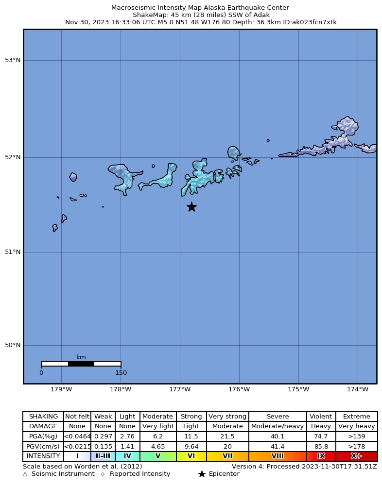
The USGS ShakeMap: shaking estimated from seismic stations and the quake’s size, on the Modified Mercalli intensity scale.
- Strongest estimated
- III, weak shaking
- Peak ground acceleration
- 1.6% of gravity
- Peak ground velocity
- -0.3 cm/s
- Map
- Automatic
Did you feel it?
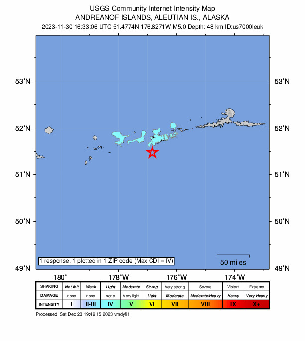
1 person reported to the USGS what they felt; the strongest reported shaking was IV, light shaking.
Fault motion and ground failure
How the rock slipped, from the moment tensor, and the USGS estimate of landslides and liquefaction.
- Faulting
- Reverse (thrust)
- Moment magnitude
- 5.0 Mwr
- Nodal plane 1
- Strike 64°, dip 67°, rake 80°
- Nodal plane 2
- Strike 268°, dip 25°, rake 112°
How well it is located
Reviewed by a seismologist.
- Location uncertainty
- About 4.0 km horizontally, 4.1 km in depth
- Magnitude uncertainty
- ±0.08
- Depth from
- From location
- Station coverage gap
- 56°
- Stations used
- 226
Nearby
Within 100 km, magnitude 2.0 and up: 91 in the 60 days after this one and 58 in the 30 days before it.
After
- 4.149 km SSW of Adak, Alaska · 1036 days ago · 34 km deep · 6 km away
- 2.955 km S of Adak, Alaska · 1036 days ago · 35 km deep · 12 km away
- 3.450 km S of Adak, Alaska · 1035 days ago · 35 km deep · 8 km away
- 2.577 km SSW of Adak, Alaska · 1035 days ago · 35 km deep · 32 km away
- 3.748 km SSW of Adak, Alaska · 1035 days ago · 41 km deep · 4 km away
- 3.843 km SSW of Adak, Alaska · 1034 days ago · 43 km deep · 4 km away
- 2.155 km ESE of Adak, Alaska · 1033 days ago · 52 km deep · 69 km away
- 2.221 km NE of Adak, Alaska · 1033 days ago · 110 km deep · 67 km away
- 3.146 km WSW of Adak, Alaska · 1033 days ago · 77 km deep · 42 km away
- 3.049 km SSW of Adak, Alaska · 1033 days ago · 37 km deep · 5 km away
- 2.075 km SE of Adak, Alaska · 1032 days ago · 23 km deep · 76 km away
- 3.174 km E of Adak, Alaska · 1032 days ago · 78 km deep · 97 km away
- 2.064 km SE of Adak, Alaska · 1032 days ago · 26 km deep · 61 km away
- 2.065 km E of Adak, Alaska · 1031 days ago · 13 km deep · 87 km away
- 2.9129 km SW of Adak, Alaska · 1031 days ago · 35 km deep · 97 km away
- 2.745 km SSW of Adak, Alaska · 1030 days ago · 55 km deep · 3 km away
- 3.674 km S of Adak, Alaska · 1030 days ago · 35 km deep · 31 km away
- 2.052 km SSE of Adak, Alaska · 1030 days ago · 25 km deep · 42 km away
- 2.657 km ENE of Adak, Alaska · 1028 days ago · 147 km deep · 95 km away
- 2.954 km S of Adak, Alaska · 1027 days ago · 35 km deep · 12 km away
- 2.045 km SW of Adak, Alaska · 1027 days ago · 69 km deep · 30 km away
- 3.941 km SSW of Adak, Alaska · 1027 days ago · 46 km deep · 5 km away
- 2.855 km S of Adak, Alaska · 1026 days ago · 35 km deep · 11 km away
- 2.061 km SSW of Adak, Alaska · 1026 days ago · 35 km deep · 18 km away
- 2.046 km E of Adak, Alaska · 1026 days ago · 71 km deep · 77 km away
- 2.059 km S of Adak, Alaska · 1025 days ago · 13 km deep · 23 km away
- 2.183 km S of Adak, Alaska · 1025 days ago · 0 km deep · 45 km away
- 3.882 km SSW of Adak, Alaska · 1025 days ago · 35 km deep · 38 km away
- 2.035 km SSE of Adak, Alaska · 1025 days ago · 35 km deep · 34 km away
- 2.417 km NNW of Adak, Alaska · 1024 days ago · 197 km deep · 61 km away
- 2.542 km SW of Adak, Alaska · 1024 days ago · 37 km deep · 20 km away
- 2.049 km SSE of Adak, Alaska · 1023 days ago · 41 km deep · 27 km away
- 2.546 km SSE of Adak, Alaska · 1023 days ago · 35 km deep · 24 km away
- 2.6136 km SW of Adak, Alaska · 1022 days ago · 10 km deep · 96 km away
- 2.630 km S of Adak, Alaska · 1021 days ago · 67 km deep · 17 km away
- 2.0114 km SW of Adak, Alaska · 1020 days ago · 25 km deep · 82 km away
- 2.290 km SW of Adak, Alaska · 1020 days ago · 39 km deep · 57 km away
- 2.1118 km WSW of Adak, Alaska · 1019 days ago · 26 km deep · 97 km away
- 2.670 km SSW of Adak, Alaska · 1019 days ago · 35 km deep · 25 km away
- 2.897 km WSW of Adak, Alaska · 1019 days ago · 35 km deep · 75 km away
- 3.010 km WSW of Adak, Alaska · 1019 days ago · 86 km deep · 41 km away
- 2.155 km SSW of Adak, Alaska · 1018 days ago · 23 km deep · 9 km away
- 2.166 km SSE of Adak, Alaska · 1018 days ago · 19 km deep · 36 km away
- 2.1122 km WSW of Adak, Alaska · 1018 days ago · 26 km deep · 99 km away
- 2.577 km SSW of Adak, Alaska · 1017 days ago · 35 km deep · 32 km away
- 2.935 km W of Adak, Alaska · 1017 days ago · 5 km deep · 52 km away
- 4.7134 km SW of Adak, Alaska · 1016 days ago · 24 km deep · 98 km away
- 4.5125 km SW of Adak, Alaska · 1016 days ago · 46 km deep · 94 km away
- 2.084 km SW of Adak, Alaska · 1016 days ago · 13 km deep · 56 km away
- 2.262 km SE of Adak, Alaska · 1015 days ago · 22 km deep · 59 km away
- 2.8121 km WSW of Adak, Alaska · 1014 days ago · 35 km deep · 96 km away
- 4.1105 km SE of Adak, Alaska · 1014 days ago · 38 km deep · 99 km away
- 3.024 km E of Adak, Alaska · 1014 days ago · 77 km deep · 55 km away
- 2.749 km SW of Adak, Alaska · 1013 days ago · 68 km deep · 16 km away
- 3.842 km SSW of Adak, Alaska · 1013 days ago · 46 km deep · 4 km away
- 2.8121 km WSW of Adak, Alaska · 1013 days ago · 35 km deep · 97 km away
- 2.251 km W of Adak, Alaska · 1013 days ago · 79 km deep · 56 km away
- 2.294 km S of Adak, Alaska · 1013 days ago · 16 km deep · 52 km away
- 2.278 km S of Adak, Alaska · 1013 days ago · 19 km deep · 38 km away
- 2.285 km WSW of Adak, Alaska · 1013 days ago · 76 km deep · 68 km away
The first 60 of 91.
Before
- 2.964 km S of Adak, Alaska · 1036 days ago · 35 km deep · 20 km away
- 2.1120 km WSW of Adak, Alaska · 1037 days ago · 37 km deep · 94 km away
- 2.8128 km WSW of Adak, Alaska · 1037 days ago · 35 km deep · 99 km away
- 2.753 km SSE of Adak, Alaska · 1038 days ago · 36 km deep · 42 km away
- 2.978 km WSW of Adak, Alaska · 1038 days ago · 36 km deep · 53 km away
- 2.194 km SW of Adak, Alaska · 1039 days ago · 23 km deep · 58 km away
- 2.074 km WSW of Adak, Alaska · 1039 days ago · 39 km deep · 50 km away
- 2.643 km NW of Adak, Alaska · 1039 days ago · 134 km deep · 74 km away
- 2.770 km SSE of Adak, Alaska · 1039 days ago · 33 km deep · 38 km away
- 2.162 km SW of Adak, Alaska · 1040 days ago · 48 km deep · 23 km away
- 2.0121 km WSW of Adak, Alaska · 1041 days ago · 26 km deep · 93 km away
- 2.771 km SSW of Adak, Alaska · 1041 days ago · 35 km deep · 26 km away
- 3.1102 km SW of Adak, Alaska · 1043 days ago · 48 km deep · 69 km away
- 2.078 km WSW of Adak, Alaska · 1043 days ago · 36 km deep · 58 km away
- 2.469 km ESE of Adak, Alaska · 1044 days ago · 34 km deep · 76 km away
- 3.369 km E of Adak, Alaska · 1044 days ago · 30 km deep · 89 km away
- 2.157 km SE of Adak, Alaska · 1046 days ago · 28 km deep · 58 km away
- 2.872 km SE of Adak, Alaska · 1046 days ago · 35 km deep · 64 km away
- 2.0Andreanof Islands, Aleutian Islands, Alaska · 1048 days ago · 24 km deep · 30 km away
- 2.5114 km SW of Adak, Alaska · 1048 days ago · 35 km deep · 78 km away
Earthquakes todayAlaska earthquakesLive radar here
Sources
From the USGS Earthquake Hazards Program and its partner networks, event us7000leuk (also filed as ak023fcn7xtk). Read Thu, Oct 1, 2026, 10:44 AM UTC.