M3.7 earthquake 12 km ENE of Adak, Alaska
A magnitude 3.7 earthquake struck 12 km ENE of Adak, Alaska on Fri, Jun 30, 2023, 8:20 PM HADT (05:20 UTC), 116 km (72 mi) below the surface.
A larger quake followed: M4.1 86 km NE of Adak, Alaska. This one was a foreshock.
Map
Where this earthquake was located, with the others nearby. Select one for its page.
The earthquake
- Magnitude
- 3.7 (mb), minor
- Local time
- UTC
- 2023-07-01 05:20:40 UTC
- Depth
- 115.8 km (72.0 mi), intermediate-depth
- Epicenter
- 51.928° N, 176.473° W
- Region
- Alaska
- Felt reports
- 1
- Strongest shaking
- III, weak shaking
- Tsunami flag
- No
- Status
- Reviewed by a seismologist
Shaking
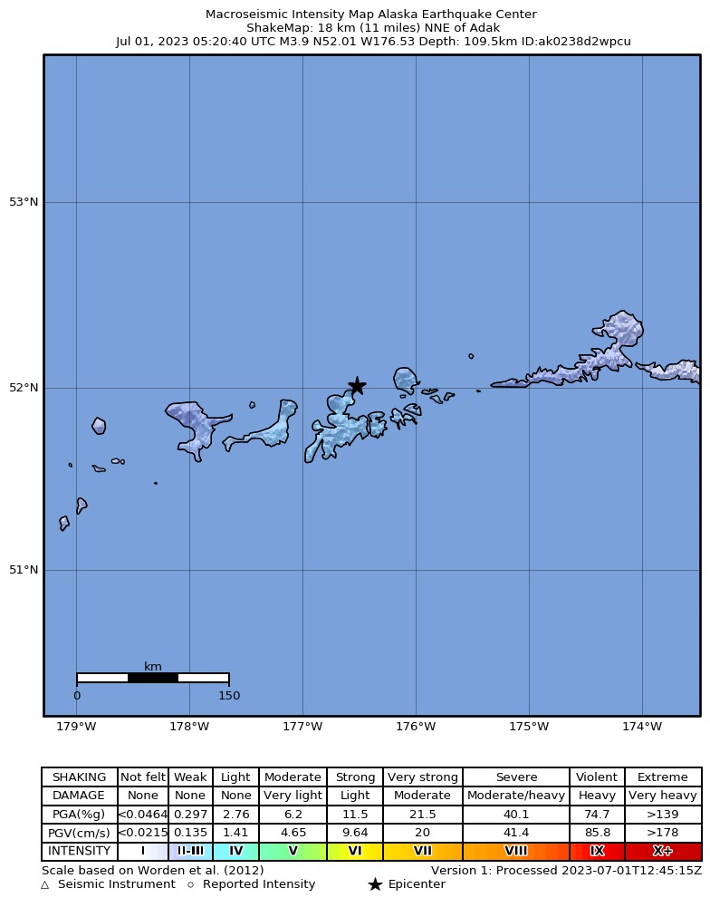
The USGS ShakeMap: shaking estimated from seismic stations and the quake’s size, on the Modified Mercalli intensity scale.
- Strongest estimated
- III, weak shaking
- Peak ground acceleration
- 0.2% of gravity
- Peak ground velocity
- -3.4 cm/s
- Map
- Automatic
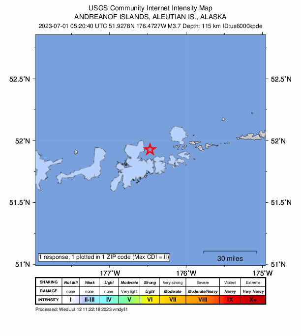
Did you feel it?
1 person reported to the USGS what they felt; the strongest reported shaking was II, weak shaking.
How well it is located
Reviewed by a seismologist.
- Location uncertainty
- About 8.1 km horizontally, 2.6 km in depth
- Magnitude uncertainty
- ±0.13
- Depth from
- From location
- Station coverage gap
- 103°
- Stations used
- 75
Nearby
Within 100 km, magnitude 1.5 and up: at least 200 in the 60 days after this one and 120 in the 30 days before it.
After
- 1.977 km SE of Adak, Alaska · 1187 days ago · 13 km deep · 73 km away
- 1.643 km SSE of Adak, Alaska · 1187 days ago · 27 km deep · 47 km away
- 2.9Andreanof Islands, Aleutian Islands, Alaska · 1186 days ago · 35 km deep · 64 km away
- 1.856 km SSE of Adak, Alaska · 1186 days ago · 24 km deep · 59 km away
- 1.545 km SSW of Adak, Alaska · 1186 days ago · 42 km deep · 56 km away
- 1.561 km S of Adak, Alaska · 1186 days ago · 13 km deep · 67 km away
- 2.973 km W of Adak, Alaska · 1185 days ago · 106 km deep · 85 km away
- 2.757 km SSW of Adak, Alaska · 1185 days ago · 35 km deep · 69 km away
- 2.252 km ENE of Adak, Alaska · 1185 days ago · 161 km deep · 40 km away
- 2.090 km SW of Atka, Alaska · 1185 days ago · 13 km deep · 99 km away
- 2.582 km SW of Adak, Alaska · 1185 days ago · 35 km deep · 95 km away
- 1.951 km SW of Adak, Alaska · 1185 days ago · 56 km deep · 63 km away
- 1.736 km SSE of Adak, Alaska · 1184 days ago · 57 km deep · 40 km away
- 2.036 km ESE of Adak, Alaska · 1184 days ago · 75 km deep · 28 km away
- 2.288 km SW of Adak, Alaska · 1183 days ago · 26 km deep · 100 km away
- 3.535 km E of Adak, Alaska · 1183 days ago · 72 km deep · 26 km away
- 1.949 km S of Adak, Alaska · 1182 days ago · 24 km deep · 55 km away
- 1.658 km SE of Adak, Alaska · 1182 days ago · 24 km deep · 59 km away
- 1.770 km SSW of Adak, Alaska · 1182 days ago · 46 km deep · 81 km away
- 3.152 km S of Adak, Alaska · 1182 days ago · 35 km deep · 59 km away
- 1.943 km ENE of Adak, Alaska · 1182 days ago · 124 km deep · 31 km away
- 1.658 km SE of Adak, Alaska · 1182 days ago · 23 km deep · 57 km away
- 1.768 km SW of Adak, Alaska · 1182 days ago · 25 km deep · 81 km away
- 1.765 km SSE of Adak, Alaska · 1181 days ago · 5 km deep · 70 km away
- 2.763 km SSE of Adak, Alaska · 1181 days ago · 35 km deep · 67 km away
- 1.961 km SE of Adak, Alaska · 1181 days ago · 24 km deep · 61 km away
- 1.959 km SE of Adak, Alaska · 1181 days ago · 22 km deep · 59 km away
- 1.6Andreanof Islands, Aleutian Islands, Alaska · 1180 days ago · 24 km deep · 55 km away
- 1.784 km WSW of Atka, Alaska · 1180 days ago · 60 km deep · 82 km away
- 2.222 km SE of Adak, Alaska · 1180 days ago · 94 km deep · 20 km away
- 3.824 km SE of Adak, Alaska · 1180 days ago · 55 km deep · 26 km away
- 1.858 km SE of Adak, Alaska · 1179 days ago · 42 km deep · 58 km away
- 3.456 km SW of Adak, Alaska · 1179 days ago · 45 km deep · 68 km away
- 1.759 km SSE of Adak, Alaska · 1179 days ago · 23 km deep · 60 km away
- 1.567 km SSE of Adak, Alaska · 1179 days ago · 22 km deep · 72 km away
- 2.064 km SW of Adak, Alaska · 1179 days ago · 20 km deep · 76 km away
- 2.6Andreanof Islands, Aleutian Islands, Alaska · 1178 days ago · 33 km deep · 60 km away
- 1.955 km ESE of Adak, Alaska · 1178 days ago · 61 km deep · 47 km away
- 1.861 km SSW of Adak, Alaska · 1178 days ago · 45 km deep · 73 km away
- 2.051 km S of Adak, Alaska · 1178 days ago · 26 km deep · 58 km away
- 1.873 km WSW of Adak, Alaska · 1178 days ago · 24 km deep · 86 km away
- 1.983 km ENE of Adak, Alaska · 1178 days ago · 116 km deep · 71 km away
- 2.9100 km ESE of Adak, Alaska · 1178 days ago · 35 km deep · 93 km away
- 1.770 km SSE of Adak, Alaska · 1178 days ago · 26 km deep · 75 km away
- 3.530 km SSW of Adak, Alaska · 1178 days ago · 54 km deep · 40 km away
- 2.071 km SSE of Adak, Alaska · 1177 days ago · 20 km deep · 75 km away
- 1.673 km SSE of Adak, Alaska · 1177 days ago · 20 km deep · 75 km away
- 1.6Andreanof Islands, Aleutian Islands, Alaska · 1177 days ago · 21 km deep · 75 km away
- 1.573 km SSE of Adak, Alaska · 1177 days ago · 18 km deep · 77 km away
- 1.916 km NNW of Adak, Alaska · 1177 days ago · 173 km deep · 19 km away
- 3.283 km NE of Adak, Alaska · 1176 days ago · 222 km deep · 71 km away
- 1.547 km SW of Adak, Alaska · 1176 days ago · 42 km deep · 59 km away
- 3.164 km SE of Adak, Alaska · 1176 days ago · 36 km deep · 62 km away
- 3.598 km ESE of Adak, Alaska · 1176 days ago · 42 km deep · 92 km away
- 2.294 km SE of Adak, Alaska · 1176 days ago · 15 km deep · 90 km away
- 2.1Andreanof Islands, Aleutian Islands, Alaska · 1176 days ago · 21 km deep · 87 km away
- 1.9100 km ESE of Adak, Alaska · 1176 days ago · 25 km deep · 94 km away
- 3.270 km SE of Adak, Alaska · 1176 days ago · 35 km deep · 66 km away
- 1.784 km WSW of Adak, Alaska · 1176 days ago · 25 km deep · 97 km away
- 1.779 km SW of Adak, Alaska · 1175 days ago · 44 km deep · 92 km away
The first 60 of at least 200.
Before
- 3.261 km SSW of Adak, Alaska · 1188 days ago · 35 km deep · 72 km away
- 1.7Andreanof Islands, Aleutian Islands, Alaska · 1188 days ago · 43 km deep · 79 km away
- 1.965 km SW of Adak, Alaska · 1188 days ago · 62 km deep · 78 km away
- 3.353 km S of Adak, Alaska · 1188 days ago · 35 km deep · 62 km away
- 2.523 km S of Adak, Alaska · 1189 days ago · 71 km deep · 30 km away
- 1.774 km SW of Adak, Alaska · 1189 days ago · 29 km deep · 86 km away
- 1.964 km WSW of Adak, Alaska · 1189 days ago · 66 km deep · 77 km away
- 1.556 km SSW of Adak, Alaska · 1189 days ago · 26 km deep · 67 km away
- 1.559 km SSE of Adak, Alaska · 1189 days ago · 13 km deep · 60 km away
- 1.533 km SSE of Adak, Alaska · 1189 days ago · 47 km deep · 35 km away
- 3.078 km NNE of Adak, Alaska · 1189 days ago · 219 km deep · 67 km away
- 1.924 km SSW of Adak, Alaska · 1189 days ago · 71 km deep · 36 km away
- 1.750 km WSW of Adak, Alaska · 1189 days ago · 93 km deep · 63 km away
- 2.845 km SSW of Adak, Alaska · 1189 days ago · 35 km deep · 54 km away
- 3.242 km SSE of Adak, Alaska · 1190 days ago · 33 km deep · 45 km away
- 1.6Andreanof Islands, Aleutian Islands, Alaska · 1190 days ago · 8 km deep · 93 km away
- 1.941 km SSW of Adak, Alaska · 1190 days ago · 59 km deep · 52 km away
- 2.146 km SSW of Adak, Alaska · 1190 days ago · 37 km deep · 56 km away
- 1.988 km W of Adak, Alaska · 1191 days ago · 6 km deep · 99 km away
- 1.635 km SSE of Adak, Alaska · 1191 days ago · 39 km deep · 37 km away
Earthquakes todayAlaska earthquakesLive radar here
Sources
From the USGS Earthquake Hazards Program and its partner networks, event us6000kpde (also filed as ak0238d2wpcu). Read Wed, Sep 30, 2026, 3:29 PM UTC.