M3.8 earthquake 117 km S of False Pass, Alaska
A magnitude 3.8 earthquake struck 117 km S of False Pass, Alaska on Fri, Jul 1, 2022, 7:23 PM AKDT (03:23 UTC), 37 km (23 mi) below the surface.
Map
Where this earthquake was located, with the others nearby. Select one for its page.
The earthquake
- Magnitude
- 3.8 (mb), minor
- Local time
- UTC
- 2022-07-02 03:23:26 UTC
- Depth
- 37.1 km (23.1 mi), shallow
- Epicenter
- 53.813° N, 163.102° W
- Region
- Alaska
- Strongest shaking
- I, not felt shaking
- Tsunami flag
- No
- Status
- Reviewed by a seismologist
Shaking
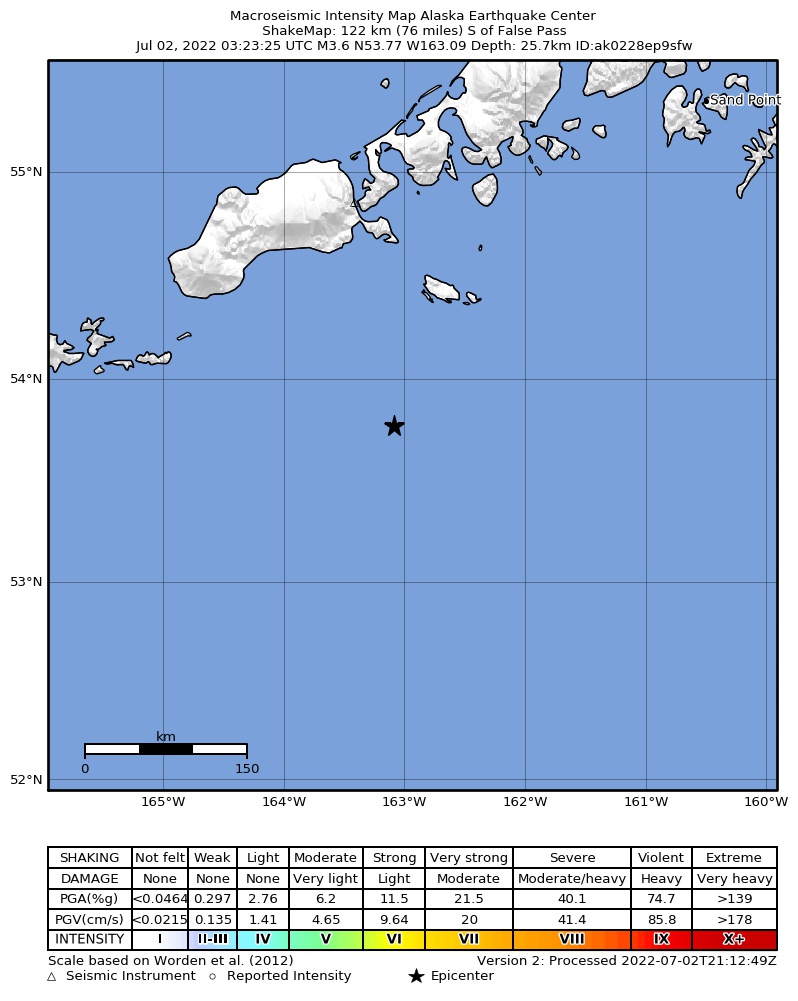
The USGS ShakeMap: shaking estimated from seismic stations and the quake’s size, on the Modified Mercalli intensity scale.
- Strongest estimated
- I, not felt shaking
- Peak ground acceleration
- 0.0% of gravity
- Peak ground velocity
- -4.5 cm/s
- Map
- Automatic
Did you feel it?
No one has reported feeling this quake to the USGS.
How well it is located
Reviewed by a seismologist.
- Location uncertainty
- About 4.2 km horizontally, 8.7 km in depth
- Magnitude uncertainty
- ±0.11
- Depth from
- From location
- Station coverage gap
- 160°
- Stations used
- 58
Nearest places
Distance and direction from each place to the epicenter, with its forecast.
Nearby
Within 100 km, magnitude 1.5 and up: 137 in the 60 days after this one and 86 in the 30 days before it.
After
- 1.837 km SSE of False Pass, Alaska · 1547 days ago · 5 km deep · 80 km away
- 1.630 km S of False Pass, Alaska · 1547 days ago · 11 km deep · 87 km away
- 1.690 km ESE of Akutan, Alaska · 1547 days ago · 41 km deep · 88 km away
- 1.798 km E of Akutan, Alaska · 1546 days ago · 29 km deep · 81 km away
- 1.7104 km ESE of Akutan, Alaska · 1545 days ago · 18 km deep · 75 km away
- 1.7118 km ESE of Akutan, Alaska · 1544 days ago · 57 km deep · 77 km away
- 1.999 km S of False Pass, Alaska · 1544 days ago · 25 km deep · 37 km away
- 1.593 km SSW of False Pass, Alaska · 1544 days ago · 28 km deep · 77 km away
- 1.8120 km S of False Pass, Alaska · 1544 days ago · 45 km deep · 26 km away
- 1.8106 km S of False Pass, Alaska · 1543 days ago · 26 km deep · 37 km away
- 1.786 km SE of False Pass, Alaska · 1542 days ago · 9 km deep · 66 km away
- 3.3138 km SE of Akutan, Alaska · 1542 days ago · 10 km deep · 89 km away
- 1.636 km SSW of False Pass, Alaska · 1541 days ago · 13 km deep · 90 km away
- 2.5159 km ESE of Akutan, Alaska · 1541 days ago · 22 km deep · 62 km away
- 1.633 km SSW of False Pass, Alaska · 1541 days ago · 13 km deep · 93 km away
- 1.8101 km ESE of Akutan, Alaska · 1541 days ago · 62 km deep · 78 km away
- 1.8105 km ESE of Akutan, Alaska · 1540 days ago · 26 km deep · 78 km away
- 2.698 km S of False Pass, Alaska · 1540 days ago · 35 km deep · 37 km away
- 1.526 km SSW of False Pass, Alaska · 1539 days ago · 15 km deep · 95 km away
- 1.629 km SSE of False Pass, Alaska · 1538 days ago · 13 km deep · 88 km away
- 1.699 km SSW of False Pass, Alaska · 1538 days ago · 26 km deep · 81 km away
- 2.0171 km S of False Pass, Alaska · 1538 days ago · 2 km deep · 62 km away
- 2.099 km S of False Pass, Alaska · 1538 days ago · 35 km deep · 40 km away
- 1.991 km E of Akutan, Alaska · 1538 days ago · 56 km deep · 88 km away
- 1.737 km S of False Pass, Alaska · 1537 days ago · 17 km deep · 80 km away
- 1.820 km SSE of False Pass, Alaska · 1537 days ago · 18 km deep · 97 km away
- 1.898 km SSW of False Pass, Alaska · 1537 days ago · 37 km deep · 83 km away
- 1.730 km SSE of False Pass, Alaska · 1537 days ago · 13 km deep · 87 km away
- 1.986 km S of King Cove, Alaska · 1537 days ago · 19 km deep · 84 km away
- 1.827 km S of False Pass, Alaska · 1537 days ago · 16 km deep · 90 km away
- 1.8107 km SE of Akutan, Alaska · 1535 days ago · 7 km deep · 93 km away
- 2.9111 km ESE of Akutan, Alaska · 1535 days ago · 35 km deep · 71 km away
- 1.8101 km ESE of Akutan, Alaska · 1535 days ago · 49 km deep · 80 km away
- 1.829 km SSE of False Pass, Alaska · 1535 days ago · 13 km deep · 88 km away
- 2.1173 km S of King Cove, Alaska · 1534 days ago · 21 km deep · 87 km away
- 2.987 km SE of False Pass, Alaska · 1534 days ago · 45 km deep · 59 km away
- 1.531 km SSE of False Pass, Alaska · 1534 days ago · 15 km deep · 86 km away
- 1.934 km S of False Pass, Alaska · 1534 days ago · 13 km deep · 86 km away
- 3.093 km SSE of False Pass, Alaska · 1533 days ago · 10 km deep · 35 km away
- 2.991 km SSE of False Pass, Alaska · 1533 days ago · 35 km deep · 34 km away
- 2.1156 km ESE of Akutan, Alaska · 1533 days ago · 12 km deep · 56 km away
- 1.9121 km SSW of False Pass, Alaska · 1533 days ago · 16 km deep · 52 km away
- 2.8165 km SE of Akutan, Alaska · 1533 days ago · 35 km deep · 84 km away
- 1.829 km SSE of False Pass, Alaska · 1532 days ago · 20 km deep · 88 km away
- 2.9Unimak Island region, Alaska · 1532 days ago · 53 km deep · 57 km away
- 2.1112 km S of False Pass, Alaska · 1531 days ago · 26 km deep · 5 km away
- 1.728 km SSE of False Pass, Alaska · 1530 days ago · 11 km deep · 89 km away
- 1.899 km E of Akutan, Alaska · 1530 days ago · 29 km deep · 80 km away
- 1.892 km S of False Pass, Alaska · 1530 days ago · 40 km deep · 42 km away
- 1.899 km SSE of False Pass, Alaska · 1529 days ago · 26 km deep · 35 km away
- 1.783 km ESE of Akutan, Alaska · 1529 days ago · 26 km deep · 98 km away
- 1.631 km SSE of False Pass, Alaska · 1529 days ago · 13 km deep · 87 km away
- 2.580 km SSE of False Pass, Alaska · 1528 days ago · 23 km deep · 47 km away
- 2.184 km SSE of False Pass, Alaska · 1528 days ago · 19 km deep · 43 km away
- 1.9Alaska Peninsula · 1528 days ago · 26 km deep · 43 km away
- 1.9Unimak Island region, Alaska · 1528 days ago · 26 km deep · 38 km away
- 1.8Unimak Island region, Alaska · 1528 days ago · 12 km deep · 88 km away
- 1.947 km SE of False Pass, Alaska · 1528 days ago · 58 km deep · 81 km away
- 2.486 km SSE of False Pass, Alaska · 1527 days ago · 35 km deep · 42 km away
- 1.986 km SSE of False Pass, Alaska · 1527 days ago · 26 km deep · 40 km away
The first 60 of 137.
Before
- 1.976 km S of King Cove, Alaska · 1548 days ago · 9 km deep · 75 km away
- 2.540 km SSE of False Pass, Alaska · 1548 days ago · 13 km deep · 77 km away
- 2.651 km SE of False Pass, Alaska · 1549 days ago · 61 km deep · 78 km away
- 1.730 km SSE of False Pass, Alaska · 1549 days ago · 13 km deep · 88 km away
- 2.543 km SSE of False Pass, Alaska · 1549 days ago · 10 km deep · 75 km away
- 1.831 km SSE of False Pass, Alaska · 1549 days ago · 13 km deep · 86 km away
- 2.734 km S of False Pass, Alaska · 1550 days ago · 12 km deep · 83 km away
- 1.995 km ESE of Akutan, Alaska · 1550 days ago · 61 km deep · 84 km away
- 2.638 km SSE of False Pass, Alaska · 1550 days ago · 18 km deep · 80 km away
- 1.932 km SSE of False Pass, Alaska · 1550 days ago · 11 km deep · 85 km away
- 1.9105 km S of False Pass, Alaska · 1551 days ago · 26 km deep · 37 km away
- 1.629 km SSE of False Pass, Alaska · 1551 days ago · 9 km deep · 88 km away
- 3.489 km S of False Pass, Alaska · 1552 days ago · 45 km deep · 42 km away
- 1.997 km S of False Pass, Alaska · 1553 days ago · 19 km deep · 21 km away
- 2.0Unimak Island region, Alaska · 1553 days ago · 23 km deep · 97 km away
- 1.9Unimak Island region, Alaska · 1553 days ago · 23 km deep · 91 km away
- 1.829 km SSE of False Pass, Alaska · 1553 days ago · 13 km deep · 88 km away
- 3.091 km SE of False Pass, Alaska · 1554 days ago · 35 km deep · 56 km away
- 2.527 km S of False Pass, Alaska · 1554 days ago · 24 km deep · 90 km away
- 2.2104 km ESE of Akutan, Alaska · 1554 days ago · 60 km deep · 79 km away
Earthquakes todayAlaska earthquakesLive radar here
Sources
From the USGS Earthquake Hazards Program and its partner networks, event us6000hzba (also filed as ak0228ep9sfw). Read Sat, Sep 26, 2026, 4:34 PM UTC.