M4.2 earthquake 27 km N of Atka, Alaska
A magnitude 4.2 earthquake struck 27 km N of Atka, Alaska on Thu, Dec 15, 2022, 5:09 PM HAST (03:09 UTC), 157 km (97 mi) below the surface.
Map
Where this earthquake was located, with the others nearby. Select one for its page.
The earthquake
- Magnitude
- 4.2 (mb, body-wave), light
- Magnitude from
- USGS National Earthquake Information Center
- Local time
- UTC
- 2022-12-16 03:09:52 UTC
- Depth
- 156.7 km (97.4 mi), intermediate-depth
- Epicenter
- 52.443° N, 174.239° W
- Region
- Alaska
- Strongest shaking
- III, weak shaking
- Tsunami flag
- No
- Status
- Reviewed by a seismologist
Magnitude estimates
Different scales measure different things and differ by a few tenths. The USGS marks one as preferred, and it is the one this page uses.
| Mag. | Scale | Computed by | Notes |
|---|---|---|---|
| 4.2 | mb, body-wave | USGS National Earthquake Information Center | Preferred · Reviewed · ±0.06 · 77 stations |
| 4.2 | mb, body-wave | Alaska Earthquake Center | Preliminary |
Shaking
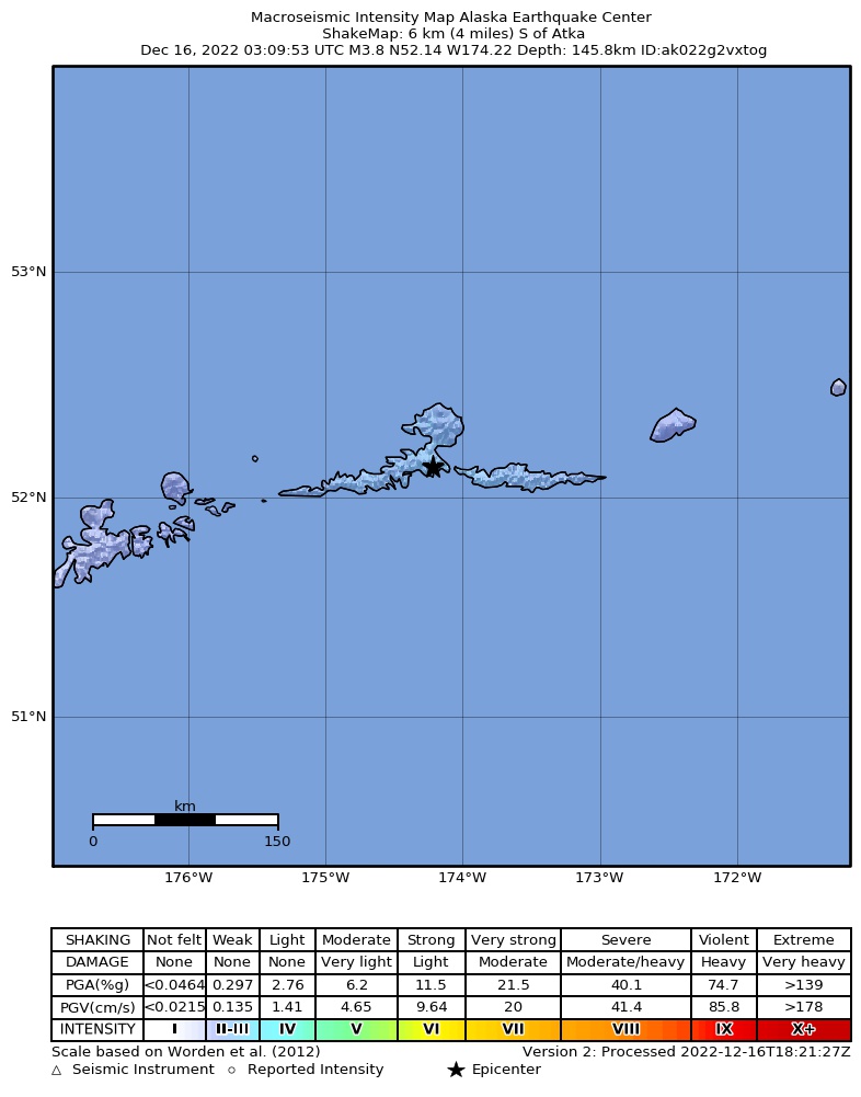
The USGS ShakeMap: shaking estimated from seismic stations and the quake’s size, on the Modified Mercalli intensity scale.
- Strongest estimated
- III, weak shaking
- Peak ground acceleration
- 0.1% of gravity
- Peak ground velocity
- -4.2 cm/s
- Map
- Automatic
Did you feel it?
No one has reported feeling this quake to the USGS.
How well it is located
Reviewed by a seismologist.
- Location uncertainty
- About 11.2 km horizontally, 4.6 km in depth
- Magnitude uncertainty
- ±0.06
- Depth from
- From location
- Station coverage gap
- 71°
- Stations used
- 54
Nearby
Within 100 km, magnitude 1.5 and up: 39 in the 60 days after this one and 24 in the 30 days before it.
After
- 3.768 km NNE of Atka, Alaska · 1384 days ago · 182 km deep · 44 km away
- 2.242 km S of Atka, Alaska · 1382 days ago · 40 km deep · 69 km away
- 2.652 km SSW of Atka, Alaska · 1381 days ago · 35 km deep · 79 km away
- 2.231 km SSW of Atka, Alaska · 1379 days ago · 33 km deep · 58 km away
- 3.073 km WNW of Atka, Alaska · 1379 days ago · 133 km deep · 66 km away
- 3.170 km SE of Atka, Alaska · 1378 days ago · 35 km deep · 94 km away
- 3.177 km SE of Atka, Alaska · 1378 days ago · 35 km deep · 99 km away
- 3.251 km S of Atka, Alaska · 1377 days ago · 35 km deep · 79 km away
- 2.965 km NE of Atka, Alaska · 1377 days ago · 92 km deep · 57 km away
- 3.4108 km NE of Atka, Alaska · 1376 days ago · 207 km deep · 92 km away
- 3.662 km E of Atka, Alaska · 1372 days ago · 90 km deep · 66 km away
- 2.062 km WSW of Atka, Alaska · 1370 days ago · 13 km deep · 72 km away
- 2.971 km SSW of Atka, Alaska · 1370 days ago · 35 km deep · 95 km away
- 2.086 km E of Adak, Alaska · 1368 days ago · 77 km deep · 97 km away
- 2.677 km WSW of Atka, Alaska · 1368 days ago · 66 km deep · 91 km away
- 2.974 km SSW of Atka, Alaska · 1367 days ago · 35 km deep · 99 km away
- 3.115 km NW of Atka, Alaska · 1365 days ago · 141 km deep · 19 km away
- 3.378 km ESE of Atka, Alaska · 1364 days ago · 66 km deep · 93 km away
- 3.172 km WSW of Atka, Alaska · 1362 days ago · 105 km deep · 84 km away
- 3.438 km NW of Atka, Alaska · 1357 days ago · 202 km deep · 23 km away
- 3.247 km WSW of Atka, Alaska · 1357 days ago · 101 km deep · 63 km away
- 3.130 km S of Atka, Alaska · 1356 days ago · 84 km deep · 57 km away
- 2.972 km SSW of Atka, Alaska · 1355 days ago · 20 km deep · 96 km away
- 3.851 km E of Atka, Alaska · 1354 days ago · 89 km deep · 57 km away
- 2.158 km SW of Atka, Alaska · 1351 days ago · 52 km deep · 79 km away
- 3.433 km S of Atka, Alaska · 1350 days ago · 10 km deep · 60 km away
- 3.211 km NW of Atka, Alaska · 1346 days ago · 143 km deep · 21 km away
- 2.017 km S of Atka, Alaska · 1342 days ago · 24 km deep · 45 km away
- 2.456 km SSE of Atka, Alaska · 1341 days ago · 22 km deep · 83 km away
- 3.141 km NE of Atka, Alaska · 1340 days ago · 127 km deep · 30 km away
- 2.056 km WSW of Atka, Alaska · 1334 days ago · 68 km deep · 73 km away
- 1.879 km SW of Atka, Alaska · 1333 days ago · 26 km deep · 98 km away
- 3.265 km E of Atka, Alaska · 1332 days ago · 105 km deep · 72 km away
- 4.0Andreanof Islands, Aleutian Islands, Alaska · 1332 days ago · 187 km deep · 53 km away
- 1.829 km E of Atka, Alaska · 1332 days ago · 23 km deep · 40 km away
- 2.314 km SW of Atka, Alaska · 1331 days ago · 121 km deep · 37 km away
- 3.322 km NW of Atka, Alaska · 1330 days ago · 194 km deep · 15 km away
- 3.566 km W of Atka, Alaska · 1327 days ago · 86 km deep · 68 km away
- 1.918 km S of Atka, Alaska · 1327 days ago · 24 km deep · 46 km away
Before
- 2.629 km E of Atka, Alaska · 1385 days ago · 93 km deep · 40 km away
- 2.285 km E of Adak, Alaska · 1387 days ago · 74 km deep · 99 km away
- 2.8Andreanof Islands, Aleutian Islands, Alaska · 1390 days ago · 83 km deep · 41 km away
- 3.413 km SE of Atka, Alaska · 1391 days ago · 72 km deep · 39 km away
- 3.362 km ENE of Atka, Alaska · 1391 days ago · 203 km deep · 59 km away
- 1.952 km W of Atka, Alaska · 1394 days ago · 14 km deep · 59 km away
- 3.077 km ENE of Atka, Alaska · 1401 days ago · 184 km deep · 76 km away
- 2.270 km S of Atka, Alaska · 1401 days ago · 38 km deep · 98 km away
- 1.978 km WSW of Atka, Alaska · 1402 days ago · 80 km deep · 93 km away
- 1.866 km SW of Atka, Alaska · 1403 days ago · 50 km deep · 86 km away
- 2.020 km S of Atka, Alaska · 1403 days ago · 62 km deep · 48 km away
- 2.223 km SSE of Atka, Alaska · 1403 days ago · 72 km deep · 50 km away
- 2.028 km SE of Atka, Alaska · 1404 days ago · 12 km deep · 54 km away
- 3.272 km NNW of Atka, Alaska · 1404 days ago · 193 km deep · 47 km away
- 3.813 km S of Atka, Alaska · 1406 days ago · 71 km deep · 40 km away
- 2.382 km W of Atka, Alaska · 1407 days ago · 109 km deep · 85 km away
- 2.659 km SSW of Atka, Alaska · 1408 days ago · 35 km deep · 85 km away
- 2.840 km SSW of Atka, Alaska · 1409 days ago · 76 km deep · 66 km away
- 2.290 km ENE of Adak, Alaska · 1411 days ago · 157 km deep · 89 km away
- 2.732 km S of Atka, Alaska · 1412 days ago · 79 km deep · 59 km away
Earthquakes todayAlaska earthquakesLive radar here
Sources
From the USGS Earthquake Hazards Program and its partner networks, event us6000j9m7 (also filed as ak022g2vxtog). Read Thu, Oct 1, 2026, 4:26 AM UTC.