M3.2 earthquake 44 km ENE of Warm River, Idaho
A magnitude 3.2 earthquake struck 44 km ENE of Warm River, Idaho on Wed, Sep 8, 2021, 11:01 AM MDT (17:01 UTC), 5 km (3 mi) below the surface.
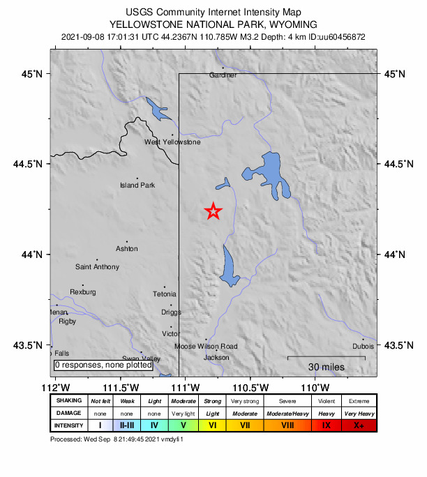
Map
Where this earthquake was located, with the others nearby. Select one for its page.
The earthquake
- Magnitude
- 3.2 (ML, local (Richter)), minor
- Magnitude from
- University of Utah Seismograph Stations
- Local time
- UTC
- 2021-09-08 17:01:31 UTC
- Depth
- 4.7 km (2.9 mi), shallow
- Epicenter
- 44.237° N, 110.785° W
- Region
- Wyoming
- Tsunami flag
- No
- Status
- Reviewed by a seismologist
Magnitude estimates
Different scales measure different things and differ by a few tenths. The USGS marks one as preferred, and it is the one this page uses.
| Mag. | Scale | Computed by | Notes |
|---|---|---|---|
| 3.22 | ML, local (Richter) | University of Utah Seismograph Stations | Preferred · Final · ±0.247 · 15 stations |
| 3.0 | ML, local (Richter) | USGS National Earthquake Information Center | Reviewed · ±0.046 · 62 stations |
Did you feel it?
No one has reported feeling this quake to the USGS.
How well it is located
Reviewed by a seismologist.
- Location uncertainty
- About 0.6 km horizontally, 0.5 km in depth
- Magnitude uncertainty
- ±0.25
- Depth from
- From location
- Station coverage gap
- 110°
- Stations used
- 19
Nearest places
Distance and direction from each place to the epicenter, with its forecast.
Nearby
Within 100 km, magnitude 1.5 and up: 75 in the 60 days after this one and 12 in the 30 days before it.
After
- 2.141 km ENE of Warm River, Idaho · 1852 days ago · 6 km deep · 4 km away
- 1.642 km ENE of Warm River, Idaho · 1852 days ago · 5 km deep · 3 km away
- 1.643 km ENE of Warm River, Idaho · 1852 days ago · 7 km deep · 3 km away
- 1.943 km ENE of Warm River, Idaho · 1852 days ago · 7 km deep · 2 km away
- 2.343 km ENE of Warm River, Idaho · 1852 days ago · 5 km deep · 1 km away · felt by 1
- 1.6Wyoming · 1852 days ago · 6 km deep · 2 km away
- 3.044 km ENE of Warm River, Idaho · 1852 days ago · 11 km deep · 0 km away · felt by 1
- 2.08 km ESE of Hebgen Lake Estates, Montana · 1849 days ago · 12 km deep · 61 km away
- 1.724 km SE of Mammoth, Wyoming · 1845 days ago · 12 km deep · 70 km away
- 1.729 km ESE of West Yellowstone, Montana · 1844 days ago · 7 km deep · 38 km away
- 1.629 km E of West Yellowstone, Montana · 1841 days ago · 7 km deep · 45 km away
- 1.729 km E of West Yellowstone, Montana · 1841 days ago · 7 km deep · 44 km away
- 2.215 km ENE of Hebgen Lake Estates, Montana · 1840 days ago · 8 km deep · 66 km away
- 1.629 km E of West Yellowstone, Montana · 1838 days ago · 9 km deep · 44 km away
- 1.529 km E of West Yellowstone, Montana · 1838 days ago · 6 km deep · 46 km away
- 1.720 km NE of West Yellowstone, Montana · 1838 days ago · 7 km deep · 63 km away
- 1.829 km E of West Yellowstone, Montana · 1838 days ago · 7 km deep · 45 km away
- 2.016 km ENE of Hebgen Lake Estates, Montana · 1836 days ago · 8 km deep · 65 km away
- 1.731 km E of West Yellowstone, Montana · 1833 days ago · 6 km deep · 42 km away
- 1.631 km ESE of West Yellowstone, Montana · 1833 days ago · 5 km deep · 41 km away
- 1.631 km ESE of West Yellowstone, Montana · 1833 days ago · 3 km deep · 40 km away
- 1.731 km E of West Yellowstone, Montana · 1833 days ago · 8 km deep · 42 km away
- 1.728 km S of Mammoth, Wyoming · 1833 days ago · 4 km deep · 55 km away
- 1.659 km ESE of West Yellowstone, Montana · 1831 days ago · 7 km deep · 37 km away
- 1.659 km ESE of West Yellowstone, Montana · 1831 days ago · 8 km deep · 38 km away
- 1.960 km ESE of West Yellowstone, Montana · 1830 days ago · 8 km deep · 38 km away
- 1.829 km E of West Yellowstone, Montana · 1829 days ago · 8 km deep · 43 km away
- 1.913 km E of Hebgen Lake Estates, Montana · 1829 days ago · 8 km deep · 63 km away
- 2.017 km ENE of West Yellowstone, Montana · 1828 days ago · 10 km deep · 57 km away
- 1.821 km W of Hebgen Lake Estates, Montana · 1828 days ago · 11 km deep · 83 km away
- 1.836 km S of Silver Gate, Montana · 1827 days ago · 3 km deep · 76 km away
- 1.824 km SSE of Mammoth, Wyoming · 1826 days ago · 5 km deep · 59 km away
- 2.5Wyoming · 1826 days ago · 4 km deep · 59 km away
- 1.624 km SSE of Mammoth, Wyoming · 1826 days ago · 3 km deep · 60 km away
- 2.425 km SSE of Mammoth, Wyoming · 1826 days ago · 5 km deep · 58 km away
- 2.024 km SSE of Mammoth, Wyoming · 1826 days ago · 3 km deep · 59 km away
- 2.224 km SSE of Mammoth, Wyoming · 1826 days ago · 3 km deep · 60 km away
- 2.325 km SSE of Mammoth, Wyoming · 1826 days ago · 4 km deep · 59 km away
- 1.625 km SSE of Mammoth, Wyoming · 1826 days ago · 5 km deep · 59 km away
- 1.625 km SSE of Mammoth, Wyoming · 1826 days ago · 4 km deep · 59 km away
- 1.623 km SSE of Mammoth, Wyoming · 1826 days ago · 2 km deep · 60 km away
- 2.625 km SSE of Mammoth, Wyoming · 1826 days ago · 5 km deep · 59 km away
- 1.524 km SSE of Mammoth, Wyoming · 1825 days ago · 2 km deep · 60 km away
- 1.524 km SSE of Mammoth, Wyoming · 1825 days ago · 5 km deep · 60 km away
- 1.625 km SSE of Mammoth, Wyoming · 1825 days ago · 5 km deep · 59 km away
- 1.523 km SSE of Mammoth, Wyoming · 1825 days ago · 4 km deep · 61 km away
- 1.760 km SE of West Yellowstone, Montana · 1821 days ago · 4 km deep · 26 km away
- 2.410 km ENE of Alta, Wyoming · 1821 days ago · 11 km deep · 52 km away · felt by 2
- 1.528 km E of West Yellowstone, Montana · 1820 days ago · 8 km deep · 46 km away
- 1.528 km E of West Yellowstone, Montana · 1820 days ago · 8 km deep · 46 km away
- 1.610 km ENE of Alta, Wyoming · 1818 days ago · 10 km deep · 51 km away
- 1.79 km ENE of Alta, Wyoming · 1816 days ago · 11 km deep · 51 km away
- 1.665 km ESE of West Yellowstone, Montana · 1816 days ago · 7 km deep · 41 km away
- 1.666 km ESE of West Yellowstone, Montana · 1816 days ago · 7 km deep · 41 km away
- 1.647 km W of Cody, Wyoming · 1813 days ago · 9 km deep · 96 km away
- 1.647 km ESE of West Yellowstone, Montana · 1812 days ago · 5 km deep · 35 km away
- 1.938 km WNW of Hebgen Lake Estates, Montana · 1810 days ago · 10 km deep · 98 km away
- 1.751 km SE of West Yellowstone, Montana · 1810 days ago · 4 km deep · 16 km away
- 1.922 km S of Mammoth, Wyoming · 1806 days ago · 4 km deep · 61 km away
- 1.632 km ESE of West Yellowstone, Montana · 1806 days ago · 6 km deep · 38 km away
The first 60 of 75.
Before
- 1.545 km ENE of Warm River, Idaho · 1852 days ago · 15 km deep · 3 km away
- 1.641 km SSE of Mammoth, Wyoming · 1856 days ago · 8 km deep · 56 km away
- 1.841 km SSE of Mammoth, Wyoming · 1856 days ago · 4 km deep · 54 km away
- 3.041 km SSE of Mammoth, Wyoming · 1856 days ago · 6 km deep · 55 km away · felt by 9
- 2.641 km SSE of Mammoth, Wyoming · 1856 days ago · 5 km deep · 54 km away
- 1.743 km W of Hebgen Lake Estates, Montana · 1868 days ago · 8 km deep · 95 km away
- 1.834 km SSE of Mammoth, Wyoming · 1870 days ago · 4 km deep · 52 km away
- 1.525 km SE of Mammoth, Wyoming · 1870 days ago · 7 km deep · 70 km away
- 1.719 km NE of West Yellowstone, Montana · 1871 days ago · 7 km deep · 62 km away
- 3.019 km NE of West Yellowstone, Montana · 1871 days ago · 9 km deep · 63 km away
- 1.733 km SE of West Yellowstone, Montana · 1877 days ago · 4 km deep · 26 km away
- 1.514 km NE of Kelly, Wyoming · 1881 days ago · 6 km deep · 60 km away
Earthquakes todayWyoming earthquakesLive radar here
Sources
From the USGS Earthquake Hazards Program and its partner networks, event uu60456872 (also filed as us7000f9bc). Read Sun, Oct 4, 2026, 12:40 PM UTC.