M1.6 earthquake 63 km SE of Pedro Bay, Alaska
A magnitude 1.6 earthquake struck 63 km SE of Pedro Bay, Alaska on Tue, Aug 31, 2021, 5:53 AM AKDT (13:53 UTC), 116 km (72 mi) below the surface.
A larger quake followed: M3.7 46 km NE of Pedro Bay, Alaska. This one was a foreshock.
Map
Where this earthquake was located, with the others nearby. Select one for its page.
The earthquake
- Magnitude
- 1.6 (ML, local (Richter)), micro
- Magnitude from
- Alaska Earthquake Center
- Local time
- UTC
- 2021-08-31 13:53:51 UTC
- Depth
- 115.6 km (71.8 mi), intermediate-depth
- Epicenter
- 59.318° N, 153.475° W
- Region
- Alaska
- Felt reports
- 1
- Tsunami flag
- No
- Status
- Reviewed by a seismologist
Did you feel it?
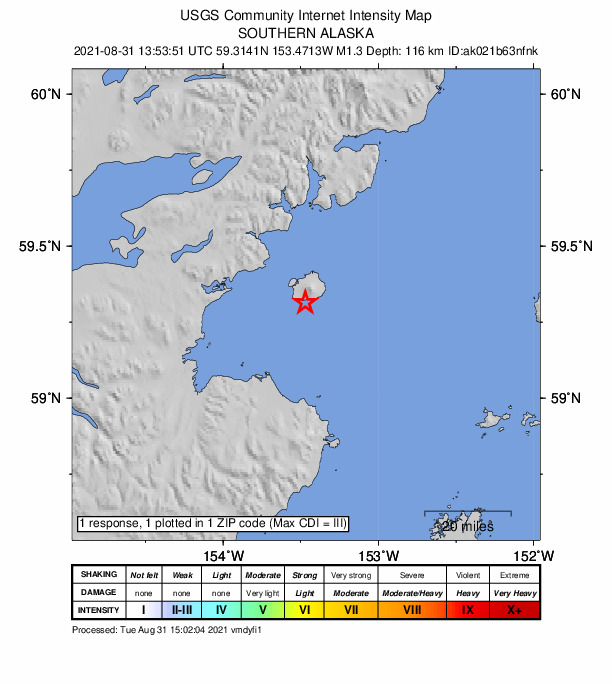
1 person reported to the USGS what they felt; the strongest reported shaking was III, weak shaking.
How well it is located
Reviewed by a seismologist.
- Stations used
- 56
Nearest places
Distance and direction from each place to the epicenter, with its forecast.
Nearby
Within 100 km, magnitude 1.5 and up: at least 201 in the 60 days after this one and 174 in the 30 days before it.
After
- 1.548 km WNW of Nanwalek, Alaska · 1858 days ago · 85 km deep · 45 km away
- 2.160 km SE of Pedro Bay, Alaska · 1858 days ago · 98 km deep · 6 km away
- 1.842 km WSW of Nanwalek, Alaska · 1858 days ago · 77 km deep · 56 km away
- 1.846 km E of Pedro Bay, Alaska · 1858 days ago · 118 km deep · 53 km away
- 2.159 km WNW of Nanwalek, Alaska · 1858 days ago · 84 km deep · 38 km away
- 1.863 km WSW of Nanwalek, Alaska · 1857 days ago · 74 km deep · 40 km away
- 2.153 km E of Pedro Bay, Alaska · 1857 days ago · 97 km deep · 51 km away
- 1.950 km ENE of Pedro Bay, Alaska · 1857 days ago · 116 km deep · 64 km away
- 1.678 km SSE of Kokhanok, Alaska · 1857 days ago · 95 km deep · 75 km away
- 2.438 km ENE of Pedro Bay, Alaska · 1857 days ago · 136 km deep · 62 km away
- 2.351 km WNW of Nanwalek, Alaska · 1857 days ago · 79 km deep · 54 km away
- 1.751 km ESE of Pedro Bay, Alaska · 1857 days ago · 106 km deep · 33 km away
- 1.528 km WSW of Anchor Point, Alaska · 1857 days ago · 73 km deep · 79 km away
- 2.237 km WSW of Anchor Point, Alaska · 1857 days ago · 69 km deep · 68 km away
- 2.046 km SW of Nanwalek, Alaska · 1856 days ago · 59 km deep · 68 km away
- 1.555 km WSW of Nanwalek, Alaska · 1856 days ago · 70 km deep · 43 km away
- 1.650 km WNW of Happy Valley, Alaska · 1856 days ago · 105 km deep · 98 km away
- 1.946 km ESE of Pedro Bay, Alaska · 1856 days ago · 109 km deep · 44 km away
- 2.028 km S of Nanwalek, Alaska · 1856 days ago · 55 km deep · 90 km away
- 1.641 km ESE of Pedro Bay, Alaska · 1856 days ago · 112 km deep · 38 km away
- 2.147 km WNW of Anchor Point, Alaska · 1855 days ago · 95 km deep · 87 km away
- 1.538 km W of Happy Valley, Alaska · 1855 days ago · 79 km deep · 94 km away
- 1.662 km SE of Kokhanok, Alaska · 1854 days ago · 101 km deep · 39 km away
- 3.625 km W of Nanwalek, Alaska · 1854 days ago · 68 km deep · 63 km away
- 3.167 km SW of Nanwalek, Alaska · 1854 days ago · 70 km deep · 46 km away
- 1.654 km W of Nanwalek, Alaska · 1854 days ago · 96 km deep · 37 km away
- 1.759 km WNW of Anchor Point, Alaska · 1854 days ago · 91 km deep · 81 km away
- 2.453 km E of Pedro Bay, Alaska · 1853 days ago · 108 km deep · 49 km away
- 1.649 km ENE of Pedro Bay, Alaska · 1853 days ago · 127 km deep · 71 km away
- 1.760 km ENE of Pedro Bay, Alaska · 1853 days ago · 109 km deep · 79 km away
- 1.635 km W of Anchor Point, Alaska · 1853 days ago · 77 km deep · 77 km away
- 1.669 km ENE of Pedro Bay, Alaska · 1853 days ago · 111 km deep · 88 km away
- 1.839 km NE of Pedro Bay, Alaska · 1853 days ago · 161 km deep · 79 km away
- 1.527 km NNW of Nanwalek, Alaska · 1853 days ago · 63 km deep · 80 km away
- 1.639 km E of Pedro Bay, Alaska · 1853 days ago · 134 km deep · 59 km away
- 1.555 km E of Pedro Bay, Alaska · 1853 days ago · 99 km deep · 54 km away
- 2.271 km WNW of Happy Valley, Alaska · 1853 days ago · 116 km deep · 96 km away
- 1.764 km ENE of Pedro Bay, Alaska · 1853 days ago · 118 km deep · 85 km away
- 1.671 km WNW of Happy Valley, Alaska · 1852 days ago · 123 km deep · 93 km away
- 1.637 km SSW of Nanwalek, Alaska · 1852 days ago · 71 km deep · 75 km away
- 1.750 km WNW of Happy Valley, Alaska · 1852 days ago · 99 km deep · 94 km away
- 2.253 km E of Pedro Bay, Alaska · 1851 days ago · 118 km deep · 63 km away
- 2.039 km E of Pedro Bay, Alaska · 1850 days ago · 143 km deep · 58 km away
- 1.648 km WNW of Nanwalek, Alaska · 1850 days ago · 80 km deep · 56 km away
- 2.469 km S of Kokhanok, Alaska · 1850 days ago · 123 km deep · 93 km away
- 1.840 km W of Nanwalek, Alaska · 1850 days ago · 81 km deep · 49 km away
- 1.950 km SE of Pedro Bay, Alaska · 1850 days ago · 119 km deep · 17 km away
- 2.362 km E of Pedro Bay, Alaska · 1850 days ago · 96 km deep · 61 km away
- 1.976 km SW of Nanwalek, Alaska · 1849 days ago · 67 km deep · 65 km away
- 2.130 km E of Pedro Bay, Alaska · 1849 days ago · 123 km deep · 47 km away
- 2.059 km SE of Pope-Vannoy Landing, Alaska · 1848 days ago · 107 km deep · 18 km away
- 1.858 km WNW of Happy Valley, Alaska · 1848 days ago · 100 km deep · 92 km away
- 2.042 km WNW of Nanwalek, Alaska · 1848 days ago · 75 km deep · 54 km away
- 1.889 km NNW of Aleneva, Alaska · 1848 days ago · 70 km deep · 54 km away
- 1.835 km WNW of Nanwalek, Alaska · 1848 days ago · 62 km deep · 56 km away
- 1.524 km SW of Anchor Point, Alaska · 1848 days ago · 87 km deep · 81 km away
- 1.866 km W of Happy Valley, Alaska · 1847 days ago · 110 km deep · 87 km away
- 2.556 km SE of Kokhanok, Alaska · 1847 days ago · 113 km deep · 43 km away
- 1.577 km N of Aleneva, Alaska · 1847 days ago · 70 km deep · 69 km away
- 1.664 km WNW of Nanwalek, Alaska · 1847 days ago · 98 km deep · 42 km away
The first 60 of at least 201.
Before
- 2.431 km E of Pedro Bay, Alaska · 1860 days ago · 144 km deep · 55 km away
- 1.853 km NE of Pedro Bay, Alaska · 1860 days ago · 127 km deep · 83 km away
- 1.770 km S of Kokhanok, Alaska · 1860 days ago · 126 km deep · 93 km away
- 2.134 km E of Pedro Bay, Alaska · 1860 days ago · 122 km deep · 49 km away
- 1.666 km W of Happy Valley, Alaska · 1860 days ago · 112 km deep · 89 km away
- 1.638 km WSW of Anchor Point, Alaska · 1861 days ago · 68 km deep · 67 km away
- 1.763 km E of Pedro Bay, Alaska · 1861 days ago · 86 km deep · 53 km away
- 1.533 km ENE of Pedro Bay, Alaska · 1861 days ago · 126 km deep · 71 km away
- 1.645 km ENE of Pedro Bay, Alaska · 1861 days ago · 113 km deep · 64 km away
- 1.773 km SE of Kokhanok, Alaska · 1861 days ago · 41 km deep · 48 km away
- 1.768 km WNW of Happy Valley, Alaska · 1861 days ago · 117 km deep · 89 km away
- 2.768 km S of Kokhanok, Alaska · 1861 days ago · 131 km deep · 95 km away
- 2.152 km W of Nanwalek, Alaska · 1861 days ago · 76 km deep · 36 km away
- 1.643 km E of Pedro Bay, Alaska · 1861 days ago · 127 km deep · 53 km away
- 2.3Southern Alaska · 1862 days ago · 76 km deep · 95 km away
- 2.065 km W of Nanwalek, Alaska · 1862 days ago · 80 km deep · 25 km away
- 2.124 km S of Nanwalek, Alaska · 1862 days ago · 49 km deep · 86 km away
- 1.651 km ENE of Pedro Bay, Alaska · 1862 days ago · 104 km deep · 71 km away
- 2.245 km NE of Pedro Bay, Alaska · 1862 days ago · 143 km deep · 79 km away
- 3.065 km WNW of Nanwalek, Alaska · 1862 days ago · 97 km deep · 37 km away
Earthquakes todayAlaska earthquakesLive radar here
Sources
From the USGS Earthquake Hazards Program and its partner networks, event ak021b63nfnk. Read Sat, Oct 3, 2026, 3:29 PM UTC.