M3.9 earthquake 42 km ENE of Pedro Bay, Alaska
A magnitude 3.9 earthquake struck 42 km ENE of Pedro Bay, Alaska on Sat, Aug 14, 2021, 2:35 AM AKDT (10:35 UTC), 149 km (92 mi) below the surface.
Map
Where this earthquake was located, with the others nearby. Select one for its page.
The earthquake
- Magnitude
- 3.9 (ML, local (Richter)), minor
- Magnitude from
- Alaska Earthquake Center
- Local time
- UTC
- 2021-08-14 10:35:15 UTC
- Depth
- 148.6 km (92.3 mi), intermediate-depth
- Epicenter
- 59.977° N, 153.456° W
- Region
- Alaska
- Felt reports
- 1
- Strongest shaking
- II, weak shaking
- PAGER alert
- Green
- Tsunami flag
- Yes: a large quake in an oceanic region
- Status
- Reviewed by a seismologist
Magnitude estimates
Different scales measure different things and differ by a few tenths. The USGS marks one as preferred, and it is the one this page uses.
| Mag. | Scale | Computed by | Notes |
|---|---|---|---|
| 3.9 | ML, local (Richter) | Alaska Earthquake Center | Preferred · Preliminary |
| 3.9 | mb, body-wave | USGS National Earthquake Information Center | Reviewed · ±0.195 · 8 stations |
| 4.0 | ML, local (Richter) | NOAA National Tsunami Warning Center | Reviewed · 22 stations |
Tsunami
The USGS flags a quake this large in an oceanic region. The flag does not mean a tsunami happened; the tsunami warning centers decide that, and their messages are below when they issued any.
Current tsunami warnings: tsunami.gov. Warnings in force in the US also appear on our alerts pages.
Shaking
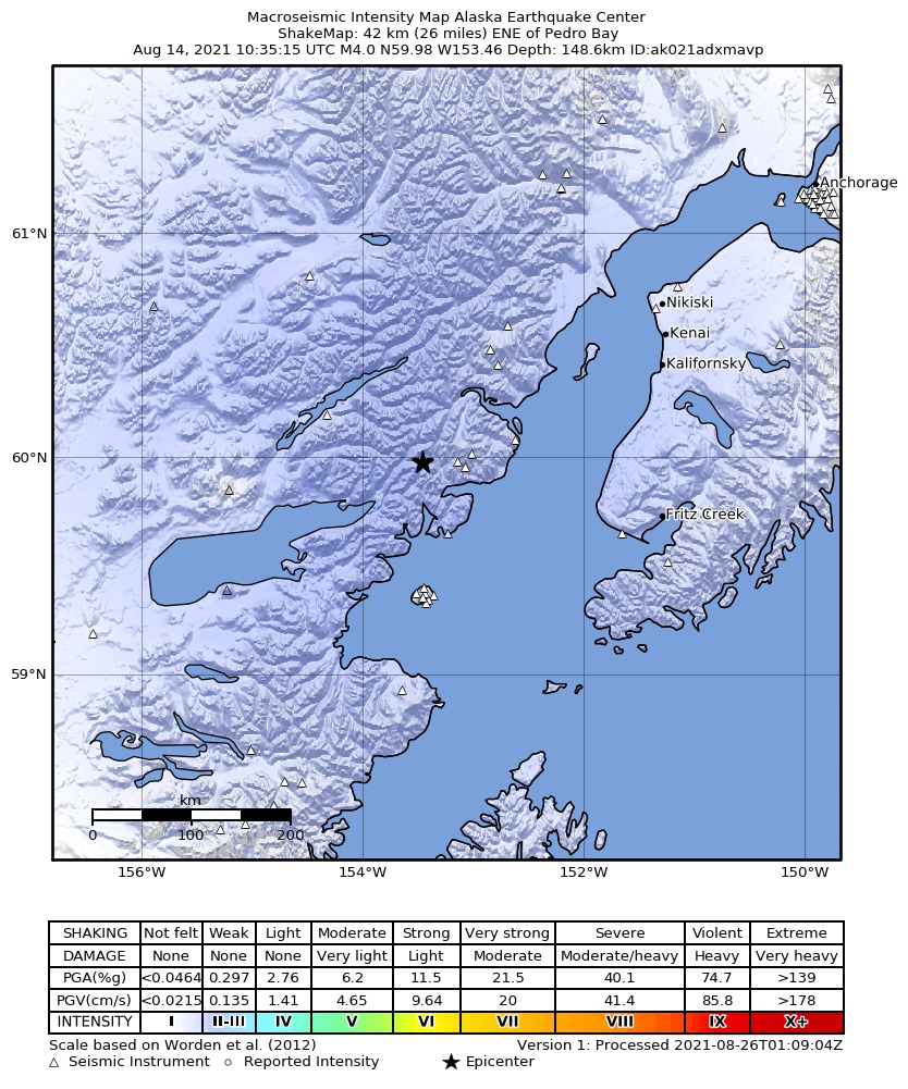
The USGS ShakeMap: shaking estimated from seismic stations and the quake’s size, on the Modified Mercalli intensity scale.
- Strongest estimated
- II, weak shaking
- Peak ground acceleration
- 0.1% of gravity
- Peak ground velocity
- -3.4 cm/s
- Map
- Automatic
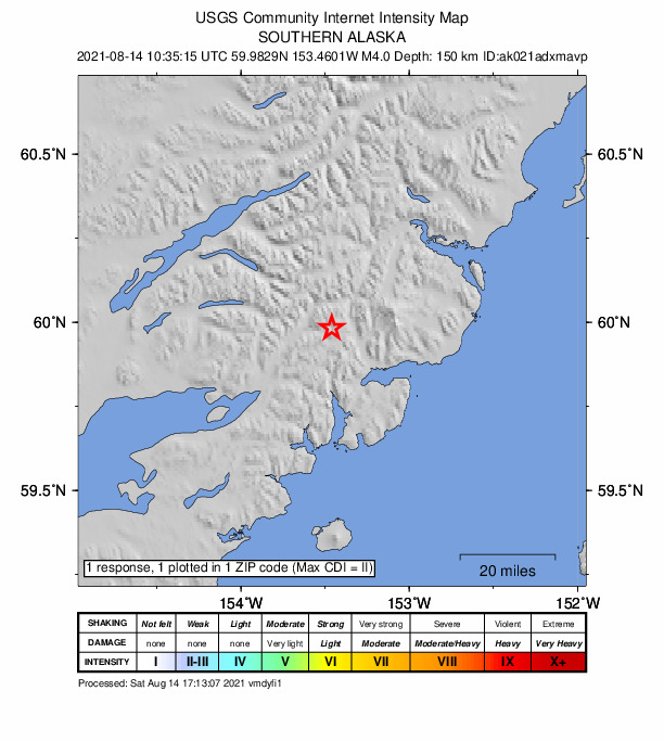
Did you feel it?
1 person reported to the USGS what they felt; the strongest reported shaking was II, weak shaking.
Estimated impact
The USGS PAGER system estimates deaths and economic losses from the shaking and the population and buildings exposed to it.
- Alert level
- Green: little or no damage or loss of life expected
| Range | Chance |
|---|---|
| Under 1 | 69% |
| 1 to 10 | 29% |
| 10 to 100 | 2% |
| 100 to 1,000 | Under 1% |
| 1,000 to 10,000 | Under 1% |
| 10,000 to 100,000 | Under 1% |
| 100,000 to 10,000,000 | Under 1% |
| Range, million USD | Chance |
|---|---|
| Under 1 | 65% |
| 1 to 10 | 30% |
| 10 to 100 | 4% |
| 100 to 1,000 | Under 1% |
| 1,000 to 10,000 | Under 1% |
| 10,000 to 100,000 | Under 1% |
| 100,000 to 10,000,000 | Under 1% |
How well it is located
Reviewed by a seismologist.
- Stations used
- 260
Nearest places
Distance and direction from each place to the epicenter, with its forecast.
Nearby
Within 100 km, magnitude 1.5 and up: at least 199 in the 60 days after this one and at least 200 in the 30 days before it.
After
- 1.739 km E of Pedro Bay, Alaska · 1878 days ago · 137 km deep · 16 km away
- 1.863 km E of Pedro Bay, Alaska · 1877 days ago · 106 km deep · 34 km away
- 1.6Southern Alaska · 1877 days ago · 131 km deep · 18 km away
- 1.553 km E of Pedro Bay, Alaska · 1877 days ago · 104 km deep · 27 km away
- 2.752 km ENE of Pedro Bay, Alaska · 1877 days ago · 133 km deep · 10 km away
- 1.958 km ESE of Pedro Bay, Alaska · 1877 days ago · 106 km deep · 43 km away
- 2.317 km NW of Happy Valley, Alaska · 1876 days ago · 83 km deep · 81 km away
- 2.242 km NW of Ninilchik, Alaska · 1876 days ago · 98 km deep · 80 km away
- 1.649 km WNW of Nanwalek, Alaska · 1876 days ago · 73 km deep · 63 km away
- 1.558 km W of Nanwalek, Alaska · 1876 days ago · 67 km deep · 65 km away
- 1.630 km WNW of Clam Gulch, Alaska · 1876 days ago · 90 km deep · 98 km away
- 1.752 km ESE of Pedro Bay, Alaska · 1876 days ago · 104 km deep · 47 km away
- 2.540 km NE of Pedro Bay, Alaska · 1876 days ago · 151 km deep · 3 km away
- 1.630 km SE of Pedro Bay, Alaska · 1876 days ago · 112 km deep · 46 km away
- 1.56 km NNE of Anchor Point, Alaska · 1876 days ago · 57 km deep · 94 km away
- 1.662 km SE of Pope-Vannoy Landing, Alaska · 1876 days ago · 111 km deep · 91 km away
- 1.649 km E of Pedro Bay, Alaska · 1876 days ago · 109 km deep · 18 km away
- 1.671 km SE of Pedro Bay, Alaska · 1875 days ago · 103 km deep · 76 km away
- 1.683 km W of Salamatof, Alaska · 1875 days ago · 123 km deep · 82 km away
- 2.280 km NW of Ninilchik, Alaska · 1875 days ago · 113 km deep · 70 km away
- 1.754 km SE of Pope-Vannoy Landing, Alaska · 1875 days ago · 124 km deep · 88 km away
- 2.241 km ENE of Port Alsworth, Alaska · 1875 days ago · 182 km deep · 40 km away
- 1.868 km W of Happy Valley, Alaska · 1875 days ago · 113 km deep · 30 km away
- 1.765 km WNW of Ninilchik, Alaska · 1875 days ago · 107 km deep · 52 km away
- 1.869 km W of Salamatof, Alaska · 1875 days ago · 122 km deep · 90 km away
- 1.970 km SE of Pedro Bay, Alaska · 1875 days ago · 105 km deep · 72 km away
- 1.946 km WNW of Happy Valley, Alaska · 1874 days ago · 94 km deep · 55 km away
- 2.156 km E of Pedro Bay, Alaska · 1874 days ago · 96 km deep · 28 km away
- 2.764 km E of Port Alsworth, Alaska · 1874 days ago · 141 km deep · 30 km away
- 1.647 km WNW of Nanwalek, Alaska · 1874 days ago · 79 km deep · 67 km away
- 1.929 km NE of Pedro Bay, Alaska · 1874 days ago · 157 km deep · 14 km away
- 2.859 km WNW of Anchor Point, Alaska · 1874 days ago · 101 km deep · 37 km away
- 1.666 km E of Port Alsworth, Alaska · 1874 days ago · 125 km deep · 39 km away
- 1.628 km WNW of Ninilchik, Alaska · 1874 days ago · 83 km deep · 79 km away
- 1.662 km SE of Pope-Vannoy Landing, Alaska · 1873 days ago · 96 km deep · 99 km away
- 2.1Southern Alaska · 1873 days ago · 102 km deep · 34 km away
- 1.578 km W of Salamatof, Alaska · 1873 days ago · 124 km deep · 83 km away
- 2.739 km NW of Ninilchik, Alaska · 1872 days ago · 75 km deep · 83 km away
- 1.833 km E of Pedro Bay, Alaska · 1872 days ago · 125 km deep · 16 km away
- 1.561 km W of Happy Valley, Alaska · 1872 days ago · 108 km deep · 35 km away
- 1.544 km NW of Ninilchik, Alaska · 1872 days ago · 81 km deep · 79 km away
- 1.640 km E of Pedro Bay, Alaska · 1872 days ago · 140 km deep · 15 km away
- 1.561 km WNW of Nanwalek, Alaska · 1872 days ago · 99 km deep · 55 km away
- 1.650 km W of Anchor Point, Alaska · 1871 days ago · 84 km deep · 50 km away
- 1.753 km E of Pedro Bay, Alaska · 1871 days ago · 115 km deep · 33 km away
- 2.0Southern Alaska · 1871 days ago · 87 km deep · 85 km away
- 1.745 km WSW of Salamatof, Alaska · 1871 days ago · 97 km deep · 95 km away
- 1.648 km WNW of Nanwalek, Alaska · 1871 days ago · 88 km deep · 66 km away
- 1.547 km WNW of Happy Valley, Alaska · 1871 days ago · 93 km deep · 53 km away
- 1.661 km SE of Pedro Bay, Alaska · 1871 days ago · 117 km deep · 70 km away
- 1.935 km E of Pedro Bay, Alaska · 1871 days ago · 132 km deep · 16 km away
- 1.683 km NW of Ninilchik, Alaska · 1871 days ago · 143 km deep · 65 km away
- 1.849 km WNW of Happy Valley, Alaska · 1871 days ago · 106 km deep · 52 km away
- 1.767 km E of Port Alsworth, Alaska · 1871 days ago · 138 km deep · 41 km away
- 1.638 km ENE of Pedro Bay, Alaska · 1870 days ago · 131 km deep · 11 km away
- 1.648 km WNW of Happy Valley, Alaska · 1870 days ago · 92 km deep · 54 km away
- 1.548 km ENE of Pedro Bay, Alaska · 1870 days ago · 123 km deep · 11 km away
- 1.551 km W of Nanwalek, Alaska · 1869 days ago · 68 km deep · 84 km away
- 1.653 km WNW of Nanwalek, Alaska · 1869 days ago · 88 km deep · 64 km away
- 1.943 km E of Pedro Bay, Alaska · 1868 days ago · 128 km deep · 27 km away
The first 60 of at least 199.
Before
- 1.565 km ESE of Pedro Bay, Alaska · 1878 days ago · 110 km deep · 48 km away
- 1.5Southern Alaska · 1878 days ago · 87 km deep · 39 km away
- 2.649 km W of Happy Valley, Alaska · 1878 days ago · 97 km deep · 48 km away
- 1.663 km ENE of Pedro Bay, Alaska · 1879 days ago · 116 km deep · 23 km away
- 1.634 km ESE of Pedro Bay, Alaska · 1879 days ago · 126 km deep · 28 km away
- 1.553 km NW of Ninilchik, Alaska · 1880 days ago · 91 km deep · 69 km away
- 1.522 km WSW of Anchor Point, Alaska · 1881 days ago · 68 km deep · 78 km away
- 2.250 km W of Nanwalek, Alaska · 1881 days ago · 74 km deep · 78 km away
- 1.863 km W of Anchor Point, Alaska · 1881 days ago · 104 km deep · 33 km away
- 1.738 km E of Pedro Bay, Alaska · 1881 days ago · 119 km deep · 21 km away
- 2.066 km ENE of Pedro Bay, Alaska · 1882 days ago · 115 km deep · 26 km away
- 2.363 km E of Pedro Bay, Alaska · 1882 days ago · 94 km deep · 39 km away
- 1.756 km WNW of Happy Valley, Alaska · 1882 days ago · 89 km deep · 43 km away
- 2.965 km SE of Pope-Vannoy Landing, Alaska · 1882 days ago · 99 km deep · 88 km away · felt by 1
- 1.932 km ENE of Pedro Bay, Alaska · 1882 days ago · 138 km deep · 10 km away
- 2.19 km WSW of Happy Valley, Alaska · 1882 days ago · 79 km deep · 88 km away
- 1.557 km W of Happy Valley, Alaska · 1882 days ago · 96 km deep · 39 km away
- 1.943 km E of Pedro Bay, Alaska · 1882 days ago · 120 km deep · 23 km away
- 1.616 km NNW of Ninilchik, Alaska · 1883 days ago · 73 km deep · 99 km away
- 1.629 km WNW of Nanwalek, Alaska · 1883 days ago · 76 km deep · 82 km away
Earthquakes todayAlaska earthquakesLive radar here
Sources
From the USGS Earthquake Hazards Program and its partner networks, event ak021adxmavp (also filed as at00qxts2q, us6000f647). Read Mon, Oct 5, 2026, 7:15 AM UTC.