M5.2 earthquake 69 km ESE of Nikolski, Alaska
A magnitude 5.2 earthquake struck 69 km ESE of Nikolski, Alaska on Thu, Nov 4, 2021, 12:57 AM AKDT (08:57 UTC), 39 km (24 mi) below the surface.
Map
Where this earthquake was located, with the others nearby. Select one for its page.
The earthquake
- Magnitude
- 5.2 (mww), moderate
- Local time
- UTC
- 2021-11-04 08:57:06 UTC
- Depth
- 39.3 km (24.4 mi), shallow
- Epicenter
- 52.668° N, 167.932° W
- Region
- Alaska
- Felt reports
- 5
- Strongest shaking
- III, weak shaking
- Tsunami flag
- Yes: a large quake in an oceanic region
- Status
- Reviewed by a seismologist
Tsunami
The USGS flags a quake this large in an oceanic region. The flag does not mean a tsunami happened; the tsunami warning centers decide that, and their messages are below when they issued any.
Current tsunami warnings: tsunami.gov. Warnings in force in the US also appear on our alerts pages.
Shaking
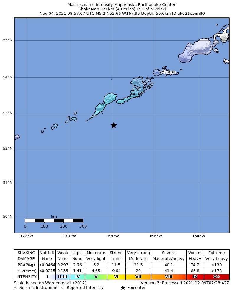
The USGS ShakeMap: shaking estimated from seismic stations and the quake’s size, on the Modified Mercalli intensity scale.
- Strongest estimated
- III, weak shaking
- Peak ground acceleration
- 0.7% of gravity
- Peak ground velocity
- -0.9 cm/s
- Map
- Automatic
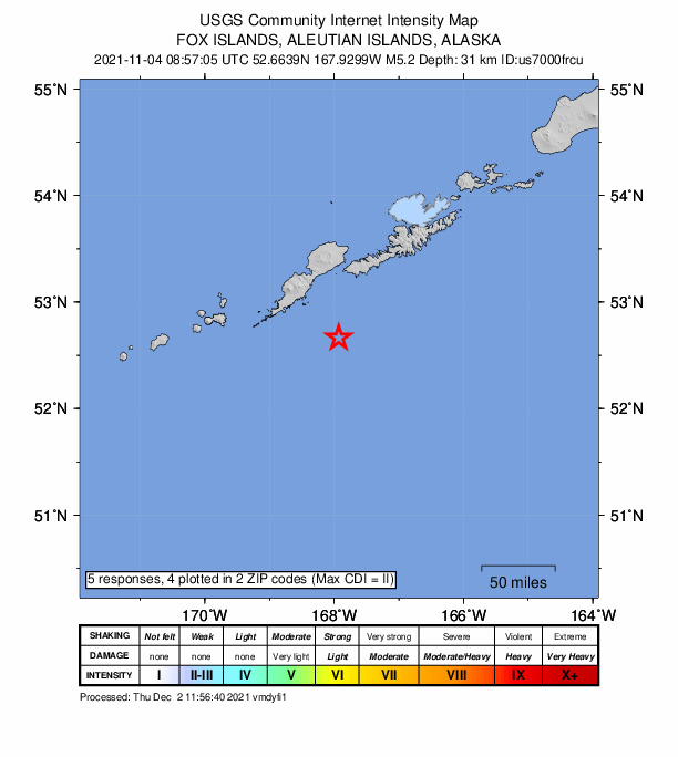
Did you feel it?
5 people reported to the USGS what they felt; the strongest reported shaking was II, weak shaking.
Fault motion and ground failure
How the rock slipped, from the moment tensor, and the USGS estimate of landslides and liquefaction.
- Faulting
- Reverse (thrust)
- Moment magnitude
- 5.2 Mww
- Nodal plane 1
- Strike 332°, dip 37°, rake 116°
- Nodal plane 2
- Strike 121°, dip 57°, rake 72°
How well it is located
Reviewed by a seismologist.
- Location uncertainty
- About 5.0 km horizontally, 4.1 km in depth
- Magnitude uncertainty
- ±0.06
- Depth from
- From location
- Station coverage gap
- 43°
- Stations used
- 259
Nearest places
Distance and direction from each place to the epicenter, with its forecast.
Nearby
Within 100 km, magnitude 2.2 and up: 29 in the 60 days after this one and 20 in the 30 days before it.
After
- 3.282 km S of Unalaska, Alaska · 1786 days ago · 27 km deep · 99 km away
- 2.892 km SSE of Nikolski, Alaska · 1785 days ago · 10 km deep · 54 km away
- 3.986 km SSW of Unalaska, Alaska · 1784 days ago · 42 km deep · 79 km away
- 2.675 km SSW of Unalaska, Alaska · 1780 days ago · 41 km deep · 99 km away
- 2.953 km SE of Nikolski, Alaska · 1778 days ago · 35 km deep · 18 km away
- 2.290 km SW of Unalaska, Alaska · 1777 days ago · 53 km deep · 73 km away
- 2.249 km SW of Nikolski, Alaska · 1774 days ago · 10 km deep · 99 km away
- 3.1Fox Islands, Aleutian Islands, Alaska · 1773 days ago · 53 km deep · 27 km away
- 2.292 km SE of Nikolski, Alaska · 1772 days ago · 26 km deep · 37 km away
- 3.828 km E of Nikolski, Alaska · 1771 days ago · 66 km deep · 43 km away
- 2.983 km SSW of Unalaska, Alaska · 1770 days ago · 35 km deep · 80 km away
- 3.994 km SSE of Nikolski, Alaska · 1770 days ago · 24 km deep · 51 km away
- 2.551 km ESE of Nikolski, Alaska · 1768 days ago · 35 km deep · 19 km away
- 2.2103 km E of Nikolski, Alaska · 1764 days ago · 26 km deep · 49 km away
- 2.248 km S of Nikolski, Alaska · 1762 days ago · 47 km deep · 69 km away
- 2.7107 km E of Nikolski, Alaska · 1761 days ago · 35 km deep · 49 km away
- 2.487 km S of Nikolski, Alaska · 1749 days ago · 14 km deep · 96 km away
- 2.950 km SE of Nikolski, Alaska · 1748 days ago · 35 km deep · 22 km away
- 2.798 km S of Nikolski, Alaska · 1747 days ago · 35 km deep · 82 km away
- 3.2116 km S of Unalaska, Alaska · 1747 days ago · 2 km deep · 81 km away
- 2.361 km ESE of Nikolski, Alaska · 1746 days ago · 19 km deep · 13 km away
- 2.565 km SSW of Nikolski, Alaska · 1744 days ago · 28 km deep · 96 km away
- 4.054 km ESE of Nikolski, Alaska · 1742 days ago · 35 km deep · 16 km away · felt by 1
- 4.353 km ESE of Nikolski, Alaska · 1742 days ago · 43 km deep · 16 km away
- 2.363 km ESE of Nikolski, Alaska · 1742 days ago · 22 km deep · 8 km away
- 2.2Fox Islands, Aleutian Islands, Alaska · 1740 days ago · 29 km deep · 77 km away
- 2.285 km SSW of Unalaska, Alaska · 1732 days ago · 17 km deep · 85 km away
- 2.966 km SSW of Unalaska, Alaska · 1731 days ago · 4 km deep · 97 km away
- 2.558 km SE of Nikolski, Alaska · 1730 days ago · 34 km deep · 17 km away
Before
- 2.686 km ENE of Nikolski, Alaska · 1792 days ago · 64 km deep · 62 km away
- 3.643 km ESE of Nikolski, Alaska · 1796 days ago · 35 km deep · 26 km away
- 2.330 km S of Nikolski, Alaska · 1796 days ago · 51 km deep · 67 km away
- 2.590 km S of Unalaska, Alaska · 1796 days ago · 29 km deep · 97 km away
- 3.948 km ESE of Nikolski, Alaska · 1797 days ago · 42 km deep · 23 km away
- 2.9102 km E of Nikolski, Alaska · 1801 days ago · 35 km deep · 42 km away
- 3.0102 km E of Nikolski, Alaska · 1801 days ago · 35 km deep · 43 km away
- 3.199 km E of Nikolski, Alaska · 1801 days ago · 35 km deep · 40 km away
- 3.686 km ENE of Nikolski, Alaska · 1804 days ago · 76 km deep · 65 km away
- 2.345 km SW of Nikolski, Alaska · 1805 days ago · 20 km deep · 100 km away
- 3.342 km SSE of Nikolski, Alaska · 1806 days ago · 40 km deep · 46 km away
- 2.890 km S of Unalaska, Alaska · 1809 days ago · 35 km deep · 90 km away
- 3.887 km SSW of Unalaska, Alaska · 1810 days ago · 35 km deep · 85 km away
- 2.882 km S of Unalaska, Alaska · 1810 days ago · 34 km deep · 95 km away
- 3.782 km E of Nikolski, Alaska · 1811 days ago · 42 km deep · 27 km away
- 3.091 km SW of Unalaska, Alaska · 1813 days ago · 35 km deep · 73 km away
- 4.177 km SSW of Unalaska, Alaska · 1816 days ago · 44 km deep · 93 km away
- 2.954 km SW of Nikolski, Alaska · 1817 days ago · 35 km deep · 97 km away
- 2.225 km W of Nikolski, Alaska · 1817 days ago · 86 km deep · 91 km away
- 2.984 km E of Nikolski, Alaska · 1818 days ago · 35 km deep · 26 km away
Earthquakes todayAlaska earthquakesLive radar here
Sources
From the USGS Earthquake Hazards Program and its partner networks, event us7000frcu (also filed as at00r21i75, usauto7000frcu, pt21308001, ak021e5imlf0, iscgem621262041). Read Mon, Sep 28, 2026, 6:22 PM UTC.