M2.1 earthquake 2 km SE of Healy, Alaska
A magnitude 2.1 earthquake struck 2 km SE of Healy, Alaska on Sun, Feb 7, 2021, 10:23 AM AKST (19:23 UTC), 6 km (4 mi) below the surface.
A larger quake followed: M5.5 28 km SE of Cantwell, Alaska. This one was a foreshock.
Map
Where this earthquake was located, with the others nearby. Select one for its page.
The earthquake
- Magnitude
- 2.1 (ml), micro
- Local time
- UTC
- 2021-02-07 19:23:24 UTC
- Depth
- 6.0 km (3.7 mi), shallow
- Epicenter
- 63.840° N, 148.923° W
- Region
- Alaska
- Felt reports
- 1
- Tsunami flag
- No
- Status
- Reviewed by a seismologist
Did you feel it?
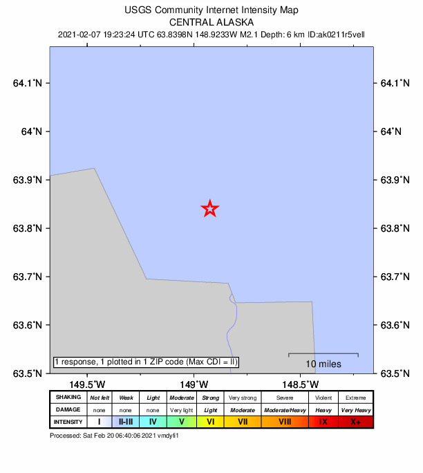
1 person reported to the USGS what they felt; the strongest reported shaking was II, weak shaking.
How well it is located
Reviewed by a seismologist.
- Stations used
- 51
Nearest places
Distance and direction from each place to the epicenter, with its forecast.
Nearby
Within 100 km, magnitude 1.5 and up: 97 in the 60 days after this one and 46 in the 30 days before it.
After
- 1.979 km ESE of McKinley Park, Alaska · 2057 days ago · 4 km deep · 83 km away
- 2.061 km WSW of Clear, Alaska, Alaska · 2057 days ago · 15 km deep · 78 km away
- 1.580 km E of Cantwell, Alaska · 2056 days ago · 9 km deep · 86 km away
- 2.14 km SE of Healy, Alaska · 2056 days ago · 8 km deep · 2 km away
- 2.215 km E of Clear, Alaska, Alaska · 2055 days ago · 10 km deep · 44 km away
- 2.177 km ESE of McKinley Park, Alaska · 2054 days ago · 3 km deep · 82 km away
- 1.75 km SSE of Healy, Alaska · 2054 days ago · 8 km deep · 3 km away
- 1.556 km W of Cantwell, Alaska · 2053 days ago · 131 km deep · 68 km away
- 1.615 km W of Healy, Alaska · 2053 days ago · 113 km deep · 18 km away
- 1.514 km NE of Healy, Alaska · 2052 days ago · 112 km deep · 14 km away
- 1.846 km E of Denali National Park, Alaska · 2052 days ago · 11 km deep · 98 km away
- 1.552 km WSW of McKinley Park, Alaska · 2052 days ago · 133 km deep · 55 km away
- 1.539 km W of Four Mile Road, Alaska · 2051 days ago · 19 km deep · 95 km away
- 2.19 km ESE of Ferry, Alaska · 2051 days ago · 8 km deep · 15 km away
- 2.38 km SE of Ferry, Alaska · 2051 days ago · 9 km deep · 14 km away
- 3.711 km ESE of Ferry, Alaska · 2051 days ago · 12 km deep · 15 km away · felt by 19
- 1.612 km NE of Healy, Alaska · 2051 days ago · 13 km deep · 12 km away
- 3.09 km ESE of Ferry, Alaska · 2051 days ago · 11 km deep · 16 km away · felt by 1
- 2.712 km NNE of Healy, Alaska · 2051 days ago · 8 km deep · 14 km away · felt by 1
- 1.510 km NNE of Healy, Alaska · 2051 days ago · 6 km deep · 12 km away
- 1.612 km NNE of Healy, Alaska · 2050 days ago · 3 km deep · 13 km away
- 3.010 km ESE of Ferry, Alaska · 2050 days ago · 11 km deep · 14 km away
- 1.546 km E of Denali National Park, Alaska · 2049 days ago · 10 km deep · 98 km away
- 2.017 km W of Healy, Alaska · 2048 days ago · 115 km deep · 19 km away
- 1.860 km ENE of Cantwell, Alaska · 2047 days ago · 16 km deep · 66 km away
- 1.719 km E of Ferry, Alaska · 2046 days ago · 3 km deep · 21 km away
- 1.651 km ENE of Cantwell, Alaska · 2046 days ago · 2 km deep · 60 km away · felt by 1
- 2.645 km ENE of Cantwell, Alaska · 2045 days ago · 7 km deep · 55 km away
- 1.646 km SSW of Cantwell, Alaska · 2044 days ago · 71 km deep · 96 km away
- 2.150 km E of Denali National Park, Alaska · 2044 days ago · 10 km deep · 93 km away
- 1.672 km ESE of Denali National Park, Alaska · 2043 days ago · 112 km deep · 98 km away
- 1.544 km WSW of Clear, Alaska, Alaska · 2043 days ago · 6 km deep · 66 km away
- 1.531 km SSW of Cantwell, Alaska · 2041 days ago · 81 km deep · 80 km away
- 1.636 km W of McKinley Park, Alaska · 2041 days ago · 123 km deep · 38 km away
- 1.510 km NNE of Cantwell, Alaska · 2041 days ago · 11 km deep · 40 km away
- 2.479 km ESE of McKinley Park, Alaska · 2038 days ago · 72 km deep · 84 km away
- 1.847 km E of Denali National Park, Alaska · 2038 days ago · 11 km deep · 96 km away
- 1.613 km E of Cantwell, Alaska · 2037 days ago · 93 km deep · 49 km away
- 1.633 km WSW of Cantwell, Alaska · 2036 days ago · 101 km deep · 73 km away
- 1.720 km NE of Healy, Alaska · 2035 days ago · 4 km deep · 21 km away
- 1.570 km ESE of Denali National Park, Alaska · 2034 days ago · 118 km deep · 100 km away
- 2.243 km SSW of Cantwell, Alaska · 2033 days ago · 76 km deep · 90 km away
- 1.751 km SW of Cantwell, Alaska · 2033 days ago · 89 km deep · 92 km away
- 1.530 km SW of Cantwell, Alaska · 2032 days ago · 85 km deep · 74 km away
- 2.821 km NE of Healy, Alaska · 2032 days ago · 8 km deep · 21 km away · felt by 1
- 1.533 km ESE of McKinley Park, Alaska · 2031 days ago · 83 km deep · 39 km away
- 2.0Central Alaska · 2031 days ago · 124 km deep · 53 km away
- 1.664 km E of Denali National Park, Alaska · 2030 days ago · 3 km deep · 80 km away
- 1.614 km NW of Four Mile Road, Alaska · 2027 days ago · 17 km deep · 98 km away
- 1.68 km E of Healy, Alaska · 2026 days ago · 105 km deep · 7 km away
- 1.537 km WSW of McKinley Park, Alaska · 2026 days ago · 118 km deep · 42 km away
- 1.856 km W of Cantwell, Alaska · 2025 days ago · 100 km deep · 78 km away
- 2.534 km W of Clear, Alaska, Alaska · 2025 days ago · 18 km deep · 68 km away
- 2.523 km WSW of McKinley Park, Alaska · 2025 days ago · 4 km deep · 28 km away
- 1.553 km SW of Cantwell, Alaska · 2023 days ago · 94 km deep · 92 km away
- 2.022 km WNW of Anderson, Alaska · 2023 days ago · 21 km deep · 70 km away
- 1.532 km WSW of Cantwell, Alaska · 2022 days ago · 102 km deep · 66 km away
- 1.582 km ESE of McKinley Park, Alaska · 2022 days ago · 3 km deep · 86 km away
- 1.523 km W of McKinley Park, Alaska · 2022 days ago · 104 km deep · 27 km away
- 1.7Central Alaska · 2020 days ago · 96 km deep · 82 km away
The first 60 of 97.
Before
- 1.7Central Alaska · 2059 days ago · 10 km deep · 82 km away
- 1.916 km E of Ferry, Alaska · 2059 days ago · 3 km deep · 18 km away
- 1.722 km ENE of Nenana, Alaska · 2060 days ago · 15 km deep · 87 km away
- 1.75 km WNW of Healy, Alaska · 2060 days ago · 118 km deep · 9 km away
- 1.5Central Alaska · 2060 days ago · 115 km deep · 97 km away
- 1.523 km ENE of McKinley Park, Alaska · 2061 days ago · 102 km deep · 21 km away
- 2.156 km WNW of Cantwell, Alaska · 2062 days ago · 133 km deep · 67 km away
- 1.548 km S of Cantwell, Alaska · 2062 days ago · 71 km deep · 98 km away
- 2.242 km SSW of Cantwell, Alaska · 2063 days ago · 72 km deep · 91 km away
- 1.663 km E of Cantwell, Alaska · 2063 days ago · 1 km deep · 73 km away
- 1.642 km WSW of McKinley Park, Alaska · 2064 days ago · 123 km deep · 47 km away
- 1.636 km WSW of Cantwell, Alaska · 2065 days ago · 96 km deep · 69 km away
- 1.525 km ENE of Healy, Alaska · 2066 days ago · 101 km deep · 24 km away
- 1.723 km WSW of Ferry, Alaska · 2068 days ago · 134 km deep · 34 km away
- 1.573 km WSW of Delta Junction, Alaska · 2068 days ago · 5 km deep · 94 km away
- 1.948 km SE of Cantwell, Alaska · 2069 days ago · 68 km deep · 91 km away
- 1.526 km W of Ferry, Alaska · 2071 days ago · 140 km deep · 41 km away
- 1.630 km SW of Cantwell, Alaska · 2074 days ago · 85 km deep · 72 km away
- 2.07 km S of Cantwell, Alaska · 2075 days ago · 79 km deep · 58 km away
- 2.260 km WSW of Cantwell, Alaska · 2076 days ago · 102 km deep · 92 km away
Earthquakes todayAlaska earthquakesLive radar here
Sources
From the USGS Earthquake Hazards Program and its partner networks, event ak0211r5vell (also filed as us6000dfes). Read Sun, Sep 27, 2026, 10:03 AM UTC.